Rungs Labs

Rungs Pilgrimage · Swimming · Europe

The 10 Best Places to Swim in Europe

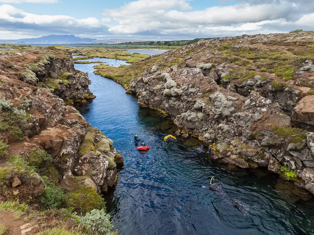
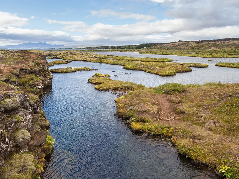
Silfra, Þingvellir National Park, Iceland. Photo: Diego Delso (CC BY-SA 4.0)

Europe swims in every kind of water: a glacier fed fissure in Iceland, the cold Irish Sea off a Dublin rock, a city lake and a city harbour, and the clear Mediterranean coves of France, Sardinia, Greece, Croatia and Malta. Some of these swims are free and open all year; the most popular coves now cap numbers and ask you to book, which keeps them worth the trip.

These ten run from Iceland, Ireland and Denmark in the north through Switzerland and Provence to Sardinia, the Algarve, Brač, Milos and Comino. For each one you get the classic swims, the best season, how to get there, the fees, bookings and rules, how hard it is and where to stay. Every fact comes from park bodies, councils, tourist boards or the other pages linked at the bottom.

Updated 2026-10-19

  1. 01SilfraÞingvellir National Park, Iceland
  2. 02The Forty FootSandycove, County Dublin, Ireland
  3. 03Bains des PâquisGeneva, Switzerland
  4. 04The CalanquesMarseille and Cassis, Provence, France
  5. 05Cala GoloritzéBaunei, Gulf of Orosei, Sardinia, Italy
  6. 06SarakinikoMilos, Cyclades, Greece
  7. 07Praia da MarinhaLagoa, Algarve, Portugal
  8. 08Zlatni RatBol, Brač, Croatia
  9. 09Islands Brygge Harbour BathCopenhagen, Denmark
  10. 10Blue Lagoon, CominoComino, Malta
01 / 10

Silfra

Þingvellir National Park, Iceland
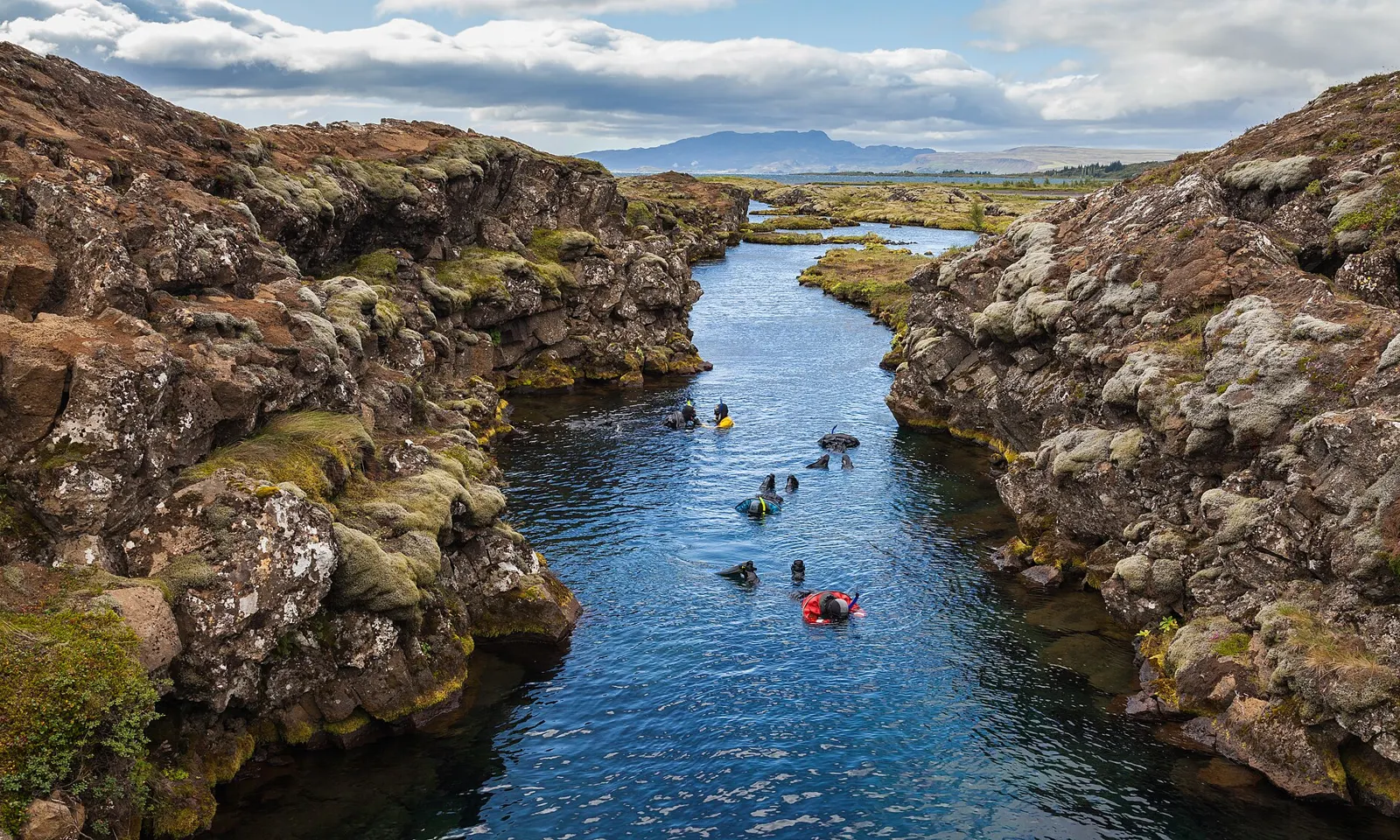
Snorkellers in red floating through the clear blue channel of Silfra between mossy lava walls at Þingvellir

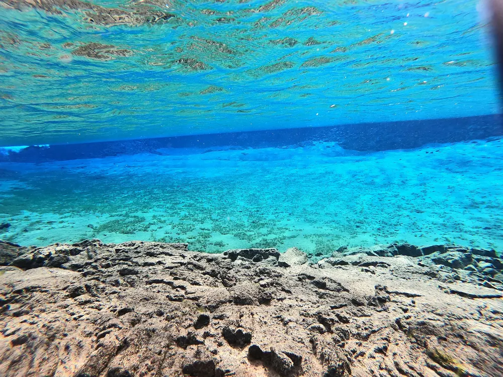
Photos: Diego Delso (CC BY-SA 4.0), Diego Delso (CC BY-SA 4.0), Josephyoon4 (CC BY-SA 4.0), Diego Delso (CC BY-SA 4.0)

Distance
The Cathedral, about 100 m long
Water
2 to 4 C all year
Depth limit
18 m for divers
Snorkellers
Age 12 and over, with a guide

Why go

Silfra is a flooded crack in the lava of Þingvellir, in the rift where the North American and Eurasian plates are pulling apart by about 2 cm a year. The water is meltwater from Langjökull, Iceland's second largest glacier, about 50 km to the north, and it spends somewhere between 30 and 100 years seeping through the porous rock before it rises in the fissure's springs. That long filtering is why the water is so clear: you float face down over pale rock walls and look a long way down and a long way ahead. It is the coldest swim on this list and one of the strangest anywhere, and most people come out of it shivering and keen to go again.

The route

The usual snorkel drifts with a slight current from the entry steps through the narrow fissure and into the wider sections. The Cathedral, about 100 m long, is the part people remember, because you can see from nearly one end to the other. It finishes in the shallow lagoon, about 120 m long, where operators say you may have to swim against a gentle current near the end. Snorkellers spend about 30 to 40 minutes in the water. Divers follow the same rift, and the park caps diving at 18 m and forbids entering caves or other overhead spaces.

When to go

Silfra is open all year and the water stays at about 2 to 4 C whatever the season, so the time of year changes the air and the light rather than the swim. Summer gives long days and mild air for warming up afterwards; winter tours run in the short daylight and you get out into frost.

Getting there

Þingvellir National Park is about 45 to 60 minutes' drive east of Reykjavík. Most snorkel tours offer either a meeting point at the Silfra car park or a transfer from the city. The park is reached on the Golden Circle road, so it pairs easily with a day of driving.

Permits and booking

The park's rules apply to everyone: never enter alone, always with a buddy; divers need a certificate equivalent to Open Water, plus a dry suit certificate or proof of 10 dry suit dives in the last two years; snorkellers need a dry suit or a thick, close fitting wetsuit with hood, gloves and boots. Snorkelling is sold as a guided tour, with a guide in the water the whole time. Operators set the minimum age at 12, ask for a height of at least 150 cm and a weight of at least 45 kg, and everyone signs a medical statement; people aged 60 and over need a doctor's signature. Check the current permit fee with your operator.

How hard it is

Physically easy, mentally bracing. The dry suit keeps your body dry, but your face and hands meet water close to freezing. You must be able to swim without a life jacket or other aids, and the current near the end needs a few steady kicks.

Where to sleep

The park runs campsites at Þingvellir, and there are guesthouses and hotels around the Golden Circle. Many people simply stay in Reykjavík and go out on a morning tour.

Tips

  • Wear thermal layers and thick socks under the dry suit; the operators provide the suit but warmth comes from what you wear inside it.
  • Walk the rift path above Silfra afterwards to see the same fissure from dry land.
02 / 10

The Forty Foot

Sandycove, County Dublin, Ireland

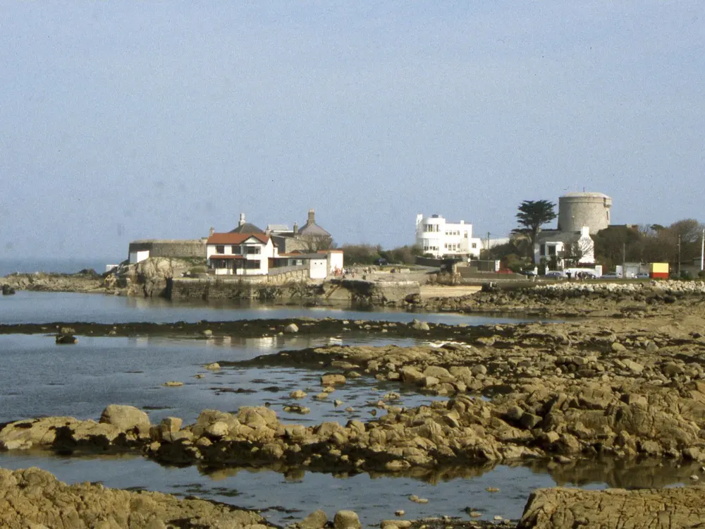
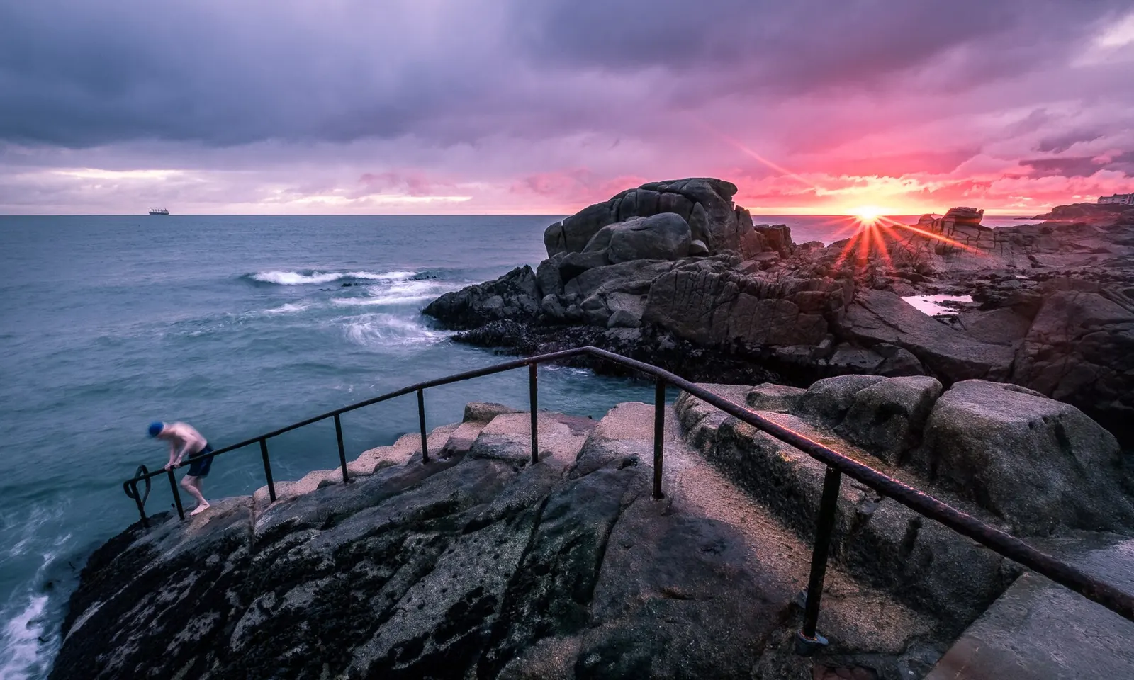
A swimmer climbing down the steps of the Forty Foot at sunrise, with waves breaking on the granite rocks

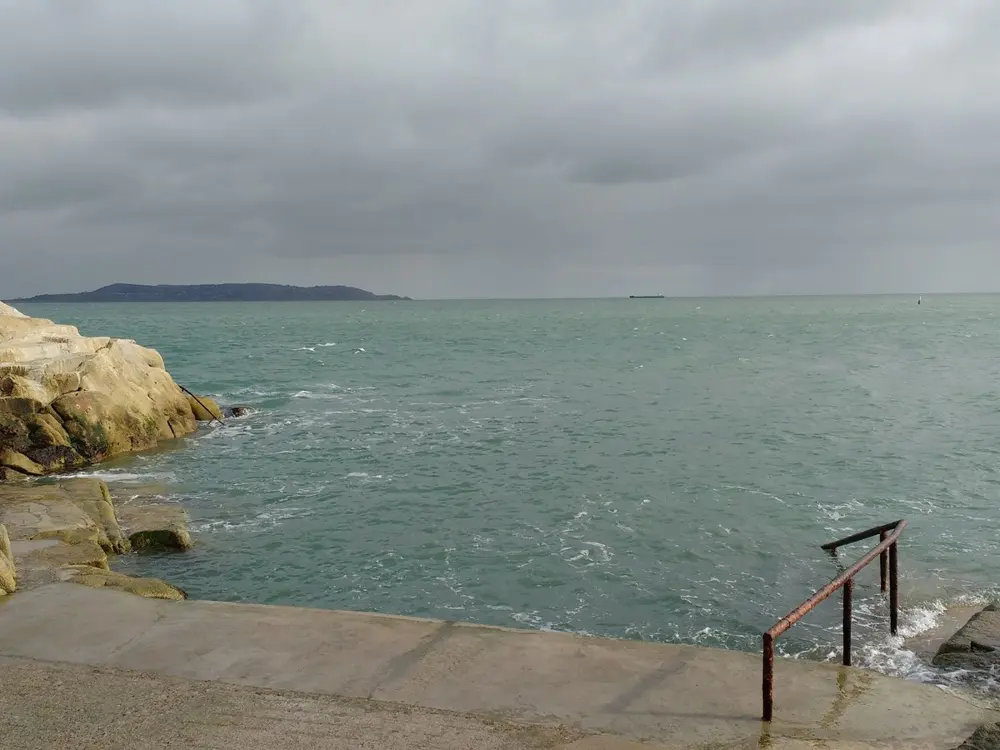
Photos: Giuseppe Milo (CC BY 3.0), Aleks Scholz (CC BY-SA 2.0), Colin Park (CC BY-SA 2.0), https://www.flickr.com/photos/infomatique/ (CC BY-SA 2.0)

Distance
About 1 km from Sandycove and Glasthule DART
Depth
About 6 m at high tide
Swum for
About 250 years
Lifeguards
None

Why go

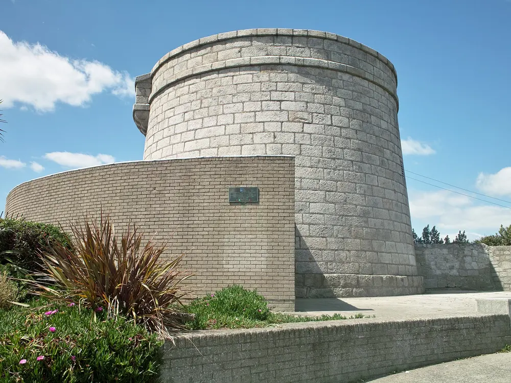
The Forty Foot is a rocky promontory at the southern end of Dublin Bay where people have swum in the Irish Sea, all year round, for about 250 years. It began as a men only bathing place; women protested there in 1974, and in 2014 the Sandycove Bathers Association opened its membership to women. Now everyone swims, from regulars who have not missed a day in years to the hundreds of Dubliners who gather on Christmas morning. Above it stands the Martello tower where James Joyce stayed, and the first pages of Ulysses send Buck Mulligan down to this water, which he calls snotgreen.

The route

There is no beach, just steps and ladders down from concrete ledges into deep water, about 6 m at high tide. Because it is deep, the Forty Foot is one of the few places on this stretch of coast you can swim at almost any state of the tide, sea permitting. Most people swim out and back along the rocks for a few minutes in winter and longer in summer.

When to go

Any day of the year; the regulars do. Summer brings the warmest water and the biggest crowds. The Christmas Day swim is a long Dublin tradition that draws hundreds. The council can close identified bathing waters after heavy rain because of storm overflows, so check its notices before you go.

Getting there

Take the DART to Sandycove and Glasthule; the bathing place is about 1 km away. There are cycle stands. Parking is limited because the roads are narrow, so the train is the easy way.

Permits and booking

Free, and no booking. The Sandycove Bathers Association looks after the place and asks swimmers for voluntary contributions toward its upkeep. Dún Laoghaire-Rathdown County Council manages it as an identified bathing water and posts prohibition notices when water quality drops. Dogs must be kept under effective control.

How hard it is

Cold water and deep entry. It is not a lifeguarded location, and drownings, near drownings and hypothermia have happened here. On rough days the swell can push swimmers against the rocks and railings, so swim only within your limits and get out when you start to shiver.

Where to sleep

Dún Laoghaire, a short walk north, has hotels and guest houses by the harbour, and central Dublin is a short DART ride away.

Tips

  • Toilets are 200 m away on Sandycove Avenue West; they open at 7.30am all year.
  • Visit the James Joyce Tower and Museum above the bathing place after your swim.
03 / 10

Bains des Pâquis

Geneva, Switzerland

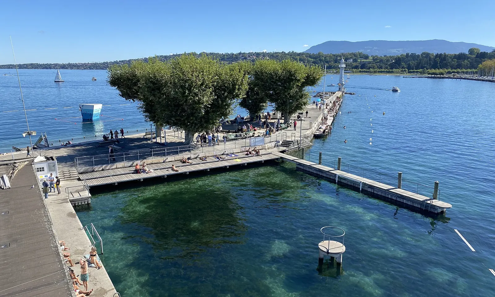
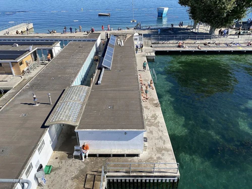
The jetty of the Bains des Pâquis from above, with sunbathers on the pier and clear green water of Lake Geneva

Photos: Credits to Mourad Ben Abdallah / Wikimedia Commons (CC BY-SA 4.0), Credits to Mourad Ben Abdallah / Wikimedia Commons (CC BY-SA 4.0), Credits to Mourad Ben Abdallah / Wikimedia Commons (CC BY-SA 4.0), Likasia (CC BY-SA 3.0)

Distance
Coupe de Noël race: 100 m
First built
1872, rebuilt in concrete 1931 to 1932
Summer entry
CHF 2 adults, CHF 1 children
Sauna season
20 Sep 2026 to 23 May 2027

Why go

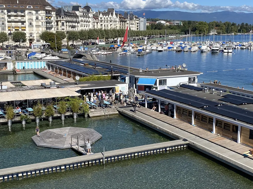
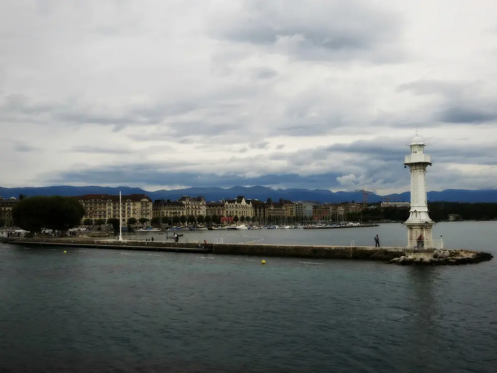
The Bains des Pâquis is a public bathing station on a jetty in Lake Geneva, a short walk from the main station, with the Jet d'Eau across the harbour and the Alps beyond. Baths have stood here since 1872; the present concrete ones went up on 448 piles in 1931 and 1932. In 1987 the city council voted to demolish and rebuild them, so the users formed an association, gathered more than 9,000 signatures and won a referendum in September 1988, when about 17,000 citizens voted to keep the baths. That association still runs them, entry still costs a couple of francs, and a large crowd swims there through the winter.

The route

In summer you swim straight off the jetty into clear lake water, between the bathing platforms and the lighthouse at the end. Diving boards and a zip line open from June, daily from 2pm to 6pm, and there is a climbing wall from mid May. In winter the baths turn into a sauna, hammam and Turkish bath, with direct access to the lake for a cold dip between rounds. The big event is the Coupe de Noël, held in the harbour since 1934: a 100 m swim along the Jardin Anglais in water of about 5 to 10 C, the weekend before Christmas.

When to go

The summer beach opens with the first warm days and runs until the end of September, depending on the weather. Winter swimmers use their own changing rooms from mid September to the end of May. The 2025 Coupe de Noël was held on 20 and 21 December; check the 2026 dates with the organisers. On 19 October 2026 the baths posted a water temperature of 16.5 C.

Getting there

The baths are at Quai du Mont-Blanc 30, 1201 Geneva. Buses 1 and 25 stop at Mont-Blanc nearby, Cornavin station is about a 10 minute walk away, and the yellow Mouettes boats on lines 1, 2 and 3 stop at Pâquis. There is bicycle and motorcycle parking at the entrance; coming by car is discouraged.

Permits and booking

In summer the beach costs CHF 2 for adults from 16 and CHF 1 for children, pensioners and AI holders; under 6s are free. Winter changing rooms cost CHF 2 a visit, and a Coupe de Noël pass valid to mid December is CHF 30. The sauna costs CHF 22, or CHF 15 on Mondays, with no reservations, and Tuesday is for women only. Animals are not allowed on site. Coupe de Noël entries go through the organisers' website.

How hard it is

In summer, an easy lake swim off a jetty. In winter the lake is properly cold; build up gradually and keep the first swims short.

Where to sleep

The Pâquis district behind the baths has many hotels at every price, and the Rive Droite lakefront has the grand ones.

Tips

  • From September 2026 synthetic swimwear is not allowed in the saunas; cotton wraps can be rented for CHF 2.
  • Look up the day's water temperature on the baths' home page before you go.
04 / 10

The Calanques

Marseille and Cassis, Provence, France

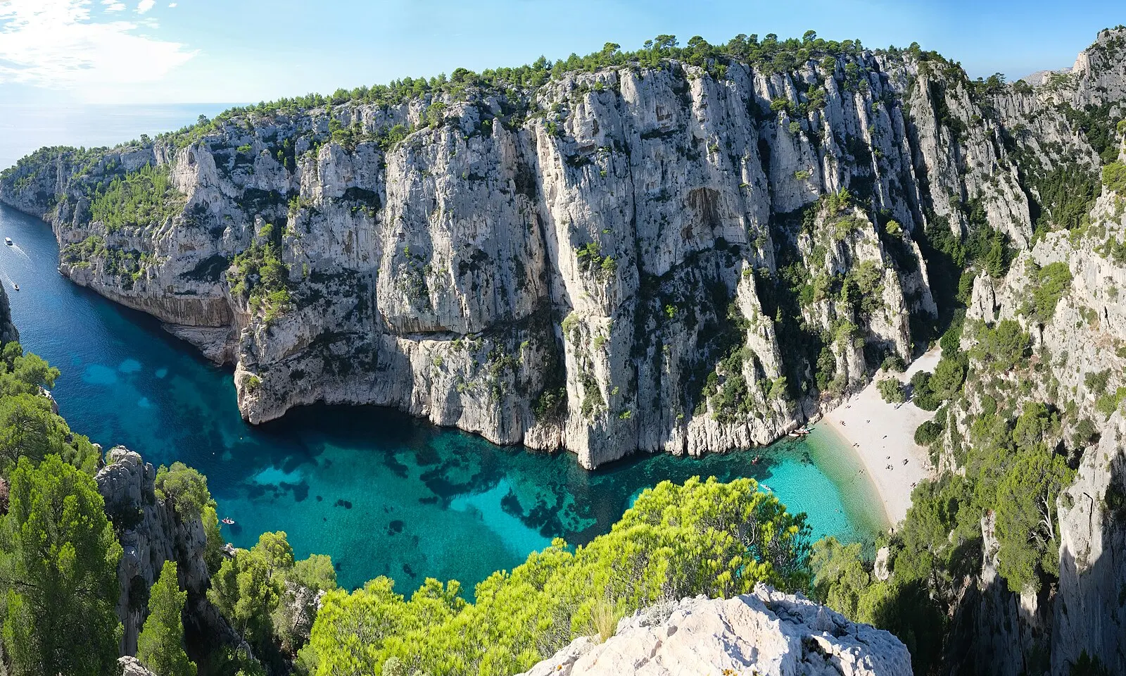
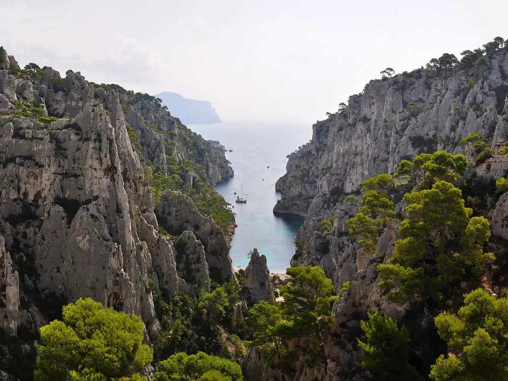
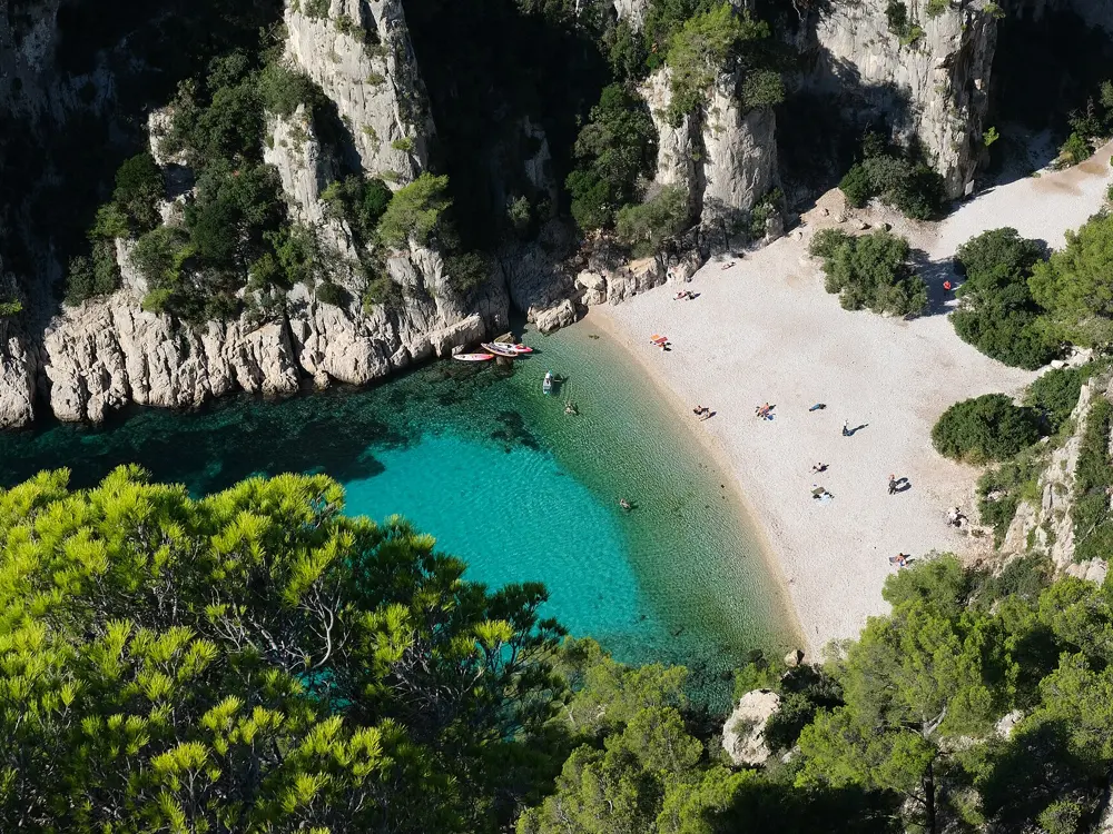
The deep turquoise inlet of the Calanque d'En-Vau between tall white limestone cliffs, with its small pebble beach

Photos: kallerna (CC BY-SA 4.0), Xxdayvidxx71 (CC BY-SA 4.0), Tobi 87 (CC BY-SA 3.0), kallerna (CC BY-SA 4.0)

Distance
Cassis to En-Vau: 7.5 km return
Climb
About 317 m up and down
National park
520 km², of which 85 km² is land
Sugiton
Free booking on peak summer days

Why go

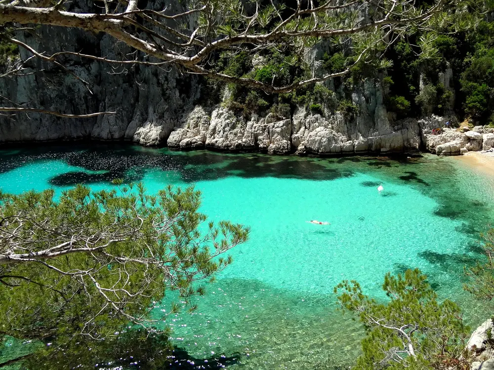
The Calanques are steep sided limestone inlets on the coast between Marseille, Cassis and La Ciotat, protected since 2012 as a national park that is mostly sea. The water at the bottom of each one is clear and blue over white pebbles and seagrass, the cliffs are pale grey and the walk in is part of the swim. En-Vau is the most famous: an inlet at the end of a 2.5 km valley that cuts 700 m into the limestone, with a pebble beach and no buildings at all. Sugiton, on the Marseille side, is two small coves under pines. Arriving on foot, hot from the trail, and walking straight into cold clear water is the reason to come.

The route

The classic is En-Vau from Cassis: from the Bestouan peninsula down to Port-Miou, along an old quarry track for about 1 km, over to Port-Pin, then up through the Portalet pass, rebuilt in 2022, and down the steep path to the beach. Marseille's tourist office rates it difficult: 7.5 km return, about 317 m of climbing and about 3 hours 30 minutes. Port-Pin, on the way, is a gentler swim under pines. Sugiton is reached from the Luminy campus in Marseille, either by a steep path cut in the rock or by the fire road. You can also rent a kayak and paddle in.

When to go

May, June and September give warm water with fewer people. From 1 June to 30 September a prefectural order controls access to the massifs because of fire risk: every evening between 5pm and 6pm the prefecture publishes the next day's level, and on red days the park is closed by land, the Route des Crêtes is closed and boats may not land.
Getting there

For En-Vau, start in Cassis at the Balli de Suffren bus stop on the Bestouan peninsula. Parking at Port-Miou is paid and fills early. For Sugiton, take the B1 bus from Castellane to Luminy in Marseille. Boat trips from Marseille's Vieux-Port pass the calanques but do not land passengers.

Permits and booking

Sugiton and Pierres Tombées need a free booking on peak days; in 2026 these were 20 and 21 June, every day from 27 June to 30 August, and 5, 6, 12 and 13 September. Bookings open at 9am three days ahead and close at 6pm the day before; groups are limited to five, and children under three need none. If the prefecture closes the massif, bookings are cancelled. Fires, camping and bivouacs are forbidden everywhere in the park, and dogs must be on a lead on the En-Vau trail.

How hard it is

The swims are easy; the walks are not. The paths are rocky and steep, with scree near En-Vau and a delicate section at the Portalet. There is no water on the trail and little shade at midday, and the beaches are unsupervised.

Where to sleep

Cassis has hotels and guest houses around its harbour; Marseille has everything. The La Fontasse youth hostel at La Gardiole is the closest bed to En-Vau.

Tips

  • Carry plenty of water and wear proper walking shoes, not sandals.
  • Download the Mes Calanques app for the day's access level, and print your Sugiton booking because phone signal is weak.
05 / 10

Cala Goloritzé

Baunei, Gulf of Orosei, Sardinia, Italy

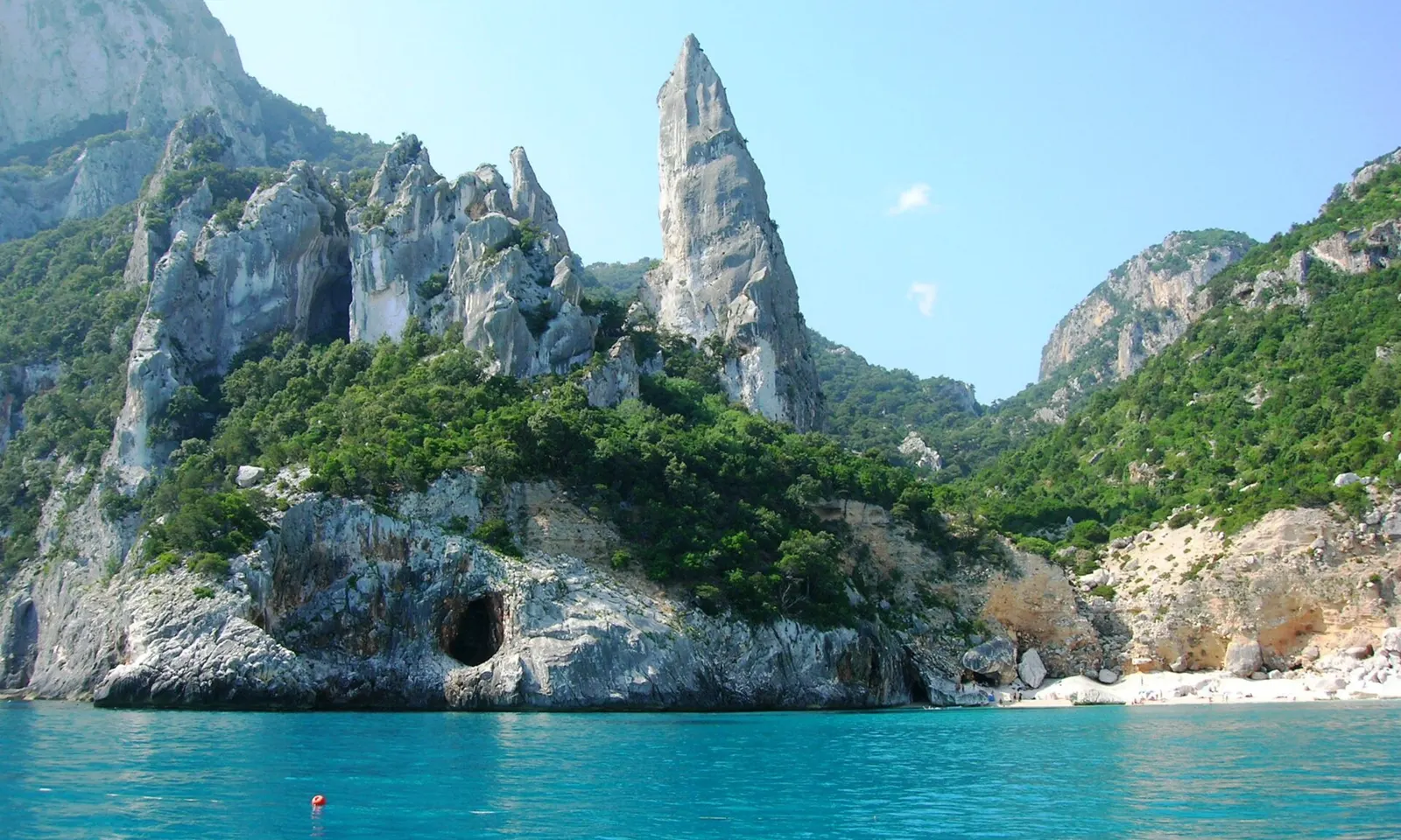
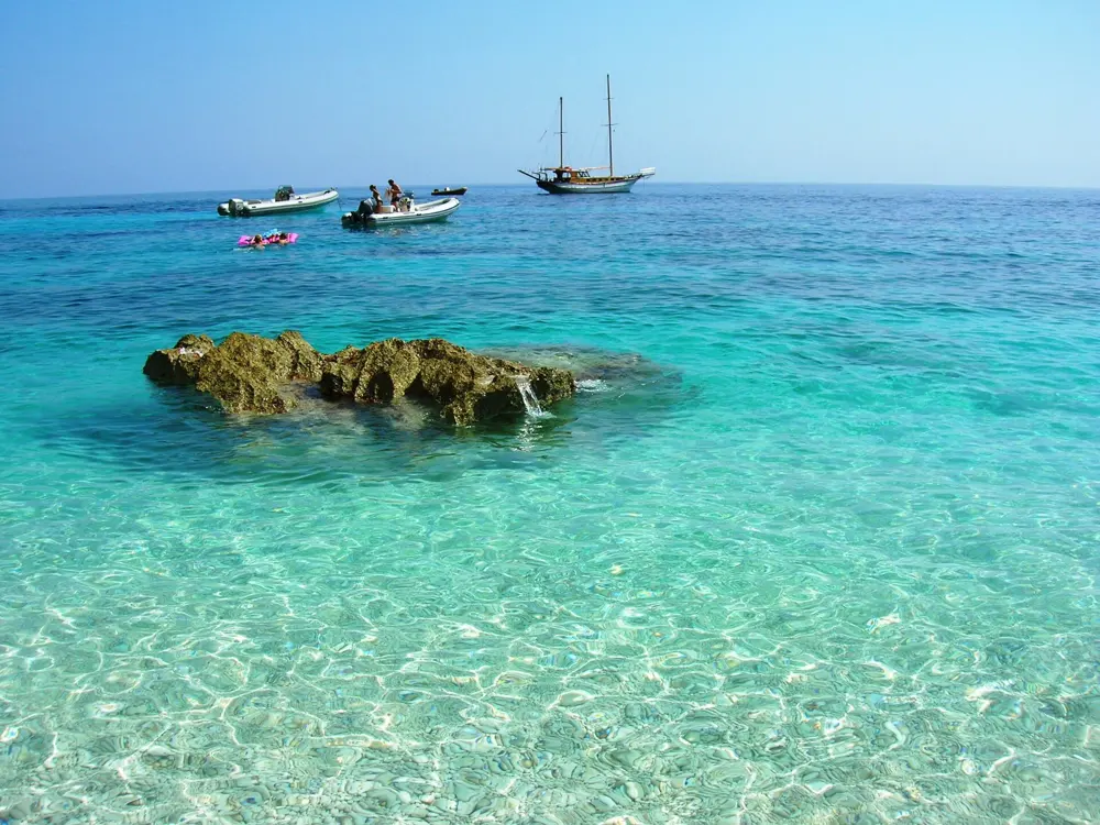
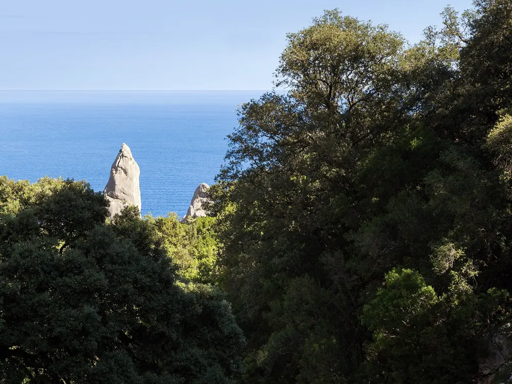
The limestone pinnacle of Cala Goloritzé above wooded cliffs and turquoise water in the Gulf of Orosei

Photos: Mentnafunangann (CC BY-SA 3.0), Sara Pizzagalli (CC BY-SA 2.0), Mentnafunangann (CC BY-SA 3.0), Unukorno (CC BY 4.0)

Walk
About 1 hour down, 2 hours back up
Pinnacle
143 m above the cove
Ticket
€7, under 6s free
Limit
250 people at a time

Why go

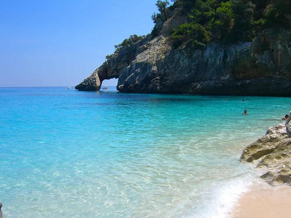
Cala Goloritzé is a small white pebble cove at the southern end of the Gulf of Orosei, under a 143 m limestone pinnacle, with a natural arch on one side and water so clear that boats seem to float above the bottom. Sardinia declared it a natural monument in 1993 and Italy a national monument in 1995. There is no road: you either walk down through the macchia from the Golgo plateau or arrive by boat, and motorboats must stay 200 m off the beach. The numbers are capped, there is nothing to buy on the beach, and the swim from pebbles to arch over pale blue water is about as good as the Mediterranean gets.

The route

Swim along the shore to the arch on the right side of the bay and out under the pinnacle, where the water deepens to deep blue. The cove is also a stop on Selvaggio Blu, the multi day trekking route along this coast, and on boat trips that run along the gulf from Santa Maria Navarrese and Arbatax, though boats cannot land you close in.

When to go

Summer is the season, and bookings open only three days ahead, so book on the first day you can. On foot, you must start down between 7.30am and 3pm and leave the beach by about 5pm.

Getting there

Drive to Baunei and up to the Golgo plateau, then follow the dirt road past As Piscinas to Su Porteddu, where the trail starts. Parking near the Su Porteddu restaurant is included in the ticket. The path climbs at first, to 490 m, then drops to the sea. Boats leave from Santa Maria Navarrese and Arbatax.

Permits and booking

The comune of Baunei charges €7 a person; children under 6 and Baunei residents go free. Since 2020 no more than 250 people may be at the cove at once. Bookings open three days before the date, on the Heart of Sardinia app or website, or by phone or WhatsApp. Walkers must wear closed shoes with grip and carry at least 2 litres of water each and food.

How hard it is

The swim is easy in calm weather; the walk out, about two hours uphill in the heat, is the hard part. There is no shade on the beach and no water.

Where to sleep

Santa Maria Navarrese and Baunei, the nearest villages, have hotels and B&Bs.

Tips

  • Start the walk at 7.30am to swim before the heat and leave before the climb gets brutal.
  • Bring water shoes: the beach is made of small white pebbles.
06 / 10

Sarakiniko

Milos, Cyclades, Greece

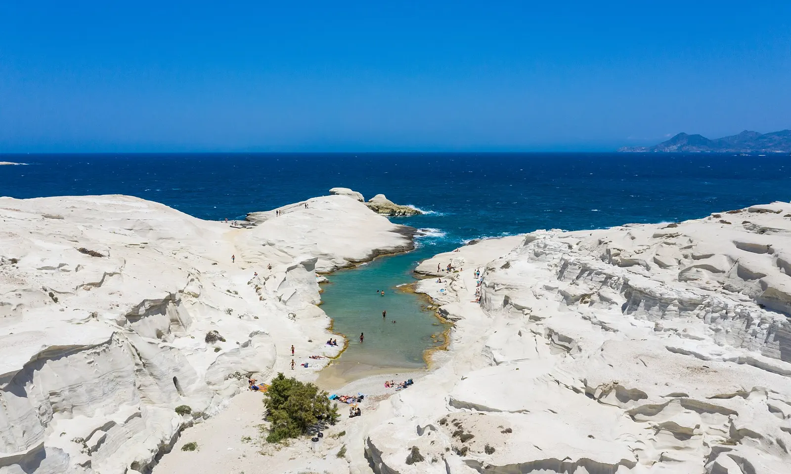
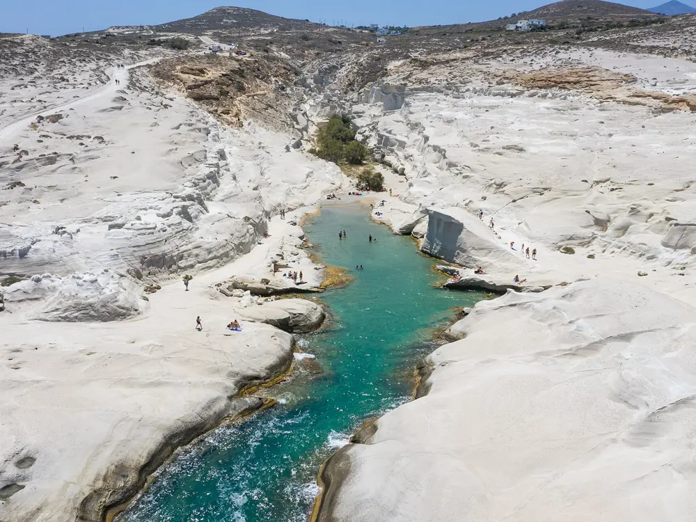
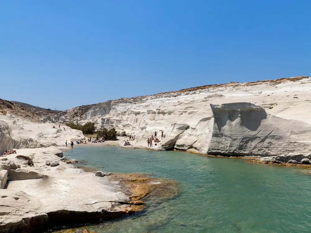
The narrow green inlet of Sarakiniko winding between smooth white volcanic rock towards the deep blue Aegean

Photos: dronepicr (CC BY 2.0), dronepicr (CC BY 2.0), Zde (CC BY-SA 4.0), dronepicr (CC BY 2.0)

Distance
About 10 minutes' drive from Adamas
Bus
€2 from Adamas
Wreck
The Africa, about 100 m offshore
Facilities
None, and almost no shade

Why go

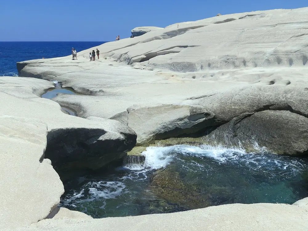
Sarakiniko is a cove on the north shore of Milos cut into smooth, greyish white volcanic rock, shaped into waves and ledges by the north wind and the sea. It looks like nowhere else in Greece: a narrow channel of green blue water between bone coloured rock, opening to the deep blue Aegean. People swim the inlet, jump from the ledges, climb in and out of the sea caves, and lie on rock that is warm long after the sun goes down. The name is said to come from Saracen pirates who sheltered in the caves.

The route

Swim the long inlet from the small sand beach out to the open sea, where the rock drops to deeper water. The caves along the shore can be explored with a torch. The wreck of the Africa, which ran aground in 2003, lies about 100 m from the shore and can be dived. The lower ledges are good for a first jump; check the depth before you go off anything higher.

When to go

May to October. Early morning and late afternoon are cooler and quieter; at midday the white rock is bright and there is almost no shade. When a north wind blows, the waves come straight into the cove and swimming out of the inlet becomes rough.

Getting there

Ferries run from Piraeus to Milos every day of the year, taking from about 2 hours 35 minutes on the fastest boats to about 4 hours on most; flights from Athens take about 40 minutes. From the port at Adamas it is about a 10 minute drive, and the KTEL bus runs direct from Adamas to Sarakiniko from 10am to 7.10pm in summer for €2, paid in cash to the driver. Outside summer most island routes stop running. There is a car park a short walk from the beach.

Permits and booking

Free, with no booking.

How hard it is

Easy in calm water, but there are no lifeguards and the rock is slippery at the waterline. Jumping is at your own risk, and rough water in a north wind makes getting out harder.

Where to sleep

Adamas, the port, and Plaka, the hill town about 5 km away, have most of the island's rooms. Pollonia, on the north east tip, is quieter.

Tips

  • Bring water, food and sun protection: there are no facilities at the beach.
  • Bring a torch if you want to look into the caves.
07 / 10

Praia da Marinha

Lagoa, Algarve, Portugal

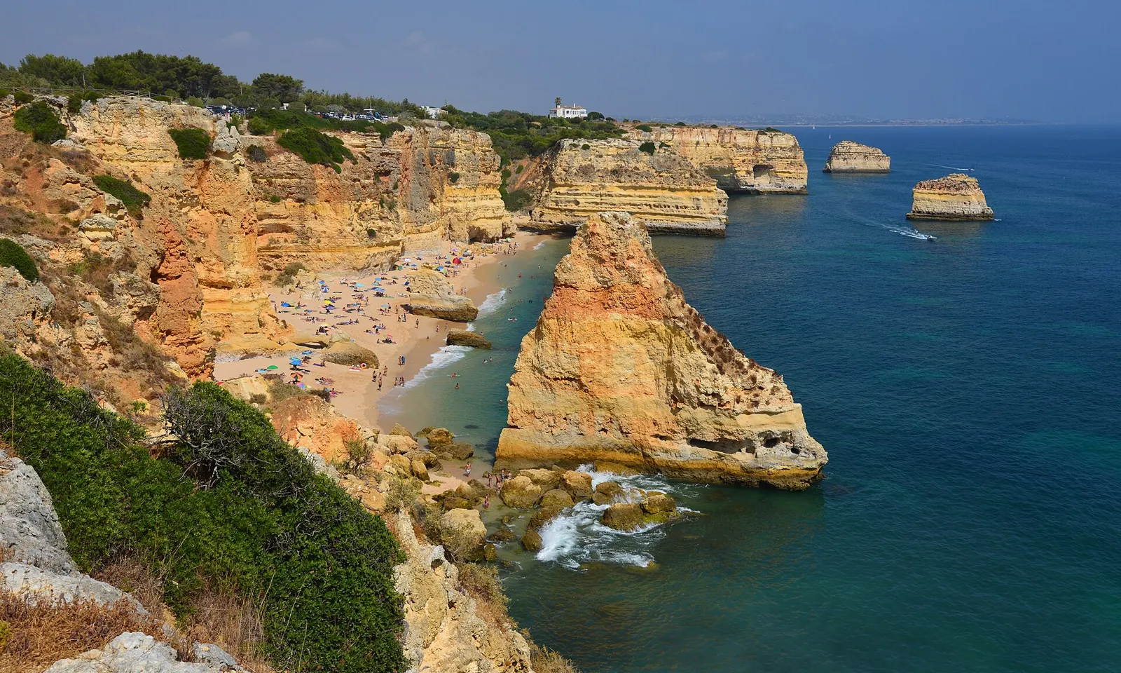
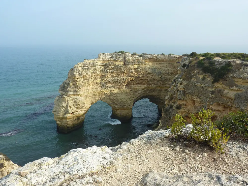
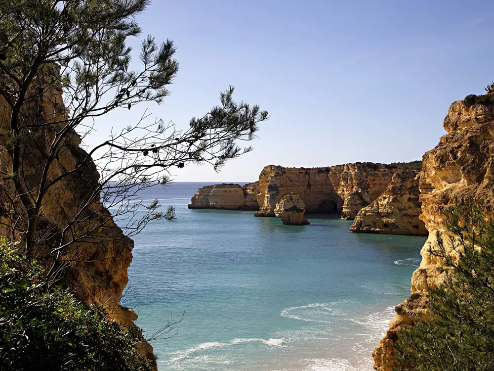
Praia da Marinha from the clifftop, with orange limestone stacks in clear blue water and the beach below

Photos: Tobi 87 (CC BY-SA 3.0), Rojs Rozentāls from Riga, Latvia (CC BY-SA 2.0), Va.sc. (CC BY-SA 3.0), KpokeJlJla (CC BY-SA 4.0)

Distance
Seven Hanging Valleys trail: 6 km one way
Climb
About 210 m of ascent on the trail
Rated
One of Europe's 10 most beautiful beaches (Michelin)
Benagil cave
No swimming in since 2024

Why go

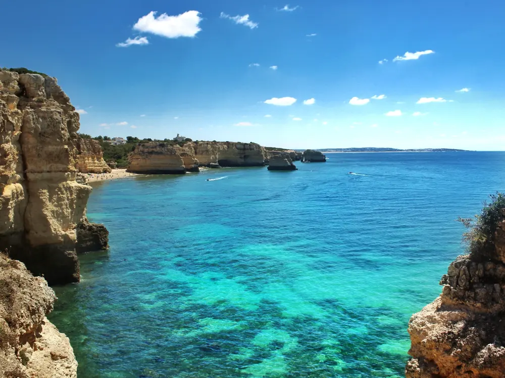
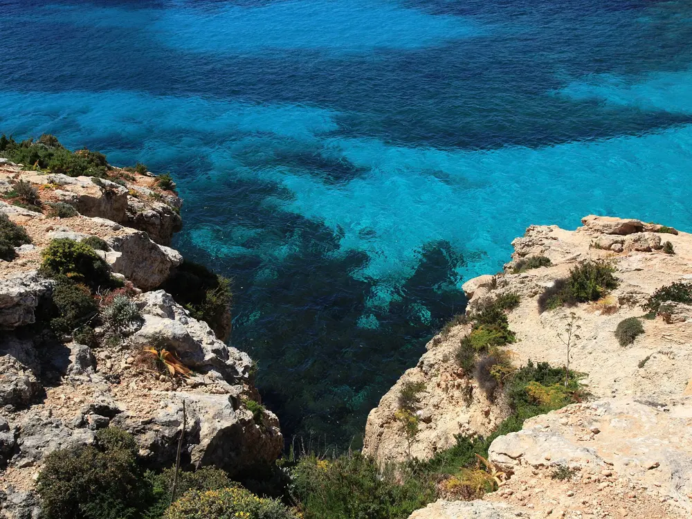
Praia da Marinha is a small sandy beach under orange limestone cliffs near Caramujeira in the municipality of Lagoa, with sea stacks standing in clear green water and a double arch on the headland. The Michelin Guide counts it among the ten most beautiful beaches in Europe, and in 1998 Portugal's environment ministry gave it a Golden Beach award for its natural qualities. It is the best known stretch of the Algarve's cliff coast, and for a swimmer it has something the busier resort beaches lack: rocks, stacks and coves to swim between, and water clear enough to watch the bottom as you go.
The route

From the beach, swim out along the cliffs to the stacks and around the rocks at each end; the water is clear on calm days. On land, the Seven Hanging Valleys trail starts from the clifftop car park and runs 6 km one way to Praia do Vale de Centianes in Carvoeiro, past Benagil beach at 2 km, Praia do Carvalho at 3.5 km and the Alfanzina lighthouse at 5 km, with about 210 m of ascent. Each beach on the way is a swim stop.

When to go

Late spring to early autumn for warm water. July and August bring crowds and a full car park by mid morning; May, June and September are calmer.

Getting there

Drive to the car park on the clifftop above the beach, near Caramujeira, and walk down the steep footpath. The trail between Marinha and Carvoeiro is linear, so arrange a lift or walk back.

Permits and booking

The beach is free. At the Benagil caves along the trail, rules in force since August 2024 forbid entering the caves by swimming or with floating devices and forbid landing on the beach inside the main grotto; the cave is visited only by licensed boat or with a certified kayak guide, one guide for at most six kayaks.

How hard it is

Easy swimming on calm days, but this is the Atlantic: check the swell and stay close to the beach when there are waves. The path down is steep.

Where to sleep

Carvoeiro and Armação de Pêra have hotels and apartments, and Lagoa town is inland a short drive away.

Tips

  • Arrive before 9am in summer to find a parking space.
  • Walk the trail from Marinha early in the day and swim at each beach on the way.
08 / 10

Zlatni Rat

Bol, Brač, Croatia

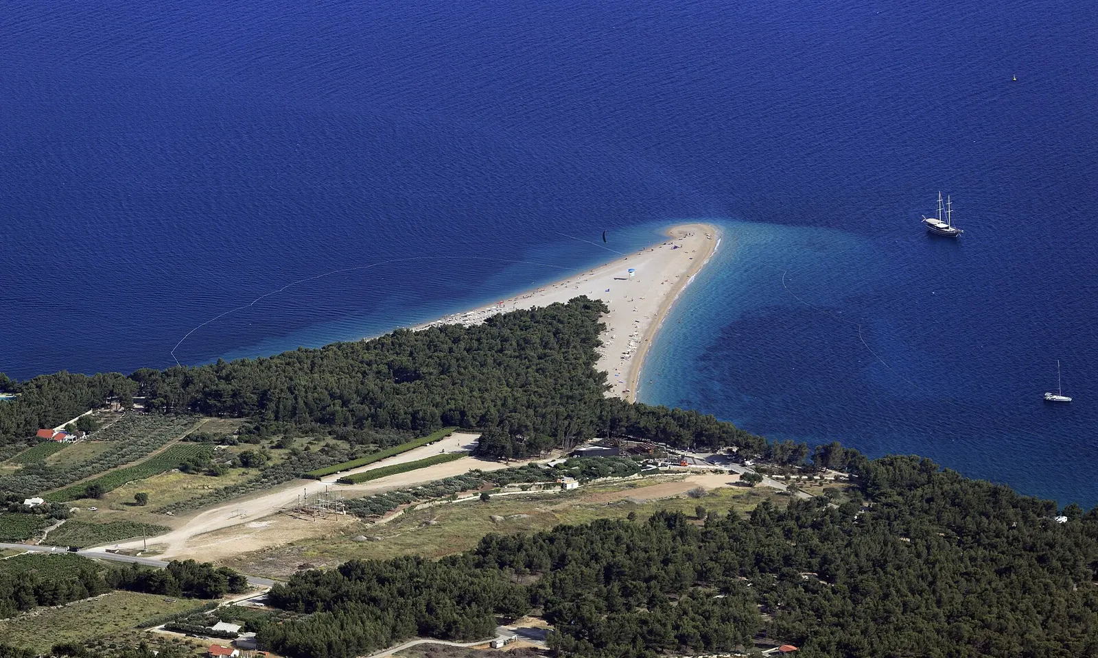
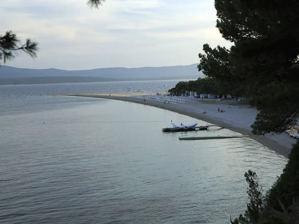
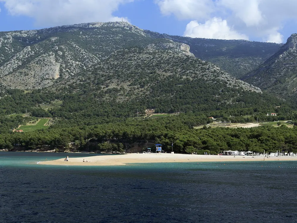
Zlatni Rat seen from Vidova Gora, a white pebble spit with pines curving into deep blue sea

Photos: Falk2 (CC BY-SA 4.0), Falk2 (CC BY-SA 4.0), Falk2 (CC BY-SA 4.0), Falk2 (CC BY-SA 4.0)

Distance
About 2 km west of Bol harbour
Length
East beach 377 m, west beach 479 m (2015)
Wind
Afternoon Maestral
Caution
Current beyond 150 m off the tip

Why go

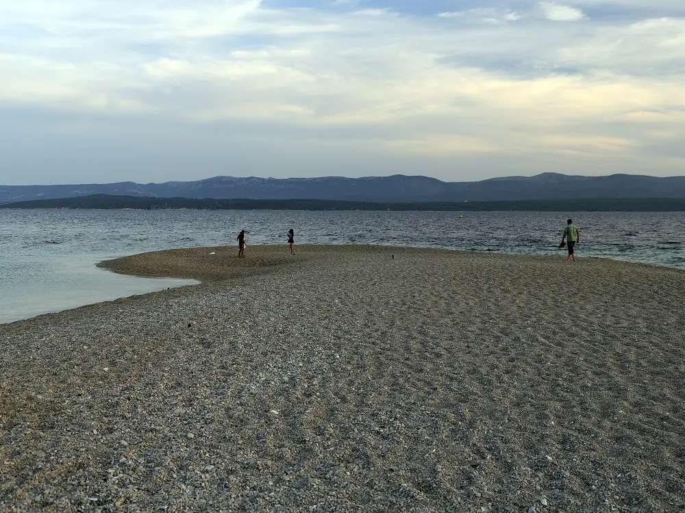
Zlatni Rat, the Golden Cape, is a spit of white pebbles that runs south from the island of Brač into the Hvar Channel, with pine woods along its spine and water on three sides. Its tip moves: the Jugo, a strong south easterly, can push it west, the summer Maestral swings it straight or east, and in a big storm it can change sides within hours. It is protected as a geomorphological phenomenon. You can swim off either side and choose the calmer one, and the reliable afternoon wind has made it a destination for windsurfers.

The route

Swim along either side of the spit; the pebbles shelve into clear water. Strong swimmers go round the tip, but do not go far out: more than about 150 m south of the tip the current can make it hard to swim back, though it usually carries you east towards Bol. In the afternoons the Maestral brings windsurfers out on the western side.

When to go

June to September for warm water. Mornings are calm and glassy; the wind fills in after lunch, which is the time for windsurfing rather than a long swim.

Getting there

Jadrolinija's catamaran on the Split, Bol and Jelsa line runs all year and lands in Bol harbour, from where the beach is about 2 km west along the shore. Car ferries also run from Split to Supetar on the north coast. Brač Airport, mostly open for summer flights, is about 14 km from the beach, with taxis but no public transport.

Permits and booking

Free, and no booking.

How hard it is

Easy close to shore. Watch for windsurfers in the afternoon and the current off the tip.

Where to sleep

Bol has hotels along the promenade towards the beach and apartments in the old town; Supetar, on the north coast, has more.

Tips

  • Walk or drive up Vidova Gora, at 780 m the highest point of the Adriatic islands, for the view down onto the spit.
  • Wear water shoes on the pebbles.
09 / 10

Islands Brygge Harbour Bath

Copenhagen, Denmark

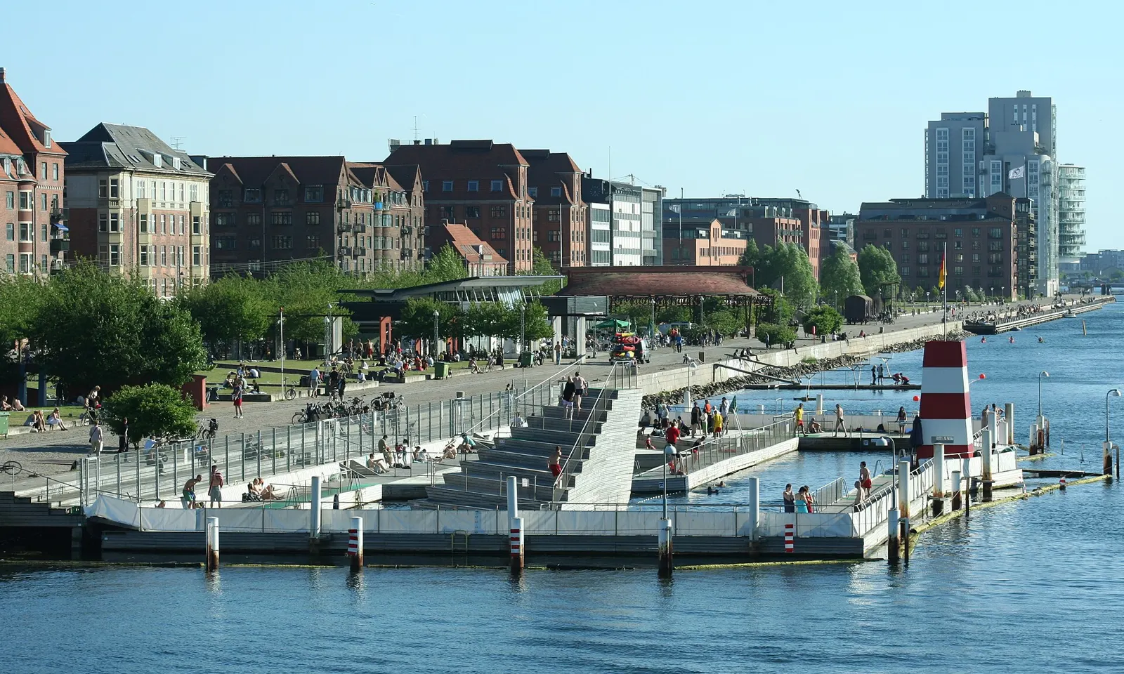
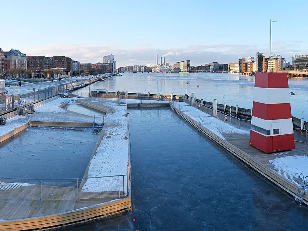
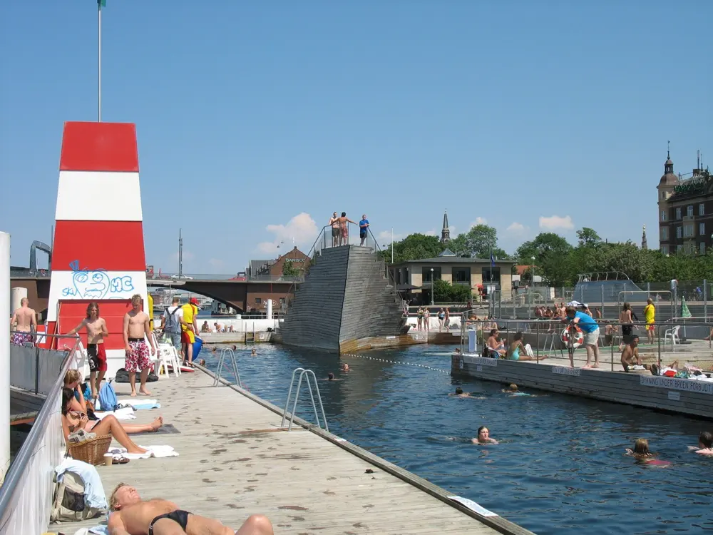
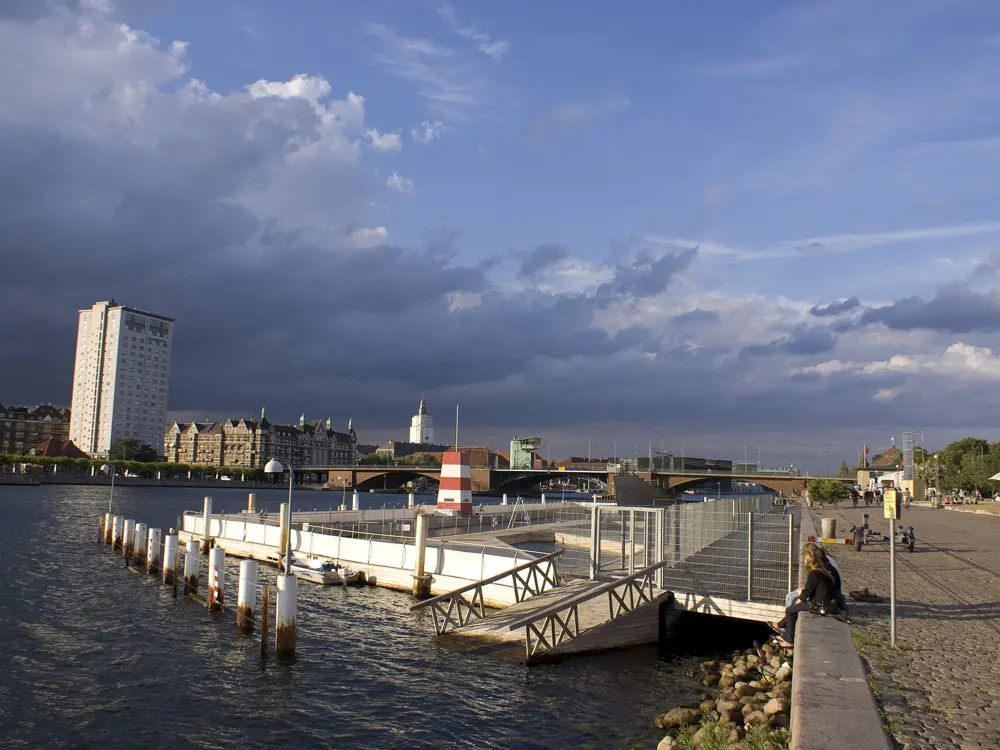
The wooden decks and pools of the Islands Brygge harbour bath on Copenhagen's harbour, with apartment blocks behind

Photos: Jacob Friis Saxberg from Denmark (CC BY 2.0), kallerna (CC BY-SA 4.0), milgrammer (CC BY 2.0), Daniel R. Witte (CC BY-SA 4.0)

Diving towers
1, 3 and 5 m
Pools
Five, two for children
Lifeguards
1 Jun to 31 Aug, 10am to 6pm
Season
1 May to 31 March

Why go

Copenhagen cleaned its harbour well enough to swim in, and Islands Brygge was the first place it let people do it, opening for the 2002 season and rebuilt as the permanent bath in 2003. It is a set of wooden decks and pools floating in the harbour in the middle of the city, with diving towers and room for about 600 people, a short walk from the city centre. The water is tested every day and has to be approved before swimmers are let in. It is the best example in Europe of a city giving its water back to its people, and it is free.

The route

Five pools: the larger ones for swimming lengths and for diving from the 1, 3 and 5 m towers, and two shallow children's pools, the shallowest 30 cm deep. Copenhagen has two more harbour baths, at Fisketorvet, with three pools, and the coral shaped bath at Sluseholmen, opened in December 2011, along with several marked bathing zones. In 2025 the baths and zones counted 475,298 visits between 1 June and 31 August, up almost 40% on the year before.

When to go

June to August, when lifeguards are on duty from 10am to 6pm. Visit Copenhagen gives the bath's season as 1 May to 31 March, and winter swimmers use it out of season.

Getting there

The bath is at Islands Brygge 14, 2300 Copenhagen S, on the south side of the inner harbour opposite the city centre. It is a short walk or bike ride from the centre over the harbour bridges.

Permits and booking

Free. Swimming in the harbour is allowed only in the harbour baths and the established bathing zones. Follow the lifeguards; when a red flag is raised, for poor water quality or another reason, swimming is prohibited. Heavy rain can cause sewage overflows that close the baths for a couple of days.

How hard it is

Easy, guarded water in summer. The harbour is cold outside July and August, and the 5 m tower is higher than it looks from the deck.

Where to sleep

Islands Brygge and nearby Vesterbro have hotels and hostels, and central Copenhagen is across the bridge.

Tips

  • After heavy rain, look for the red flag before you get in: it means swimming is prohibited.
  • If Islands Brygge is crowded, try the harbour baths at Fisketorvet or Sluseholmen.
10 / 10

Blue Lagoon, Comino

Comino, Malta

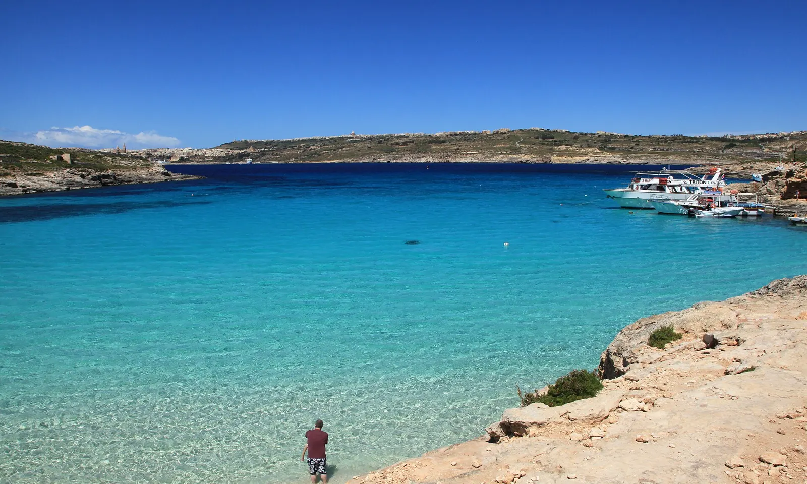
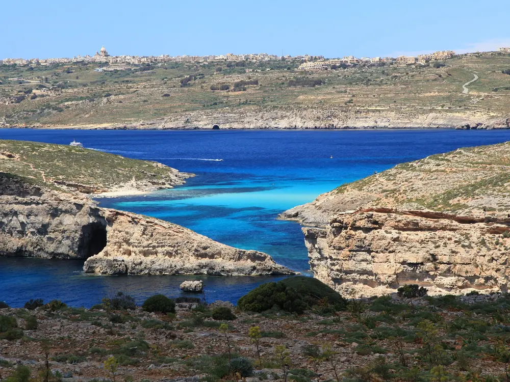
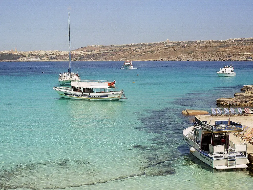
Clear pale blue water over white sand in the Blue Lagoon at Comino, with boats moored across the channel

Photos: Frank Vincentz (CC BY-SA 3.0), Silar (CC BY-SA 4.0), Frank Vincentz (CC BY-SA 3.0), Frank Vincentz (CC BY-SA 3.0)

Distance
About 15 minutes by boat from Malta
Visitor cap
4,000 at any one time
Booking
Free, in three daily slots
Comino
3.5 km², a nature reserve

Why go

The Blue Lagoon is the channel between Comino and the islet of Cominotto, with a white sandy bottom under shallow water of a pale, almost unreal blue. Comino is tiny, 3.5 km² with two permanent residents, and it is a bird sanctuary and nature reserve whose surrounding waters are a Natura 2000 marine protected area. The lagoon is shallow enough to stand in near the shore and clear enough that you see your feet from the surface; swim across to Cominotto and the water deepens to dark blue. Malta now limits numbers, which makes it better to swim in than it was.

The route

Swim from the shore across the lagoon to Cominotto and back, or along the rocks for snorkelling. On crowded days the Crystal Lagoon, best reached by boat, Santa Marija Bay and San Niklaw Bay are quieter. A walk up to St Mary's Tower, built by the Knights in 1618 about 80 m above the sea, gives the view over the lagoon.

When to go

May and June are the best months: warm enough to swim, before the July and August crowds. In summer, come before 10am or after 4pm. In winter the sea drops to around 16 C and undercurrents are common, so it is not a swimming season.

Getting there

Comino ferries sail from Marfa and Ċirkewwa in the north of Malta, taking around 15 minutes, and from Mġarr on Gozo. The return ferry from Malta costs about €15 for adults.

Permits and booking

Since 1 May 2025, anyone arriving by private or commercial boat who wants to set foot at the Blue Lagoon must book a free slot at bluelagooncomino.mt: 8am to 1pm, 1.30pm to 5.30pm or 6pm to 10pm. The booking gives a QR code, shown at the access points in exchange for a wristband valid for the slot. The system caps visitors at 4,000 at a time; in summer 2024 up to 12,000 were counted at once. Landing without a booking can bring a fine.

How hard it is

Easy, shallow water near the shore. Shade is scarce and the sun is strong Stay inside the marked swimming zones.

Where to sleep

Stay in the north of Malta near the Marfa and Ċirkewwa ferries, or on Gozo near Mġarr.

Tips

  • Book your slot as soon as your dates are fixed in July and August.
  • Bring a hat, water and sun protection; food comes from kiosks or the boats.

Sources

Distances, heights, seasons and permit rules were checked against these pages. Rules change, so check the park or trail authority before you go.