Rungs Labs

Rungs Pilgrimage · Cycling · The world

The 10 Best Places to Cycle in the World

Mont Ventoux, Provence, France. Photo: BlueBreezeWiki (CC BY-SA 3.0)

A great place to ride gives you roads or trails you would cross the world for, and it gives them to you on a bike rather than through a car window. Some of these are famous climbs that test your legs against a century of racing history. Others are long, gentle routes where the pleasure is in the miles, the villages and the food along the way.

These ten cover road climbing, touring, gravel and mountain biking on six continents. For each one you get the classic rides, the best season, how to get there, any permits or road rules, how hard it is and where riders stay. Every fact comes from tourism boards, park and road authorities or the routes' own records, linked at the bottom of the page.

Updated 2026-10-18

  1. 01Mont VentouxProvence, France
  2. 02The Sella Ronda and the Dolomite passesDolomites, Italy
  3. 03The Serra de TramuntanaMallorca, Spain
  4. 04The Shimanami KaidoHiroshima and Ehime, Japan
  5. 05The Cape PeninsulaCape Town, South Africa
  6. 06The Carretera AustralAysén and Los Lagos, Chile
  7. 07MoabUtah, United States
  8. 08The Danube Cycle Path, Passau to ViennaGermany and Austria
  9. 09The Otago Central Rail TrailCentral Otago, New Zealand
  10. 10Taroko Gorge to WulingHualien and Nantou, Taiwan
01 / 10

Mont Ventoux

Provence, France
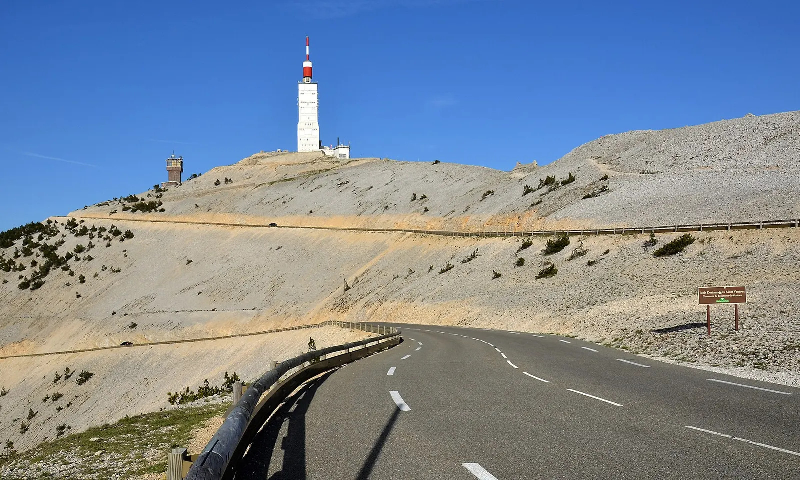
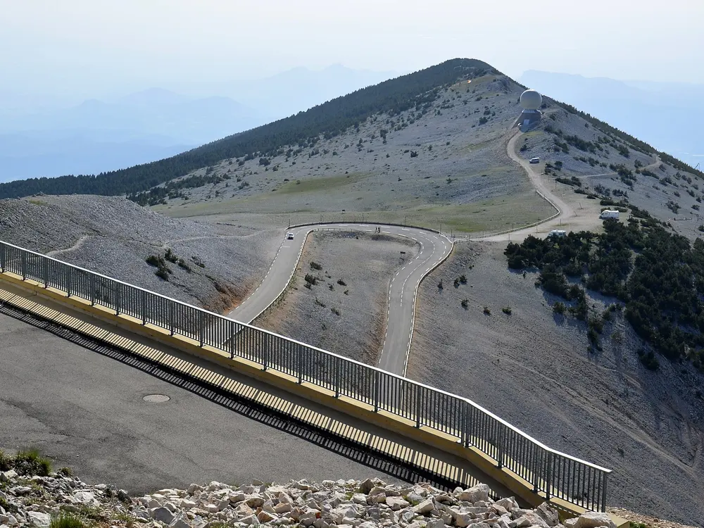
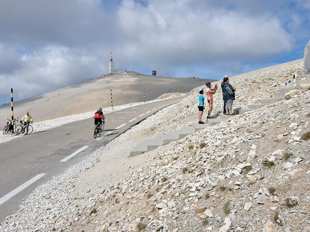
The road climbing across bare white limestone to the mast on the summit of Mont Ventoux

Photos: BlueBreezeWiki (CC BY-SA 3.0), BlueBreezeWiki (CC BY-SA 3.0), BlueBreezeWiki (CC BY-SA 3.0), BlueBreezeWiki (CC BY-SA 3.0)

Distance
21.8 km from Bédoin
Climb
1,617 m from Bédoin
Summit
1,910 m
Season
April to mid-November

Why go

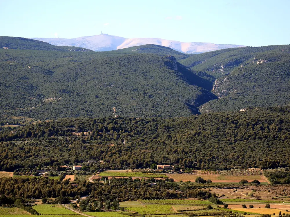
Mont Ventoux stands alone above Provence, so you see it long before you reach it. The upper slopes are bare white limestone, the lunar landscape that starts at Chalet Reynard, with the red and white mast of the old weather station on top. It is also cycling's most storied hill. The Tour de France has crossed or finished on it 18 times since 1951, and Tom Simpson died on its slopes in 1967, about a kilometre from the top, where a memorial now stands and riders leave tokens.

The route

Three paved roads reach the summit. The classic climb starts in Bédoin and runs 21.8 km through forest to Chalet Reynard at 1,435 m, then out onto the open stone for the last stretch past the Col des Tempêtes. From Malaucène the north side climbs 21.2 km, more sheltered from the wind. The road from Sault is the longest, about 26 km, and joins the Bédoin road at Chalet Reynard. Riding all three in one day makes you a member of the Club des Cinglés du Mont-Ventoux.

When to go

The summit road is closed every winter. In 2025 the Département de Vaucluse lowered the barriers on 18 November, and after a snowy winter the south side reopened on 17 April 2026, with the north side following in mid-May. No date has been announced yet for the 2026 closure, so check before riding in November.

Getting there

Bédoin, the usual start, lies on the D974 about 50 km east of Avignon and 15 km from Carpentras. Malaucène lies on the northwest side and Sault to the east.

Permits and booking

No permit or fee is needed to ride. In winter the Département closes the D974 to all traffic, bicycles included, above the Mont Serein station on the north side and Chalet Reynard on the south. After the spring reopening, cyclists must descend by the same road they climbed until the end of May. The Club des Cinglés registers riders through its own website.

How hard it is

From Bédoin the climb gains 1,617 m at an average of 7.43 percent, and the steepest kilometre, the ninth, averages 10.5 percent in the forest. Malaucène is about as hard, averaging 7.23 percent with ramps up to 15 percent. Sault averages 4.4 percent. The wind is the real hazard: it blows at about 90 km/h on roughly 240 days a year, and gusts have reached 320 km/h, enough to close the road. A Tour stage in 2016 was cut short at Chalet Reynard for that reason.

Where to sleep

Most riders base themselves in one of the three villages at the foot of the climbs. Bédoin is the busiest and sits at the start of the classic route.

Tips

  • Carry a windproof jacket for the summit and the long descent, even on a hot day.
  • Check the Département de Vaucluse road conditions page before riding in spring or late autumn.
  • Skip the summit on strong mistral days and turn at Chalet Reynard instead.
02 / 10

The Sella Ronda and the Dolomite passes

Dolomites, Italy

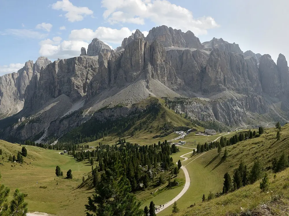
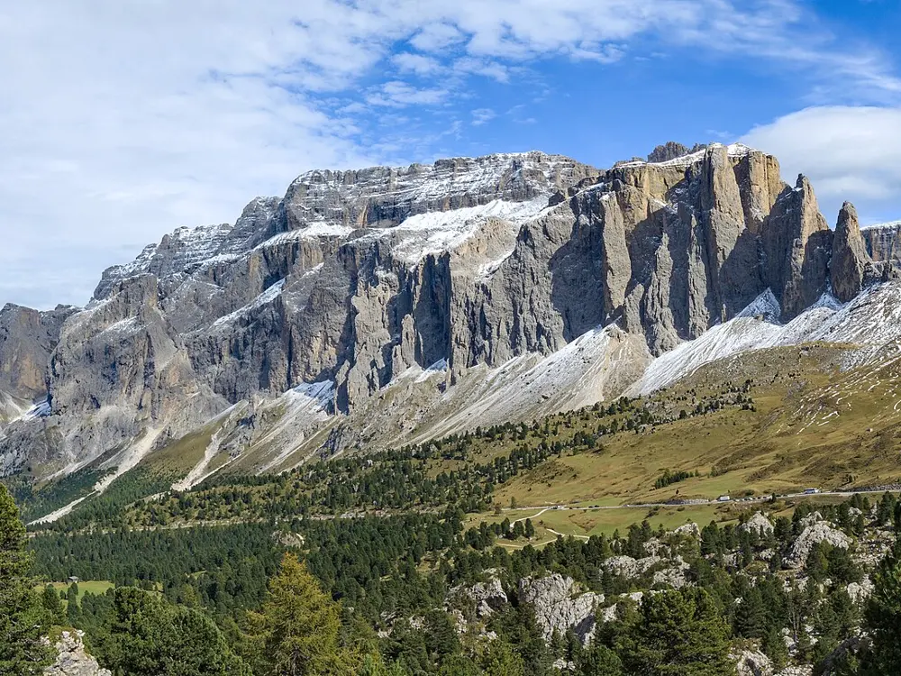
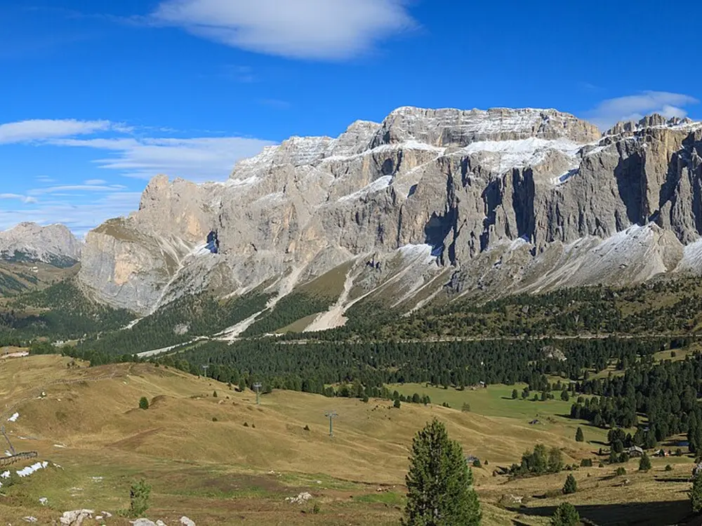
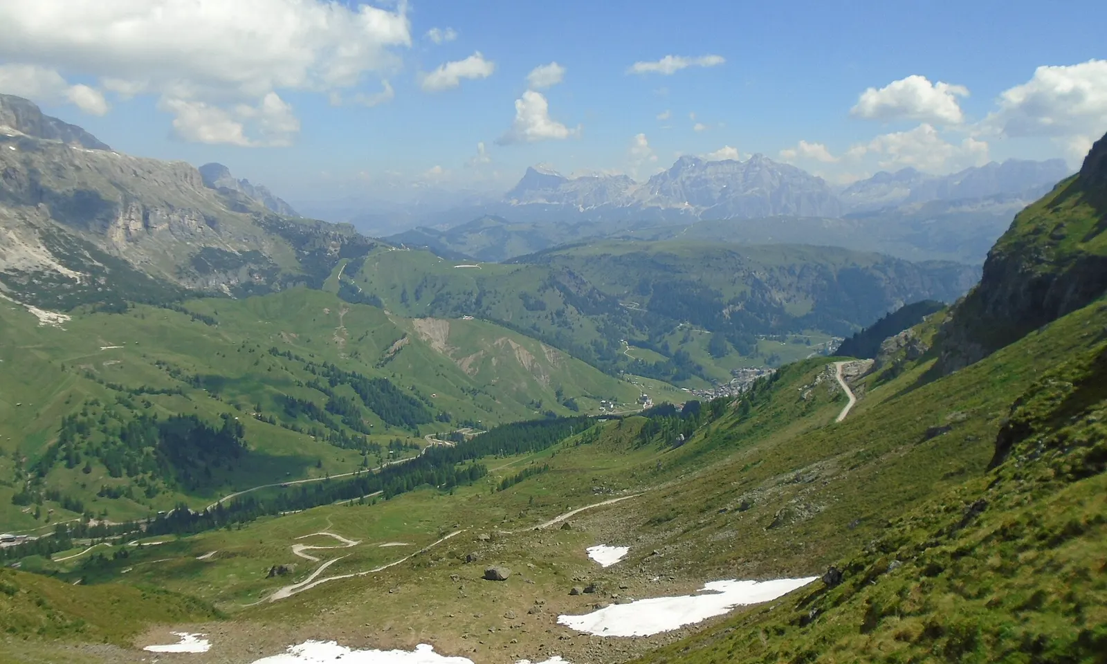
The SS48 road winding down a green valley from Passo Pordoi towards Arabba

Photos: Pimlico27 (CC BY-SA 4.0), This Photo was taken by Wolfgang Moroder. Feel free to use my photos, but please mention me as the author and send me a message. This image is not in the public domain. Please respect the copyright protection. It may only be used according to the rules mentioned here. This specifically excludes use in social media, if applicable terms of the licenses listed here not appropriate. Please do not upload an updated image here without consultation with the Author. The author would like to make corrections only at his own source. This ensures that the changes are preserved.Please if you think that any changes should be required, please inform the author.Otherwise you can upload a new image with a new name. Please use one of the templates derivative or extract. (CC BY-SA 3.0), H. Zell (CC BY-SA 3.0), H. Zell (CC BY-SA 3.0)

Distance
About 51 km loop
Climbing
About 1,700 m
Highest pass
Passo Pordoi, 2,239 m
Car-free days
5 June and 11 September 2027

Why go

Four mountain passes ring the Sella group, a fortress of pale limestone that rises to 3,151 m at Piz Boè, and one road links them in a loop. You can ride all four in a morning and see the massif from every side, with the Sassolungo and the Marmolada in view. Some of the Giro d'Italia's most famous climbs are close by, and twice a year the loop is closed to cars for the day.

The route

The Alta Badia tourist board describes the loop anticlockwise from Corvara: up through Colfosco to Passo Gardena at 2,136 m, then Passo Sella at 2,218 m, down towards Canazei and up to Passo Pordoi at 2,239 m. More than 30 bends drop to Arabba, and Passo Campolongo at 1,875 m leads to a descent of about 7 km back to Corvara. Its route data gives 50.7 km and 1,674 m of ascent. Stronger riders add Passo Giau, whose last ten kilometres from the Selva di Cadore side average 9.6%, or Passo Fedaia at 2,057 m below the Marmolada.

When to go

Summer and early autumn are the riding season, and snow can linger or return at pass height outside it. The Sellaronda Bike Day ran on 6 June and 12 September 2026, and the organisers list 5 June and 11 September 2027. The Maratona dles Dolomites, a mass ride over the passes, is set for 4 July 2027.

Getting there

Bolzano airport is 40 km from Val Gardena, Innsbruck 120 km and Verona 190 km. From Bolzano, regional buses, transfers and taxis run into the valleys, and AltoAdigeBus runs direct coaches from several larger airports.

Permits and booking

No permit or fee is needed to ride the passes. On Sellaronda Bike Day the four passes are closed to motor traffic from 9:00 to 16:00, with no registration or charge, and the organisers make helmets obligatory. Italian law did not require adult cyclists to wear helmets as of early 2026. South Tyrol dropped a planned through-traffic ban on Passo Gardena for autumn 2026 in favour of a digital test with no barriers or fines, and rules from 2027 are undecided.

How hard it is

Gradients on the loop are mostly 8 to 10% and sometimes reach 13%, on mostly good asphalt with small potholes in places. From Arabba, Pordoi gains 637 m in 9.4 km at an average of 6.8%. Giau is far harder, with a steepest kilometre of 11.8%. Summer traffic is the real challenge, as cars, coaches and motorcycles share the narrow hairpins.

Where to sleep

Riders base themselves in Corvara or another Alta Badia village, in Sëlva or Ortisei in Val Gardena, in Arabba or in Canazei, all on or near the loop.

Tips

  • Start early on ordinary days to climb before the traffic builds on the passes.
  • On Bike Day the roads only close at 9:00, so expect cars on the passes before then and ride anticlockwise as the organisers advise.
  • Carry a windproof layer for the long descents, which stay cold at over 2,000 m even in summer.
03 / 10

The Serra de Tramuntana

Mallorca, Spain

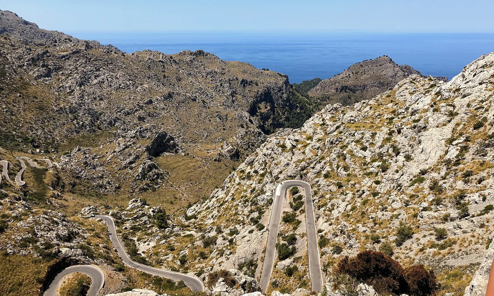
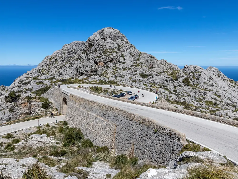
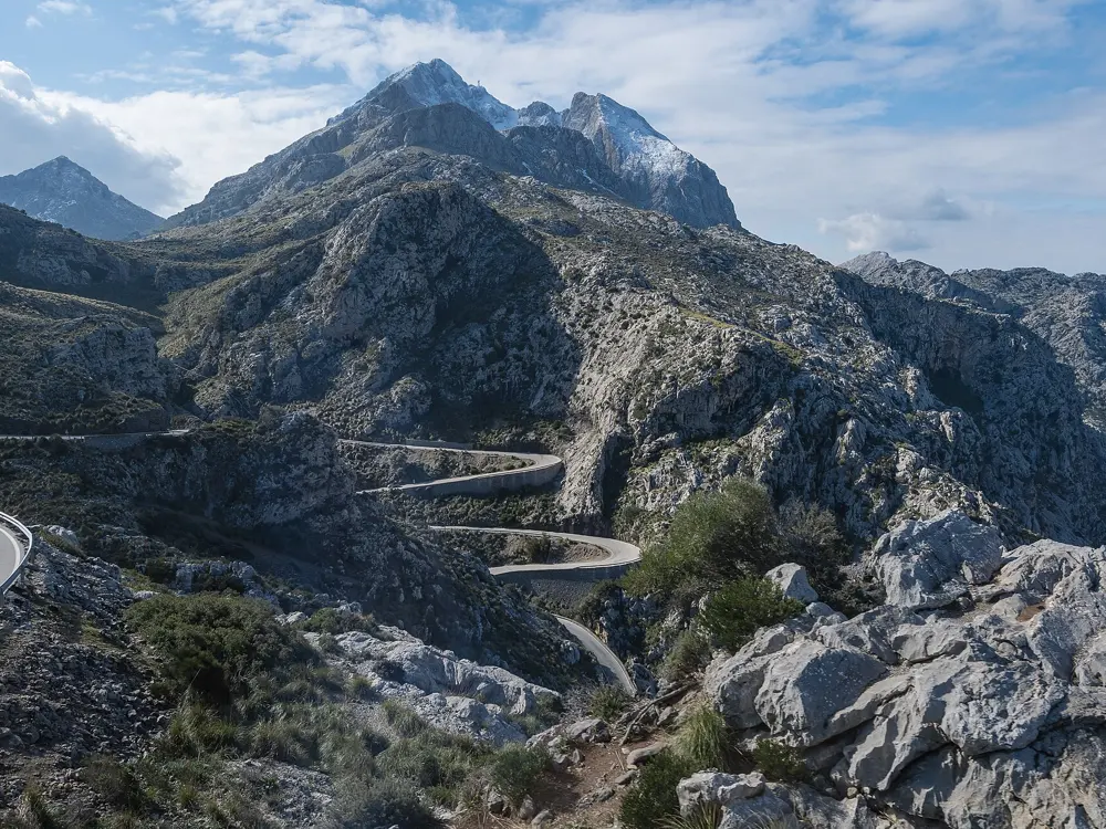
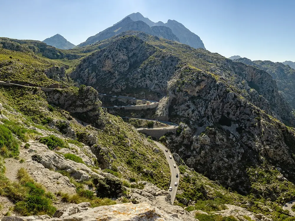
The Ma-2141 road to Sa Calobra winding in hairpins down a rocky valley towards the sea

Photos: Wasquewhat (CC BY-SA 4.0), User:Matthias Süßen (CC BY-SA 4.0), Isiwal (CC BY-SA 4.0), pjt56 --- If you use the picture outside Wikipedia I would appreciate a short e-mail to pjt56@gmx.net or a message on my discussion page (CC BY-SA 3.0)

Distance
46.7 km, Lluc to Sa Calobra and back
Signature climb
Sa Calobra, about 10 km at 7%
Highest peak
Puig Major, 1,436 m
Season
Autumn to spring

Why go

The Tramuntana runs along Mallorca's north coast, a limestone range listed by UNESCO in 2011, and its roads were built with a care for curves that riders now come for from all over Europe. Professional teams prepare for the season here each spring, so in January and February you may share a climb with a team in matching kit. The climbs are long and steady rather than brutal, and nearly every one ends in a view of the sea.

The route

Sa Calobra is the famous one. From the turn near Lluc, 2.6 km of climbing takes you to the Coll dels Reis at 682 m, then the road drops through 26 hairpins and a loop that passes under itself to a cove at sea level, and the only way home is back up, about 10 km at around 7%. Puig Major is the long climb from Sóller, nearly 14 km at about 6%, topped by the Monnaber tunnel and followed by the Gorg Blau and Cúber reservoirs on the way to Lluc. The coast road through Valldemossa and Deià links Sóller with the southwest, and Cap de Formentor is a rolling out-and-back to the lighthouse from Port de Pollença.

When to go

Thousands of riders come through autumn, winter and spring, and pros fill the roads in January and February. Summer is hot, with heavy tourist traffic, so ride early. The Mallorca 312 sportive in late April offers 312, 225 and 167 km routes; the 2027 edition is on 24 April and sold out within hours of opening.

Getting there

Fly to Palma, then head north. Bike hire is easy to find in the riding bases, and many hotels in the north are set up for cyclists.

Permits and booking

No permit is needed to ride. From 15 May to 18 October 2026, the Formentor road was closed to private cars from 10 am to 10 pm beyond the beach car park, with fines of 100 to 200 euros for drivers, but bicycles may pass. Spanish law requires a helmet on roads outside towns.

How hard it is

Gradients are moderate, but the big days add up: the classic Puig Major loop runs to 138 km with about 2,640 m of climbing. On the Sa Calobra descent coaches inch round the bends, and in the narrow canyon near the bottom uphill traffic has right of way. There is little shade on the climb.

Where to sleep

Port de Pollença, Port d'Alcúdia and Playa de Muro are the usual bases, close to Formentor, the Lluc loops and the 312 start. Sóller suits riders who want Puig Major and the coast road on the doorstep.

Tips

  • Carry lights for the Monnaber tunnel near the top of Puig Major.
  • Start Formentor early in summer, before the coaches and the heat.
  • Take more water than you think for Sa Calobra, which has almost no shade.
04 / 10

The Shimanami Kaido

Hiroshima and Ehime, Japan

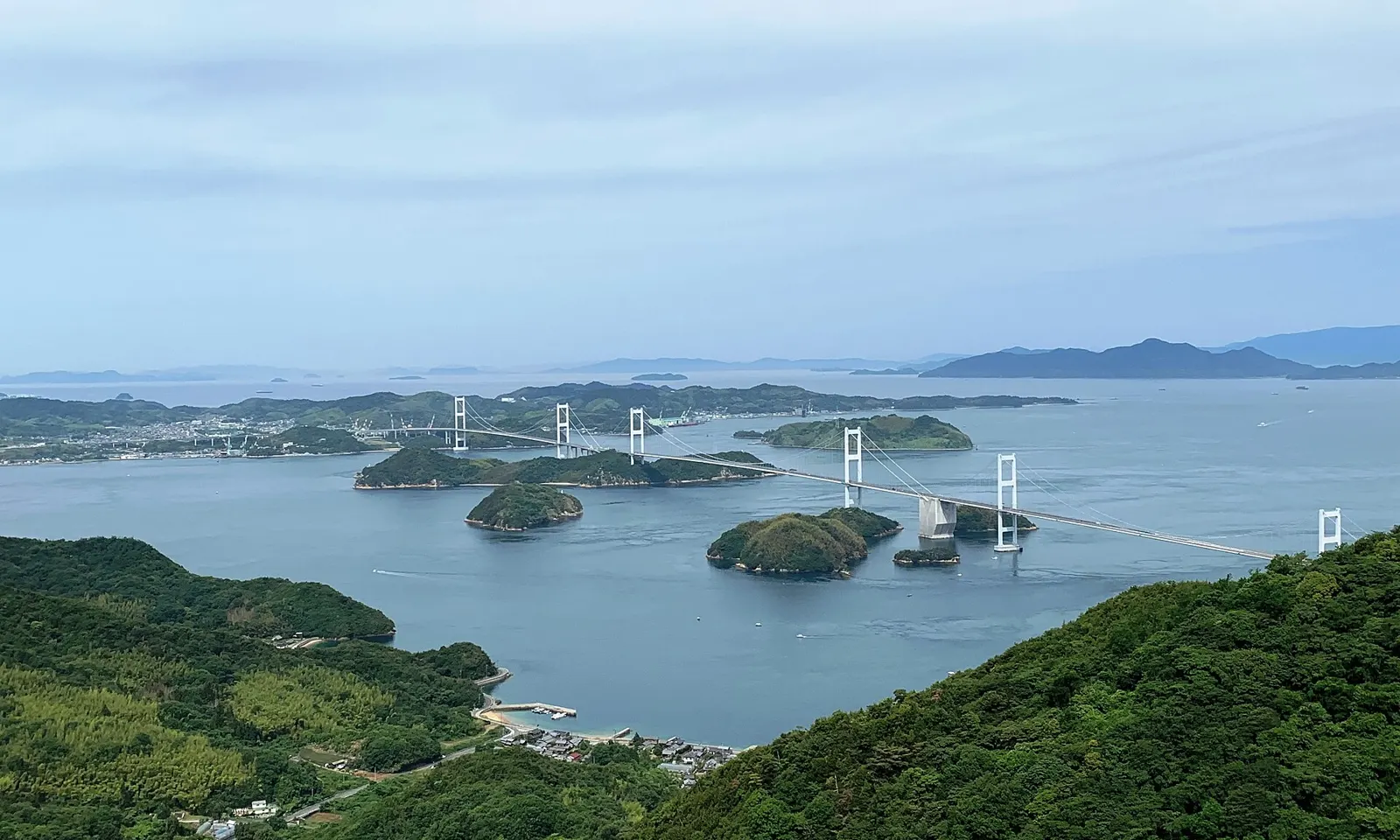
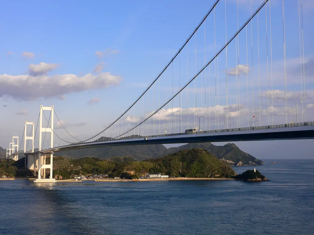
The Kurushima Kaikyo Bridge crossing a strait dotted with green islands, seen from a hilltop

Photos: OKJaguar (CC BY-SA 4.0), redlegsfan21 (CC BY-SA 2.0), Herry Lawford (CC BY 2.0), Dyota Condrorini (CC BY-SA 2.0)

Distance
About 70 km one way
Islands
Six
Bridge tolls
Free for bicycles until 31 March 2028
Season
All year

Why go

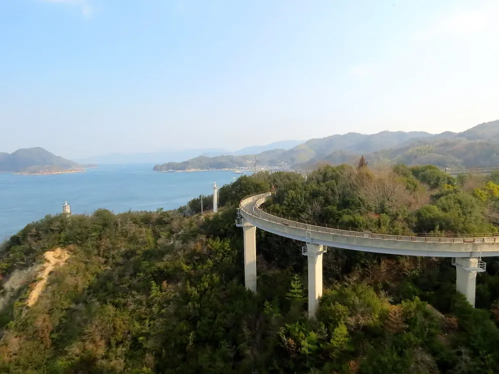
The Shimanami Kaido is the only road link between Honshu and Shikoku that you can cross by bicycle. A separate cycle path runs beside the expressway over each bridge, so you ride high above the Seto Inland Sea, then drop onto quiet island roads past fishing ports and temples. Japan named it a National Cycle Route in 2019.

The route

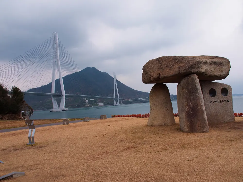
The classic ride runs from Onomichi in Hiroshima to Imabari in Ehime, about 70 km by the bike route, across Mukaishima, Innoshima, Ikuchijima, Omishima, Hakatajima and Oshima. Blue lines painted on the road mark the way. Riders take a short ferry from central Onomichi to Mukaishima, because the Shin-Onomichi Bridge has no cycle path and the Onomichi Bridge is narrow and busy. On Ikuchijima, the town of Setoda has Kosanji Temple and the Hirayama Ikuo museum. The finale is the Kurushima Kaikyo Bridge, three suspension bridges in a row with a total length of 4,105 m, crossing the strait from Oshima to Imabari. Kirosan Observatory on Oshima, at 307.8 m, looks straight down on it.

When to go

The route is ridden all year in a mild climate. Summer brings heat, so carry plenty of water, and spring and autumn can be windy on the open bridges.

Getting there

The rental terminal in Onomichi is about 150 m from Onomichi Station, and a limousine bus from Hiroshima Airport takes about 50 minutes. At the far end, the Imabari Station terminal is a few steps from the west exit, and highway buses run from Imabari to Hiroshima and Fukuyama.

Permits and booking

No permit is needed. Bridge tolls for bicycles, normally about 500 yen in total, are waived under the Shimanami Cycling Free scheme, which Hiroshima Prefecture has extended to 31 March 2028. The Onomichi ferry costs 110 yen with a bike. Cyclists keep left, as traffic does, and riding on the right counts as wrong way. Since April 2023 every cyclist is asked by law to try to wear a helmet, with no fine. Since 1 April 2026, riders aged 16 and over can be fined on the spot, for example for phone use or riding without lights at night.

How hard it is

Gradients are gentle, because the ramps up to each bridge were built at small inclines, though every bridge still means a climb from sea level. The Japan National Tourism Organization puts the ride at about 4 hours for experienced riders and up to 10 for beginners. The path is well marked and maintained.

Where to sleep

Most riders sleep in Onomichi or Imabari and do the ride in a day. For two days, there are minshuku guesthouses and campsites on the islands, and Sunrise Itoyama, the big cycling terminal by the Kurushima Kaikyo Bridge, has rooms.

Tips

  • Book a rental ahead in busy seasons. About ten terminals let you drop a standard bike at a different one, while tandems must go back where they started.
  • Stop at an island terminal and take a bus onward if your legs give out, which the rental system allows.
  • Carry front and rear lights if you might finish after dark.
05 / 10

The Cape Peninsula

Cape Town, South Africa

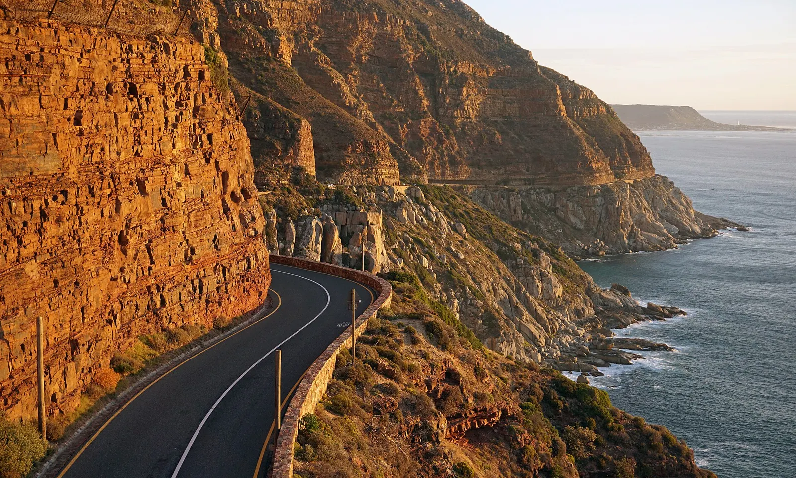
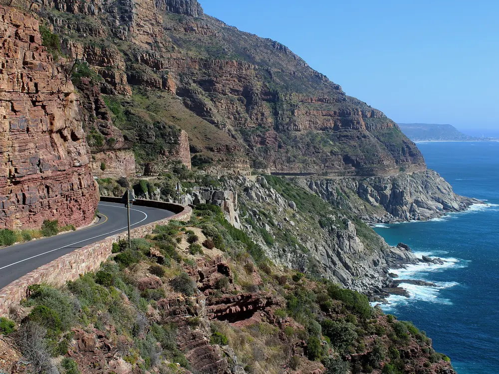
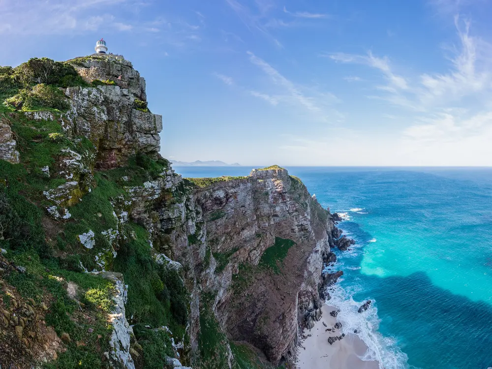
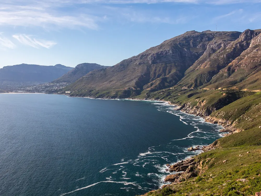
Chapman's Peak Drive curving under orange sandstone cliffs above the Atlantic

Photos: kallerna (CC BY-SA 4.0), Martinvl (CC BY-SA 4.0), Diego Delso (CC BY-SA 4.0), Diego Delso (CC BY-SA 4.0)

Distance
109 km Cycle Tour loop
Climbing
About 1,200 m
Next Cycle Tour
14 March 2027
Season
Year round; driest December to March

Why go

Few cities let you ride out of the centre and round a whole mountain range by lunch. The Cape Peninsula loop runs along the warm False Bay shore and back up the cold Atlantic side, with Table Mountain in view most of the day. It is the course of the Cape Town Cycle Tour, first run in 1978 and billed as the world's largest individually timed cycle race.

The route

The classic is the Cycle Tour loop: south from the city to Muizenberg, then through Fish Hoek and Simon's Town to the long drag up Smitswinkel, beside the Cape Point reserve gate. The road turns north through Scarborough and Kommetjie to Chapman's Peak Drive, a 9 km cliff road with 114 curves built between 1915 and 1922. After Hout Bay comes Suikerbossie, about 1.5 km of climbing, then a fast run through Camps Bay to Green Point. Ou Kaapse Weg crosses between the coasts, topping out at 315 m, and a road inside the reserve leads to Cape Point itself.

When to go

Summer, from December to March, is warm and dry, while winter brings cold fronts and most of the year's rain. The southeaster, known locally as the Cape Doctor, blows hard and often from September to March, so ride early in summer. The 2027 Cycle Tour is on Sunday 14 March, and roads around the peninsula close that day.

Getting there

Fly into Cape Town and ride from the city or the Atlantic suburbs, where the loop starts at your door. Bike shops in town rent road bikes.

Permits and booking

Public roads need no permit. Chapman's Peak Drive is a toll road, but its tariff lists no class for bicycles. Its rules bar cycling after dark and riding in groups, so go single file. It closes in high wind, heavy rain and after rockfall; a rockfall shut it on 24 April 2026 and it showed as closed on 18 October 2026, so check before you set out. Entry to the Cape of Good Hope section of Table Mountain National Park costs R110 for South African adults and R515 for international adults until 31 October 2026. Riders also need a SANParks cycling permit, which a Wild Card does not cover.

How hard it is

The full loop is a long day, but no climb is severe: Ou Kaapse Weg from the Noordhoek side runs 6.9 km at an average of 4.6 percent. Wind is the real test, and Ou Kaapse Weg carries heavy traffic.

Where to sleep

Most riders stay in the city, Sea Point or Green Point near the Cycle Tour finish. Hout Bay, Muizenberg and Simon's Town put you on the loop itself, and SANParks rents a few cottages inside the Cape Point reserve.

Tips

  • In summer, start early, before the southeaster builds on the Atlantic side.
  • Check Chapman's Peak Drive's road status on the morning of your ride.
  • Reach the Cape Point gate within its hours: 6am to 6pm from October to March, 7am to 5pm from April to September.
06 / 10

The Carretera Austral

Aysén and Los Lagos, Chile

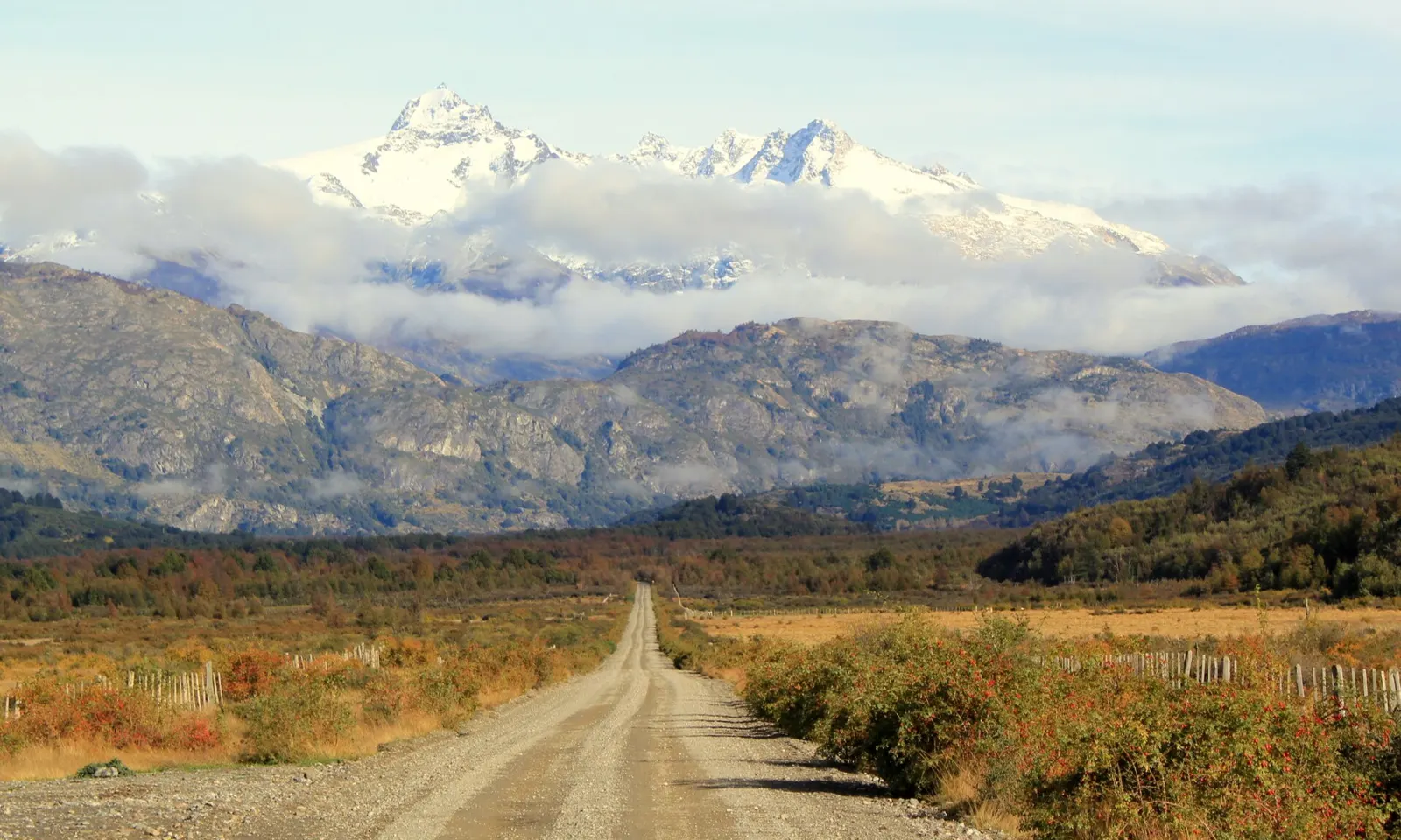
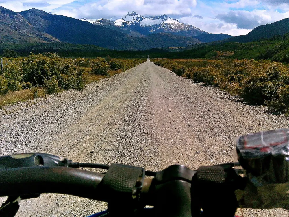
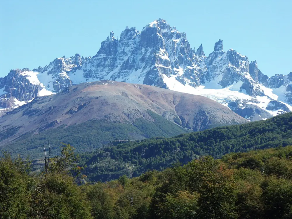
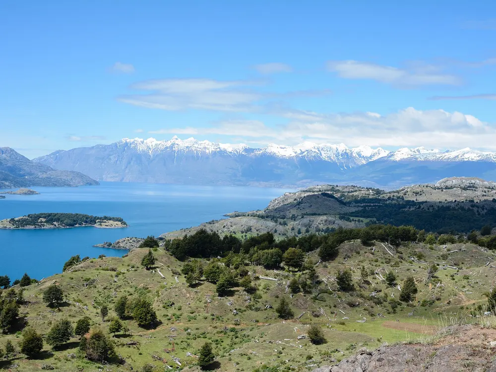
A long straight gravel stretch of the Carretera Austral running toward snow-capped peaks in Aysén

Photos: Rakela (CC BY-SA 3.0), Nicolás Lara (CC BY-SA 3.0), Roberto Araya Barckhahn (CC BY-SA 3.0), M M from Switzerland (CC BY-SA 2.0)

Distance
More than 1,000 km, Puerto Montt to Villa O'Higgins
Classic climb
Portezuelo Ibáñez, 15 km and 770 m
Paved
About 58% of Route 7 (May 2026)
Season
December to March

Why go

Route 7 runs south from Puerto Montt through cold rainforest, fjords and lakes of an improbable blue, past hanging glaciers. It is one of the most popular long rides in the world, with asphalt and ferries in the north and more gravel the further south you go. At Villa O'Higgins the road stops, and the way on to Argentina is by boat and on foot.

The route

From Puerto Montt a short ferry crosses from Caleta La Arena to Caleta Puelche on the way to Hornopirén, where the road breaks off. A boat runs to Leptepu, you ride about 10 km to Fiordo Largo, and a second boat lands you at Caleta Gonzalo, about 60 km from Chaitén. The road then crosses Queulat National Park to Coyhaique. About 100 km south, the Portezuelo Ibáñez climb, 15 km with six hairpins, drops to Villa Cerro Castillo beneath its jagged peak. Gravel follows Lago General Carrera, Chile's largest lake, to Puerto Río Tranquilo and the boats to the Marble Caves. South of Cochrane a ferry from Puerto Yungay to Río Bravo leads to Villa O'Higgins. The finale crosses Lago O'Higgins by boat to Candelario Mancilla, then about 22 km of track to Laguna del Desierto, a boat or 12 km trail along it, and about 40 km of road to El Chaltén.

When to go

December to March brings the mildest weather and longest days. The Lago O'Higgins boat runs several times a week from November to March. Snow can shut the road in winter, as it did overnight near Chaitén in June 2025.

Getting there

Fly from Santiago to El Tepual (PMC) at Puerto Montt to start in the north, or to Balmaceda (BBA) near Coyhaique to join in the middle.

Permits and booking

The road needs no permit. Buy the Hornopirén to Caleta Gonzalo crossing early, online at barcazas.cl, even with only a bicycle. Book a guided boat or kayak tour for the Marble Caves, the only way in. You leave Chile near Candelario Mancilla and enter Argentina at Laguna del Desierto. Chilean law asks for a white front light and a red rear light after dark, and a helmet in urban areas. In 2026 Vialidad is paving 16.2 km between Bahía Murta and Puente El Belga and 18 km between Fiordo Queulat and Puente Chucao; expect work zones, though no closures are announced.

How hard it is

Pavement and gravel alternate, and the southern ripio is loose in places. The Queulat pass is narrow and steep. Portezuelo Ibáñez averages 5.1%, with a steepest 100 m at 11.7%. Services are thin, and near the Argentine border the path turns muddy and technical, so expect to push or carry the bike.

Where to sleep

Riders stop in Hornopirén, Chaitén, Puyuhuapi, Coyhaique, Villa Cerro Castillo, Puerto Río Tranquilo, Cochrane and Villa O'Higgins, and a tent helps on the long gaps between them.

Tips

  • Leave spare days at Villa O'Higgins, since weather can stop the Lago O'Higgins boat for several days.
  • Carry cash and extra food for the border crossing, as Candelario Mancilla sells only basic supplies.
  • Expect horseflies until about the end of January, and stock up on tyres, cash and repairs in Coyhaique before the gravel of the south.
07 / 10

Moab

Utah, United States

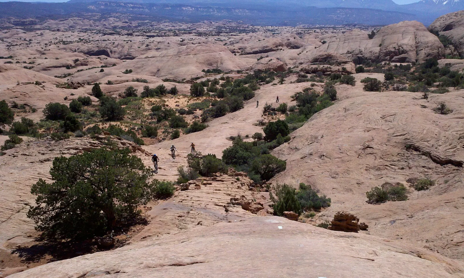
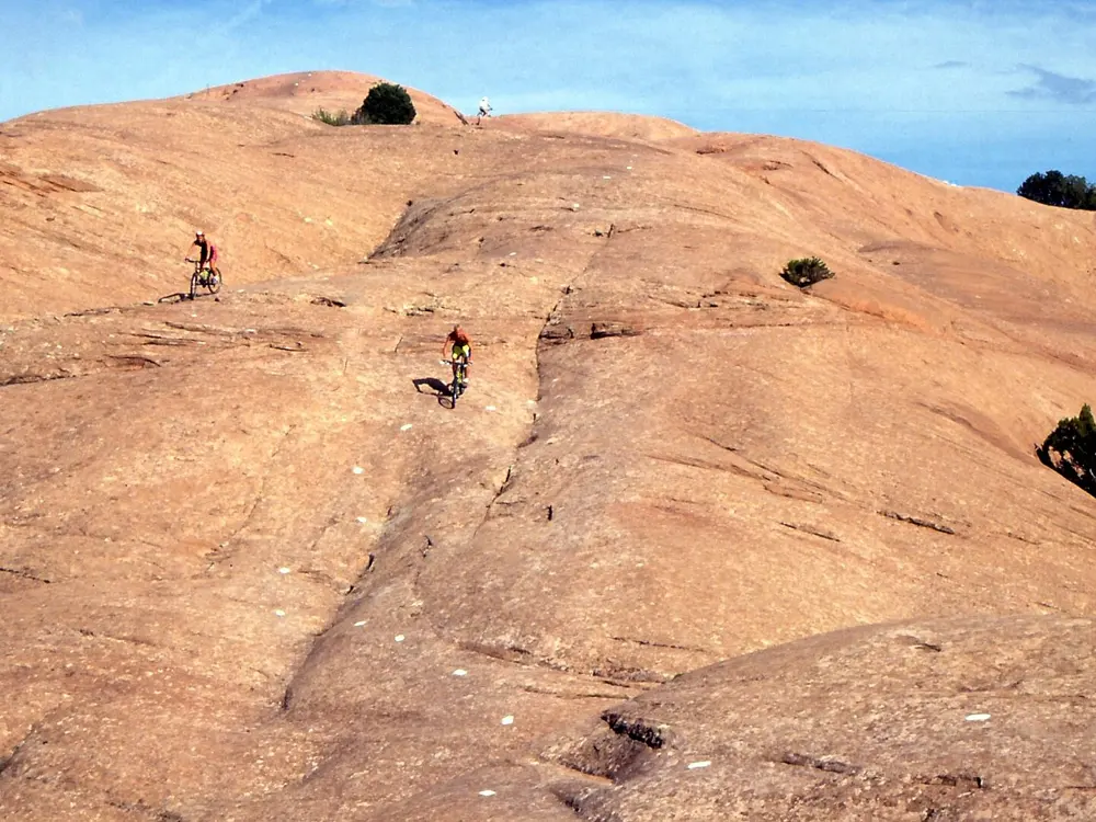
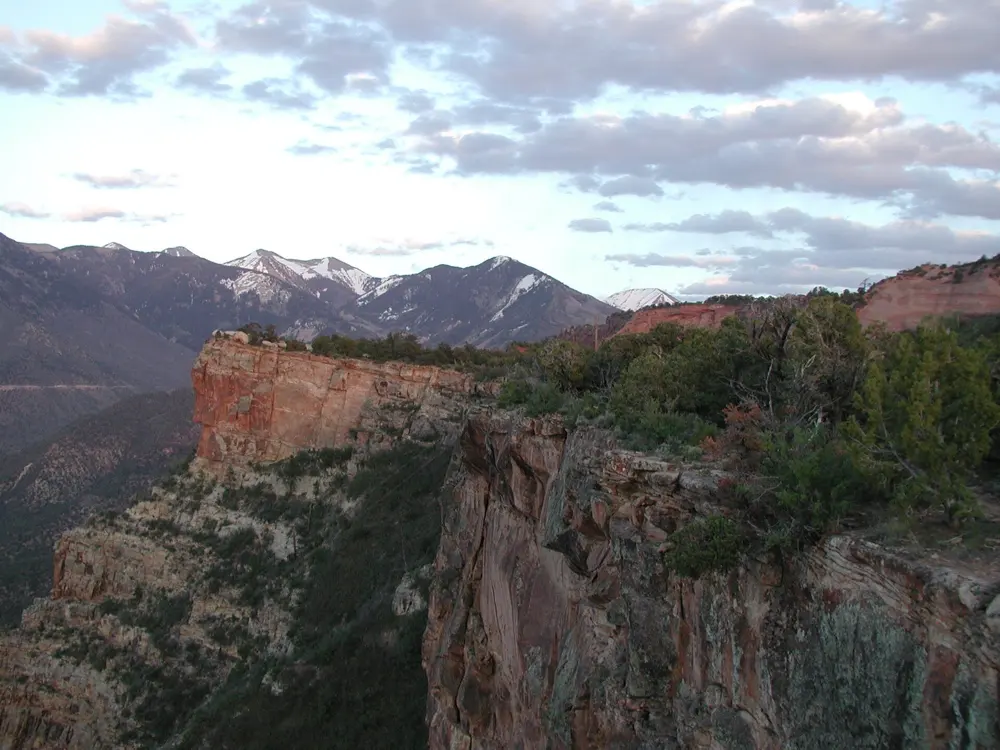
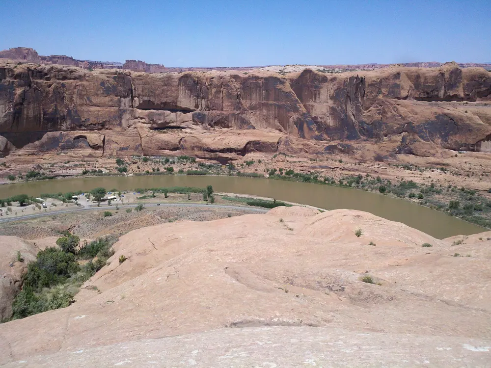
Mountain bikers crossing the slickrock of the Slickrock Trail with the snow-capped La Sal Mountains behind

Photos: Jacob Montgomery (CC BY-SA 3.0), Albert Backer (CC BY-SA 3.0), Intermountain Region US Forest Service (Public domain), Jacob Montgomery (CC BY-SA 3.0)

Distance
Slickrock Trail: 10.5 mi (about 17 km) loop
Biggest descent
Whole Enchilada: 7,794 ft (2,376 m)
Season
March to May, September to November
Sand Flats entry
$5 per bike for 7 days

Why go

Moab sits beside the Colorado River in Utah's red rock country, and for mountain bikers it is the home of riding on bare sandstone. Its best-known trail began in 1969 as a motorcycle route across petrified dunes, and the riding now reaches from the canyon rims up into the La Sal Mountains. Road riders get a paved path to the gates of Arches National Park.

The route

The Slickrock Trail in the Sand Flats Recreation Area is a 10.5 mile loop over Navajo Sandstone, its line painted on the rock in white dashes. The Whole Enchilada runs 34 miles point to point from the Geyser Pass trailhead in the La Sals, linking Burro Pass, Hazard County and Porcupine Rim and dropping 7,794 feet towards the river. North of town the Moab Brands system has over 30 miles of trails for every level. On a road bike, the paved Moab Canyon Pathway runs about 2 miles from the Colorado River bridge to the Arches entrance, good for a 30 to 40 mile out-and-back inside the park, then 6.5 miles more to Highway 313. That road climbs about 35 miles to Grand View Point in Canyonlands.

When to go

The main seasons are March to early May and September to October, and November brings quieter trails. Summer is very hot, so ride at dawn or dusk if you come then. Burro Pass, at the top of the Whole Enchilada, usually opens around 1 July and closes in late September once snow falls.

Getting there

Canyonlands Regional Airport, 18 miles north of town, has flights to Phoenix and Denver. Grand Junction in Colorado is about an hour and a half away by car, and Salt Lake City roughly four hours. Shuttles from town carry riders to the top of the Whole Enchilada.

Permits and booking

Sand Flats charges its own entry fee and does not take national park passes: $5 for 7 days on a bike, $10 by vehicle. Arches charges $15 per cyclist and needs no timed-entry reservation in 2026. Until the end of October 2026, State Route 128 near Grandstaff Canyon is down to one lane while the paved path is extended to give Whole Enchilada riders a safer exit.

How hard it is

Slickrock is grippy, but its technical moves and the stamina it takes draw mostly expert riders. The Whole Enchilada is rated strenuous and technical, with exposed edges along Porcupine Rim. Arches has no bike lanes or paved shoulders, and you must ride single file among buses and RVs. On the pathway only the middle 4 miles climb noticeably.

Where to sleep

Most riders base themselves in Moab, close to the shops and shuttles. Sand Flats has 140 first come, first served campsites at $20 a night per vehicle, near the Slickrock trailhead. Lodging fills in spring and autumn, so book ahead.
Tips

  • Ride Porcupine Rim on its own before you try the full Whole Enchilada.
  • Start early in Arches, when traffic on the park road is lighter.
  • Carry plenty of water and snacks, since the desert trails have little shade.
08 / 10

The Danube Cycle Path, Passau to Vienna

Germany and Austria

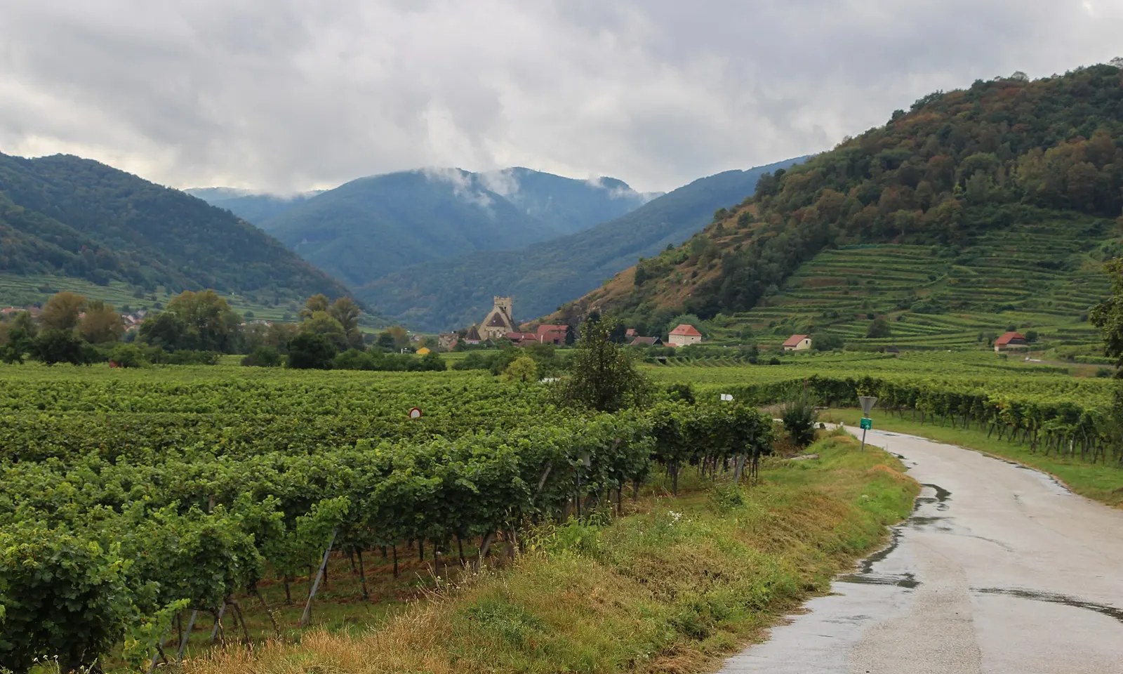
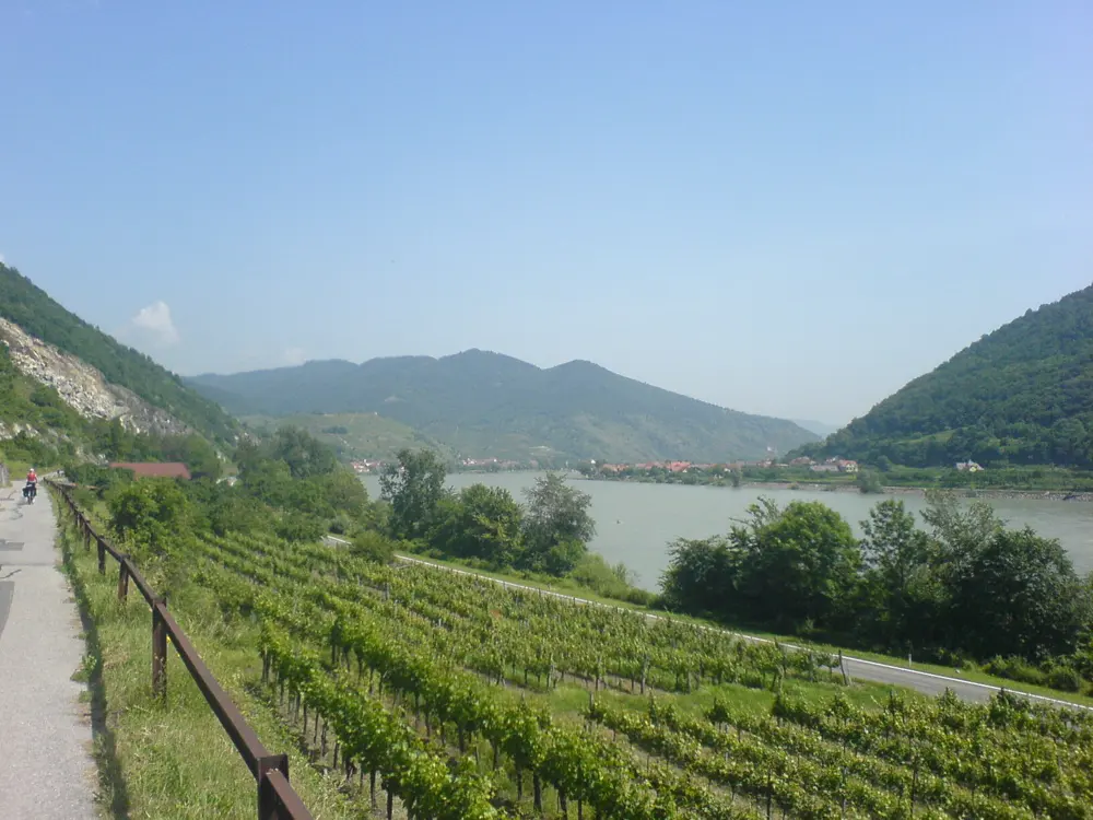
The Danube cycle path running between vineyards in the Wachau, with wooded hills behind

Photos: Michal Klajban (CC BY-SA 4.0), Chris Bainbridge (CC0), Thomas Ledl (CC BY-SA 4.0), Riadchikova (CC BY-SA 4.0)

Distance
About 330 km, Passau to Vienna
Time
About 8 days
Terrain
Mostly flat, riding downstream
Season
April to October

Why go

This is the busiest stretch of EuroVelo 6, the river route that crosses Europe from the Atlantic to the Black Sea, and it suits almost anyone who can sit on a bike for a few hours a day. The path follows the Danube downstream from the Bavarian town of Passau through Upper and Lower Austria to Vienna, past baroque abbeys, castle ruins and terraced vineyards. In the Wachau, the valley between Melk and Krems, the landscape is a UNESCO World Heritage site, listed in 2000.

The route

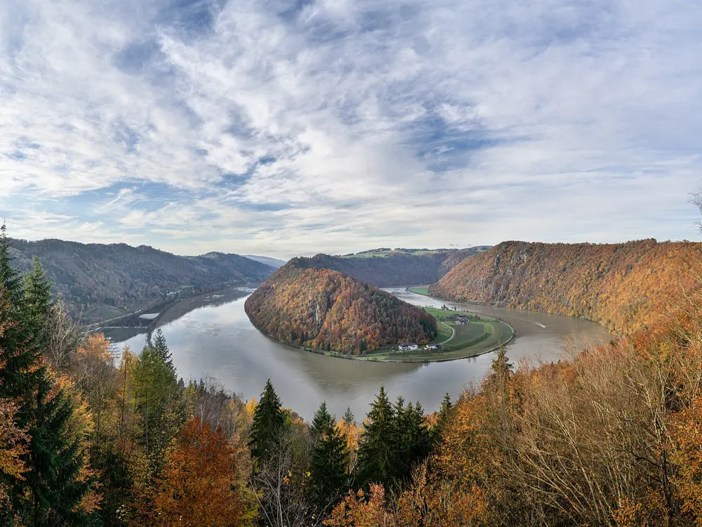
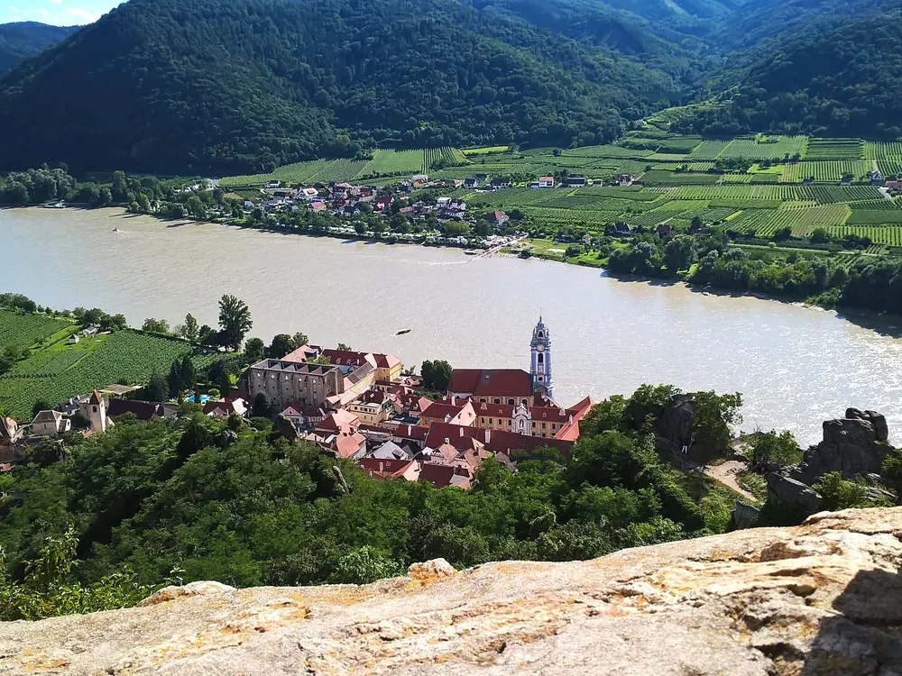
From Passau the first stage follows the north bank for about 41 km to Schlögen, where the river turns back on itself in the Schlögener Schlinge, and a short ferry crosses to the village. The next day runs about 52 km past Aschach and Wilhering Abbey to Linz. Beyond Linz the river passes Enns and Mauthausen and the narrower Strudengau at Grein. The Wachau is the high point: the north bank runs about 34 km from Emmersdorf, opposite Melk Abbey, through Spitz, Weissenkirchen and Dürnstein to Krems, and the south bank about 33 km from Melk past the ruins of Aggstein. From Krems the path continues through Tulln to Vienna.

When to go

Most riders go between April and October, the season when the bike ferries run. The Schlögen ferry sails from 1 April to 26 October, and the Wachau roll ferries at Spitz and Weissenkirchen work from April to October.

Getting there

Passau has a main line station. For the way back, ÖBB Railjets carry bikes with a bike ticket and a compulsory reservation, 3 euros online, and spaces sell out in summer, so book early. Several operators sell self-guided packages with hotels, rental bikes, daily luggage transfer and the train from Vienna back to Passau.

Permits and booking

No permit or fee is needed to ride the path. Ferries charge small fares, for example 3.50 euros per adult with a bike at Schlögen, paid in cash. In 2026, check the diversions: the south bank at the Pyburger Au near Mauthausen is closed until 13 April 2028 with a signed detour, the path through Mautern is closed until April 2027, the Stein to Mautern bridge has been single-lane since 18 May 2026, and Weissenkirchen's centre is due to close from 27 October 2026.

How hard it is

The path loses height gently as it follows the river, and daily stages of 40 to 70 km are usual. It is mostly asphalt, with a few gravel and forest sections. In the Wachau the north bank often runs beside the B3 main road, so expect traffic there.

Where to sleep

Riders usually stop in Schlögen, Linz, Grein or Perg, Melk or Krems, and then Vienna. Inns and hotels along the river are used to cyclists and many offer bike storage.

Tips

  • Use the ferries to switch banks in the Wachau, since the north bank is often beside a main road and the south bank is quieter.
  • Book bike spaces on the train home when you book the trip.
  • Check the regional tourism pages for diversions before you set off.
09 / 10

The Otago Central Rail Trail

Central Otago, New Zealand

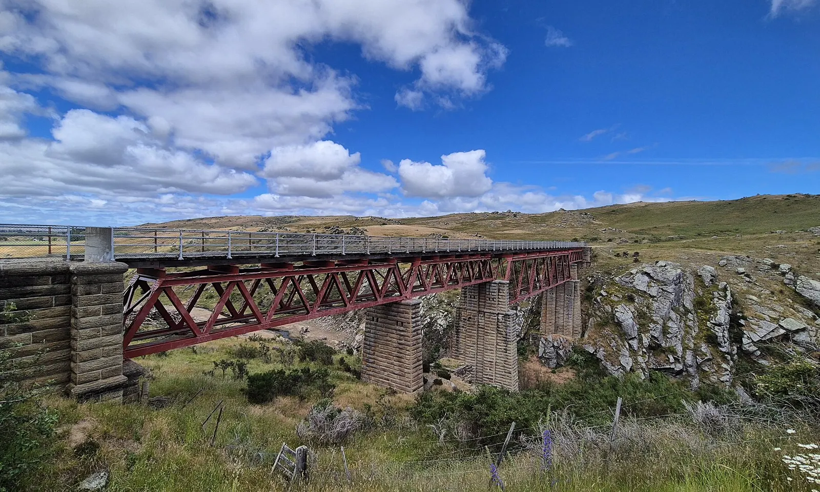
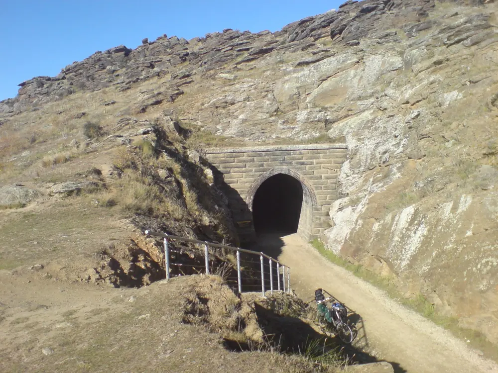
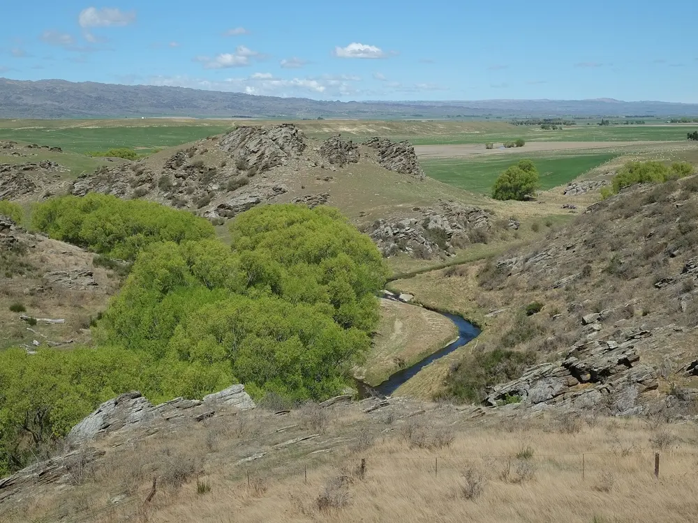
The red iron Poolburn Viaduct on stone piers crossing a rocky gorge under a summer sky

Photos: Jun Jie Yam (CC BY 4.0), Pseudopanax at English Wikipedia (Public domain), Ingolfson (CC0), Pseudopanax at English Wikipedia (Public domain)

Distance
152 km, Clyde to Middlemarch
Time
3 to 5 days
Highest point
618 m, near Wedderburn
Grade
Grade 1, the easiest

Why go

The railway through Central Otago closed in 1990, and in 2000 it reopened as New Zealand's first rail trail, the ride that inspired the country's whole network of Great Rides. Because it was built for steam trains, the grades stay gentle while the land around it changes a great deal: schist gorges, wide tussock basins and old gold diggings, with country pubs in the small towns along the way.

The route

Most people ride from Clyde, past Alexandra and over Tiger Hill to Omakau, with a short detour to the old gold town of Ophir. Beyond Lauder the trail enters the Poolburn Gorge, where it passes through two tunnels cut into schist bluffs and crosses the 108 m Poolburn Viaduct. It then runs up the Ida Valley past Oturehua and Hayes Engineering Works to the high point near Wedderburn, before dropping across the Maniototo to Ranfurly, with its art deco buildings and restored station. The last stretch follows the Taieri River past the Tiroiti bridge and the bricked Prices Creek tunnel to Middlemarch. From Clyde, the more technical Alexandra 150th Anniversary River Track makes a loop with the trail for experienced riders.

When to go

The trail is open all year. Peak season runs from January to April, and autumn and spring usually bring the kindest riding. Summer days can pass 30°C with almost no shade, while winter brings frosts and snow, and many trail businesses close from mid May to early September.

Getting there

Queenstown and Dunedin airports are each about an hour's drive from the trail ends, and InterCity buses serve Alexandra and Clyde. From Dunedin, the Taieri Gorge train runs to Pukerangi, Thursday to Monday at 9:30am, and shuttles connect onward to Middlemarch. Bikes can be hired in Clyde, Alexandra, Omakau, Ranfurly and Middlemarch.

Permits and booking

No permit or fee is needed to ride the trail. Walkers, cyclists, dogs and horses share it, e-bikes are allowed, and farm gates must be closed behind you. New Zealand law requires every cyclist on the road to wear an approved helmet, securely fastened. No 2026 closures were listed in October 2026, and the Poolburn section reopened in July 2025 after a closure.

How hard it is

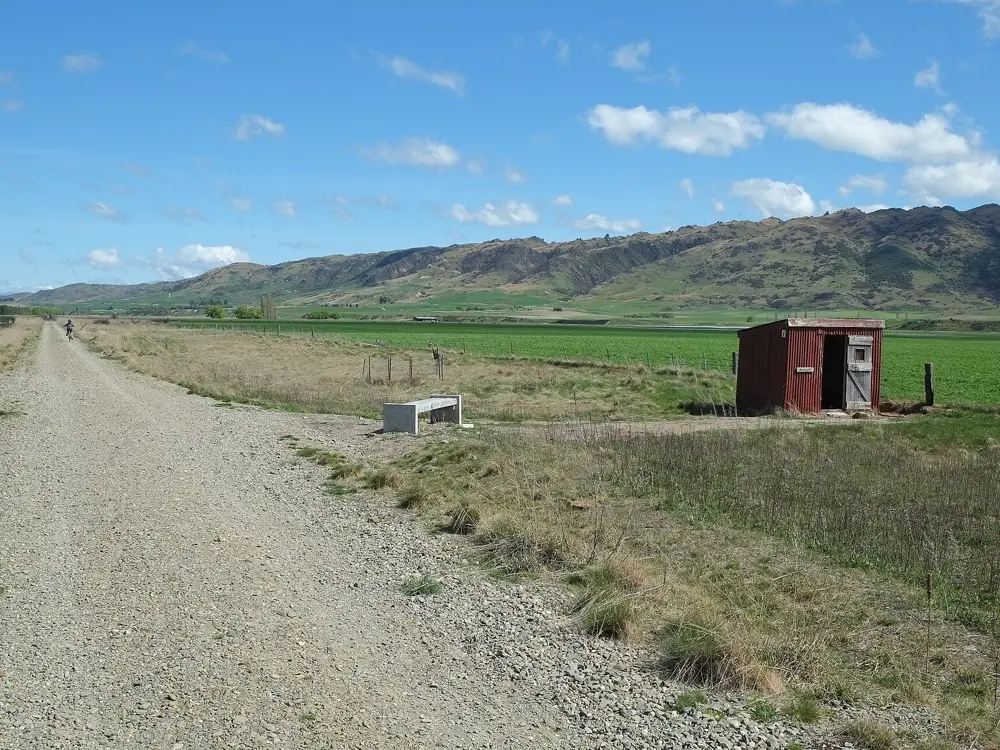
The surface is unsealed but mostly compacted gravel, and the steepest section, Tiger Hill between Chatto Creek and Omakau, climbs at only 1 in 50. The real challenge is the wind, which can be gusty and strong and hard to predict. Expect four to five hours of riding a day on a three or four day trip.

Where to sleep

Riders stay in pubs, farmstays and lodges in the towns along the line. DOC runs two basic camping areas with toilets on the trail, and there are campgrounds in Middlemarch, Ranfurly, Omakau, Alexandra and Clyde.

Tips

  • Book beds, bike hire and shuttles early for January to April.
  • Carry a torch for the Poolburn tunnels and walk your bike through them.
  • Carry plenty of water in summer, since the trail has very little shade.
10 / 10

Taroko Gorge to Wuling

Hualien and Nantou, Taiwan

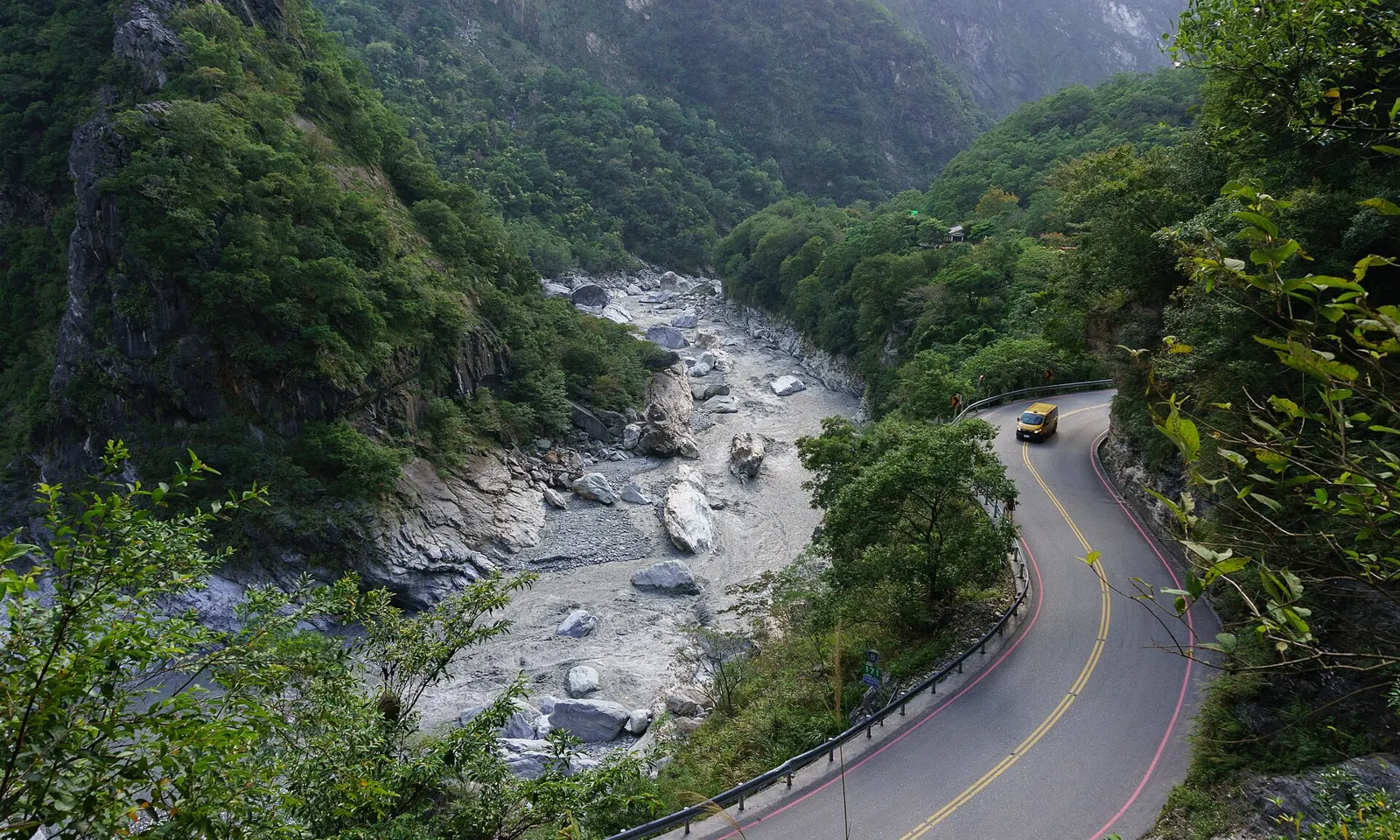
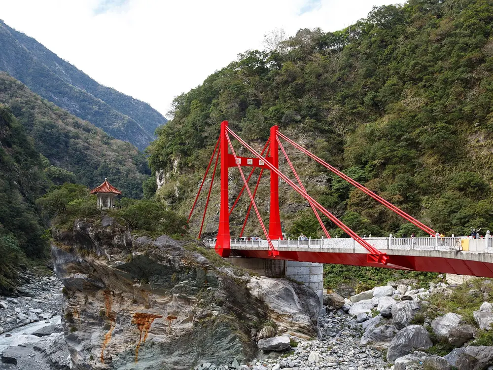
Highway 8 winding along a cliff above the Liwu River in Taroko Gorge

Photos: eugene_o (CC BY 2.0), Fred Hsu (Wikipedia:User:Fred Hsu on en.wikipedia) (CC BY-SA 3.0), CEphoto, Uwe Aranas (CC BY-SA 3.0), Mark Kao from Taichung, Taiwan (CC BY 2.0)

Distance
About 105 km, Hualien to Wuling
Climbing
Nearly 3,500 m
Highest point
3,275 m at Wuling
Season
Autumn and spring

Why go

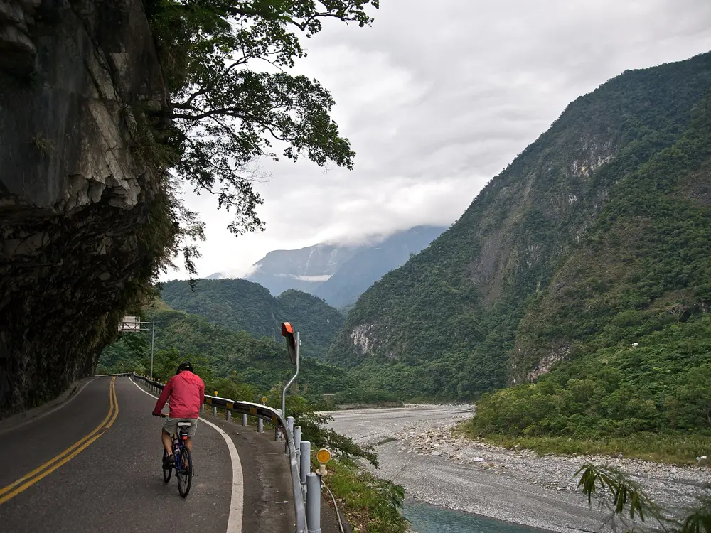
Leaving the coast at Hualien, Highway 8 enters a gorge the Liwu River has cut through marble, then keeps rising past the tree line to Wuling, at 3,275 m the highest point in Taiwan you can reach by road. The ride passes from warm, damp forest to open high grassland, and the Taiwan KOM Challenge, held here each October or November since 2012, made it one of the best known climbs in Asia.

The route

The classic line starts near sea level in Hualien, turns onto Highway 8 at the Taroko entrance and follows the river up through the gorge to Tianxiang. From there the road climbs steadily to Dayuling, where Highway 14A takes over for about 10 km more to Wuling, a saddle between the main and east peaks of Hehuanshan.

When to go

Autumn and spring are the usual choices. Summer brings afternoon storms and typhoons that close the road, and in winter ice regularly shuts Highway 14A between Cuifeng and Dayuling. The Highway Bureau has discouraged cycling on Hehuanshan in the rhododendron season and summer holidays, when traffic is heaviest.

Getting there

Take the train from Taipei to Xincheng, one stop before Hualien, about 7 km from the park headquarters; the trip takes between 2 hours 15 minutes and 3.5 hours. The bus through the gorge is suspended, so plan a support car or a way home from the top.

Permits and booking

Since the April 2024 earthquake the gorge has run on traffic control, and bicycles follow the same release times as cars. In June 2026 the official notice for the Taroko entrance to Tianxiang listed five releases a day: 6:30 to 8:00, 10:00 to 10:05, 12:00 to 13:00, 15:00 to 15:05 and 17:00 to 18:00, with the road shut overnight. Above Tianxiang the road opened at 6:30, became exit only at 16:30 and closed at 18:00. These times change often, so check the Highway Bureau and Taroko National Park notices first.

How hard it is

The gorge is gentle; the work grows above Tianxiang, and the steepest ramps come in the last stretch below Wuling, where the thin air above 3,000 m tells. Gorge tunnels are dim, the road is shared with tour buses and repair traffic, and it can be cold at the top when the coast is hot.

Where to sleep

Most riders sleep in Hualien City or near Xincheng the night before. In the gorge only two hotels were open in 2026, both in Tianxiang: Silks Place Taroko and the cheaper Tienhsiang Youth Activity Center. Below Wuling, the Forestry Bureau's Songxue Lodge is the only bed on the mountain and hard to book, so many riders continue west to Cingjing.

Tips

  • Fit front and rear lights for the tunnels in the gorge.
  • Reach the control point early for the five-minute releases, since only the waiting queue is let through.
  • Carry warm layers and full-finger gloves for the top and the descent.

Sources

Distances, heights, seasons and permit rules were checked against these pages. Rules change, so check the park or trail authority before you go.