Rungs Labs

Rungs Pilgrimage · Swimming · The world

The 10 Best Places to Swim in the World

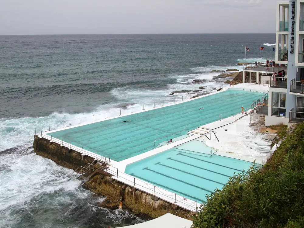
Bondi Icebergs and Sydney's ocean pools, Sydney, Australia. Photo: François Bianco (CC BY-SA 2.0)

A great place to swim gives you water you would cross the world for, and a reason to get in that you cannot find at home. Some of these are pools built into the shore, where the sea breaks over a wall while you swim lengths inside it. Others are open water, from an Alpine lake and a river through a capital city to bays over coral and fresh water in limestone caves.

These ten cover seas, lakes, rivers, ponds and caves on six continents, from cold water in London and Cape Town to warm reefs in Brazil and Japan. For each one you get the classic swims, the water temperature and the best season, how to get there, the fees, rules and closures, how hard it is and where to stay. Every fact comes from park authorities, councils, tourism boards, event organisers or other pages linked at the bottom.

Updated 2026-10-19

  1. 01Bondi Icebergs and Sydney's ocean poolsSydney, Australia
  2. 02Lake BledJulian Alps, Slovenia
  3. 03The cenotes of the YucatánYucatán Peninsula, Mexico
  4. 04Fernando de NoronhaPernambuco, Brazil
  5. 05The Kerama IslandsOkinawa, Japan
  6. 06The Hampstead Heath pondsLondon, United Kingdom
  7. 07The Aare in BernBern, Switzerland
  8. 08Cape Town's tidal poolsWestern Cape, South Africa
  9. 09Kailua Bay, KonaHawaiʻi Island, United States
  10. 10Wadi ShabTiwi, Sur, Oman
01 / 10

Bondi Icebergs and Sydney's ocean pools

Sydney, Australia
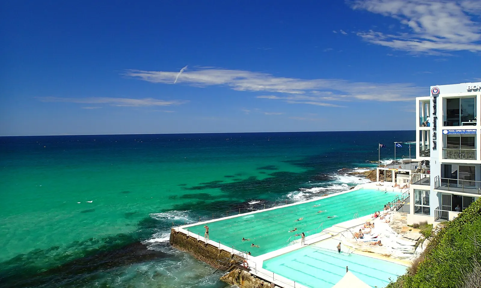
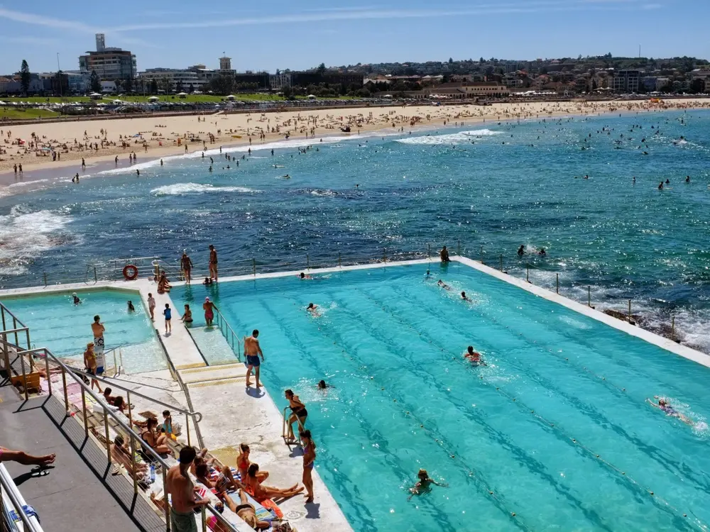
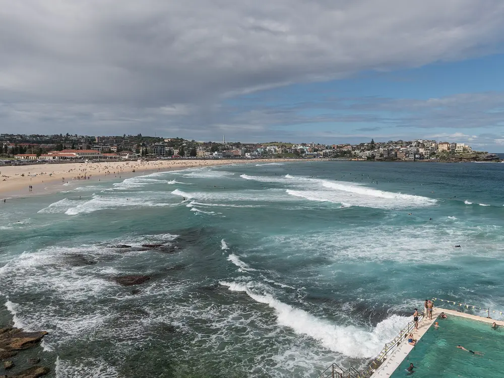
The Bondi Icebergs pools on the rocks at the southern end of Bondi Beach, with the clubhouse above and the green Pacific beyond

Photos: François Bianco (CC BY-SA 2.0), Tony Hisgett from Birmingham, UK (CC BY 2.0), Tim Grubb (CC BY-SA 3.0), DXR (CC BY-SA 4.0)

Distance
50 m main pool; Bondi to Bronte ocean swim about 2.2 km
Entry
Icebergs A$10 adult, A$7 child; Bronte Baths free
Water
About 17.5 C in July to 23.5 C in February
Lifeguards
Bondi Beach patrolled every day of the year

Why go

At the southern end of Bondi Beach, the Bondi Icebergs pool sits on the rock shelf with the Pacific breaking over its outer wall. Its winter swimming club was founded in 1929 by local lifesavers who wanted to stay fit through the cold months, and for years members had to swim on three Sundays out of four for five years to keep their place. The pool is open all year, and Sydney's eastern beaches are lined with more ocean pools a short walk apart.

The route

Swim laps in the 50 metre main pool at Icebergs, with a smaller children's pool beside it. Then walk the coast path south: Bronte is just over a kilometre away, where the ocean fed lap pool of Bronte Baths is free to use. The 6 km Bondi to Coogee walk continues past Tamarama, Clovelly and Gordons Bay to Wylie's Baths, a few hundred metres south of Coogee Beach. For open water, the Bondi to Bronte Ocean Swim covers about 2.2 km; its 25th edition is on 8 November 2026.

When to go

Average sea temperatures at Bondi run from about 17.5 C in July to 23.5 C in February, so summer and early autumn are the easy months. The Icebergs pool stays open in winter, when the club swims, and from May to November the coast walk is a good place to watch for whales.

Getting there

Bondi is about 30 minutes by public transport from Town Hall station. Take the train to Bondi Junction and a bus to the beach, or a bus that runs straight from the city centre; plan the trip on transportnsw.info.

Permits and booking

Icebergs entry is A$10 for adults, A$7 for children and A$30 for a family, with the sauna included. The pool is closed on Thursdays for cleaning, though in summer it may open when tides allow. Bronte Baths is free. Wylie's Baths, open every day, charges A$6.50 for adults. Bondi Beach is patrolled all year: 6am to 7pm from October to April and 7am to 5:30pm from May to September.

How hard it is

Big swell can wash over the Icebergs wall, which is part of its appeal but rough on a weak swimmer. On the beach, swim between the red and yellow flags. The southern half of Bondi is shaped by rips, including the strong Backpackers' Rip that runs out against the southern headland, and Surf Life Saving's BeachSafe advises against swimming there; the north end is gentler. Bronte has underwater rocks and swell from any direction.

Where to sleep

Bondi has everything from youth hostels to beachside hotels, including QT Bondi and the self contained Adina Apartment Hotel on Hall Street.

Tips

  • If you are caught in a rip, stay calm and raise an arm for the lifeguards.
  • Check the Icebergs website on a Thursday, or plan your Icebergs swim for another day.
02 / 10

Lake Bled

Julian Alps, Slovenia

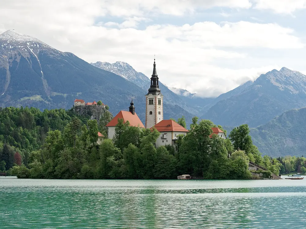
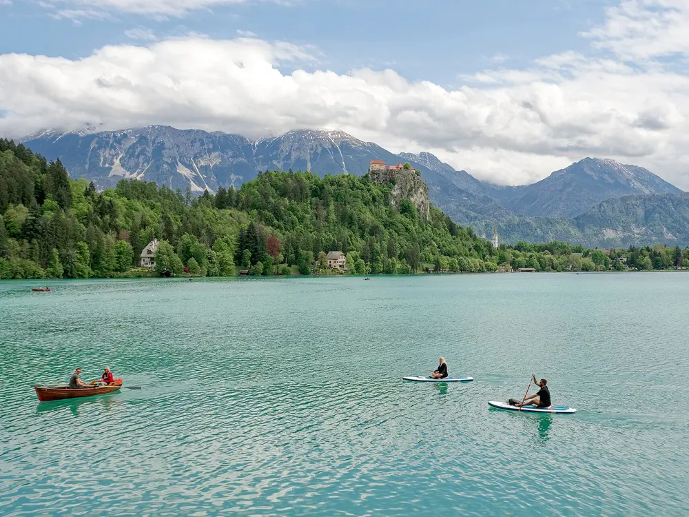
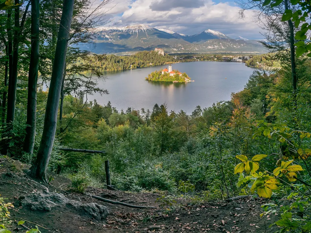
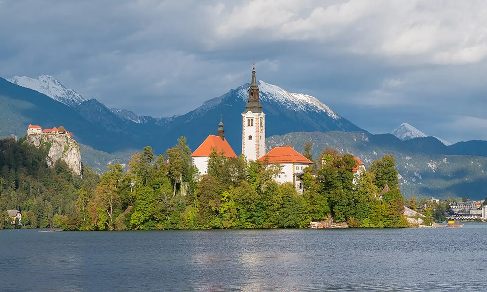
Bled Island and its church on Lake Bled, with the castle on its cliff and the Julian Alps behind

Photos: Krzysztof Golik (CC BY-SA 4.0), Jakub Hałun (CC BY 4.0), Jakub Hałun (CC BY 4.0), Krzysztof Golik (CC BY-SA 4.0)

Distance
1.6 km island loop; 5 km around the lake
Lake
About 2,120 m by 1,380 m, up to 29.5 m deep
Water
About 22 to 25 C in July and August
Season
Castle bathing area June to mid-September

Why go

Lake Bled sits at 475 m below the Julian Alps, with a castle on its cliff and a pilgrimage church on the only island. A thermal spring at about 23 C feeds the lake, so in midsummer the surface is far warmer than most Alpine water. Swimming here is part of ordinary summer life in the town, and you can swim with the island church in view the whole time.

The route

The Castle bathing area, Grajsko kopališče, is the main place to swim: an enclosed lido about 260 m long under the castle, with four outdoor pools, two water slides and a jump board beside the lake itself. Other bathing areas on the shore are at Mala Zaka and Velika Zaka on the western side and in front of Hotel Vila Bled and the Grand Hotel Toplice. For longer swims, the X-WATERS Slovenia event in September runs a one mile course of 1.6 km past the island and a 5 km course around the whole lake, with 10 km as two laps; everything starts from the pontoon at the Olympic Rowing Centre.

When to go

July and August are the warmest months, with the water at roughly 22 to 25 C according to a local guide, who puts June at about 18 to 21 C and September at about 18 to 20 C. The Castle bathing area opens from June to mid-September. By late morning on a sunny day in high summer the lawns there are full, so come early.

Getting there

Bled is 35 km from Ljubljana airport and 55 km from Ljubljana. The nearest railway station, Lesce-Bled, is 4.2 km from the lake. Parking by the lake is limited.

Permits and booking

No permit is needed. A licensed local guide says swimming is allowed only in the designated bathing areas, that jumping in from paths, docks and grassy banks is not allowed, and that municipal wardens fine swimmers outside the zones; ask the tourist office for the current rule. In 2026 that guide listed a full day at the Castle bathing area at 15 euros for adults and 10 euros for children under 14, or 12 and 7 euros after 3pm. The lido flies the Blue Flag. Velika Zaka, Mala Zaka and the shingle beach at Mlino on the south shore are free.

How hard it is

The water is calm and warm by Alpine standards, and the Castle bathing area has lifeguards. Swimming out to the island is discouraged, because pletna boats, rowing boats and electric shuttles cross that water all day and the deep water is colder than the surface. Swim the island loop in the organised event, when the lake is closed to boats along the course. The lake is up to 29.5 m deep, so stay close to shore if you are not a confident swimmer.

Where to sleep

Bled has hotels along the shore, including the Grand Hotel Toplice and Hotel Vila Bled, which have their own bathing areas. The Grand Hotel Toplice also has a covered thermal pool at 22 C.

Tips

  • Hire a rowing boat or a paddle board if you want to reach the island; the pletna boats take visitors across too.
  • In 2025 the Julian Alps Card: Bled gave 10 percent off a day ticket at the Castle bathing area; ask whether it still does.
03 / 10

The cenotes of the Yucatán

Yucatán Peninsula, Mexico

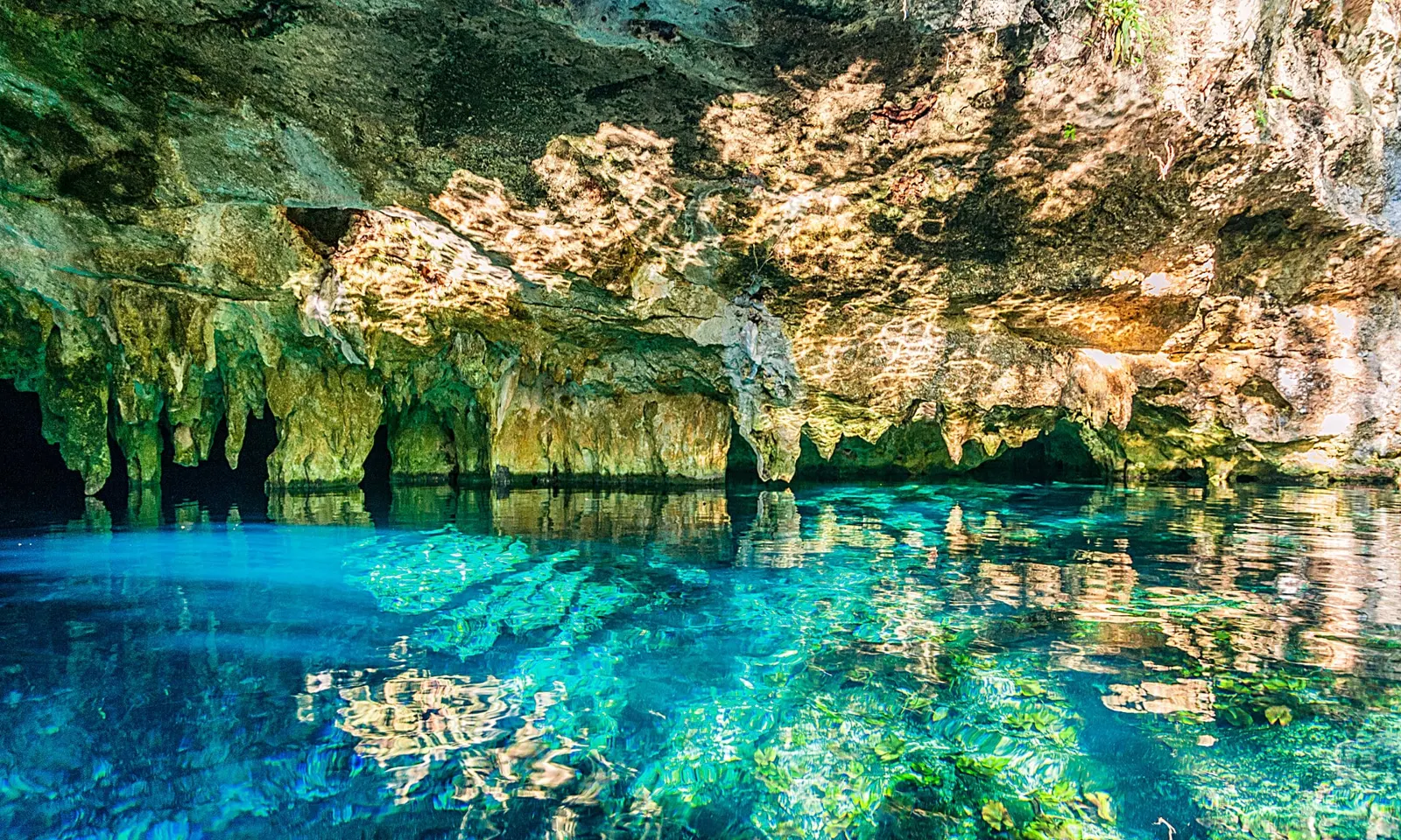
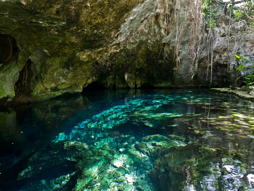
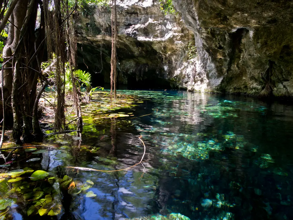
The clear turquoise pool of Gran Cenote near Tulum under a ledge of limestone

Photos: simon (CC0), eugene_o (CC BY 2.0), Ken Thomas (Public domain), Ken Thomas (Public domain)

Distance
About 60 m across the pool at Ik Kil
Water
24 C or a little below, all year
Cenotes
10,000 or more estimated in Yucatán state, about 2,400 recorded
Rules
Shower first, no ordinary sunscreen or repellent, life jacket

Why go

A cenote forms where rain has dissolved the limestone and the roof over an underground pool has fallen in, leaving fresh, clear groundwater open to swimmers. Yucatán Today estimates more than 10,000 in Yucatán state, about 2,400 of them recorded. Several near Tulum belong to Sac Actun, the second longest known underwater cave system.

The route

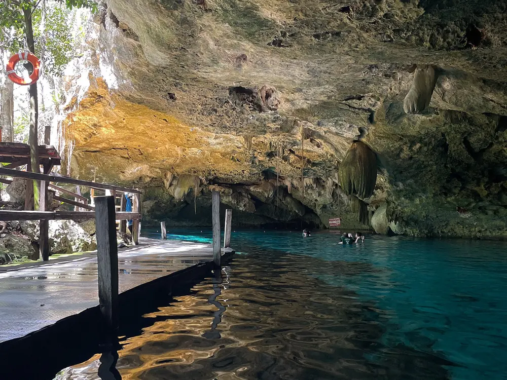
Ik Kil, about 3 km from Chichén Itzá, is a round open well: the water lies about 26 m below ground, the pool is about 60 m across and 48 m deep, and a carved stairway leads down to a swimming platform. Suytun, near Valladolid, is a cave with a stone walkway out to a platform in the middle, lit through a hole in the dome; its water is at most 5 m deep. Gran Cenote, about 5 km west of Tulum, mixes open water with cavern sections and small turtles. Dos Ojos, about 20 minutes north of Tulum, is two connected sinkholes opening into one large flooded cavern.

When to go

The water stays at or just below 24 C through the year, so any month works. Arrive at opening, before the tour buses. At Suytun the beam of light on the platform is strongest between noon and 2 pm.

Getting there

Fly into Cancún. The Tren Maya stops at Cancún Aeropuerto, Tulum, Valladolid and Chichén Itzá, joining the Tulum cenotes to Suytun and Ik Kil. Suytun is about 12 minutes by road from Valladolid.

Permits and booking

No permit is needed. Each cenote charges its own entry fee in cash pesos: 2026 guides put Gran Cenote at about 500 MXN and Suytun at roughly 200 to 250 MXN, but prices change. Ik Kil opens every day from 9 am to 5 pm, with a life jacket in the ticket price, and Suytun keeps the same hours. Most cenotes make you shower first and turn away ordinary sunscreen and insect repellent, which harm the aquifer, and in Yucatán state the law requires a life jacket in every cenote, however well you swim. No 2026 closures were reported at these four.

How hard it is

There are no waves or currents, but the water can be deep. Stay in the roped areas and never follow a passage beyond the daylight without a certified cave guide; divers have drowned in these cave systems. Limestone steps are slippery when wet.

Where to sleep

Tulum has the most beds for Gran Cenote and Dos Ojos. Valladolid sits between Suytun and Ik Kil, and Ik Kil has its own bungalows.

Tips

  • Bring pesos in cash: gates are usually cash only, with no cash machine on site.
  • Wear water shoes on the wet limestone, and bring a mask for the caverns at Gran Cenote and Dos Ojos.
04 / 10

Fernando de Noronha

Pernambuco, Brazil

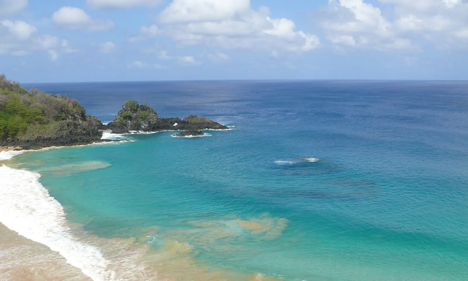
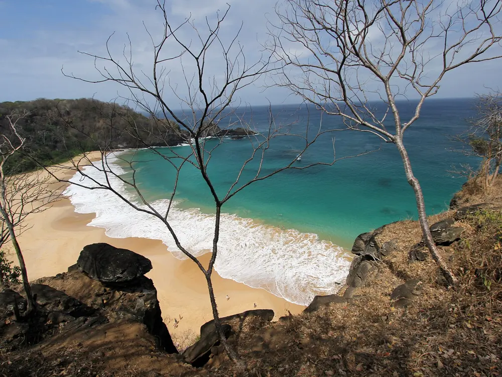
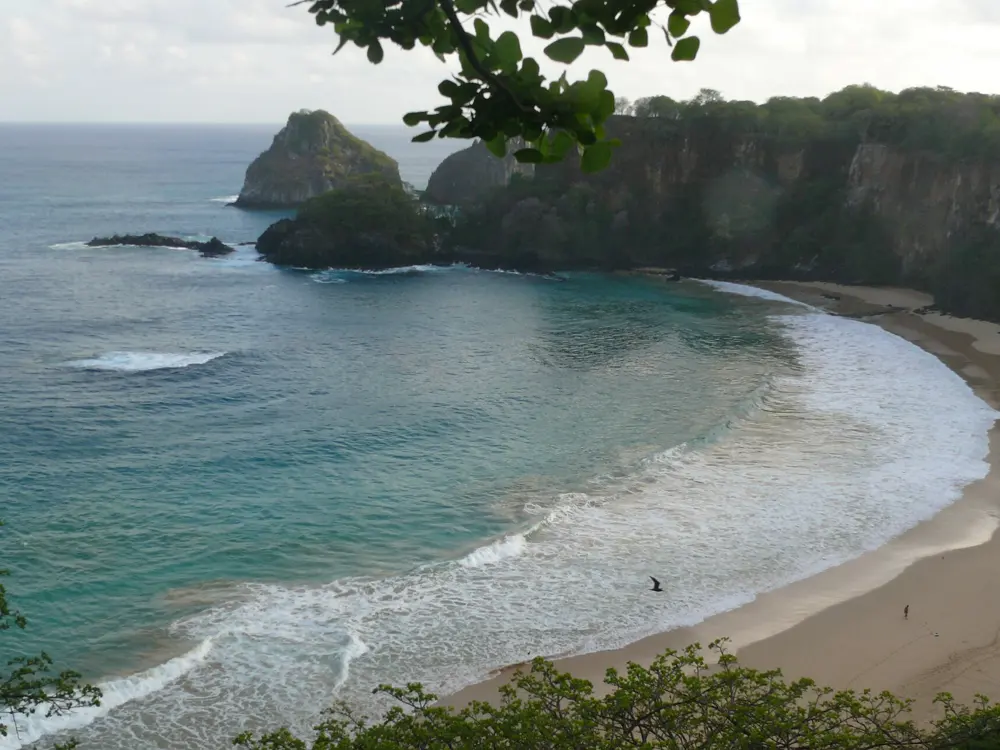
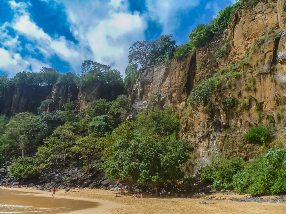
The turquoise water of Baía do Sancho below green cliffs on Fernando de Noronha

Photos: Osaki (CC BY-SA 3.0), Adelano Lázaro (CC BY-SA 4.0), Osaki (CC BY-SA 3.0), Dronepicr (CC BY 3.0)

Visibility
Up to about 50 m underwater
Island fee
TPA R$105.79 a day in 2026
Park ticket
R$192 Brazilians, R$384 foreigners, 10 days
Best water
August to October, calm and clear

Why go

Fernando de Noronha is an archipelago of 21 islands and islets about 354 km off the coast of Brazil, and most of it is a marine national park, listed by UNESCO with Rocas Atoll in 2001. A warm current from Africa keeps the water warm enough to dive without a wetsuit, visibility can reach about 50 m, and UNESCO notes its large resident population of spinner dolphins. Its Baía do Sancho was named the world's best beach in Tripadvisor's Travellers' Choice awards for the seventh time in 2025.

The route

Baía do Sancho, reached down a staircase set in a cleft of the cliffs, is a sheltered cove of green water over reef, where turtles, dolphins and reef fish are often seen. Next to it, Baía dos Porcos is a small bay of rock and reef for snorkelling, reached only at low tide along a rocky path from the beach at Cacimba do Padre; the old path between Porcos and Sancho is closed. The island's other famous swims, including Baía do Sueste, are also inside the park.

When to go

The rains fall roughly from February to July, wettest from March to May, and the rest of the year is dry. August to October brings the calmest sea and the clearest water, when the bays are at their best for snorkelling. Avoid the swell season at Baía dos Porcos, when the sea is rough and visibility drops.

Getting there

There are daily flights from Recife and Natal to the island's airport. Only the main island is inhabited, with about 3,300 residents.

Permits and booking

Every visitor pays the Taxa de Preservação Ambiental, R$105.79 a day from 1 January 2026, rising with the length of stay (R$672.85 for seven days), and extra days beyond the declared stay are charged at double; pay online on the island's official site or in person. The marine park ticket, R$192 for Brazilians and R$384 for foreigners and valid for 10 days, is needed for Sancho, Porcos, Sueste and the park's other beaches, trails, boat trips and dives. Register your biometrics and collect a park card at the ticket office, even if you buy online. Some sites must be booked, up to six days ahead, and some need a certified guide. Sancho takes a limited number of visitors a day.
How hard it is

Inside the bays the water is usually calm and warm, but the swell can make it rough and murky. The path to Porcos crosses rocks and can only be walked at low tide, so wear water shoes. At low tide a small natural pool forms on the left side of Porcos; entering it is forbidden, to protect its marine life.

Where to sleep

Visitors stay in guesthouses, known as pousadas, and small hotels on the main island.

Tips

  • Bring your own mask and snorkel to Porcos, where nothing is for hire.
  • Book any park sites that need a reservation as soon as your six day window opens.
05 / 10

The Kerama Islands

Okinawa, Japan

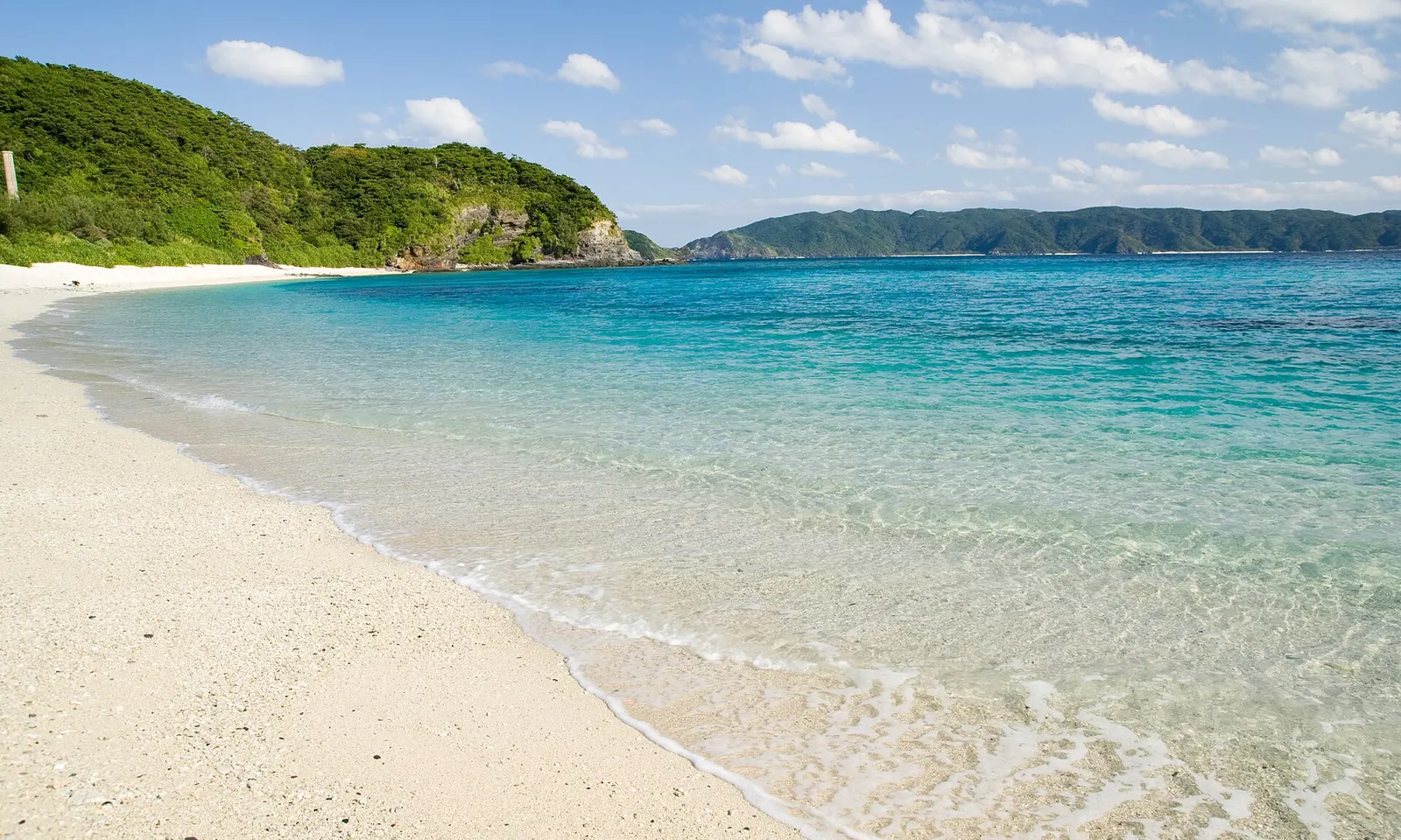
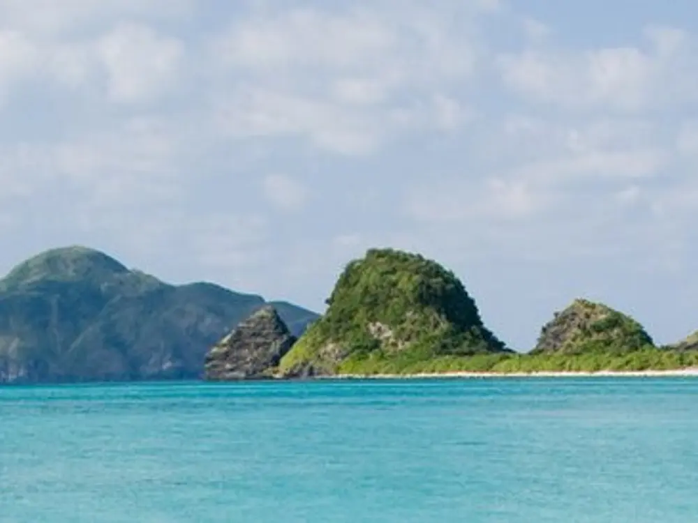
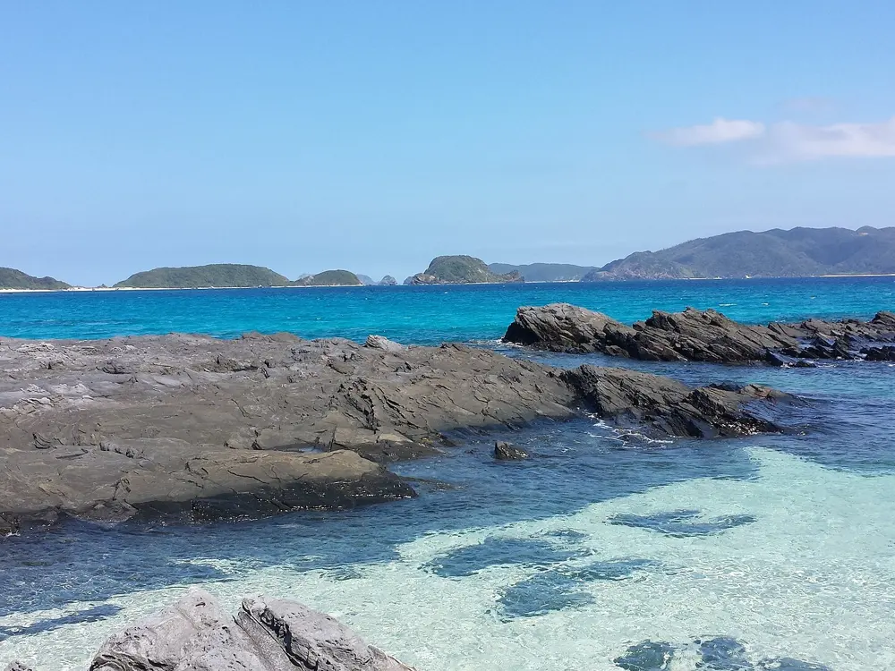
The clear turquoise water and white sand of Furuzamami Beach on Zamami Island

Photos: Hashi photo (CC BY 3.0), Grueslayer (CC BY-SA 4.0), ja:User:Hashi_photo (CC BY-SA 3.0), Rickard Törnblad (CC BY-SA 4.0)

Islands
36, four of them inhabited
Coral
248 species recorded on the reefs
Swim season
April to the end of October
Ferry
Naha to Zamami in about 50 minutes by fast boat

Why go

The Kerama Islands are a group of 36 islands about 32 km southwest of Okinawa Island, and since 5 March 2014 their islands and waters have been the Keramashoto National Park, known for the clear water locals call Kerama blue. The reefs hold 248 species of coral, and two reef areas, off western Tokashiki and between Aka and Zamami, have been Ramsar wetlands since 2005. It is the easiest place in Japan to swim off a white beach straight onto living coral.

The route

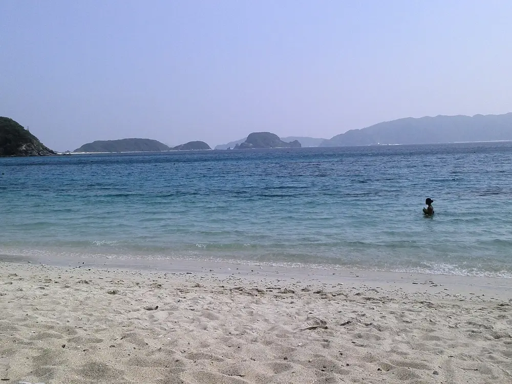
Furuzamami Beach on Zamami, given two stars by the Michelin Guide, is a long, narrow beach facing Tokashiki. It shelves steeply, so big clumps of coral with schools of tropical fish lie only a short swim from the sand, and the water is usually calm enough for snorkelling. Tokashiki, the largest island, and Aka, linked to Geruma, have beaches of their own and are on the same ferry routes from Naha.

When to go

The swimming season runs from April to the end of October, with lifeguards on duty at Furuzamami and parasols and loungers for hire until then. From December to April humpback whales come into these waters, and whale watching trips go out from Zamami.

Getting there

Ferries leave Tomari Port in Naha. In October 2026 the fast Queen Zamami sailed at 9am and 3pm and reached Zamami in 50 minutes; the slower Ferry Zamami takes about 2 hours. Adult fares were 3,950 yen one way on the fast boat and 2,900 yen on the ferry. Tickets are sold on the day at Tomari, and boats fill in summer, so book by phone with the Zamami village office. Separate boats run to Tokashiki.

Permits and booking

No permit is needed to swim. Visitors to Zamami pay a 100 yen island entry tax; children up to junior high school age are exempt. On 19 October 2026 the Ferry Zamami was out of service while it covered the Aguni route, and the inter-island boat between Zamami, Aka and Tokashiki had a suspension notice dated 15 October, so check the village site before you plan island hopping.

How hard it is

The water off Furuzamami is usually calm, but the beach drops off quickly, so weaker swimmers should stay close in. Do not stand on or touch the coral. In summer, Okinawa Prefecture warns about the habu box jellyfish (its 2024 advisory ran from 1 June to 30 September) and advises swimming inside the jellyfish nets on guarded beaches.

Where to sleep

Zamami, Aka and Tokashiki each have small guesthouses and minshuku near their harbours, and many visitors come out from Naha for the day.
Tips

  • Board the Queen Zamami 10 minutes before departure from berth 7A on the north side of Tomari Port, a 7 to 8 minute walk from the Tomari building.
  • Check the Zamami village site on the morning you sail: it posts whether the boats are running and whether swimming at Furuzamami is possible that day.
06 / 10

The Hampstead Heath ponds

London, United Kingdom

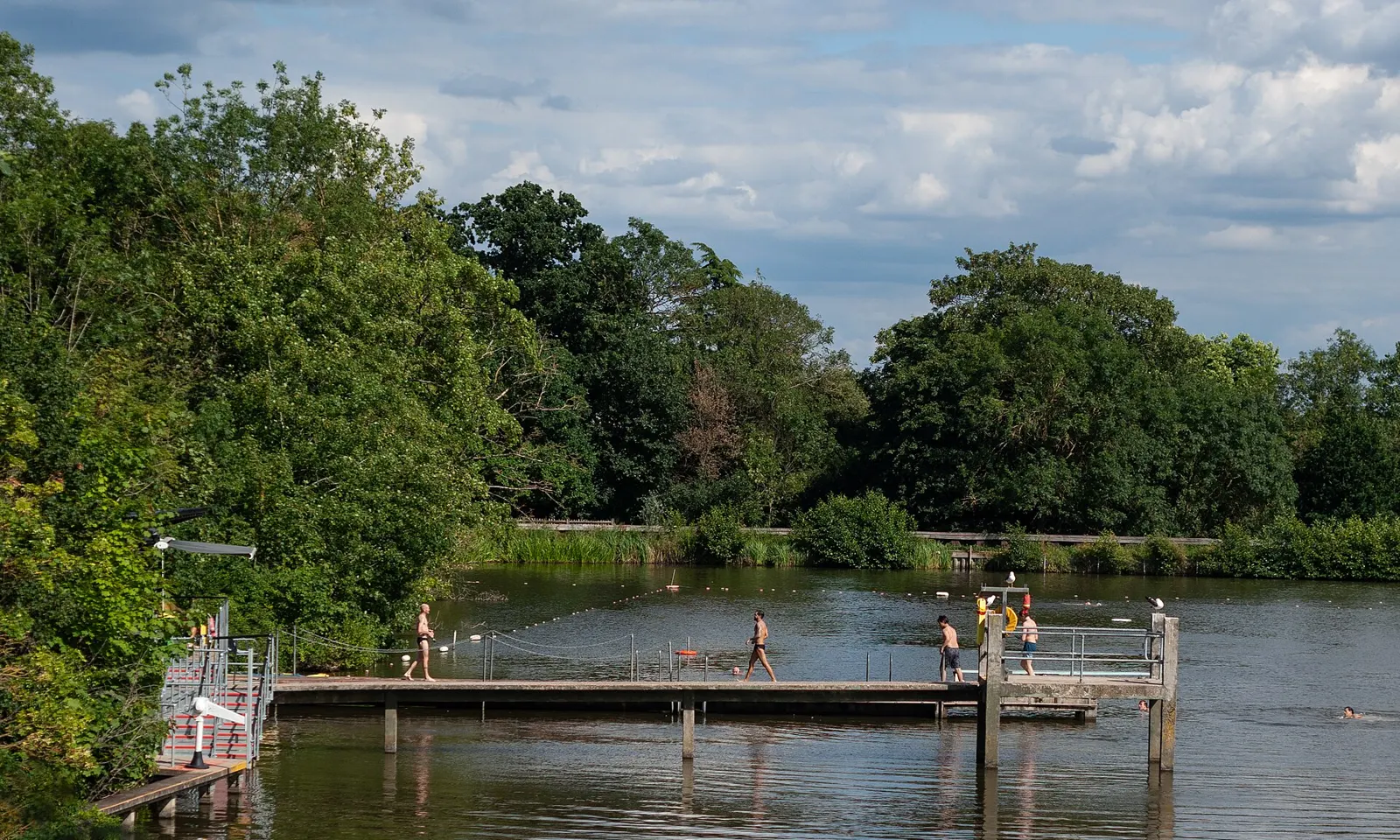
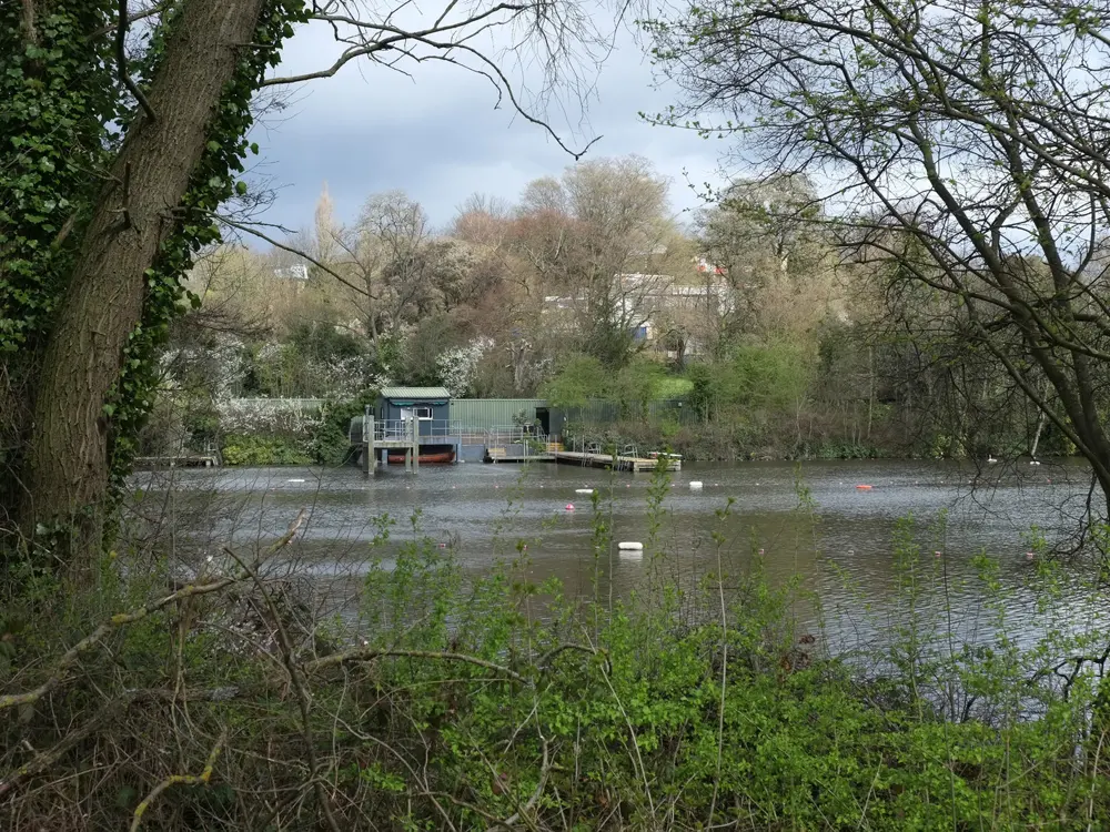
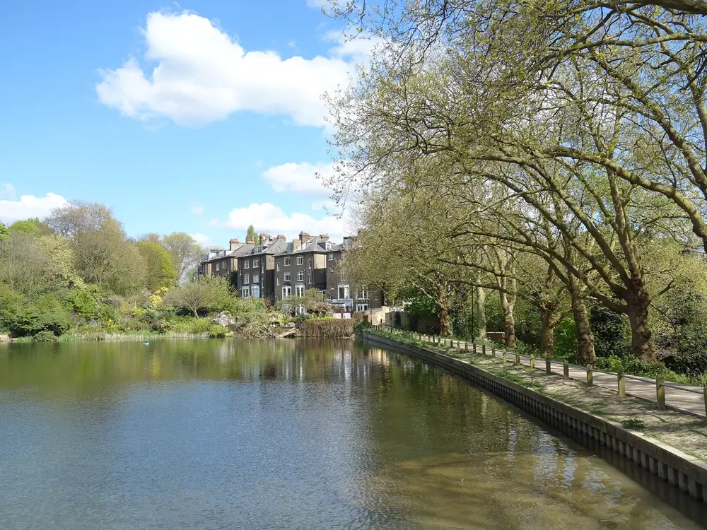
The diving jetty of the Highgate Men's Bathing Pond on Hampstead Heath, with swimmers in the water

Photos: Jim Osley (CC BY-SA 2.0), Bloodholds (CC BY-SA 4.0), Martin Addison (CC BY-SA 2.0), Des Blenkinsopp (CC BY-SA 2.0)

Distance
61 m length at Parliament Hill Lido
Entry
Ponds £5 adult, £3 concession and under 16s
Season
Ladies', Men's and Lido all year; Mixed April to October
Age
8 and over in the ponds, with a swim test for children

Why go

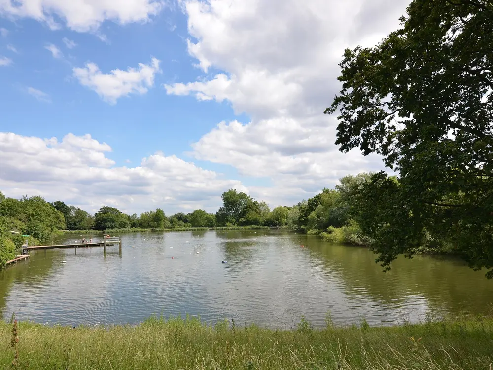
On Hampstead Heath, a few miles from central London, people swim through the year in ponds that were dug in the 17th and 18th centuries as reservoirs for the city. Three of them are kept for bathing: the Kenwood Ladies' Pond, the Highgate Men's Pond and the Hampstead Mixed Pond. Swimming here has been free since at least the 1920s, before tickets came in, and the regulars who break the surface on a winter morning are part of the city's character. The water is natural and untreated, with trees and reeds at the edges.

The route

The Highgate Men's Pond and the Kenwood Ladies' Pond lie off Millfield Lane on the eastern side of the Heath. Each has a lifeguarded swimming area, ladders for stepped entry and a hoist for assisted entry. The Mixed Pond is on the Hampstead side, a 10 to 15 minute walk from Hampstead Heath station. For lengths, Parliament Hill Lido, opened on 20 August 1938, is an unheated pool 61 m long and 27 m wide, 1 to 2 m deep, and since 2005 lined with stainless steel.

When to go

The Ladies' and Men's ponds and the Lido open all year, and the Mixed Pond from April to October. In 2026 the pond timetable ran from 7am to 8.15pm between 10 May and 15 August, shrinking to 7am to 2pm from late October and 7.30am to 2.30pm from 22 November to 13 February 2027. From late May to early September some sessions must be booked online and sell out on warm days. The Lido sauna runs from mid-October to May.

Getting there

Gospel Oak on the Overground is about 18 minutes' walk from the Men's Pond and about 23 minutes from the Ladies' Pond. The 214 bus stops near both. The Lido is beside Gospel Oak station, and Hampstead Heath station serves the Mixed Pond.

Permits and booking

Tickets to 31 March 2027 cost £5 for adults at the ponds and £3 for concessions and under 16s. At the Lido a summer morning or afternoon session costs £8.80 for adults, and a winter swim £5. Under 16s and over 60s swim free before 9.30am with proof of age. From 1 October 2026 the swimming facilities take cashless payment only. Children under 8 are not allowed at the ponds. Those aged 8 to 15 must be with an adult, one adult to two children, and pass a swim test first.

How hard it is

The City of London says the ponds are for competent swimmers only: the water is deep and opaque, untreated, and its microorganism levels can rise after rain. In autumn 2026 the Ladies' Pond page warned of elevated blue green algae that may harm vulnerable swimmers. Winter water is cold, and temperatures are posted at each pond and online. The ponds close for thunderstorms and for Met Office warnings of gusts of 40mph or more. Masks, snorkels and swimming aids are not allowed in the Men's Pond; wetsuits, boots and gloves are.

Where to sleep

Hampstead, Highgate and Kentish Town have hotels and guesthouses within walking distance of the Heath, and the whole of London is a short train ride away.

Tips

  • The Men's Pond has no lockers, so bring a floating dry bag for anything you cannot leave in the changing area.
  • Check the City of London's Hampstead Heath social media accounts for short notice closures before you set out.
07 / 10

The Aare in Bern

Bern, Switzerland

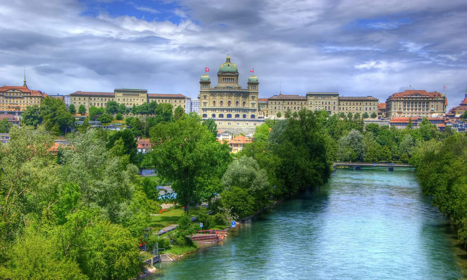
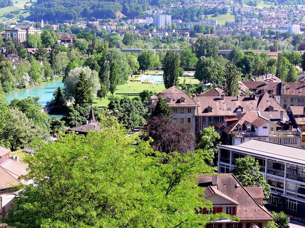
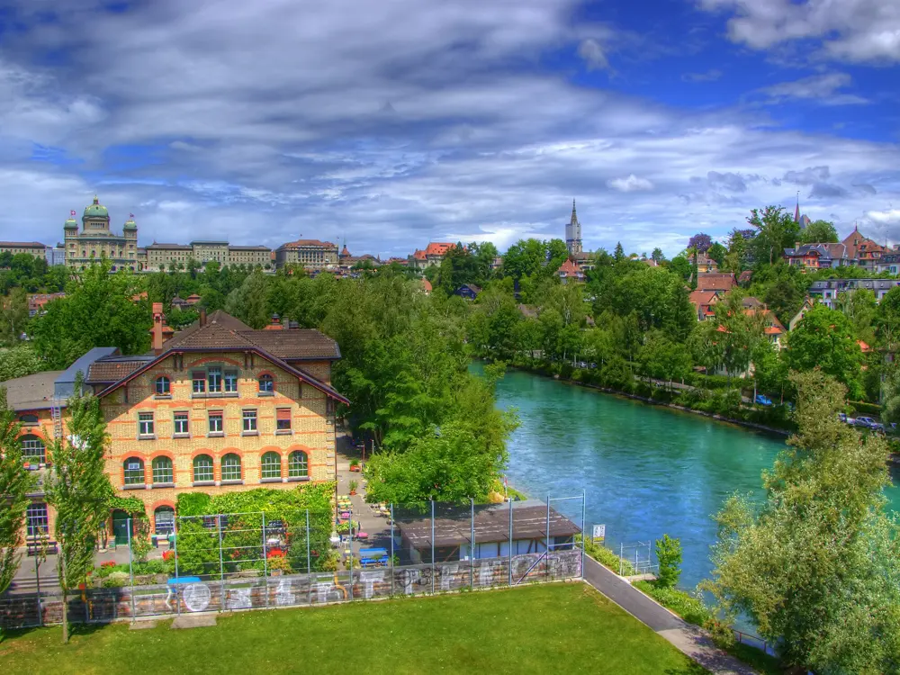
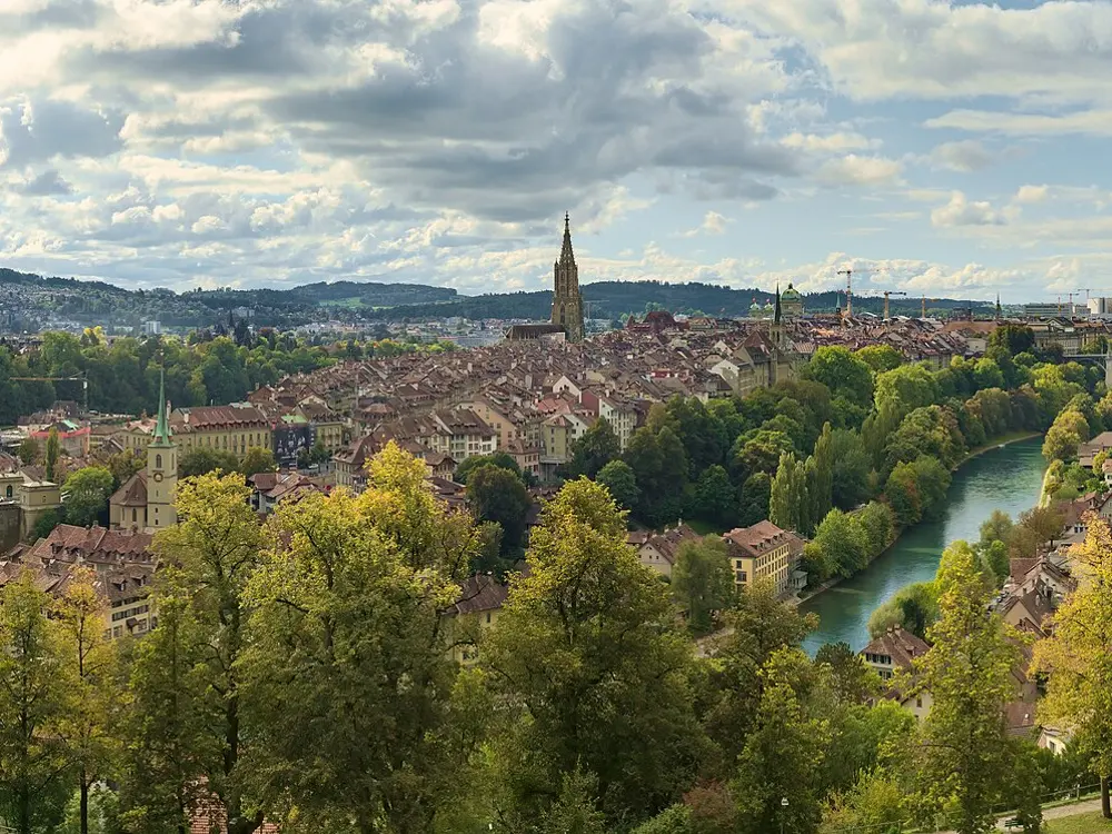
The green Aare flowing below the Federal Palace in Bern

Photos: Martin Abegglen from Bern, Switzerland (CC BY-SA 2.0), Photo: Andreas Praefcke (CC BY 3.0), Martin Abegglen from Bern, Switzerland (CC BY-SA 2.0), Daniel Kraft (CC BY-SA 3.0)

Classic swim
Eichholz to the Marzili, drifting with the current
Water
About 15 to 22 C in summer
Entry
Free at Eichholz and the Marzili river bath
Marzili season
23 May to 13 September 2026

Why go

On a hot day in Bern, people walk upstream along the Aare in their swimming things, step into the green water and let the river carry them back into town under the Federal Palace. The Aare is the longest river that both rises and ends within Switzerland, and it reaches the capital as glacial meltwater, cold and very clear. Some locals even float home from work in summer, with their clothes rolled into a waterproof river bag.

The route

The classic swim starts at Camping Eichholz, upstream of the city, and ends at the Marzili, Bern's riverside lido below the old town, about 10 minutes on foot from the main station. Signs mark the places to get in and out along this stretch, which Bern Tourism calls the safest on the river, and red bars at the exits give you something to grab as you float past. From inside the city a float of 20 to 30 minutes is possible, and a longer Old Town route ends at the enclosed river pool at Lorrainebad, its last exit. The small Marzilibähnli funicular lifts you back up to the centre afterwards.

When to go

Summer. The water runs at about 15 to 22 C and is usually around 21 C on a hot day in high summer. In 2026 the Marzili opened from 23 May to 13 September, from 7am on weekdays between June and August. Check aareschwumm.ch for the day's water speed and temperature.

Getting there

Bern is on the main Swiss rail lines. The Marzili, at Marzilistrasse 29, is about 10 minutes' walk from the station, and you walk on from there along the river to Eichholz.

Permits and booking

Getting into the river at Eichholz and using the Marzili river bath cost nothing; cabins and lockers there charge a fee. From 22 September 2025 to the end of May 2026 the city banned swimming and boating from Eichholz to the Dalmazibrücke for flood protection works, which are planned over several winters while summer swimming carries on, so check bern.ch before an autumn or winter swim. Swimming is closed below the Dalmazibrücke and between Lorrainebad and Felsenausteg because of weirs and an old hydroelectric plant.

How hard it is

This is a fast, cold river with no lifeguards at the Marzili river bath, and BLS says Aare swimming suits only practised swimmers, at their own risk. Know your exits before you get in, because the weir just below the Marzili spans the whole river. Stay out after heavy rain, when the current is stronger and carries logs and debris, and never swim after drinking. Look upstream before jumping from a bridge. A wetsuit adds warmth and buoyancy.

Where to sleep

Bern's old town and the streets around the station have hotels within walking distance of the Marzili, and Camping Eichholz sits at the start of the swim.

Tips

  • Carry your clothes, phone and shoes in a waterproof river bag so you can walk straight home from the exit.
  • If you swim on through the old town, take the middle arch at the Untertor bridge, where the current is strongest, and watch for people jumping from the bridges.
08 / 10

Cape Town's tidal pools

Western Cape, South Africa

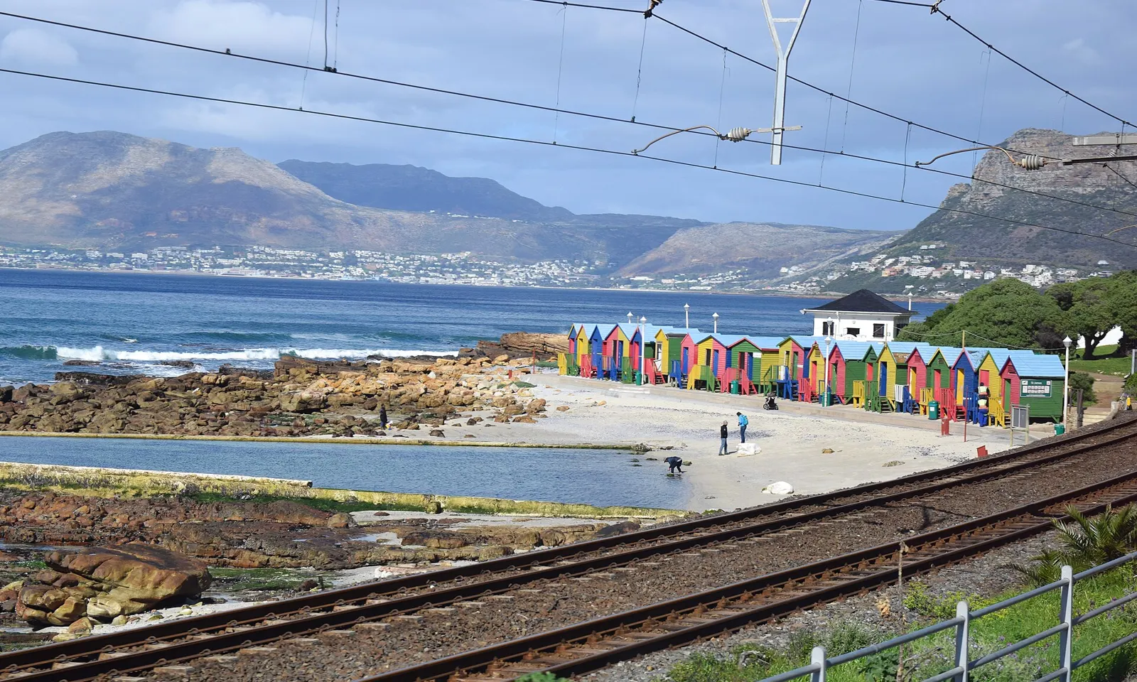
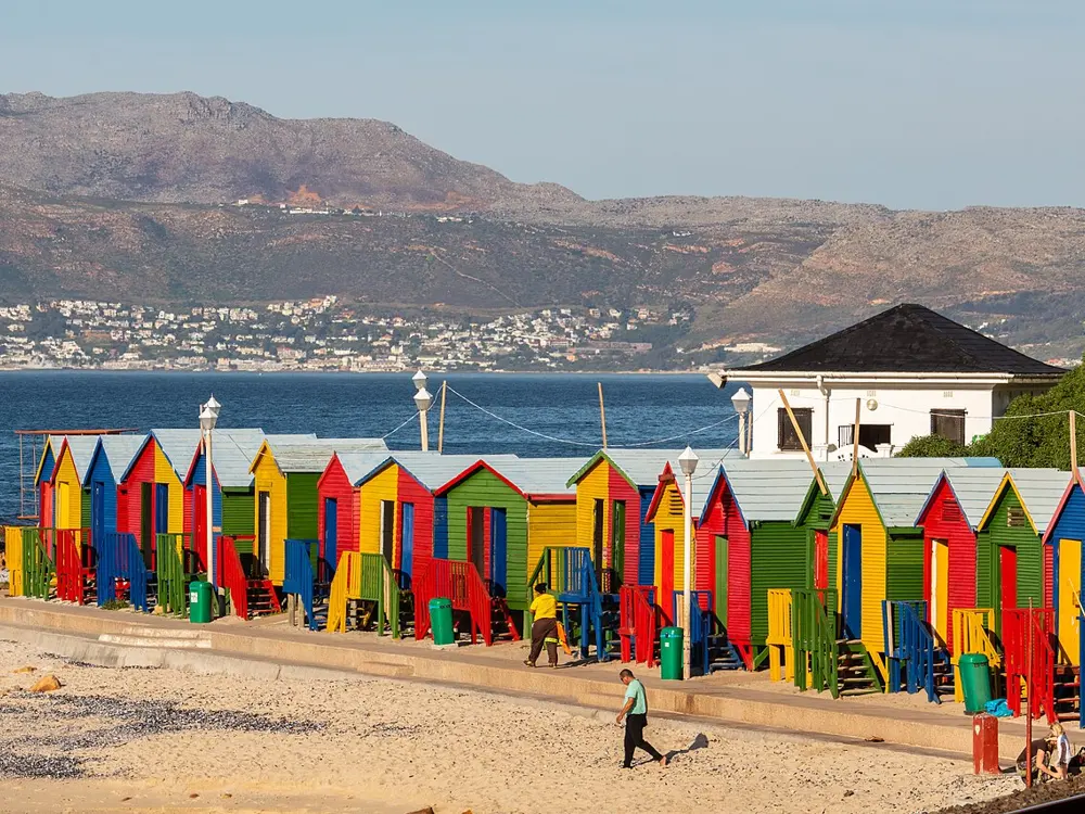
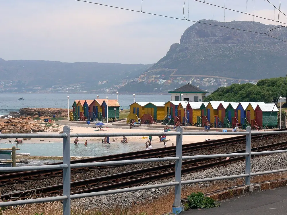
The St James tidal pool and its striped bathing boxes on False Bay, beside the railway

Photos: Raita Futo from Tokyo, Japan (CC BY 2.0), Diego Delso (CC BY-SA 4.0), Hilton Teper (CC BY-SA 3.0), ~ souTH AFRica ~ (CC BY 3.0)

Distance
Robben Island to Bloubergstrand about 7.5 km
Water
False Bay about 16 to 22 C in summer; Atlantic side 10 to 15 C
Entry
Tidal pools free; Sea Point Pool R39 adult
St James pool
1,229 square metres, open 24 hours

Why go

Along both coasts of the Cape Peninsula, low walls built across the rocks hold back the sea in tidal pools, where the swell breaks outside and the water inside stays calm enough for a morning swim. The two sides of the peninsula feel like different seas: False Bay, on the east, is warmed by water piled up along the coast by the southeaster wind, while the Atlantic shore has cold, clear water brought up from the depths. Swimmers here can choose a warm sheltered pool or a cold one under Table Mountain on the same day.

The route

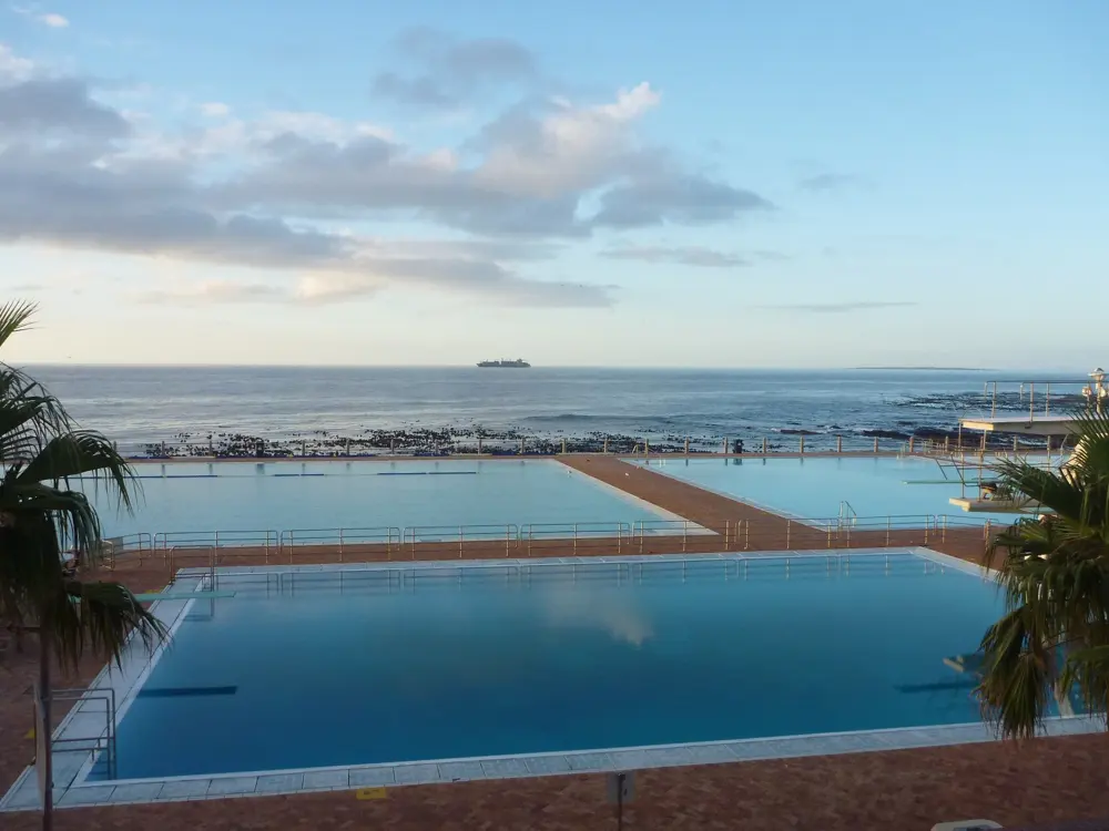
On False Bay, the St James tidal pool on Main Road, known for its Victorian bathing boxes painted in bright stripes, covers 1,229 square metres. A short walk on, Dalebrook, a 1,022 square metre rock pool between St James and Kalk Bay, is shallow and generally warm, which makes it a family favourite. On the Atlantic side, Camps Bay and Maiden's Cove have tidal pools off Victoria Road, and Saunders Rocks is built into the rocks on the Sea Point promenade. The City's Sea Point Swimming Pool, on the same promenade, has a 50 m main pool as well as diving and children's pools. For open water, the crossing from Robben Island to Bloubergstrand is about 7.5 km.

When to go

Summer is the season for swimming. City of Cape Town figures put False Bay at about 16 to 22 C in summer and the Atlantic coast at about 10 to 15 C. St James is busy on weekends and holidays, and early mornings are quietest.

Getting there

St James is on the Simon's Town railway line, between Muizenberg and Kalk Bay, and Dalebrook is a short walk along the coast. Camps Bay and Sea Point are on the Atlantic side of the city, below Table Mountain and Lion's Head.

Permits and booking

The City's tidal pools cost nothing to use; St James is open 24 hours. Sea Point Swimming Pool charges R39 for adults and R23 for children aged 3 to 15, takes cards only, and opens from 7am to 7pm on Tuesday to Sunday and from noon on Mondays. The Robben Island crossing is an organised swim, run in wetsuit and non wetsuit categories.

How hard it is

Tidal pools are calm, but the rocks are slippery and the Atlantic pools are cold. Outside the walls, False Bay has white sharks: Shark Spotters watches Muizenberg, St James, Fish Hoek and Caves every day of the year, and a white flag with a siren means a shark has been seen close to swimmers and you should leave the water. The Robben Island swim is a cold water event, with water reported as low as 8 to 9 C over Easter 2015, and the organisers suggest relays when it is 11 C or colder.

Where to sleep

Muizenberg, St James and Kalk Bay have guesthouses on the train line by the False Bay pools. Sea Point and Camps Bay have hotels and apartments near the Atlantic pools.

Tips

  • Bring goggles at Dalebrook to see fish among the boulders.
  • Pick the side of the peninsula by the wind: when the southeaster blows, the Atlantic beaches below the mountain are more sheltered.
09 / 10

Kailua Bay, Kona

Hawaiʻi Island, United States

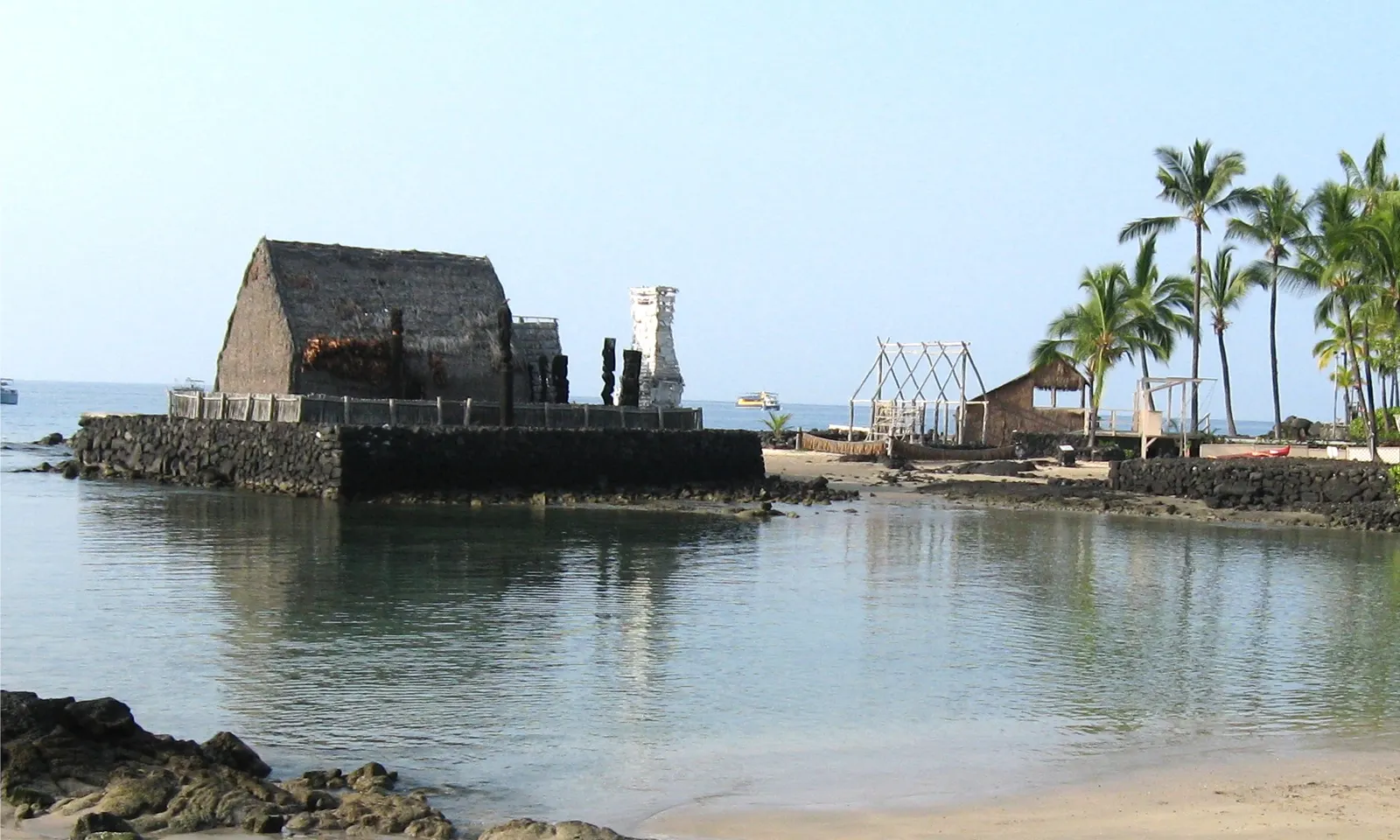
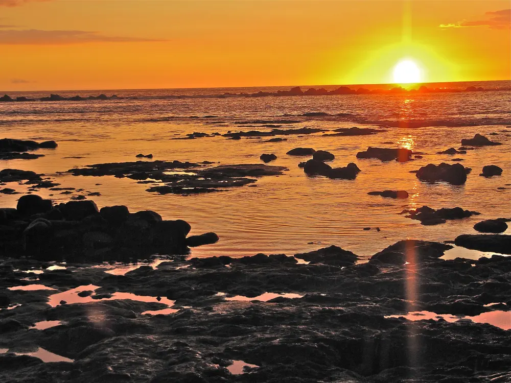
Kamakahonu beach and the calm water of Kailua Bay beside Ahuʻena Heiau, at the Ironman swim start in Kailua-Kona

Photos: W Nowicki (CC BY 3.0), Ken Lund from Reno, Nevada, USA (CC BY-SA 2.0), Corwin Hee (CC BY-SA 3.0), Vlad & Marina Butsky (CC BY 2.0)

Distance
2.4 miles (3.86 km) on the Ironman course
Water
About 25 to 27 C
Start
Beside Kailua Pier, Kailua-Kona
Best time
Early morning, about 7 to 9 am

Why go

Kailua Bay, in front of the old town of Kailua-Kona, has held the Ironman World Championship swim since the race moved here from Oʻahu in 1981. Part of the course stays marked after race day, and residents and visiting triathletes swim it through the year in warm, clear water.

The route

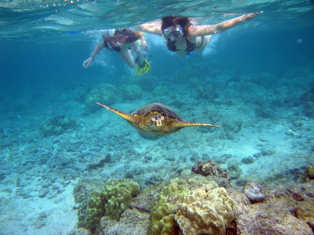
The race swim is a single loop of 2.4 miles (3.86 km): athletes start beside Kailua Pier, off the small beach called Dig Me Beach, swim clockwise along the coast and turn at a boat about 1.2 miles out. On ordinary mornings swimmers walk in from the same sand beach. The fourth buoy is about 300 yards out, and the Kings buoy makes a round trip of 2,000 m. South of town, Kahaluʻu Bay is a reef-sheltered beach park for snorkeling among honu, the green sea turtles.

When to go

The sea is warm all year, about 27 C on average in October and around 25 C in February. Early morning, roughly 7 to 9 am, brings calm water and little boat traffic, when the informal Pier Group swims. The 2026 race, with the men and women racing together again in Kona, was on 10 October; the pier closes to the public around race day.

Getting there

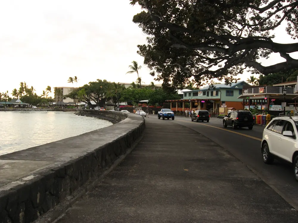
Kona International Airport is about seven miles from Kailua-Kona. The pier is on Aliʻi Drive and has no parking of its own, but public and paid parking lie within walking distance. At Kahaluʻu, nonresidents pay $12 for four hours of parking.

Permits and booking

No permit is needed. Since 1 January 2021 Hawaiʻi has banned the sale of sunscreen containing oxybenzone or octinoxate without a prescription. At Kahaluʻu, The Kohala Center asks for cover ups or mineral sunscreen with only zinc oxide or titanium dioxide as active ingredients. The park opens 7 am to 7 pm, with lifeguards from 9:30 am to 4:30 pm, and closes for dangerous surf or coral spawning, which brought a 10 day closure earlier in 2026. Keep at least 10 feet (3 m) from honu.

How hard it is

This is open ocean. Swell and sighting are the main challenges, with only the buoys to aim for, and the water deepens from about 15 to 20 feet at the fourth buoy to about 50 feet at the Kings buoy. Keep inside the buoyed lane, away from boats. At Kahaluʻu, waves, strong currents, sharp rocks and sea urchins are common; float above the reef instead of standing on it.

Where to sleep

King Kamehameha's Kona Beach Hotel stands beside the pier and the swim start, and much of Kailua-Kona lies along Aliʻi Drive within walking distance of the water.

Tips

  • Check hioceansafety.com for surf, wind and hazard reports before you swim.
  • At Kahaluʻu, check in with the ReefTeach volunteers, there from 8:30 am to 3 pm, and enter through the channel in front of the lifeguard tower.
10 / 10

Wadi Shab

Tiwi, Sur, Oman

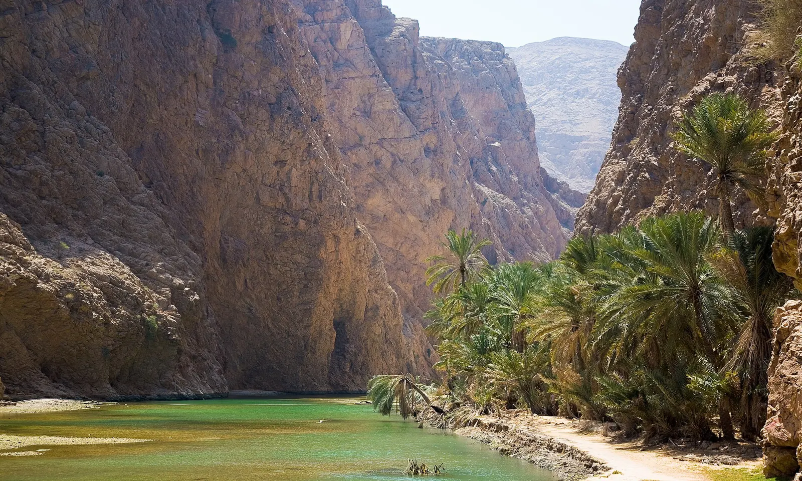
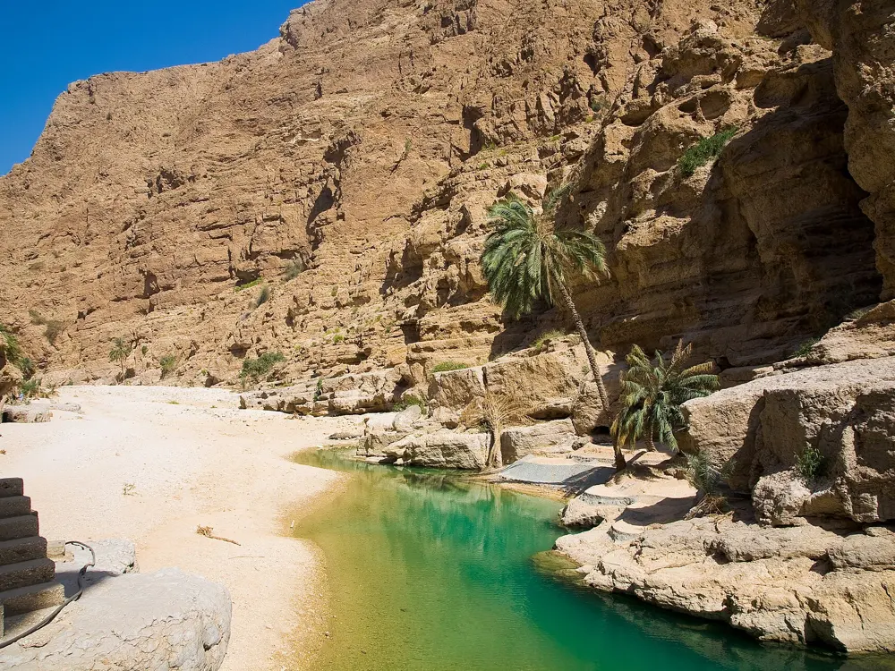
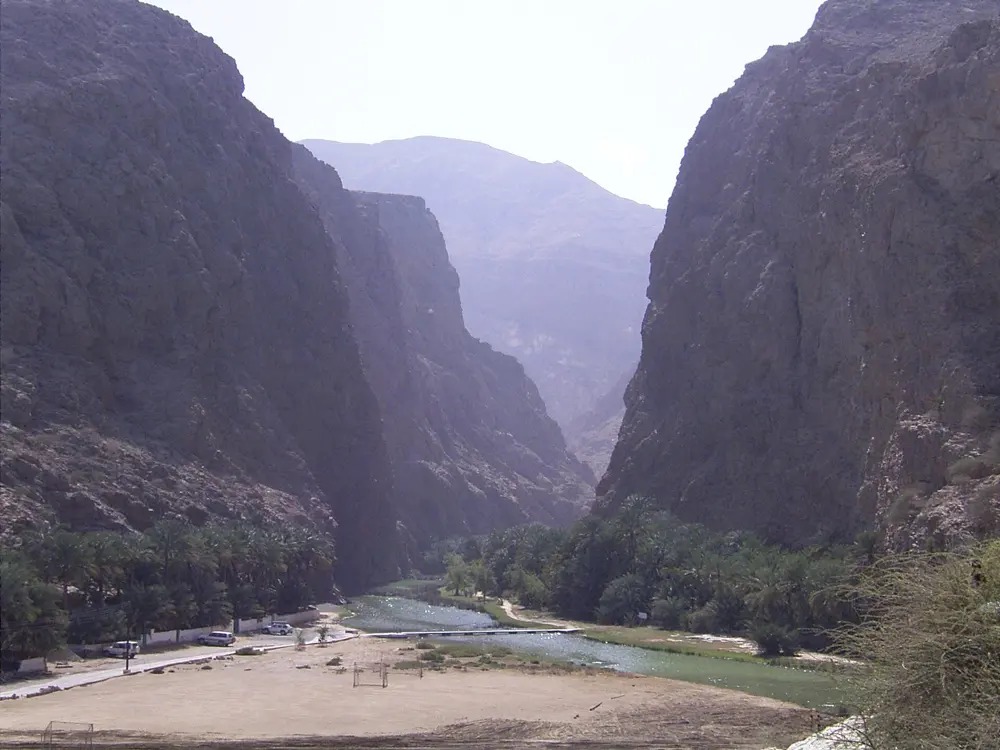
A green pool between the canyon walls and palms of Wadi Shab

Photos: Andries Oudshoorn (CC BY-SA 2.0), Andries Oudshoorn (CC BY-SA 2.0), Mai-Sachme (CC BY-SA 3.0), albinfo (CC BY-SA 4.0)

Distance
About 5 km walk out and back, plus three pools to the cave
Time
About 2 hours of walking; allow 3 to 4 hours
Boat
1 OMR per person, return included
Best months
November to April

Why go

Wadi Shab is a gorge that runs inland from the coast at Tiwi, near Sur, where a path along the cliffs leads up to a chain of green pools between the canyon walls. At the end, a narrow slit in the rock opens into a cave with a waterfall inside, which you can only reach by swimming. Oman's Ministry of Heritage and Tourism made it a tourist area by ministerial decision in 2023, and in May 2025 it signed an agreement with OMRAN Group to develop it.

The route

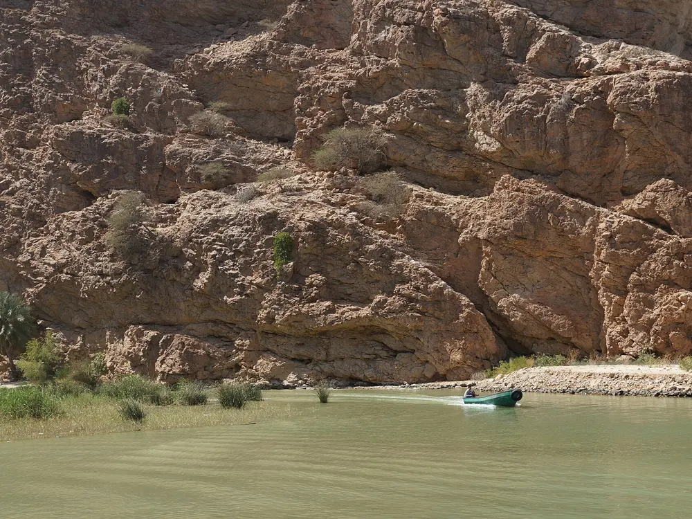
A short boat ride crosses the water at the mouth of the wadi, under the highway bridge. From there the path follows the side of the gorge to the first pool, about 5 km there and back in all. There are three pools to swim through: the first is shallow at the start and takes about 10 minutes to cross at an easy pace, the second is short with deep patches, and swimming from the first to the end of the third takes about 35 minutes. At the end of the third pool, turn sideways through the gap in the rock into the cave pool, which is deep with only handholds to rest on.

When to go

November to April is the walking season; by April it is already hot, and November and March are cooler. Avoid the Friday and Saturday weekend, when the wadi is crowded, and start early.

Getting there

Wadi Shab is about 155 km from Muscat, about an hour and a half by car on the paved Highway 17 towards Sur; leave at the Tiwi exit. Parking is free under the bridge by the boat dock.

Permits and booking

No permit is needed. The boat across costs 1 OMR per person, with the return included, and in 2025 boats ran from about 7am to 5.30pm; keep the slip of paper the boatman gives you. In October 2024 the ministry told people not to visit until the end of the month, after high water from tropical weather damaged parts of the valley. OMRAN's development plans include suspension bridges, a zipline, via ferrata routes and marked swimming zones, so arrangements at the wadi may change.

How hard it is

The walk is moderate, over rocks and uneven paths in the heat. The swimming is the hard part: in the third pool you cannot touch the bottom until near the cave, and the cave pool has nowhere to stand. Weaker swimmers should take a life jacket, which the shop by the dock rents out. Never go when rain is forecast, because even light rain upstream can bring a flash flood, and after rain the cave entrance may be impassable. Oman is conservative: swim in shorts and a T-shirt over your swimsuit.

Where to sleep

Sur, a short drive south, has the nearest choice of hotels, and many visitors come for the day from Muscat.

Tips

  • Wear hiking sandals or water shoes you can swim in, not flip-flops.
  • There is no phone signal at the dock; wave to call the boat back for the return.

Sources

Distances, heights, seasons and permit rules were checked against these pages. Rules change, so check the park or trail authority before you go.