Rungs Labs

Rungs Pilgrimage · Running · South America

The 10 Best Places to Run in South America

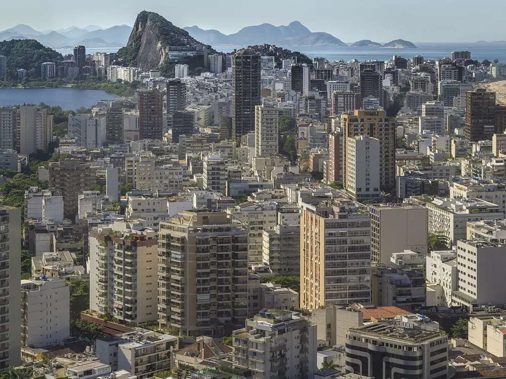
Rio de Janeiro's beachfront and Lagoa, Rio de Janeiro, Brazil. Photo: Cesvieira (CC BY-SA 4.0)

South America's running runs from sea level to nearly 4,000 m. Some of these places are city promenades where half the town turns out on a Sunday; others are mountain trails where the weather decides the day. These ten take in Rio de Janeiro, São Paulo, Montevideo and Buenos Aires on the Atlantic side, Lima on the Pacific, Bogotá and Quito high in the Andes, Santiago under its city hill, and Patagonia Run and the Patagonian International Marathon in the far south.

For each place you get the classic runs, the big races, the best season, how to get there, entry rules and fees, how hard it is and where runners stay. Every fact comes from city and park authorities, race organisers or the other pages linked at the bottom.

Updated 2026-10-18

  1. 01Rio de Janeiro's beachfront and LagoaRio de Janeiro, Brazil
  2. 02Buenos Aires: the Bosques de Palermo and Costanera SurBuenos Aires, Argentina
  3. 03San Martín de los Andes and Patagonia RunNeuquén, Argentina
  4. 04Torres del Paine and the Patagonian International MarathonMagallanes, Chile
  5. 05Santiago: Cerro San Cristóbal and the Santiago MarathonSantiago, Chile
  6. 06Lima: the Malecón and the Lima 42KMiraflores and Barranco, Lima, Peru
  7. 07Quito: the Parque Metropolitano, Rucu Pichincha and the Quito 15KQuito, Ecuador
  8. 08Bogotá: Simón Bolívar, Monserrate and the CiclovíaBogotá, Colombia
  9. 09São Paulo: Ibirapuera and the São SilvestreSão Paulo, Brazil
  10. 10Montevideo: the RamblaMontevideo, Uruguay
01 / 10

Rio de Janeiro's beachfront and Lagoa

Rio de Janeiro, Brazil
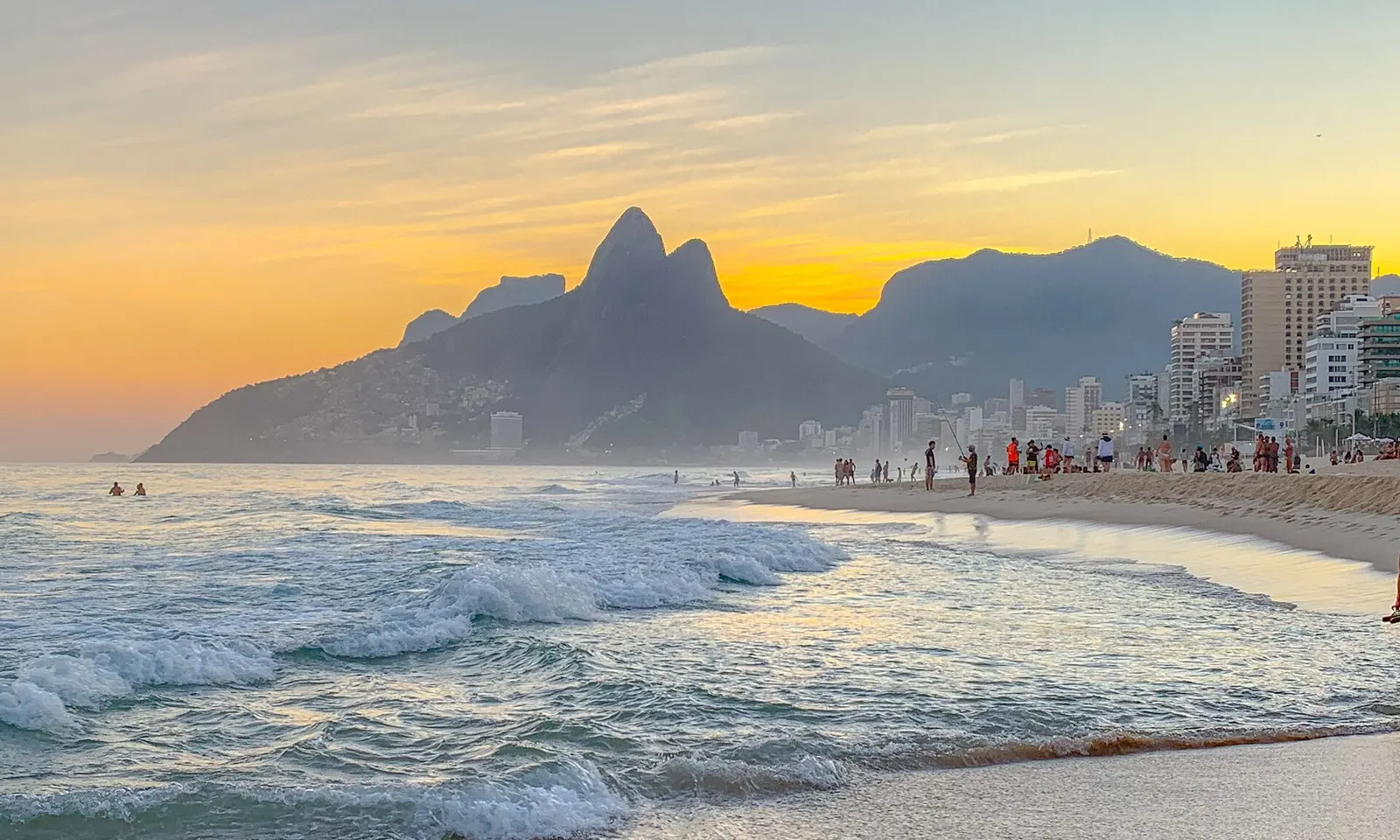
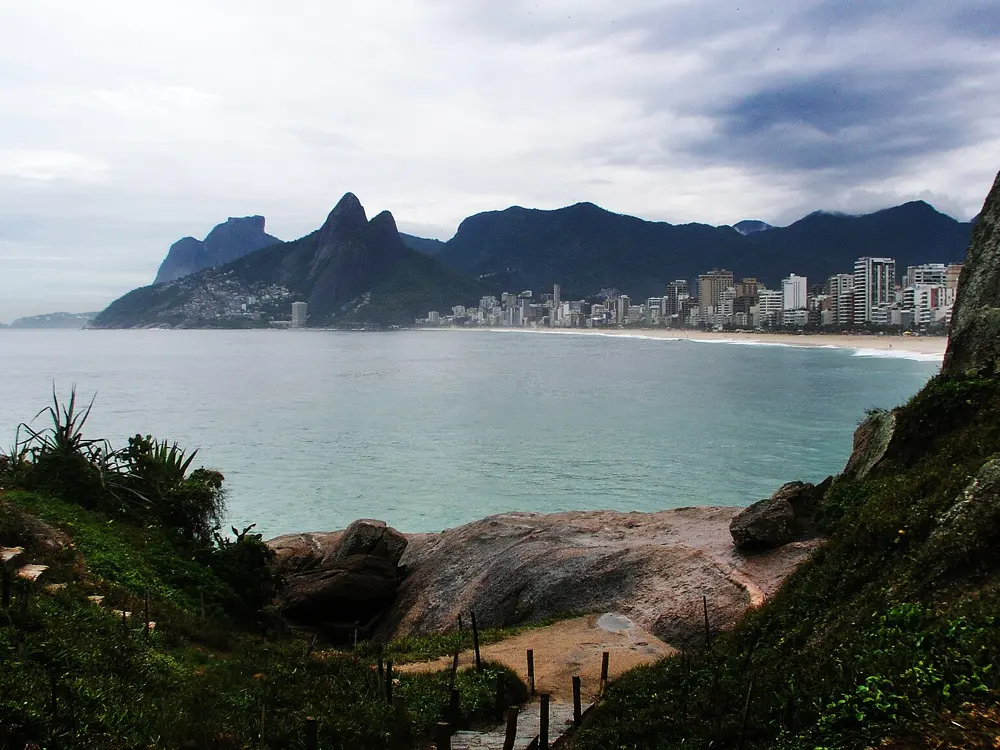
Ipanema beach at sunset with the twin peaks of Morro Dois Irmãos beyond Leblon

Photos: Cesvieira (CC BY-SA 4.0), Wilfredor (CC0), Wilfredor (CC0), JYB Devot (CC BY-SA 4.0)

Distance
Up to 8.5 km, Leme to Leblon
Lagoa loop
7.4 km
Big race
Maratona do Rio, 27 to 30 May 2027
Best months
May to June, September to October

Why go

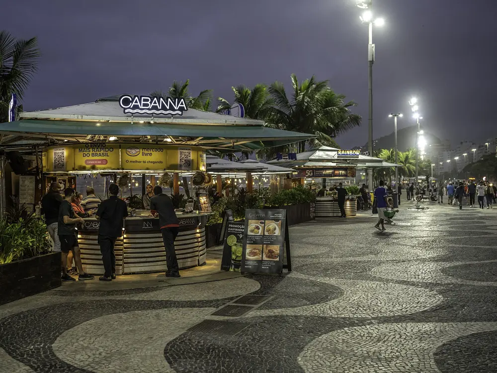
Few cities give runners this much flat ground beside the sea. The calçadão, the wide patterned promenade along Copacabana, Ipanema and Leblon, is busy from first light, with granite peaks rising behind the apartment blocks. On Sundays the city closes lanes of the beachfront roads to cars and hands them to people on foot. The Maratona do Rio, a World Athletics Elite Label race, had about 70,000 runners in 2026, the biggest field in its history.

The route

The classic run starts at Leme, the east end of Copacabana, and heads west past lifeguard posts numbered 1 to 12. It is 4 km to the Copacabana Fort. Cut through Garota de Ipanema park at Arpoador, then run 3.7 km along Ipanema and Leblon to the Mirante do Leblon lookout, up to 8.5 km one way with about 58 m of climbing. From the beach it is 0.7 km to the Lagoa Rodrigo de Freitas, a 7.4 km loop. The Aterro do Flamengo runs from Santos Dumont airport to Botafogo through gardens by Roberto Burle Marx. For trail, the path up Pedra Bonita in Tijuca National Park climbs about 1.3 km through forest to a summit near 696 m.

When to go

Summer, December to March, is hot and humid, with highs that can reach 40°C and evening storms. Winter, June to September, averages about 23°C. May to June and September to October are the mildest choices. The 25th Maratona do Rio runs from 27 to 30 May 2027, over the Corpus Christi holiday, with 5 km, 10 km, 21 km and 42 km races and a challenge that pairs the half on Saturday with the marathon on Sunday.

Getting there

Metro Line 1 serves the seafront: Cardeal Arcoverde for Leme, Siqueira Campos and Cantagalo for Copacabana, General Osório for Ipanema. Line 4 continues to Jardim de Alah near the Lagoa and Antero de Quental in Leblon. Flamengo station serves the Aterro. Reach Pedra Bonita by car or ride app, and arrange the return, since signal at the gate is weak.

Permits and booking

No permit or fee is needed. Riotur says the Aterro roads close to traffic on Sundays from 7 am to 6 pm. On the beachfront, lanes of Avenida Atlântica, Vieira Souto and Delfim Moreira close on Sundays and holidays from 7 am to 5 pm. Since 30 August 2026 bicycles use a separate 7.2 km leisure lane by the median, and a city decree bans them from the leisure area itself, except for children up to eight.

How hard it is

The roads are flat and paved. Heat and humidity are the real test, and shade is scarce. The UK Foreign Office warns that thefts are common on city beaches and advises staying off them after dark. Pedra Bonita turns slippery in and after rain.

Where to sleep

Stay in Copacabana or Ipanema, close to the promenade and the metro.

Tips

  • Run at dawn and carry only a phone and some cash, out of sight.
  • Start Pedra Bonita early: the last start is 4 pm.
02 / 10

Buenos Aires: the Bosques de Palermo and Costanera Sur

Buenos Aires, Argentina

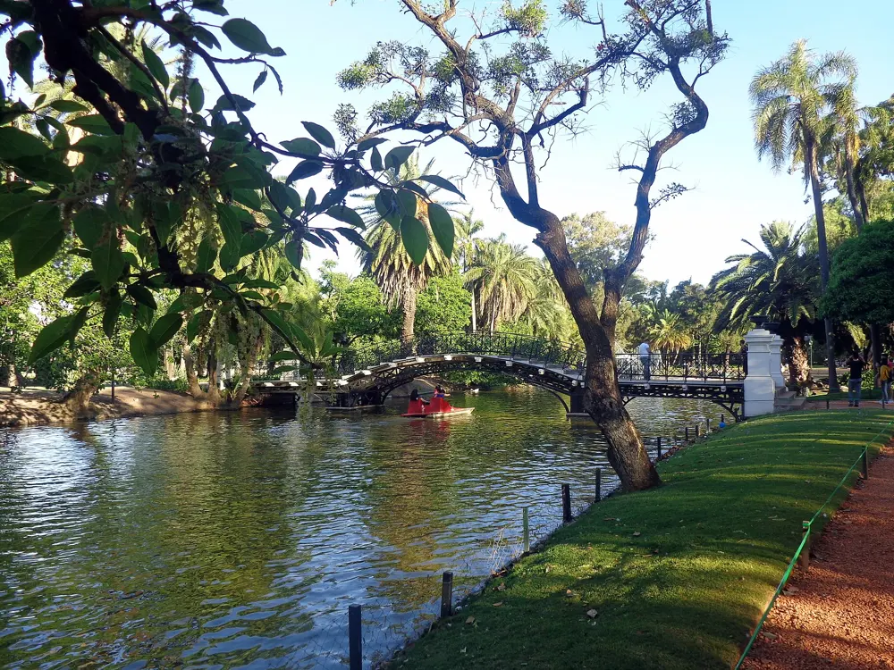
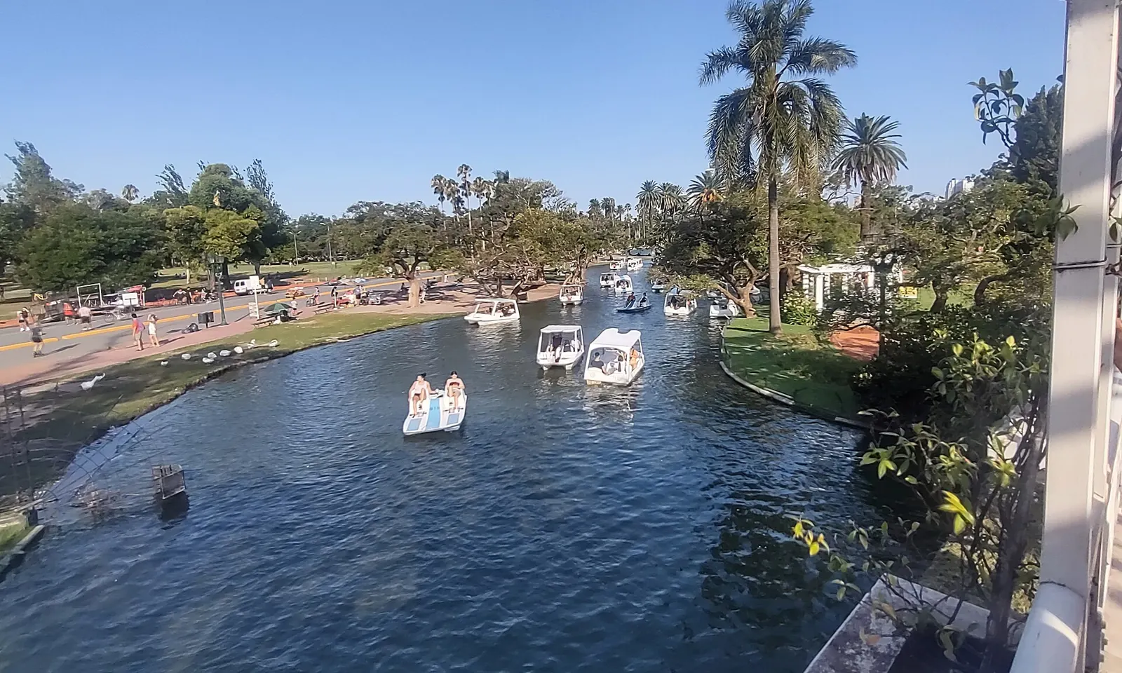
Pedal boats on the lake in Parque Tres de Febrero, with palms and the Rosedal pergola beside it

Photos: Roberto Fiadone (CC BY 4.0), Roberto Fiadone (CC BY-SA 4.0), BugWarp (CC BY-SA 4.0), Roberto Fiadone (CC BY-SA 4.0)

Distance
4 to 12 km circuits in Palermo
Rosedal loop
1,600 m, marked every 100 m
Big races
Half marathon in August, marathon in September
Best months
March to May, September to November

Why go

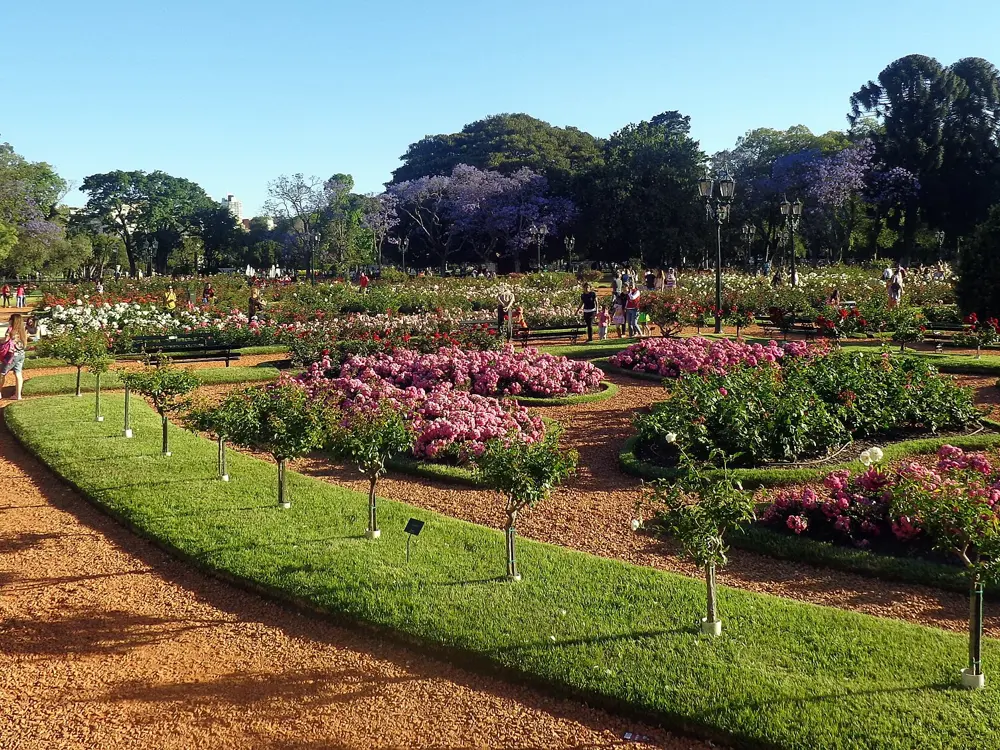
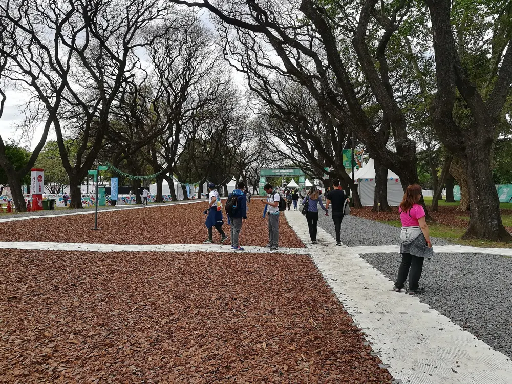
The Bosques de Palermo, the parkland of the Parque Tres de Febrero, are where Buenos Aires runs. Paths circle the lakes, the Rosedal rose garden and the planetarium, and running clubs such as Nike Run Club and Adidas Runners are based there. The city's road races have become some of the fastest anywhere: on 23 August 2026 Yomif Kejelcha won the Buenos Aires half marathon in 56:51, a world record subject to ratification, in a 6°C start with a light breeze.

The route

The circuits between the lakes, the Rosedal and the planetarium run from 4 to 12 km. The loop around the Rosedal is a flat 1,600 m on asphalt, marked every 100 m, and suits speed sessions. For longer, flat runs head east to Puerto Madero and its waterfront promenade, then into the Reserva Ecológica Costanera Sur, 350 hectares of woods, lagoons and grassland beside the Río de la Plata with more than 10 km of paths.

When to go

Autumn, March to May, runs about 12 to 22°C, and spring, September to November, about 15 to 25°C. Winter is cool, around 5 to 15°C, and good for long runs. Summer reaches 25 to 35°C with high humidity, so run before 8 am or at sunset. The 2026 marathon was on 20 September, with almost 17,000 runners starting at 7 am, and the half had more than 31,000 participants.

Getting there

Subte Line D stops at Palermo and Plaza Italia, a short jog from the lakes. The Costanera Sur reserve has a south entrance at Avenida Tristán Achával Rodríguez 1550 in Puerto Madero and a north entrance at Mariquita Sánchez de Thompson and Avenida Giralt.

Permits and booking

The parks are free. The Costanera Sur reserve opens Tuesday to Sunday and on holidays, 8 am to 6 pm from April to October and 8 am to 7 pm from November to March. It closes on rainy days, and afterwards if the paths were damaged. Entry is free, pets are not allowed, and under 16s need an adult. The marathon starts and finishes at Figueroa Alcorta and Dorrego in Palermo and passes the Rosedal, the Teatro Colón, the Obelisco and Boca Juniors' stadium before returning through Puerto Madero; in 2026 it had a painted blue line marking the shortest path.

How hard it is

Everything here is flat. Most paths are asphalt or paving, and the reserve's are natural surfaces. Summer heat and humidity are the main challenge.

Where to sleep

Stay in Palermo to run the Bosques from your door, or in Puerto Madero for the riverside and the reserve.

Tips

  • Use the 100 m marks on the Rosedal loop for intervals.
  • Check the weather before heading to Costanera Sur, since it shuts in rain.
03 / 10

San Martín de los Andes and Patagonia Run

Neuquén, Argentina

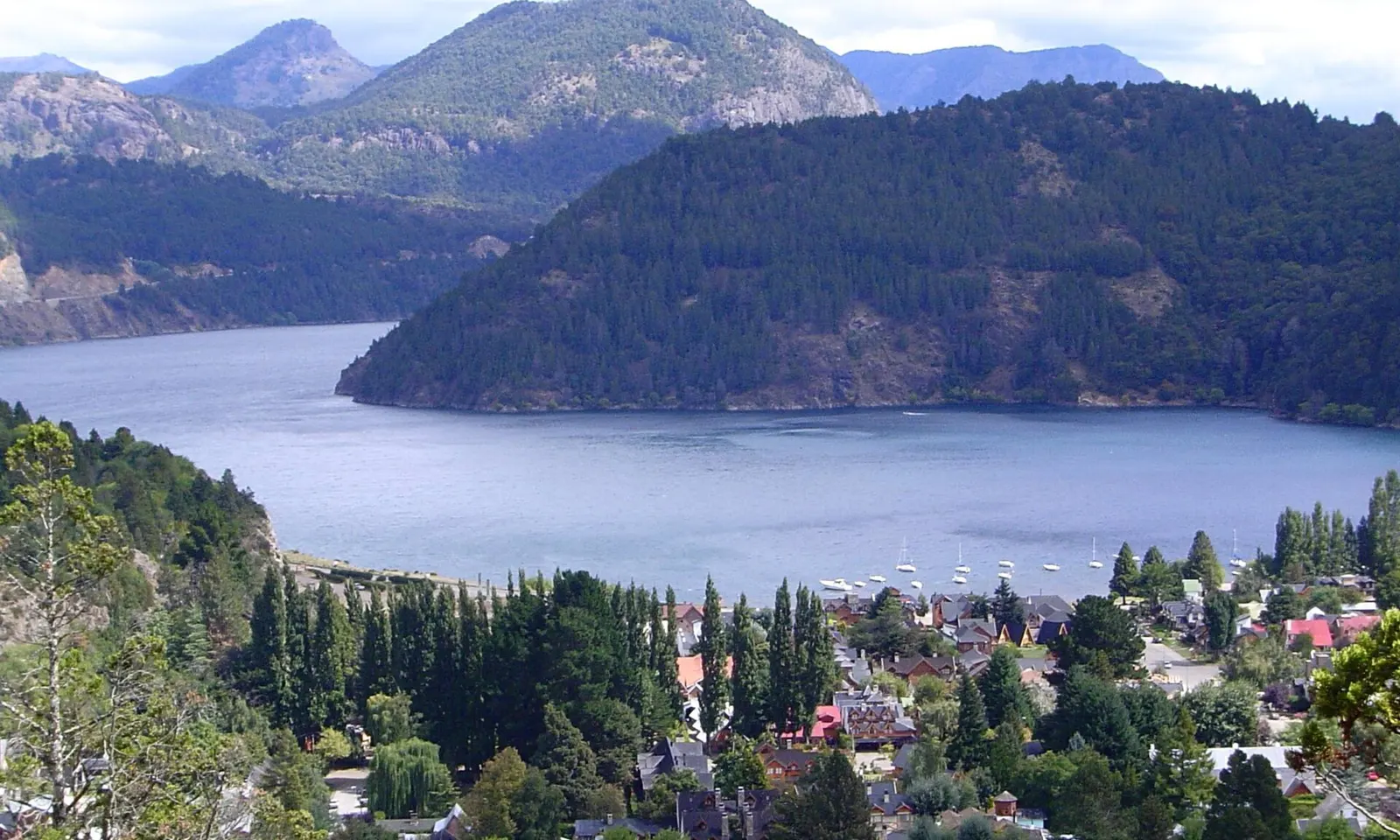
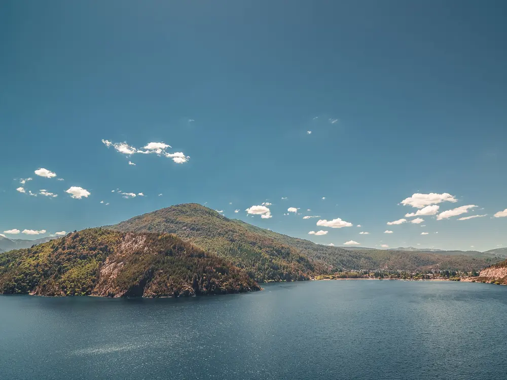
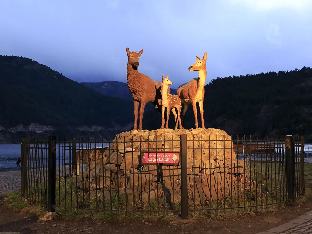
Lago Lácar and San Martín de los Andes below forested mountains

Photos: No machine-readable author provided. Albasmalko assumed (based on copyright claims). (Public domain), Falk2 (CC BY-SA 4.0), Emilio Küffer from Ciudad Autónoma de Buenos Aires, Argentina (CC BY-SA 2.0), Falk2 (CC BY-SA 4.0)

Distance
Races from 12 km to 100 miles
Big race
Patagonia Run, 7 to 11 April 2027
Biggest climb
9,221 m over 160.3 km
Average altitude
About 1,000 m

Why go

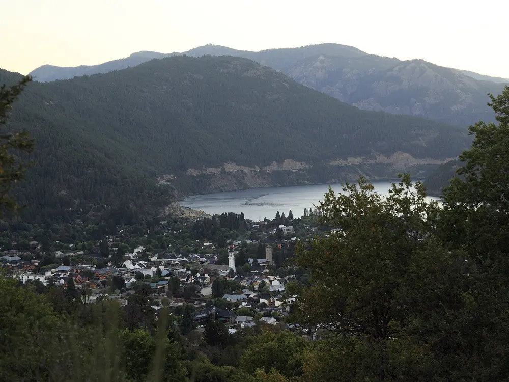
San Martín de los Andes sits at the head of Lago Lácar, a glacial lake protected by Lanín National Park, with forested hills on every side. Each April the town hosts Patagonia Run, which the Spartan Trail series, its organisers, call the largest and most prestigious trail and ultrarunning festival in Latin America. Outside race week the same hills give you lake viewpoints, beaches and long forest trails a few minutes from the centre.

The route

The race distances in 2027 are about 13 km with 693 m of climbing, 21.2 km with 1,234 m, 42 km with 2,403 m, 71 km with 4,128 m, 107.3 km with 5,730 m and 160.3 km with 9,221 m. The official site lists the short race as 12k. For a training run from town, the trail to the Mirador Bandurrias starts at the end of calle Juez del Valle on the lakeshore and climbs through cypress forest to a view of the town, the lake and Cerro Chapelco. About half an hour further on is La Islita, a small island a few metres offshore. Quila Quina, 18 km away by a winding gravel road or 30 minutes by boat from the town pier, has more lakeside trails.

When to go

Patagonia Run is an autumn race, with an average temperature of about 15°C. After the ski season ends in late September, Chapelco opens for guided trekking through lenga forest with views of Lago Lácar and the Lanín volcano. The town is snowy in winter.

Getting there

Chapelco airport is about 20 to 22 km from town, with a daily Aerolíneas Argentinas flight from Buenos Aires Aeroparque. San Martín is also the north end of the Ruta de los Siete Lagos, 110 km of Route 40 to Villa La Angostura, and less than two hours from the Mamuil Malal border crossing into Chile.

Permits and booking

Patagonia Run entries for 2027 are closed; the race site takes emails for any places that open, and the 100 miles has its own entry requirements. On the Bandurrias trail you pass a craft stall and a toll booth for crossing Mapuche community land. Continuing past Quila Quina you pay the Lanín National Park entry fee.

How hard it is

The race trails are described as soft and of low technical difficulty, suited to a wide range of runners; the challenge is the climbing. Rescues have happened on the Bandurrias path, and park staff advise taking the cliff-edge sections calmly.

Where to sleep

Stay in town near the lakeshore: the Bandurrias trail and the boat to Quila Quina both start there.

Tips

  • Start Bandurrias early with plenty of water.
  • Sign up for the Patagonia Run waiting list if you missed entries.
04 / 10

Torres del Paine and the Patagonian International Marathon

Magallanes, Chile

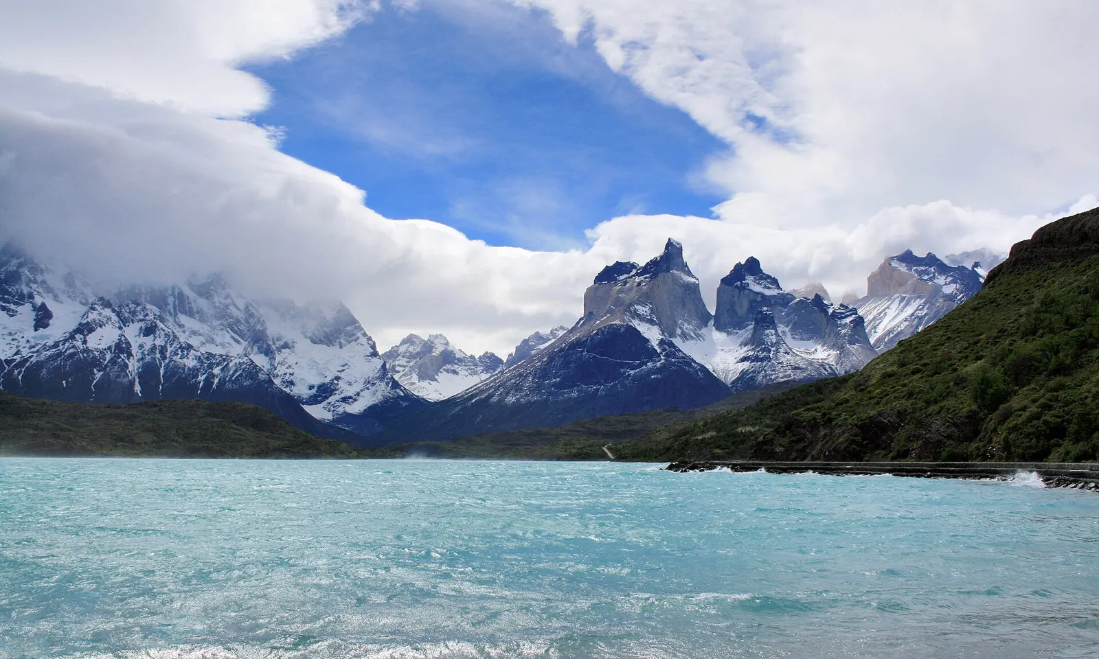
The Cuernos del Paine above the turquoise water of Lago Pehoé

Photos: Diego Delso (CC BY-SA 3.0), Diego Delso (CC BY-SA 3.0), Diego Delso (CC BY-SA 3.0), Diego Delso (CC BY-SA 3.0)

Distance
42 km, plus 30, 21, 15 and 10 km
Big race
4 and 5 September 2027
Park entry
CLP 25,000 a day for foreign adults
Base town
Puerto Natales

Why go

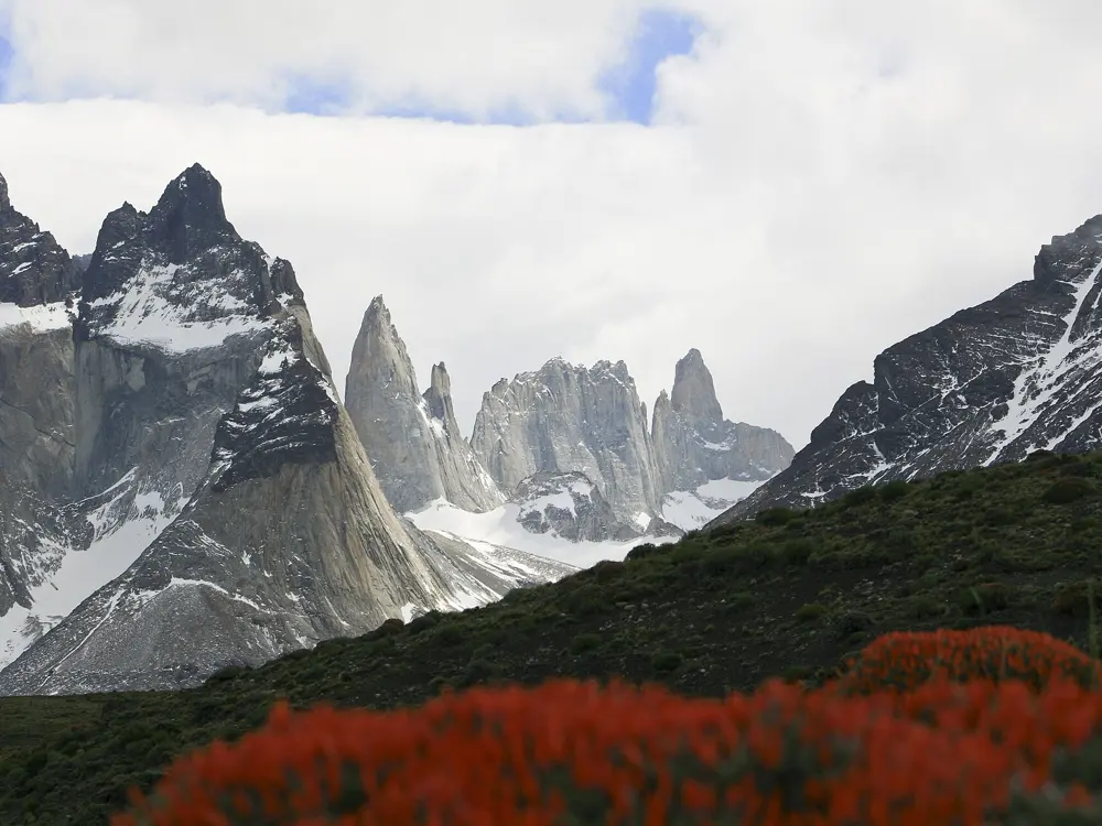
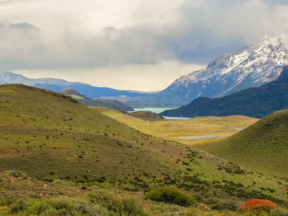
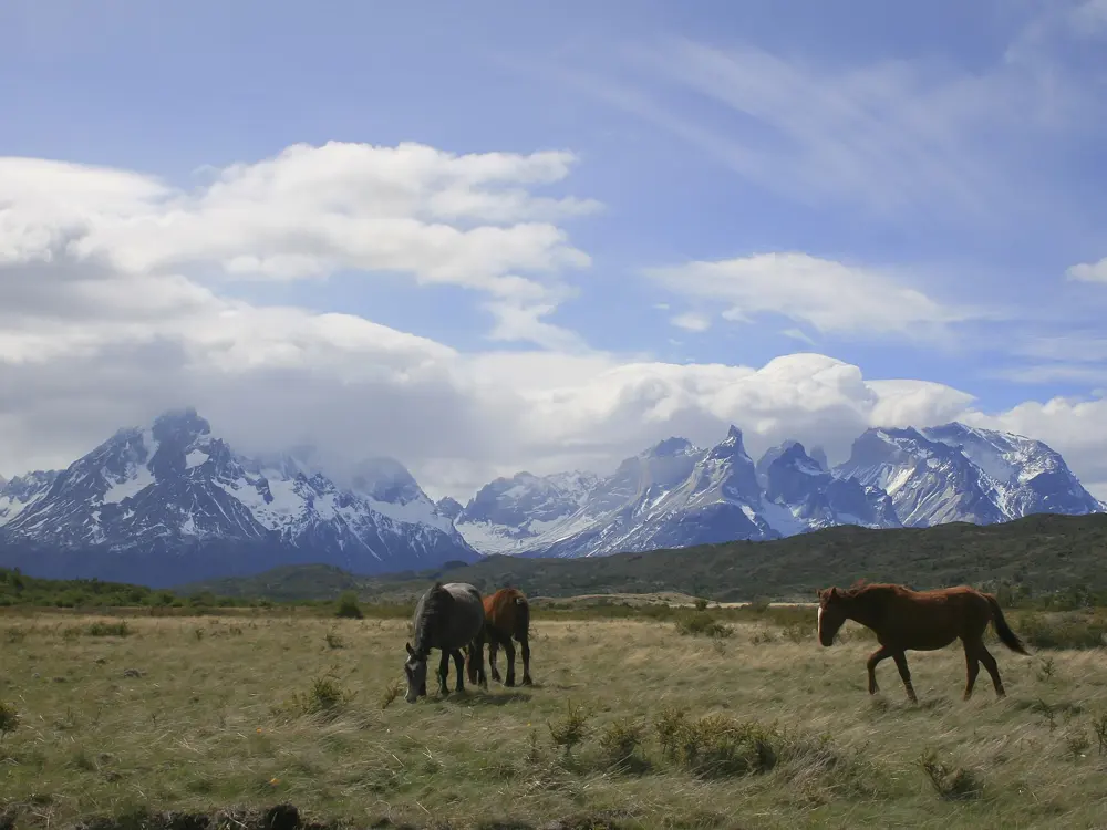
The Patagonian International Marathon has been run in and around Torres del Paine National Park every September since 2012, on gravel roads beneath the granite of the Paine massif. Chile's tourism board says it has drawn more than 7,000 runners from over 78 countries. The 15th edition in 2027 has five distances over two days, and the scenery of lakes, glaciers and the Cuernos del Paine is the reason people travel this far for it.

The route

The marathon, half and 10 km are on Saturday 4 September 2027, and the 30 km and 15 km on Sunday 5 September. The courses follow the park's unpaved roads; an early edition finished all races at Hotel Las Torres, and the 10 km began along the shore of Laguna Amarga. Race listings give 1,000 to 1,240 m of climbing for the marathon, and the organiser publishes a map and profile but no GPS track. Away from race day, the park's trails include the path to the lookout at the base of the towers, about 45 minutes beyond Campamento Torres.

When to go

The race is at the end of the southern winter. July averages a high of 5°C and a low of minus 3°C, and July to October are the drier months, but the weather can go through four seasons in a day. In 2026 CONAF started the winter season early, on 27 April, and during it anyone doing high-difficulty routes or winter activities must go with an authorised guide.

Getting there

International flights land in Santiago. Flights to Puerto Natales are seasonal; Punta Arenas has daily flights and is about 250 km away, a three-hour bus ride with frequent departures from 7 am to 9 pm. Official race buses take runners from Puerto Natales to the starts and back from the finish; buy the tickets when you register. Public buses to the park take about two hours, but run only once a day in April and September and not at all from May to August.
Permits and booking

Since 1 May 2026 park entry is sold online in advance through pasesparques.cl, CONAF's only official channel: CLP 25,000 for a day or CLP 50,000 for two or more days, up to ten, for foreign adults. You get a QR code by email to show at the gate, dates cannot be changed, and there are no refunds unless CONAF closes the park. All overnight stays in the park must be booked ahead.

How hard it is

The race roads are gravel and hilly, and the weather can be harsh, with wind, cold and changing conditions. The park's trails are rougher than the race roads.

Where to sleep

Puerto Natales is the race base and the closest city. Inside the park, refugios and campsites need a reservation, and rangers check them.

Tips

  • Book the race bus with your entry, since public buses are scarce in September.
  • Pack for wind, rain and snow on the same day.
05 / 10

Santiago: Cerro San Cristóbal and the Santiago Marathon

Santiago, Chile

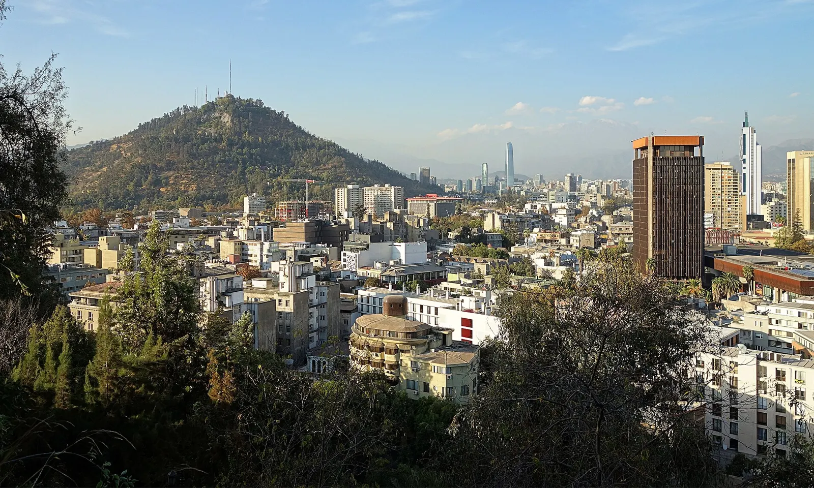
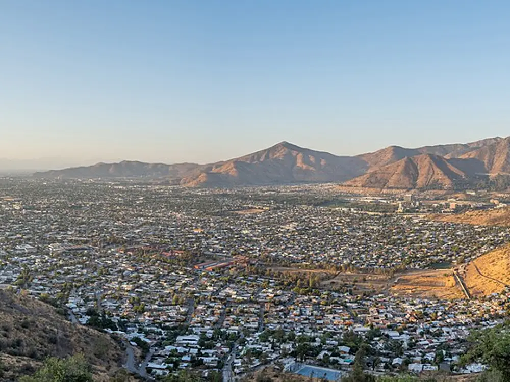
Cerro San Cristóbal rising above the apartment blocks of Santiago

Photos: Velvet (CC BY-SA 4.0), José Joaquín Cortes (CC BY-SA 4.0), Rjcastillo (CC BY-SA 4.0), Rjcastillo (CC BY-SA 4.0)

Distance
8 km loop, 160 m of climbing
Summit
880 m, about 300 m above the city
Big race
Santiago Marathon, 16 May 2027
Riverside loop
11.4 km, Mapocho parks

Why go

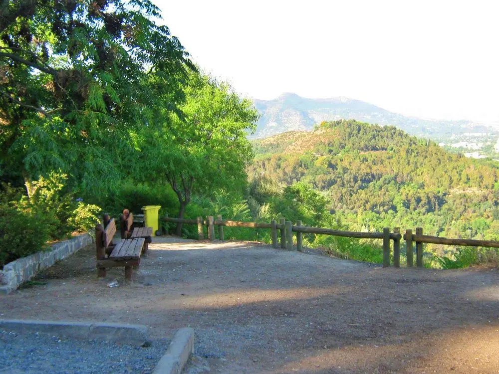
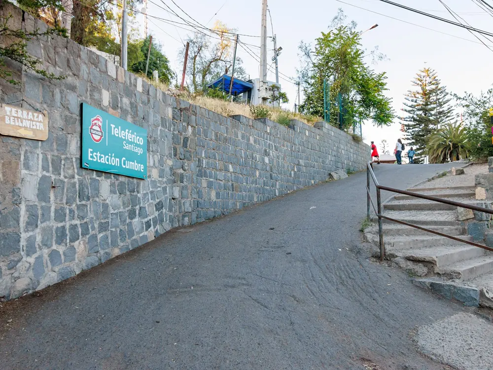
Cerro San Cristóbal rises out of the middle of Santiago, and its park, the Parque Metropolitano, is closed to private cars. That leaves miles of quiet road, trail and stairs for runners, with the Andes behind the city at the top. At the summit stand a sanctuary and a 22 m statue of the Virgin Mary. Each autumn the Santiago Marathon, the biggest annual sports event in Chile, fills the Alameda.

The route

Great Runs suggests a loop of about 8 km with 160 m of climbing: start on the El Cerro road past the Japanese Garden, climb Abate Molina to Camino Claudio Gay, and bear left by Plaza Antilen up to the Pablo Neruda amphitheatre and lookout. Three roads climb to the summit: from Pedro de Valdivia about 4.5 km, the quickest; from Pío Nono about 5.5 km, the steepest; and from La Pirámide about 7 km, the gentlest. For flat running, the greenway along the Mapocho through the Parque de los Reyes, Parque Forestal and Parque Balmaceda makes an 11.4 km loop.

When to go

The hill is open year round. The 2026 marathon was on 26 April, starting and finishing by the La Moneda palace with the Alameda as its main road; the 42 km started at 7:40 am. The 2027 race is on Sunday 16 May, with 10 km, 21 km and 42 km.

Getting there

The Pío Nono entrance at Pío Nono 450 in Recoleta is about 20 minutes' walk from Baquedano station on Metro Line 1. Pedro de Valdivia station, also Line 1, serves the Pedro de Valdivia Norte entrance, the Japanese Garden and the cable car; Escuela Militar serves La Pirámide, and Zapadores on Line 2 the Zapadores entrance. A new cable car from Pío Nono, about 1 km long, began trial runs in March 2026 and runs Tuesday to Sunday, 10 am to 7:45 pm.

Permits and booking

The park is free to enter on foot. A 2022 notice gave pedestrian hours of 6 am to 8 pm, with bikes allowed until noon at weekends; on one day in September 2024 cyclists and walkers shared the roads from 6 am to 1:30 pm and the afternoon was for walkers only, so check the park's current hours. Marathon general entries opened on 15 October 2026, with 11,000 places in the 42 km and a fee of CLP 135,462 for foreign non-residents.

How hard it is

The roads climb steadily and the Pío Nono side is steep. The Mapocho greenway is flat.

Where to sleep

Providencia, near Pedro de Valdivia station, puts you a short jog from the hill and on Line 1 for the marathon start.

Tips

  • Ride the cable car down if you only want to run the climb.
  • Check the park's current opening hours before an early or late run.
06 / 10

Lima: the Malecón and the Lima 42K

Miraflores and Barranco, Lima, Peru

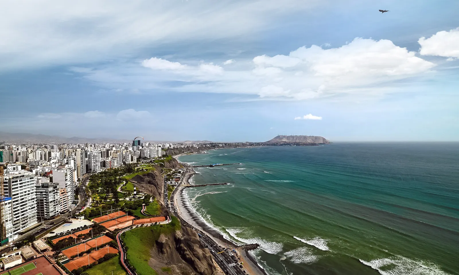
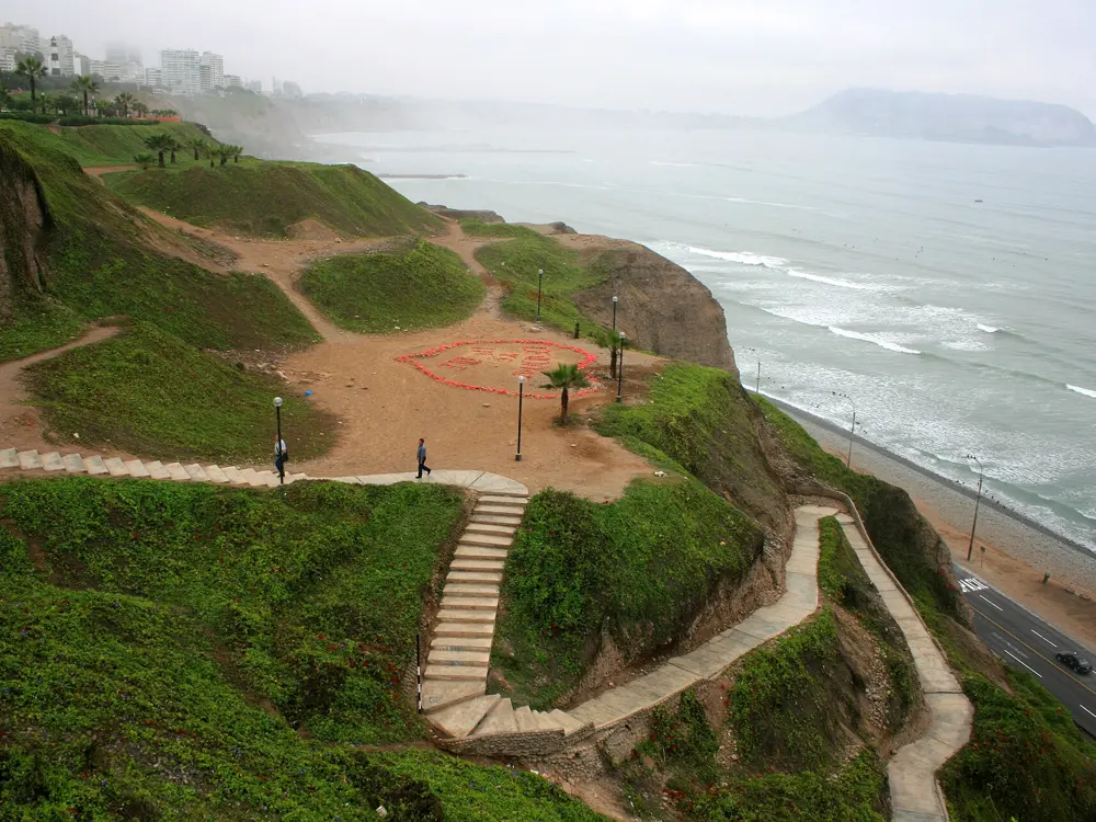
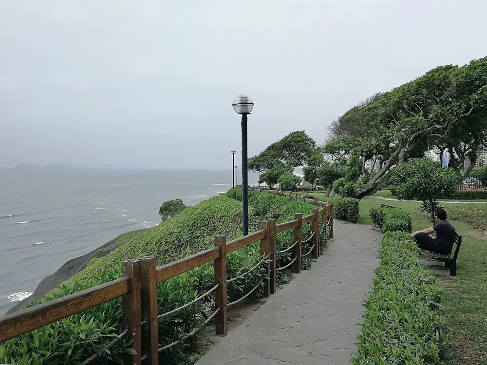
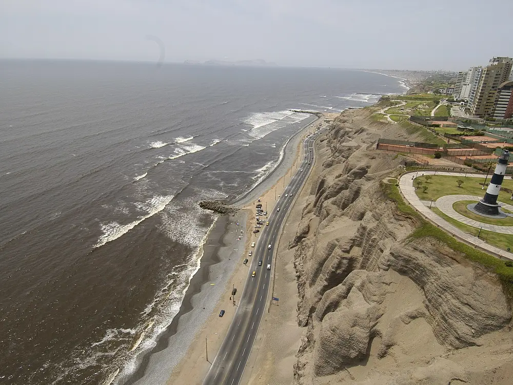
The green clifftop parks of the Malecón de Miraflores above the Pacific and the Costa Verde road

Photos: Alec Gamoff (CC BY 2.0), Indisdepe (CC BY-SA 3.0), Diegovaxz (CC BY-SA 4.0), Municipalidad de Miraflores (CC BY 2.0)

Distance
About 5 km, Malecón de la Marina to Barranco
Longer run
About 8.9 km one way to La Herradura
Big race
Lima 42K, late May
Marathon climb
About 220 m

Why go

Miraflores sits on cliffs above the Pacific, and along their edge runs the Malecón, a chain of clifftop parks joined by a wide concrete walkway with the ocean to one side the whole way. Runners, cyclists and dog walkers share it from early morning, and the city's marathon, the Lima 42K, starts on Avenida Larco in Miraflores. It holds a World Athletics Elite Label and an AIMS-certified course.

The route

A walking guide's kilometre count makes a handy run: from 0.0 at the Malecón de la Marina park, where the cycle path starts, it is 2.5 km to the Parque Raimondi by the Marina lighthouse and the Parque del Amor on the Malecón Cisneros, 4.2 km to the Parque Domodossola on the Malecón de la Reserva, and 5 km to the Puente de la Paz into Barranco. Great Runs says you can carry on south to the La Herradura viewpoint, about 8.9 km one way. A dirt path follows the cliffs alongside, and below them walkways run north along the Costa Verde by Avenida Costanera. For a hard hill, the Morro Solar in Chorrillos is a short, steep climb.

When to go

From about June to September or later the coast lies under the garúa, a fine grey mist, with days around 15 to 19°C. Summer, December to April, is sunnier and warmer, with days up to about 30°C. The Lima 42K is usually in late May; the 2026 race was on 24 May, and race listings give 23 May 2027.

Getting there

The Airport Express bus runs hourly from the airport to Miraflores between 7 am and midnight, with stops at Larcomar and Parque Kennedy. The Metropolitano bus does not reach the airport.

Permits and booking

The Malecón is free and open to all. Lima 42K entries are online only, through lima42k.com.pe, are personal and non-transferable, and filled in January in 2026, well before the deadline. The marathon has a six-hour limit, and bibs are collected at the expo beforehand, never on race day.

How hard it is

The Malecón is flat and paved. The marathon makes two loops north of Miraflores, with two long climbs and a stretch through tunnels, about 220 m of climbing in all.

Where to sleep

Miraflores puts you on the Malecón and near the marathon start on Avenida Larco; Barranco is quieter, at the southern end.

Tips

  • Run from the Malecón de la Marina to the Puente de la Paz and back for an easy 10 km.
  • Watch for the Lima 42K presale: for the 2026 race it opened in September 2025.
07 / 10

Quito: the Parque Metropolitano, Rucu Pichincha and the Quito 15K

Quito, Ecuador

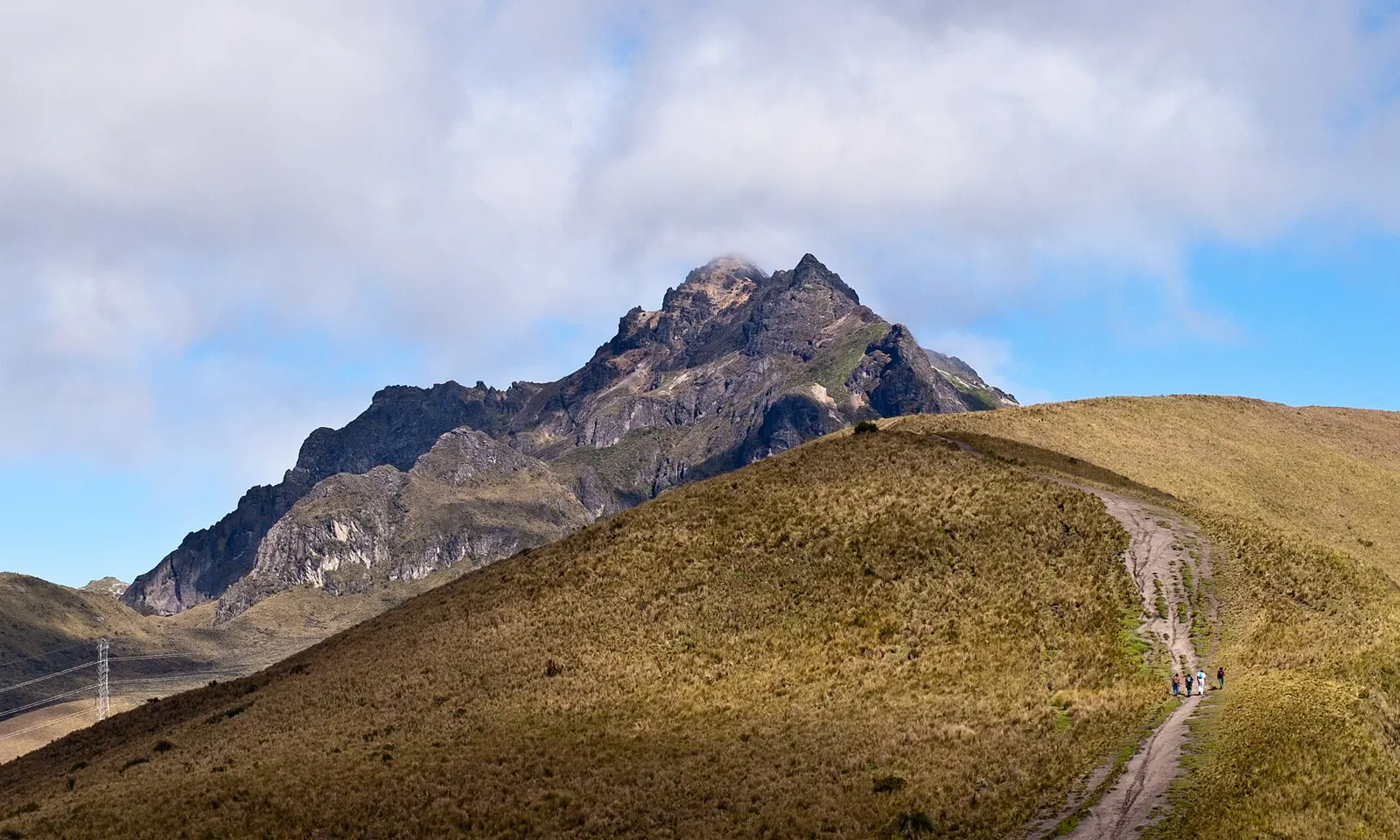
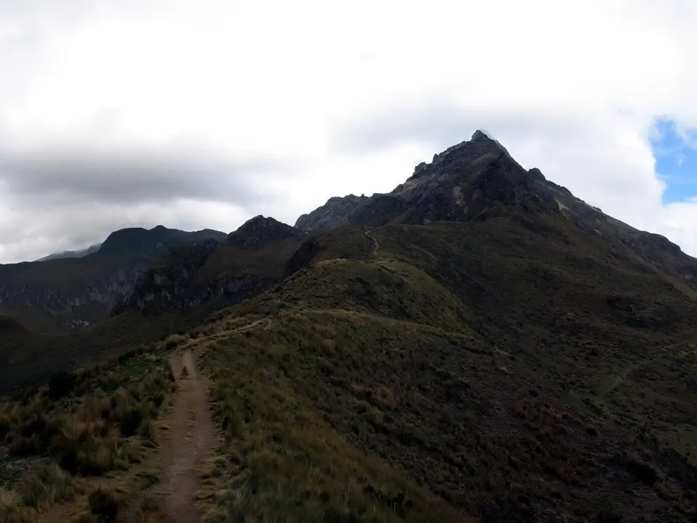
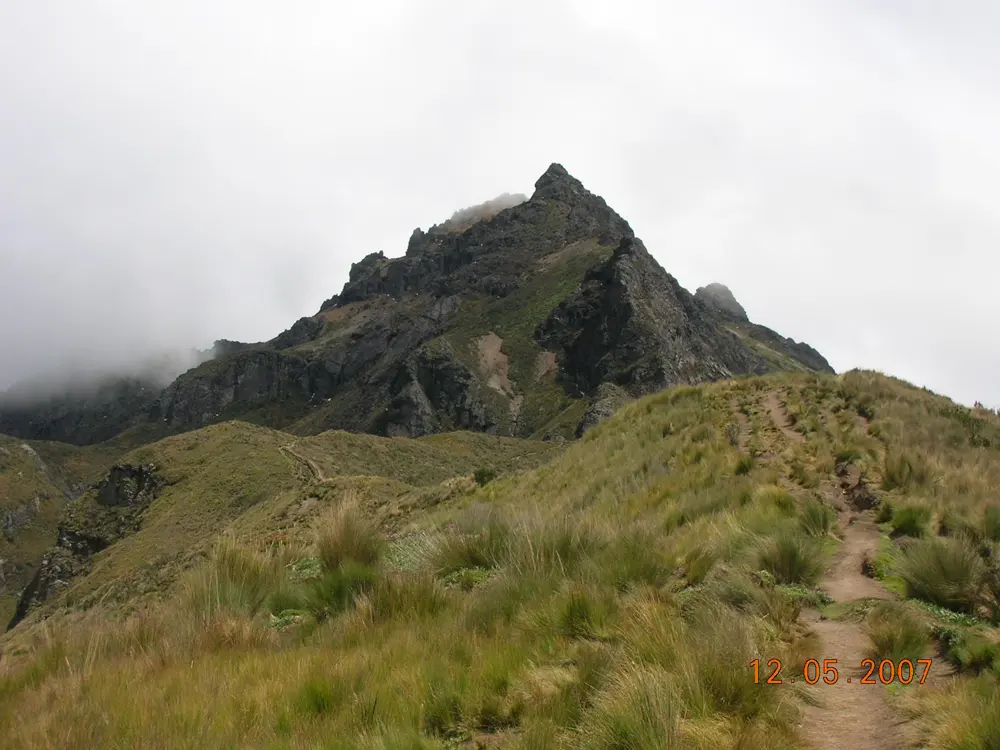
The rocky summit of Rucu Pichincha above a grassy ridge path near Quito

Photos: Timwryan (CC BY-SA 3.0), Annom (Public domain), Friedrich Kircher (CC BY 3.0), Photography, Scan and postprocessing by Hubertl (CC BY-SA 4.0)

Distance
8 km loop, Parque Metropolitano
Race altitude
About 2,850 m
Rucu Pichincha
About 4,700 m summit
Big race
Quito 15K and half marathon, late May

Why go

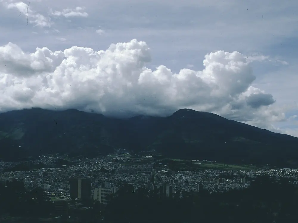
Quito lies in an Andean valley under the Pichincha volcano, so every run here is an altitude session. The city's big race, the Quito 15K, reached its 63rd edition in 2026 and added a half marathon at 2,850 m that the organisers bill as the highest in the world. Above the city, a cable car lifts you to nearly 4,000 m and the start of a ridge path to the summit of Rucu Pichincha.

The route

The most popular run is the Parque Metropolitano Guangüiltagua, where a stone and gravel road makes an 8 km loop with many side paths, and runners meet hummingbirds and a herd of llamas. It joins Parque La Carolina, which has a measured track and paved paths. Great Runs also lists the climb to El Panecillo, 4.8 km out and back, the Chaquiñán, a hilly 20 km dirt trail outside the centre, and the Parque Metropolitano del Sur, with a 12 km out-and-back path. On Pichincha, the TelefériQo climbs from 3,117 m to Cruz Loma at 3,947 m, and from there a ridge path leads to Rucu Pichincha, a round trip of about five hours.

When to go

Mornings are best on Pichincha, since clouds usually build by noon, and storms in the rainy season often stop the cable car. The 2026 Quito 15K and half marathon were on Sunday 31 May, with the half starting at 6:45 am and the 15K from 7:30 am.

Getting there

The 15K starts at El Tablón in the south of the city and finishes at the Estadio Olímpico Atahualpa. The Parque Metropolitano is reached from Calle Guangüiltagua.

Permits and booking

The parks are free. The TelefériQo costs 9 dollars for adults. In 2026 the city ran a free running school in La Carolina, meeting at the Cruz del Papa on Monday and Wednesday from 5:30 to 7:30 pm and on Saturday from 7 to 9 am. About 24,000 runners were expected across the 15K, the half and a children's 5K in 2026.

How hard it is

Altitude is the real test: spend a couple of days in Quito before racing or climbing. Rucu Pichincha is a demanding mountain walk with easy scrambling near the top. On 5 April 2026 a storm stopped the cable car and left at least 100 visitors stranded at Cruz Loma for hours, and the old approach on foot from the city has had a reputation for crime.

Where to sleep

Stay in the north, near La Carolina and the Parque Metropolitano, for daily runs.

Tips

  • Take the first cable car up and carry warm, waterproof layers.
  • Ask about current conditions before climbing Rucu Pichincha.
08 / 10

Bogotá: Simón Bolívar, Monserrate and the Ciclovía

Bogotá, Colombia

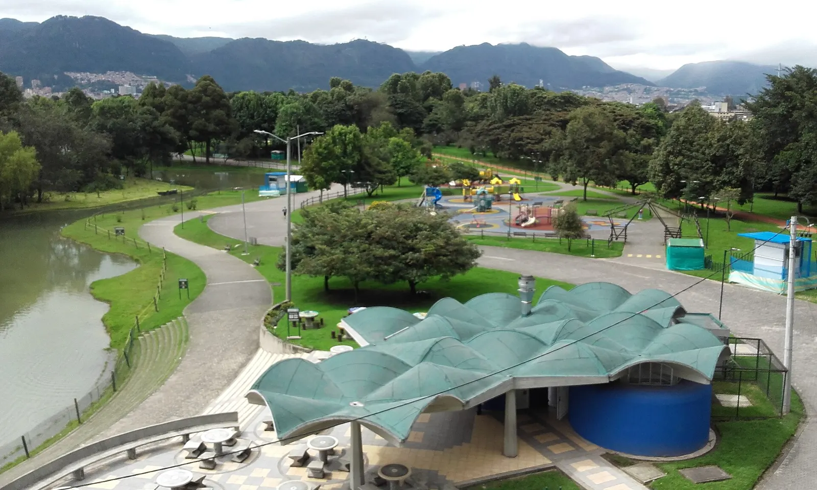
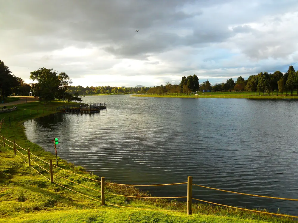
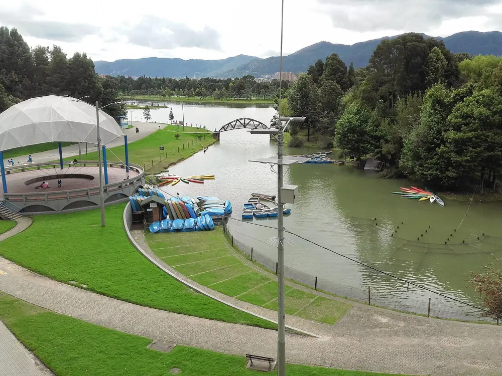
Paths and a café pavilion beside the lake in Parque Simón Bolívar, with Bogotá's eastern hills behind

Photos: EEIM (CC BY-SA 4.0), Felipe Restrepo Acosta (CC BY-SA 3.0), Felipe Restrepo Acosta (CC BY-SA 3.0), EEIM (CC BY-SA 4.0)

Distance
3,160 m jogging track, Parque Simón Bolívar
Monserrate
1,605 steps to 3,152 m
Ciclovía
141.46 km, Sundays and holidays, 7am to 2pm
Big race
Media Maratón de Bogotá, late July

Why go

Bogotá sits at about 2,600 m, and its half marathon draws some 40,000 runners; its organisers say it has held World Athletics' top labels since 2009. Every Sunday and holiday the Ciclovía closes 141.46 km of the city's streets to cars, and runners share them with cyclists. For a hard climb, the stone path up Monserrate rises from the old town to a 17th-century church at 3,152 m.

The route

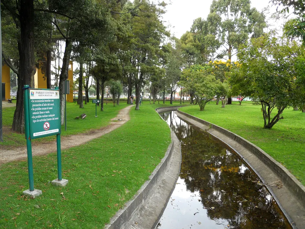
The Parque Metropolitano Simón Bolívar has a 3,160 m jogging track, a 4 km circuit round the outside used by runners and cyclists, and a lake of about 10 hectares; the half marathon starts and finishes here. The Monserrate path, more than 2,350 m long with 1,605 steps, starts at Carrera 2 Este 21-48 on the Paseo Bolívar. The Ciclovía follows corridors such as Carrera Séptima, Calle 26, Avenida Boyacá, Carrera 50 and Carrera 9.

When to go

All year. The 2026 half marathon was on Sunday 26 July, with 21 km from 8:30 am and 10 km from 10 am, starting in staggered waves; the 21 km went out along Calle 63, Carrera Séptima, Calle 92 and Avenida NQS.

Getting there

Most visitors fly into El Dorado airport. Simón Bolívar lies between Calle 53 and Calle 64 in Teusaquillo, with the jogging track reached from Calle 53 and the gates on Avenida 68.

Permits and booking

Everything is free. Simón Bolívar opens every day from 6 am to 6 pm. The Monserrate path is open from 5 am to 1 pm and closed on Tuesdays for maintenance; the city recommends it for over 14s only and advises against it for people with heart, blood pressure or breathing conditions. There are no toilets on the path.

How hard it is

The parks and the Ciclovía are flat, but the altitude slows everyone from sea level. Monserrate is a long staircase climb: El Tiempo, citing Colombia Corre, puts it at 30 to 40 minutes for the fit and up to 55 minutes for others.

Where to sleep

Teusaquillo and Chapinero are close to Simón Bolívar; La Candelaria, the old town, is at the foot of Monserrate.

Tips

  • Keep right on Monserrate, going up and coming down.
  • Join the Ciclovía early, before the streets fill up.
09 / 10

São Paulo: Ibirapuera and the São Silvestre

São Paulo, Brazil

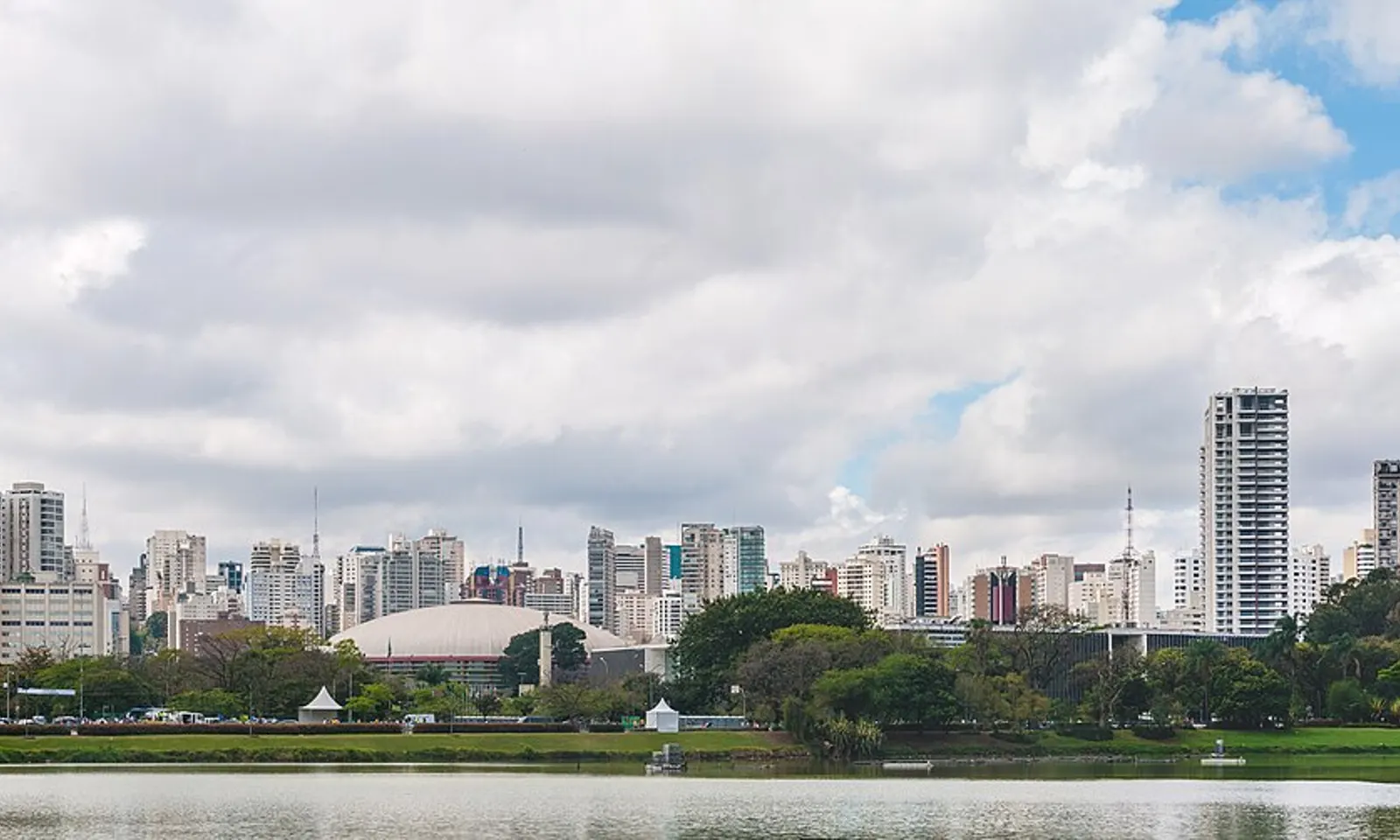
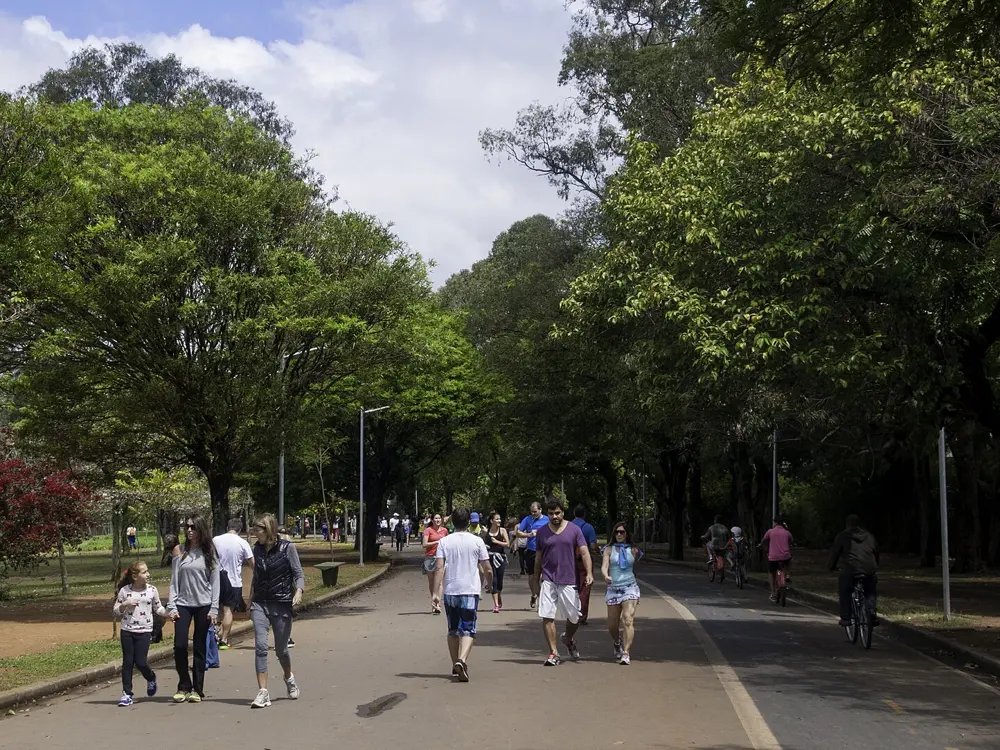
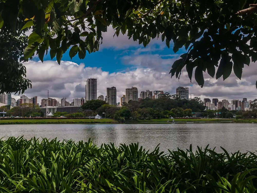
Ibirapuera Park's lake and trees with the São Paulo skyline behind

Photos: Wilfredor (CC0), Wilfredor (CC0), Wilfredor (CC0), Wilfredor (CC0)

Distance
About 3 km lake loop, 6 km round the fence
Park hours
5am to midnight, all night Saturday
Big race
São Silvestre, 15 km, 31 December
Avenida Paulista
Car free Sundays and holidays, 9am to 4pm

Why go

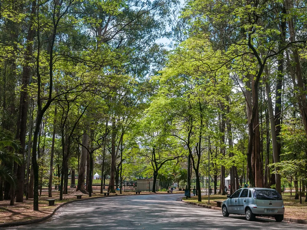
Parque Ibirapuera is the green heart of São Paulo, and its gates open to runners at 5 am. The city's great race, the São Silvestre, created in 1925, is run every New Year's Eve over 15 km from Avenida Paulista. Its 100th edition in 2025 expected about 55,000 runners, including some 4,600 from 39 other countries.

The route

At Ibirapuera the main run is the lake loop, about 3 km of almost flat asphalt; for more, follow the fence round the whole park for about 6 km. Parque Villa-Lobos has three colour-coded tracks of 700 m, 1,400 m and 2,100 m. The University of São Paulo campus is where runners gather on Saturdays for long marathon training, with long climbs. Horto Florestal has dirt tracks of 4.1 km and 5.5 km with steeper hills. The São Silvestre starts on Avenida Paulista, drops to Pacaembu and the old centre and comes back up the hard climb of Avenida Brigadeiro Luís Antônio to finish outside the Cásper Líbero building at Paulista 900.

When to go

The 101st São Silvestre is on 31 December 2026. In 2025 the general field started at 8:10 am in waves by declared pace, the start closed after 9 am and the time limit was 2 hours 30 minutes.

Getting there

Ibirapuera's gates 2, 3 and 10 are on Avenida Pedro Álvares Cabral. Villa-Lobos is at Avenida Professor Fonseca Rodrigues 2001, and the USP running area at Avenida Afrânio Peixoto and Rua Alvarenga.

Permits and booking

The parks are free. Ibirapuera opens daily from 5 am to midnight and all night from Saturday to Sunday; Villa-Lobos from 5:30 am to 7 pm; USP on weekdays from 5 am to 8 pm and on Saturdays until 2 pm; Horto Florestal from 6 am to 6 pm. Under the city's Ruas Abertas programme Avenida Paulista is open only to people on foot on Sundays and holidays from 9 am to 4 pm, though it is suspended for big events. São Silvestre entries are sold online through Ticket Sports.

How hard it is

Ibirapuera and Villa-Lobos are flat and easy. The São Silvestre's Brigadeiro climb, late in the race, is its hardest point.

Where to sleep

Stay near Avenida Paulista for the São Silvestre start and the Sunday car-free street, or in Vila Mariana or Moema for Ibirapuera.

Tips

  • Arrive at the São Silvestre start at least 45 minutes early.
  • Run Ibirapuera's lake loop early, before the paths get crowded.
10 / 10

Montevideo: the Rambla

Montevideo, Uruguay

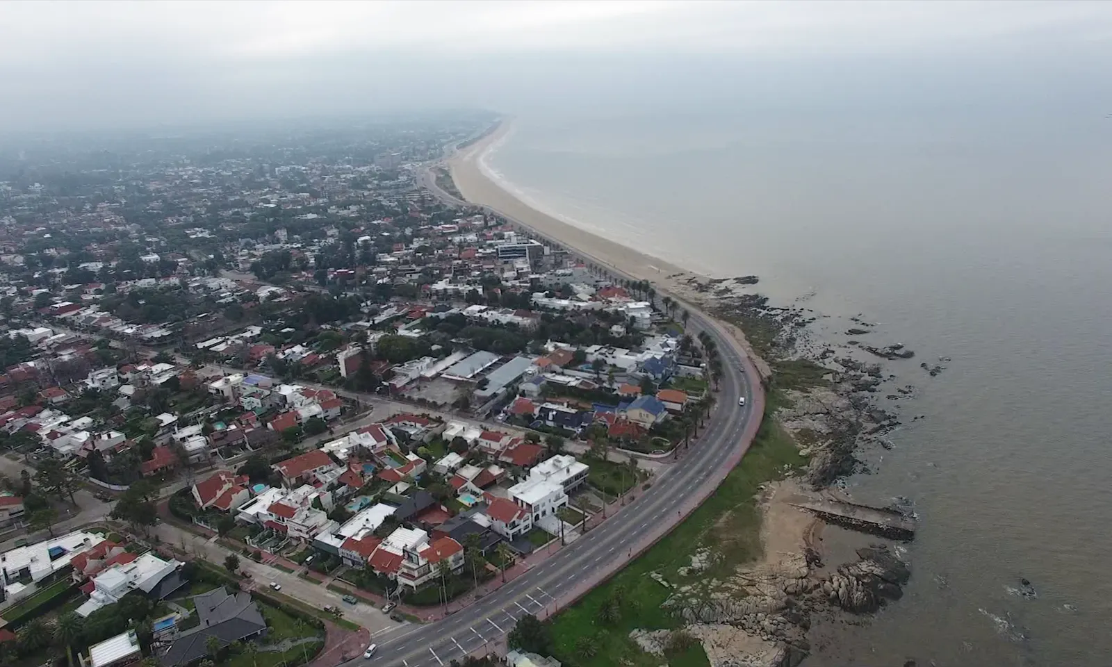
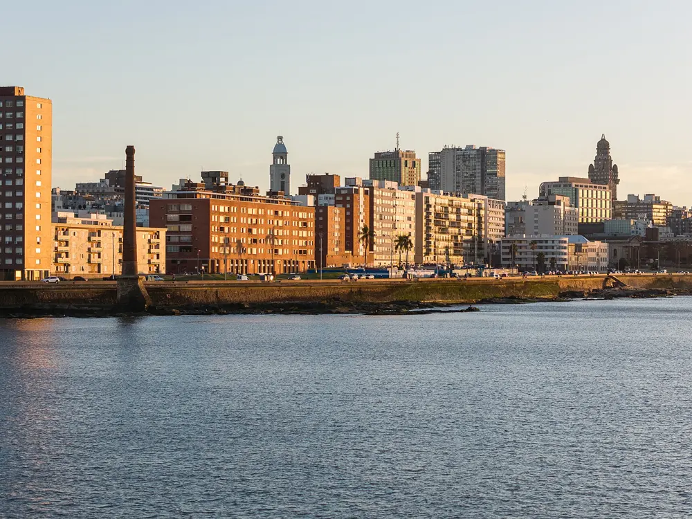
The Rambla curving along the coast past the houses of Montevideo, seen from the air

Photos: Fedaro (CC BY-SA 4.0), Falk2 (CC BY-SA 3.0 de), Fedaro (CC BY-SA 4.0), Sala de Medios - Intendencia de Montevideo (CC BY-SA 4.0)

Distance
Up to about 25 km, Ciudad Vieja to Carrasco
Markers
Every 500 m
Big race
Maratón de Montevideo, May
Warmest month
January, about 18 to 27°C

Why go

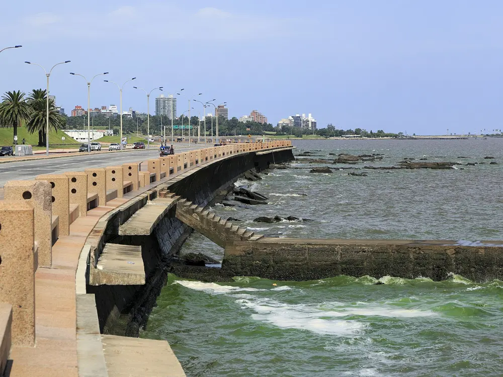
The Rambla follows Montevideo's whole shore on the Río de la Plata, from Capurro in the west to Carrasco on the city's eastern edge. The city calls it about 30 km long and its favourite promenade. For runners it is a flat, wide path with water views for hours. Its first stretch, the Rambla Sur, was designed in 1928 and opened in 1935. The city's own marathon, run on it each May, grew to 8,000 entrants in 2026, about 2,000 of them from abroad.

The route

Great Runs measures up to 25 km from the Ciudad Vieja to the Parque Roosevelt in Carrasco, with markers every 500 m. The most popular stretch runs from the old town to Pocitos. Add the 1 km spur to the Punta Carretas lighthouse, or turn inland from Playa Ramírez into the Parque Rodó. Pocitos beach gives about 1.5 km of sand, and Playa Buceo to Playa Honda more than 2 km. Toward the east, some sections are separate paths away from the road, and orange outdoor gyms dot the way. The 2026 marathon started and finished on Avenida 18 de Julio by the city hall, went out along the Rambla to a turn at Rimac and came back along it to the centre.

When to go

January is the warmest month, about 18 to 27°C, and November to early April is the warm season. July is the coldest, with lows of about 7°C. The city is windy almost all year, and winters are cold, wet and windy. The 2026 marathon was on Sunday 10 May, the 11th edition, with 10 km, 21 km and 42 km races; race listings give 9 May 2027.

Getting there

Start anywhere: a bus runs along much of the Rambla. Pocitos, Punta Carretas and the Ciudad Vieja all lie on it.

Permits and booking

The Rambla is free and open to all. The marathon is organised by the Intendencia de Montevideo, which closes the course to traffic from midnight on race day.

How hard it is

It is flat and paved, so the only hard part is the wind off the river, which can make one direction much slower than the other.

Where to sleep

Pocitos and Punta Carretas put you on the most popular stretch; the Ciudad Vieja is close to the marathon start.

Tips

  • Run into the wind first so it helps you home.
  • Use the 500 m markers for intervals.

Sources

Distances, heights, seasons and permit rules were checked against these pages. Rules change, so check the park or trail authority before you go.