Rungs Labs

Rungs Pilgrimage · Hikes · Japan

The 10 Best Hikes in Japan

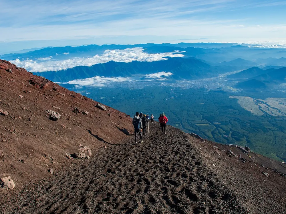
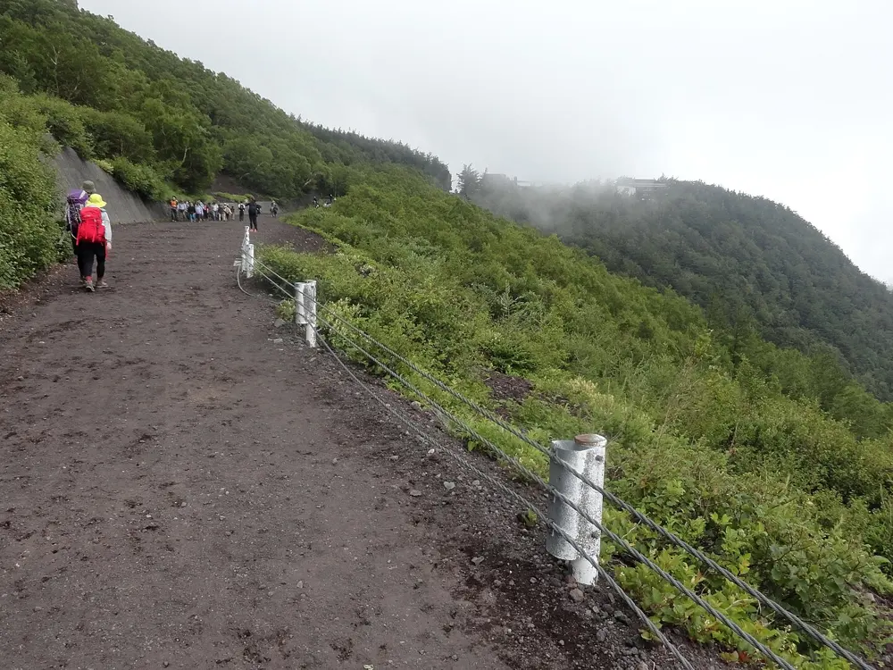
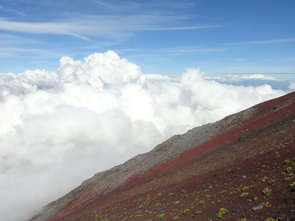
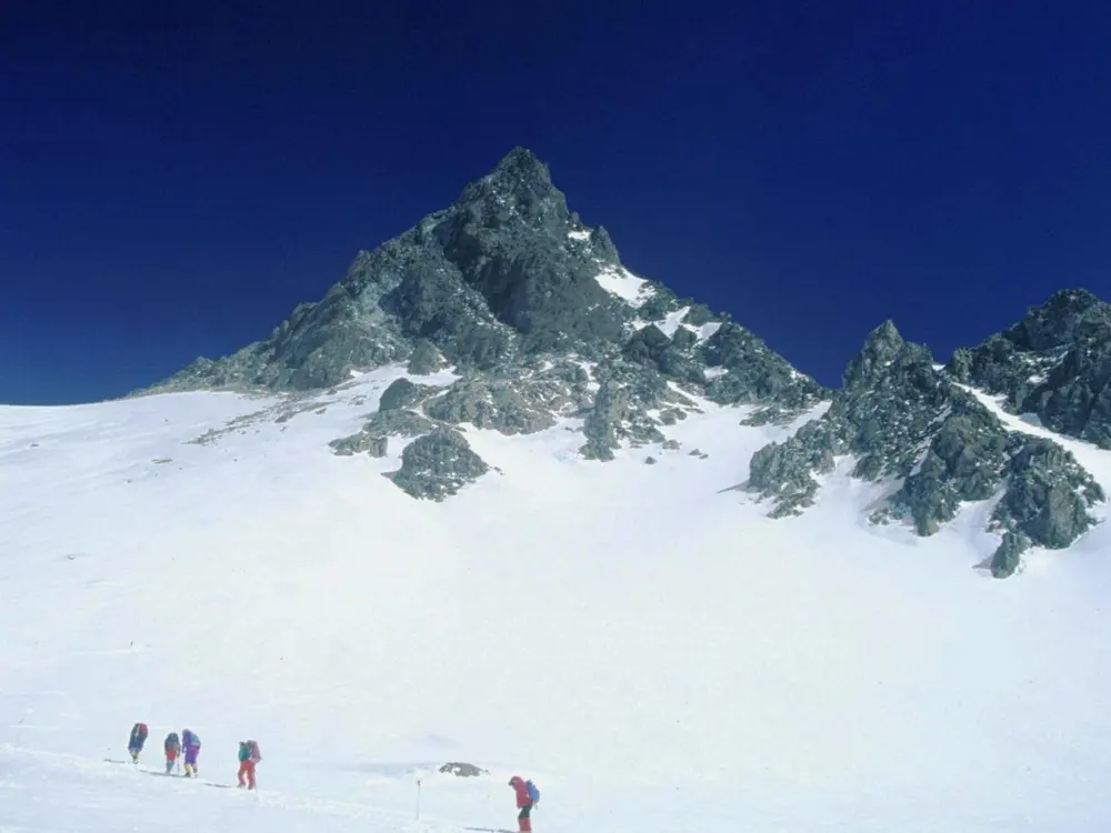
Mount Fuji by the Yoshida Trail, Yamanashi Prefecture. Photo: Midori (CC BY 3.0)

Japan is mostly mountains, and walking them is old here: pilgrims, mountain ascetics and travellers on the Edo highways were on these paths long before anyone hiked for fun. These ten run from the volcanoes of Daisetsuzan in Hokkaido, through the sacred mountains of Dewa Sanzan, the Oze marsh, Mount Takao on the edge of Tokyo, Mount Fuji and Yarigatake in the Alps, the old Nakasendo road and the Kumano Kodo, to the Shikoku pilgrimage and the cedar forest of Yakushima.

For each one you get the distance, the route, the best season, how to get there, the fees and rules, how hard it is and where to sleep. Every fact comes from prefectures, national parks, Japan's tourism board, regional tourism bodies or the other pages linked at the bottom.

Updated 2026-10-19

  1. 01Mount Fuji by the Yoshida TrailYamanashi Prefecture
  2. 02Yarigatake from KamikochiNorthern Alps, Nagano Prefecture
  3. 03The Kumano Kodo (Nakahechi)Kii Peninsula, Wakayama
  4. 04Jomon Sugi on YakushimaYakushima, Kagoshima Prefecture
  5. 05The Nakasendo from Magome to TsumagoKiso Valley, Gifu and Nagano Prefectures
  6. 06The Asahidake to Kurodake traverseDaisetsuzan National Park, Hokkaido
  7. 07Dewa Sanzan: Haguro and GassanTsuruoka, Yamagata Prefecture
  8. 08The Shikoku 88 Temple PilgrimageShikoku: Tokushima, Kochi, Ehime and Kagawa
  9. 09Ozegahara and OzenumaOze National Park, Gunma and Fukushima Prefectures
  10. 10Mount Takao and the ridge to Mount JinbaHachioji, Tokyo
01 / 10

Mount Fuji by the Yoshida Trail

Yamanashi Prefecture
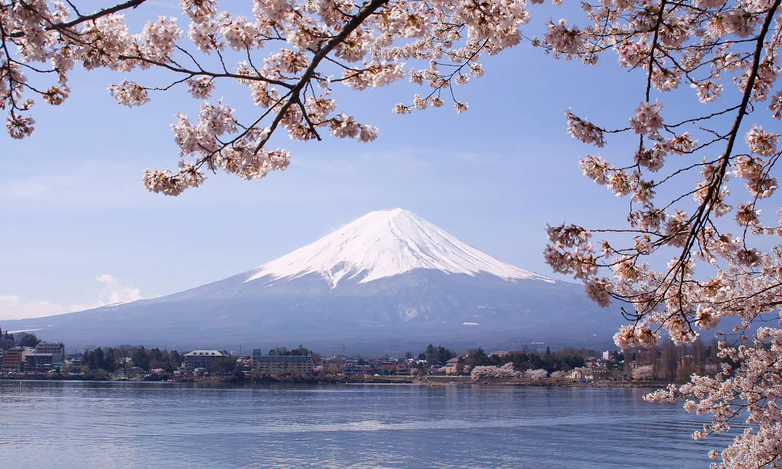
Snow-capped Mount Fuji above Lake Kawaguchiko, framed by cherry blossom

Photos: Midori (CC BY 3.0), Photos of Japan (CC0), Fabio Achilli from Milano, Italy (CC BY 2.0), Fabio Achilli from Milano, Italy (CC BY 2.0)

Distance
6.8 km up from the 5th Station
Summit
3,776 m
Time
5 to 7 hours up, 3 to 5 down
Season
1 July to 10 September (2026)

Why go

Fuji is the mountain everyone in Japan can draw, and climbing it is a summer ritual: thousands start in the dark to stand on the rim of the crater as the sun comes up over the clouds. The Yoshida Trail on the Yamanashi side is the most used of the four routes, with more huts and first aid posts than any other, which makes it the natural choice for a first ascent.

The route

The old Yoshida Trail starts at Fujiyoshida Sengen Shrine at the foot of the mountain, but almost everyone begins at the Fuji Subaru Line 5th Station, at about 2,300 m. From there the trail climbs 6.8 km over volcanic gravel and rock through the 6th, 7th and 8th stations, with huts every hour or so, to the summit at 3,776 m. Above the 8th Station the path is the most crowded part of the climb, especially in the hours before sunrise. The crater walk at the top takes about an hour. The way down uses a separate track; the Yoshida and Subashiri descents split near the 8th Station, so follow the yellow Yoshida signs.

When to go

The Yoshida Trail is open from 1 July to 10 September in 2026, and the opening can slip if snow lingers. It is busiest during the school holidays, roughly 20 July to the end of August, at Obon in mid-August and at weekends. A weekday in the first half of July is the quietest time to go.

Getting there

Buses run from Fujisan Station and Kawaguchiko Station to the 5th Station in about 50 minutes, hourly in the climbing season. Direct buses from Shinjuku in Tokyo take about 150 minutes, with four to six round trips a day in season.

Permits and booking

Yamanashi charges a hiking fee of 4,000 yen per climber, paid in advance online when you reserve passage. The gate at the 5th Station closes once 4,000 climbers have passed in a day, and it is shut from 14:00 to 03:00 to anyone without a mountain hut booking. You are asked to bring cold weather clothing, separate rain gear and proper climbing shoes.

How hard it is

The trail is not technical, but the altitude, the cold at the summit and the loose volcanic ground make it harder than the distance suggests. Most people need at least six hours to climb from the 5th Station. Helmets can be rented at the 6th Station guidance center.

Where to sleep

More than a dozen mountain huts stand between the 7th and 8th stations, among them Kamaiwakan at 2,790 m and Taishikan at 3,100 m. A night with two meals costs about 13,000 to 15,000 yen, and huts should be booked well ahead. A hut booking also lets you pass the gate after 14:00 and climb in the small hours for the sunrise.

Tips

  • Climb slowly from the 5th Station and rest at the huts to give your body time to adjust to the altitude.
  • The toilets on the trail are at the huts and charge a fee.
  • If you will not reach the top by dawn, the trail itself has good views of the sunrise.
02 / 10

Yarigatake from Kamikochi

Northern Alps, Nagano Prefecture

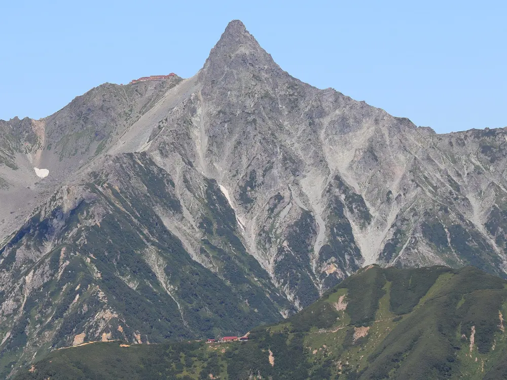
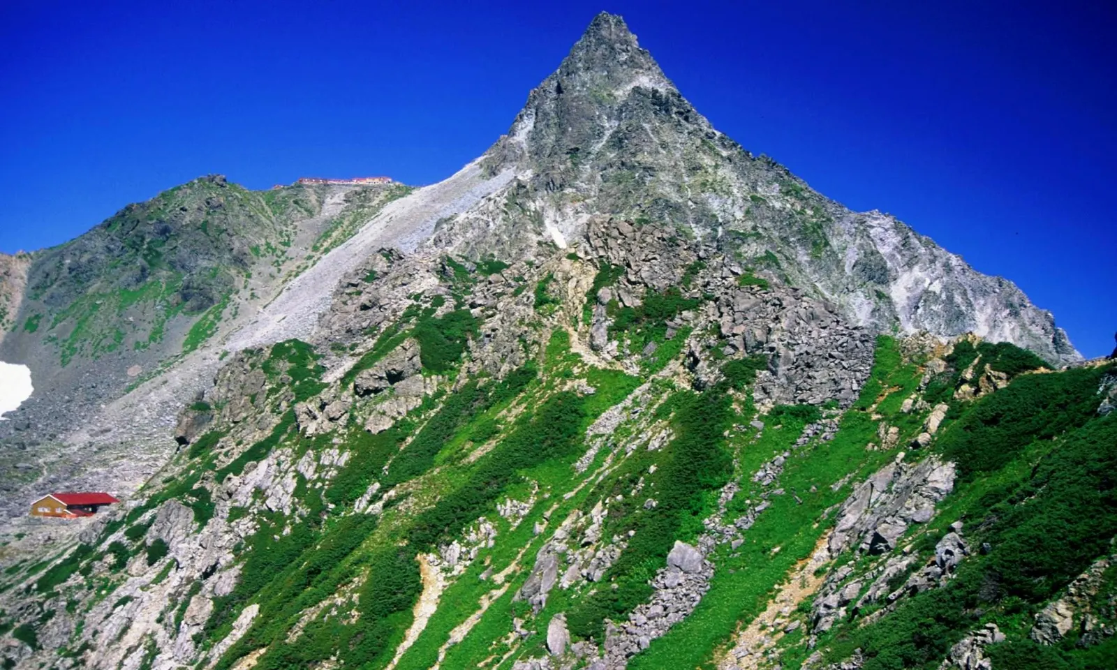
The rock spire of Yarigatake above green alpine slopes and a red-roofed mountain hut

Photos: Alpsdake (Public domain), Alpsdake (CC BY-SA 3.0), Alpsdake (CC BY-SA 4.0), Naganojmmmm (CC BY-SA 4.0)

Distance
39.1 km round trip
Summit
3,180 m
Time
About 20 hours over 3 to 4 days
Elevation difference
2,130 m

Why go

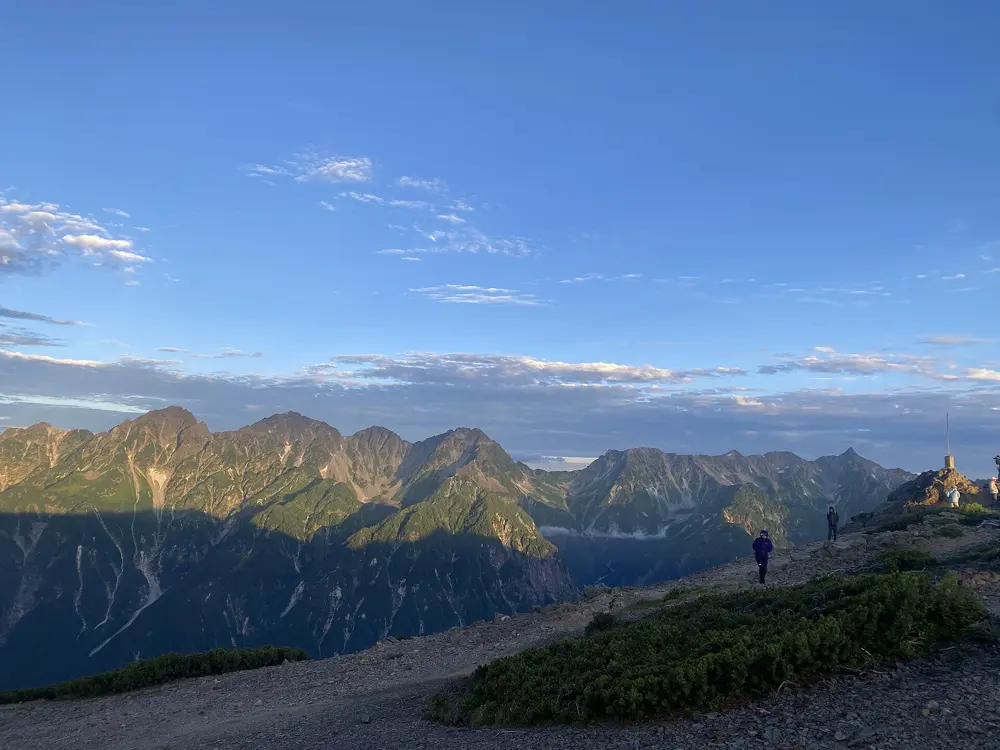
Yarigatake, the spear, is the sharpest summit in the Japanese Alps: a rock spire at 3,180 m, the fifth highest mountain in Japan and one of the Hyakumeizan, the hundred famous mountains. The walk in from Kamikochi follows a long, clear river valley before it climbs into a cirque under the peak, and the last few minutes go up ladders and chains to a summit with the whole of the Northern Alps around it.

The route

From the Kamikochi bus terminal the trail follows the valley upstream for the first two or three hours, flat and wooded, past the lodges at Tokusawa and Yokoo. Beyond Yokoo it turns into the Yarisawa Valley and grows steeper and rockier, passing Yarisawa Lodge. Yarigatake Sanso, the hut on the shoulder below the spire, is about five hours beyond Yarisawa Lodge, and the summit is about 30 minutes above it by steel ladders and chains. Most people return the same way. Strong walkers continue south along the ridge to the Hotaka peaks by the Daikiretto, a gap whose sides drop about 300 m, which is for experienced scramblers only.

When to go

The main hiking season runs from mid-July to mid-October. Yarigatake Sanso can open in late April, but snow can lie on the route into early June. Autumn colour reaches the mountain from mid-September to early October.

Getting there

Private cars and motorcycles are banned from Kamikochi all year. Drivers park at Sawando, about an hour from the Matsumoto interchange, or at Hirayu Akandana, about 45 minutes from the Takayama interchange, then take a shuttle bus or taxi for about 30 minutes. By public transport, take the Matsumoto Dentetsu Kamikochi Line to Shinshimashima Station and a bus from there, about 1 hour 30 minutes in all. Reserved direct buses also run from Tokyo, Nagoya and Osaka or Kyoto.

Permits and booking

None of the official sources used here lists a permit for the climb. The rule that shapes the trip is the vehicle ban on the Kamikochi road, so plan your arrival around the shuttle buses.

How hard it is

This is a serious mountain walk: 39.1 km with 2,130 m of elevation difference, and long rocky stages above the tree line. The summit spire is exposed, with ladders and chains, and is no place for anyone uneasy with heights. Allow three or four days so that each stage stays reasonable.

Where to sleep

Lodges stand along the valley at Tokusawa and Yokoo, and Yarisawa Lodge and Yarigatake Sanso are the usual overnight stops on the climb. Yarigatake Sanso sits about 30 minutes below the summit, close enough to climb it at dawn.

Tips

  • Snow can lie on the route into early June, so go in summer unless you are equipped for snow.
  • The Kamikochi visitor center can answer questions on conditions: phone 0263-95-2606.
03 / 10

The Kumano Kodo (Nakahechi)

Kii Peninsula, Wakayama

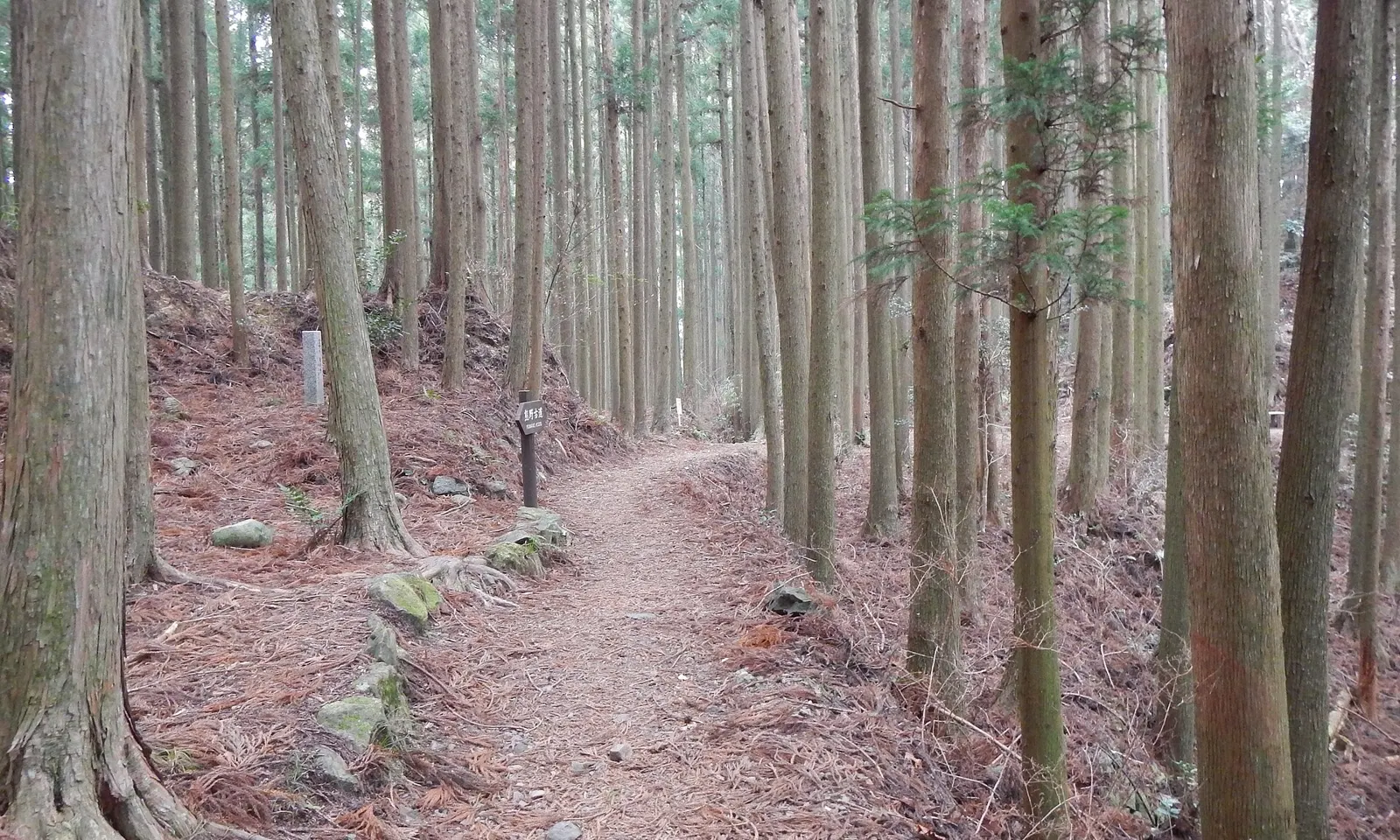
A path through tall cedar forest on the Kumano Kodo

Photos: Nekosuki (CC BY-SA 4.0), Nekosuki (CC BY-SA 4.0), Nekosuki (CC BY-SA 4.0), Nekosuki (CC BY-SA 4.0)

Distance
37 to 38 km one way
Time
2 days
Season
March to April, October to November
Status
UNESCO World Heritage

Why go

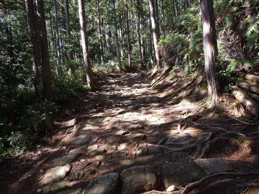
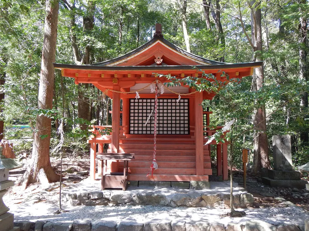
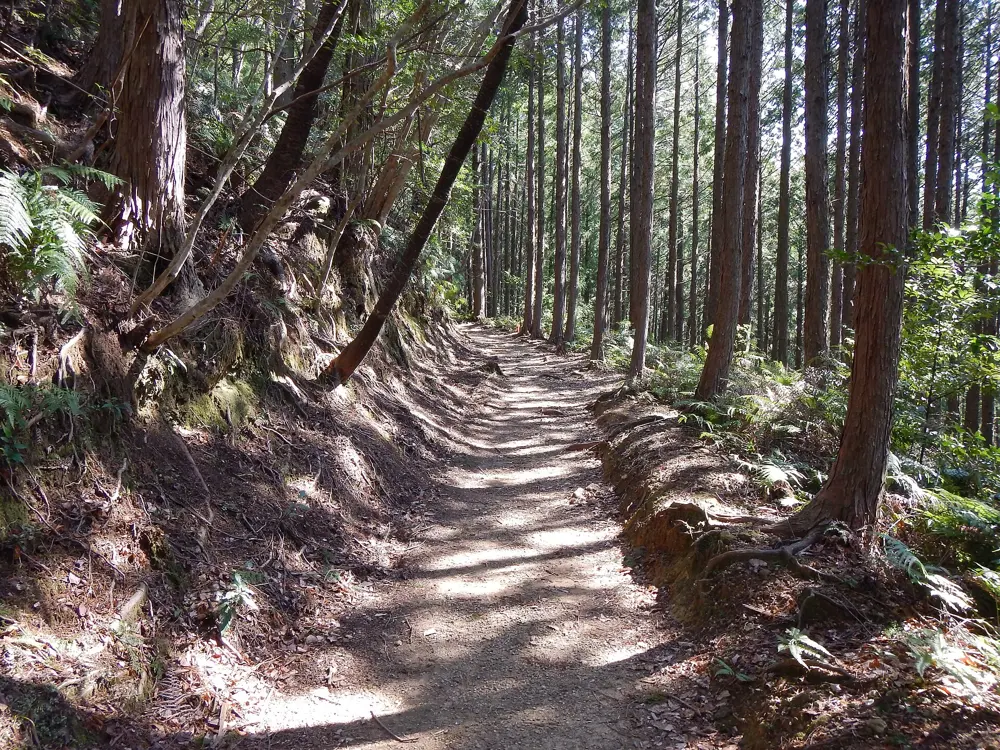
The Nakahechi is the old imperial road to the Kumano shrines, walked by pilgrims from Kyoto for more than a thousand years and inscribed by UNESCO in 2004 as part of the Sacred Sites and Pilgrimage Routes in the Kii Mountain Range. It is a forest walk rather than a summit walk, threaded with small oji shrines, and each night ends in a village guesthouse.

The route

The UNESCO section starts at Takijiri-oji, one of the five most important oji shrines, and climbs steeply at once towards Takahara, the village of mist. Day one continues past Daimon-oji, Jujo-oji and the small Gyuba Doji statue to Chikatsuyu, about 13 km in all, the last overnight stop for pilgrims before Hongu. Day two, about 25 km, passes Tsugizakura-oji to Hosshinmon-oji. The last few kilometres go through Fushiogami-oji, where pilgrims knelt at their first sight of the shrine, to Kumano Hongu Taisha and the giant torii at Oyunohara.

When to go

Spring (March and April, cherry blossom season) and autumn (October and November) are the favourite seasons. June to August is humid and wet, August and September is the peak of typhoon season, and in winter the days are short and most accommodation closes over New Year.

Getting there

The walk begins from Kii-Tanabe, where the bus to Takijiri takes about 40 minutes and luggage can be stored at the Tanabe Tourist Information Center next to JR Kii-Tanabe Station. From Hongu, buses run back towards Takijiri and on to Shingu.

Permits and booking

There is no trail permit; the booking that matters is your accommodation. The Kumano tourism bureau suggests booking about six months ahead for spring and autumn, and turning up at a guesthouse unannounced is not the custom.

How hard it is

The path is rugged mountain trail with about 1,010 m of climbing on the first day and some 1,360 m of descent between Tsugizakura-oji and Hongu. The second day can take 9 to 12 hours, so you need steady hill fitness more than any technical skill.

Where to sleep

Small family guesthouses (minshuku), hostels and campsites in Takahara and Chikatsuyu, and the hot spring villages of Yunomine, Kawayu and Wataze near Hongu. The mountain villages have little capacity and fill quickly in spring and autumn.

Tips

  • There are no restaurants between Tsugizakura-oji and Hongu, so order a packed lunch from your guesthouse.
  • Public bins are almost nonexistent, so carry out all your rubbish.
04 / 10

Jomon Sugi on Yakushima

Yakushima, Kagoshima Prefecture

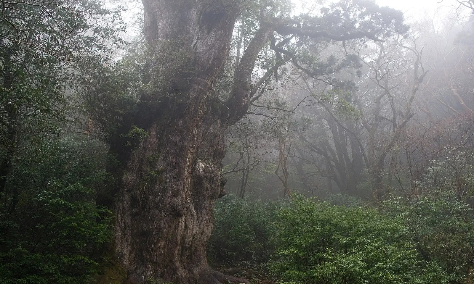
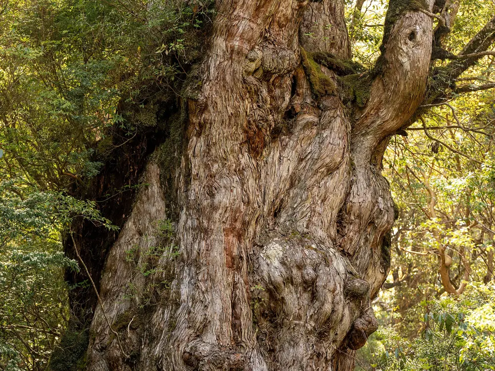
The massive trunk of Jomon Sugi in misty cedar forest on Yakushima

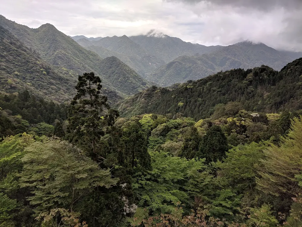
Photos: Σ64 (CC BY 3.0), Σ64 (CC BY 3.0), Raita Futo from Tokyo, Japan (CC BY 2.0), Grendelkhan (CC BY-SA 4.0)

Distance
19.4 km round trip
Time
9 to 10 hours
Highest point
1,292 m
Status
UNESCO World Heritage since 1993

Why go

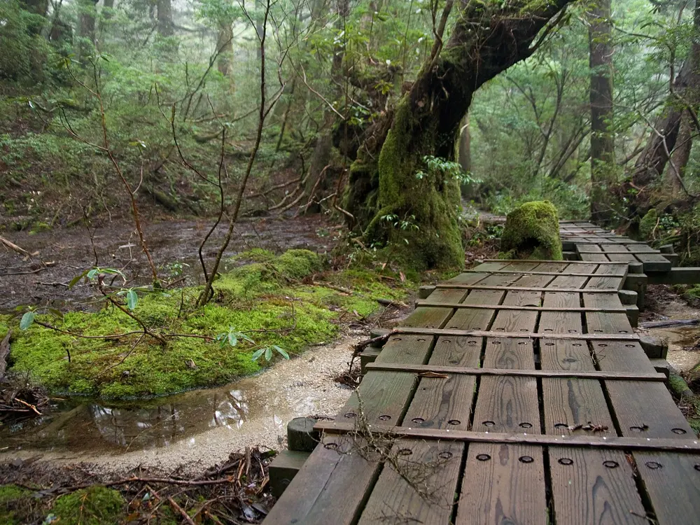
Yakushima is a mountainous island south of Kagoshima, and in 1993 it became one of Japan's first natural World Heritage Sites. Its forests of yakusugi cedar and moss feel older than anywhere else in the country, and the walk to Jomon Sugi ends at the most famous of them: a vast cedar thought to be well over a thousand years old, and by some estimates more than 2,000.

The route

From the Arakawa trailhead the path follows an old forestry railway for most of the way in, through the remains of former settlements and forests of cedar. The track is mostly flat, and rail cars still run on it between the Arakawa and Okabu trailheads, so walk in single file and step aside when one comes. At the Okabu trailhead the path leaves the rails and climbs through the forest, past Wilson's Stump, one of the largest yakusugi stumps, and Takatsuka Hut to the viewing deck at Jomon Sugi, then returns the same way.

When to go

Spring and autumn are the best seasons. Summer is hot and humid, and in winter snow reaches the trails. Some bridges have no full handrails, so take particular care on windy days.

Getting there

Ferries take about two hours from Minami-futo Wharf at Kagoshima Port to Miyanoura Port on Yakushima. From 1 March to 30 November, ordinary vehicles may not drive to the Arakawa trailhead at any time of day, and walkers ride the Arakawa hiking bus from outside the Yakusugi Museum, about 35 minutes.

Permits and booking

Fill in a climbing registration form before you set off. A World Natural Heritage Yakushima Mountain Environment Conservation Donation is collected from walkers. Stay on the viewing deck at Jomon Sugi, whose roots are fragile, and do not camp or stay overnight there.

How hard it is

The walk is long rather than steep: 19.4 km and about 700 m of climbing, with the hard part after Okabu. Allow 9 to 10 hours, and start between 5:00 and 7:00 so that you are back for the bus. The trail is easy to lose if you stray from it, and English-speaking guides are available.

Where to sleep

The day walk starts and ends with the bus from the Yakusugi Museum, so stay where you can reach it early. In the mountains there are basic huts and designated campsites for those who want to stay longer.

Tips

  • Toilets are at the Arakawa trailhead, Sandai-sugi, the Okabu trailhead and Takatsuka Hut, and nowhere else.
  • There are no public phones at the trailhead, so check whether your mobile network has signal on the island.
05 / 10

The Nakasendo from Magome to Tsumago

Kiso Valley, Gifu and Nagano Prefectures

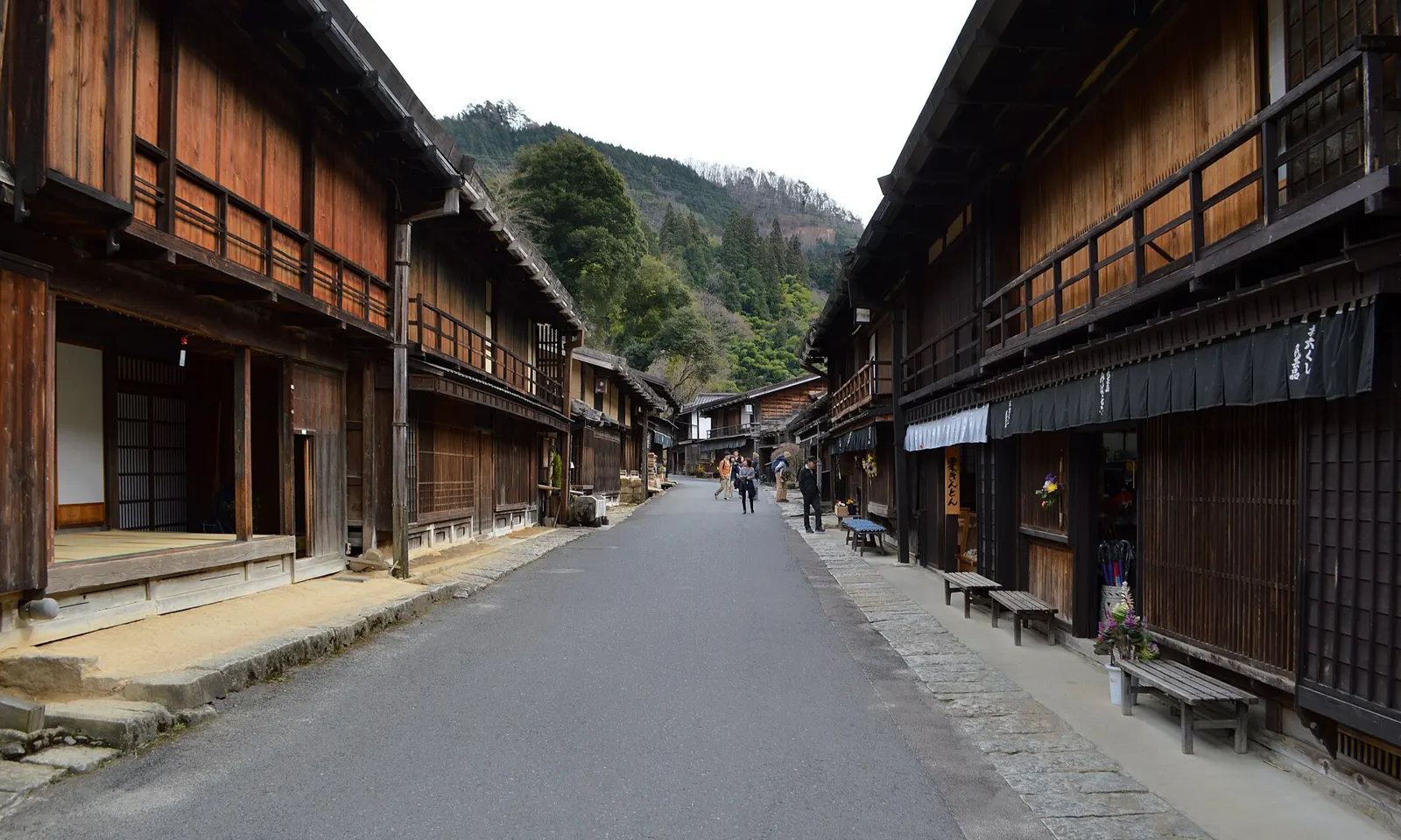
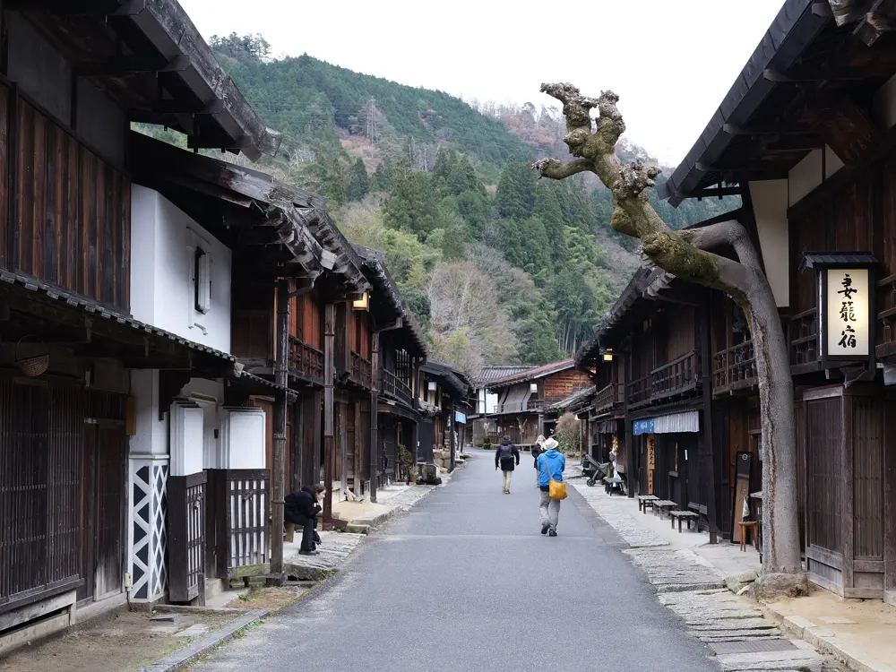
The old Nakasendo road between dark timber houses in Tsumago-juku

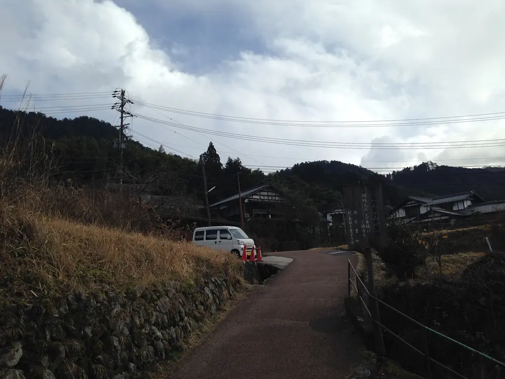
Photos: DimiTalen (CC0), そらみみ (CC BY-SA 3.0), Chensiyuan (CC BY-SA 4.0), そらみみ (CC BY-SA 3.0)

Distance
About 8 km one way
Time
2 to 3 hours
The road
534 km, 69 post towns
Luggage service
20 March to November

Why go

The Nakasendo was the longest of the five great roads of the Edo period, about 534 km with 69 post towns where travellers rested between Kyoto and Edo. The stretch between Magome and Tsumago in the Kiso Valley is the easiest way to walk into old Japan: dark timber inns, stone paving, cypress forest, and at the end Tsumago, considered one of the best preserved post towns in the country.

The route

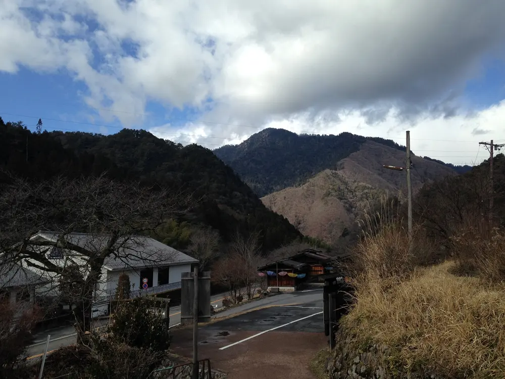
Magome sits on a hillside with views of Mount Ena and a sloping main street of restored Edo-style houses. From the top of the town the trail climbs gently over the pass and then descends through cypress forest and farmland to Tsumago, about 8 km in all. Some short sections follow asphalt roads. Around halfway, an old farmhouse with an irori fire pit and farming tools serves tea and snacks to walkers in return for a donation. If you want to go further, the path continues about 3.5 km beyond Tsumago to Nagiso Station, an hour through more built-up country.

When to go

The luggage forwarding service between the two towns runs from 20 March through November, which is the easiest time to walk. The walk is possible outside those months, but deliveries then cost more.

Getting there

From Nagoya, the JR Chuo Line's Shinano limited express reaches Nakatsugawa in about 50 minutes, and a bus takes about 25 minutes from there to Magome. Infrequent direct buses link Magome and Tsumago, and Tsumago is also reached by bus from Nagiso Station.

Permits and booking

No permit is needed. The service worth booking is the luggage forwarding between the tourist information centers in Magome and Tsumago: drop bags between 8:30 and 11:30 and collect them at the other end between 13:00 and 17:00, for 1,000 yen per item in season. Outside the season, delivery costs 4,500 yen for up to three bags.

How hard it is

This is an easy walk on good paths, with some climbing over the pass. Walking from Magome to Tsumago involves a little less uphill than the other way round. Comfortable shoes are enough.

Where to sleep

Staying overnight in Tsumago or Magome lets you see the towns after the day visitors leave. Otherwise the walk fits into a day trip from Nagoya by way of Nakatsugawa.

Tips

  • Reach the tourist information center well before 11:30 if you want your bags sent on the same day.
  • In Magome, try the local gohei-mochi rice cakes and oyaki dumplings before you set off.
06 / 10

The Asahidake to Kurodake traverse

Daisetsuzan National Park, Hokkaido

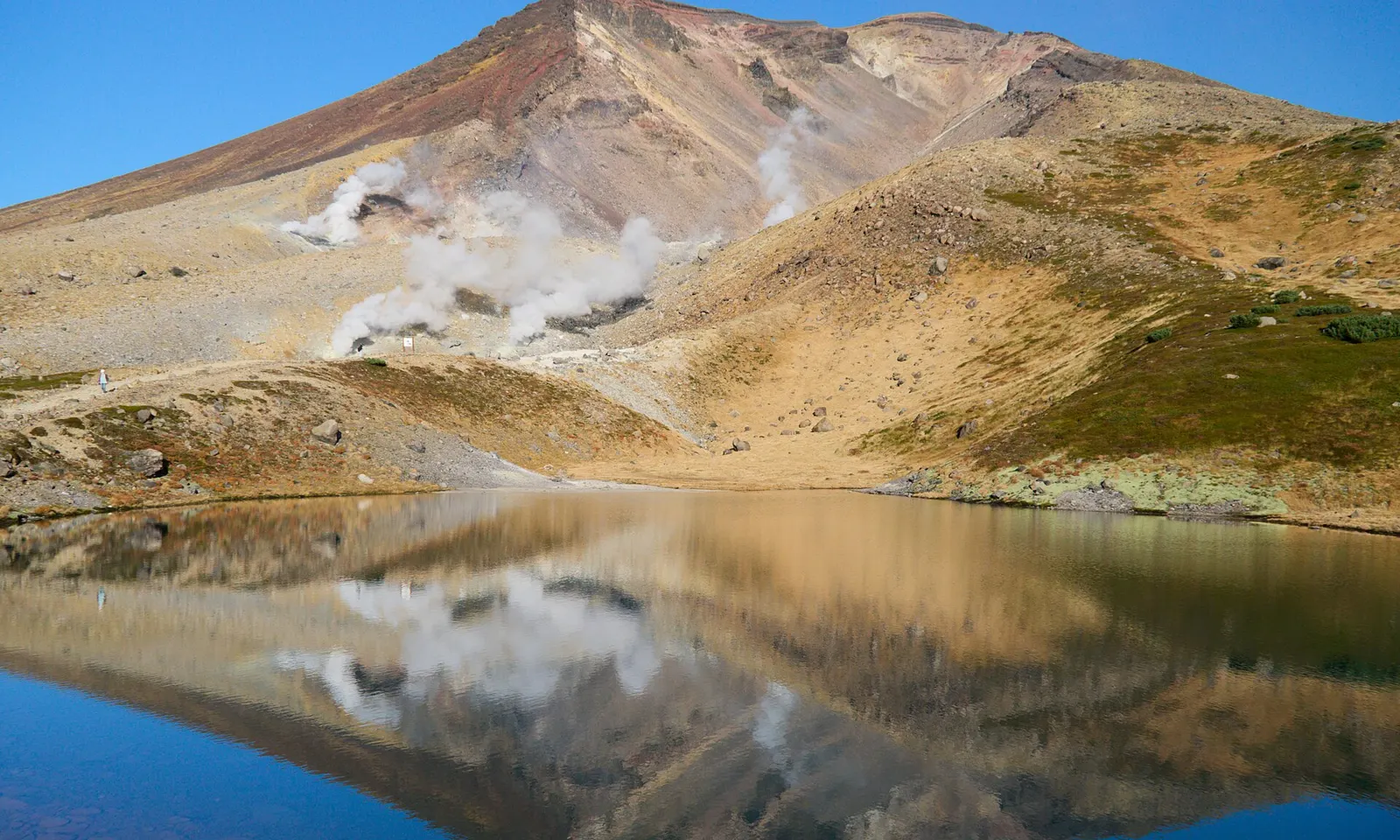
Asahidake with steaming fumaroles reflected in a still pond at Sugatami

Photos: lumoplank (CC0), Shirokazan (CC BY-SA 3.0), lumoplank (CC0), Miya.m (CC BY-SA 3.0)

Distance
13 km one way
Time
7 to 8 hours
Highest point
Asahidake, 2,291 m
Season
July and August

Why go

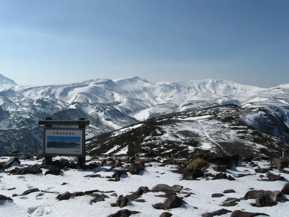
Daisetsuzan is the roof of Hokkaido, a wide volcanic upland of steaming vents, late snowfields and alpine flowers, and this traverse crosses the heart of it. It starts beside the fumaroles of Asahidake, climbs Hokkaido's highest summit, then follows the rim of the Ohachidaira caldera to Kurodake, with ropeways at both ends that let you do it in a day.

The route

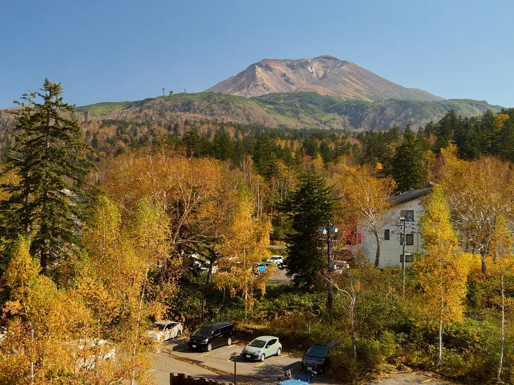
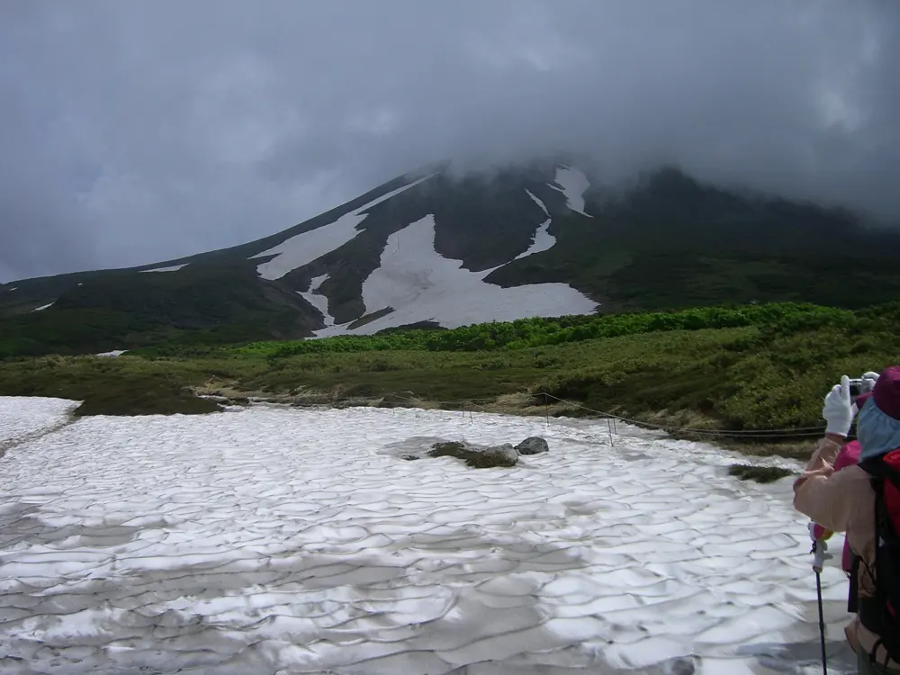
From the top of the Asahidake ropeway at Sugatami, 1,600 m, the trail climbs past the fumaroles to the summit of Asahidake at 2,291 m. It heads east to Mamiyadake, 2,185 m, about an hour on, and then splits around the Ohachidaira crater. The northern line crosses Hokuchindake, at 2,244 m the second highest peak in Hokkaido; the southern one goes over Hokkaidake, 2,149 m, and includes a river crossing. The two meet before the Kurodake Ishimuro hut, and the last climb goes over Kurodake, 1,984 m, to the top of the chairlift at 1,510 m above Sounkyo.

When to go

July and August are the main summer hiking season. Before and after them, expect snow on the ground or falling, and be equipped for it.

Getting there

Buses run from JR Asahikawa Station to Asahidake Onsen in about 1 hour 40 minutes. The Asahidake ropeway climbs from about 1,100 m to Sugatami in 10 minutes. At the far end, the Kurodake chairlift and the Sounkyo ropeway drop to Sounkyo Onsen, which has buses back towards Asahikawa in about two hours.

Permits and booking

None of the sources used here lists a permit for the traverse. What you need is a ticket for each ropeway and the chairlift, and for an overnight, a place at the Kurodake Ishimuro hut or its campsite.

How hard it is

About 1,010 m of climbing over 13 km, on clear paths with no technical sections. The challenge is the distance more than the terrain. Bears live throughout the national park.

Where to sleep

Asahidake Onsen has a youth hostel, a campsite, pensions and hotels. Sounkyo has hotels and hot springs. On the mountain, the Kurodake Ishimuro hut is staffed from the last weekend of June to the last weekend of September and provides bedding, and camping is allowed beside it.

Tips

  • The northern line over Hokuchindake takes about an hour longer than the southern one over Hokkaidake.
  • Check the ropeway timetables before you start, so that you reach Kurodake before the chairlift stops.
07 / 10

Dewa Sanzan: Haguro and Gassan

Tsuruoka, Yamagata Prefecture

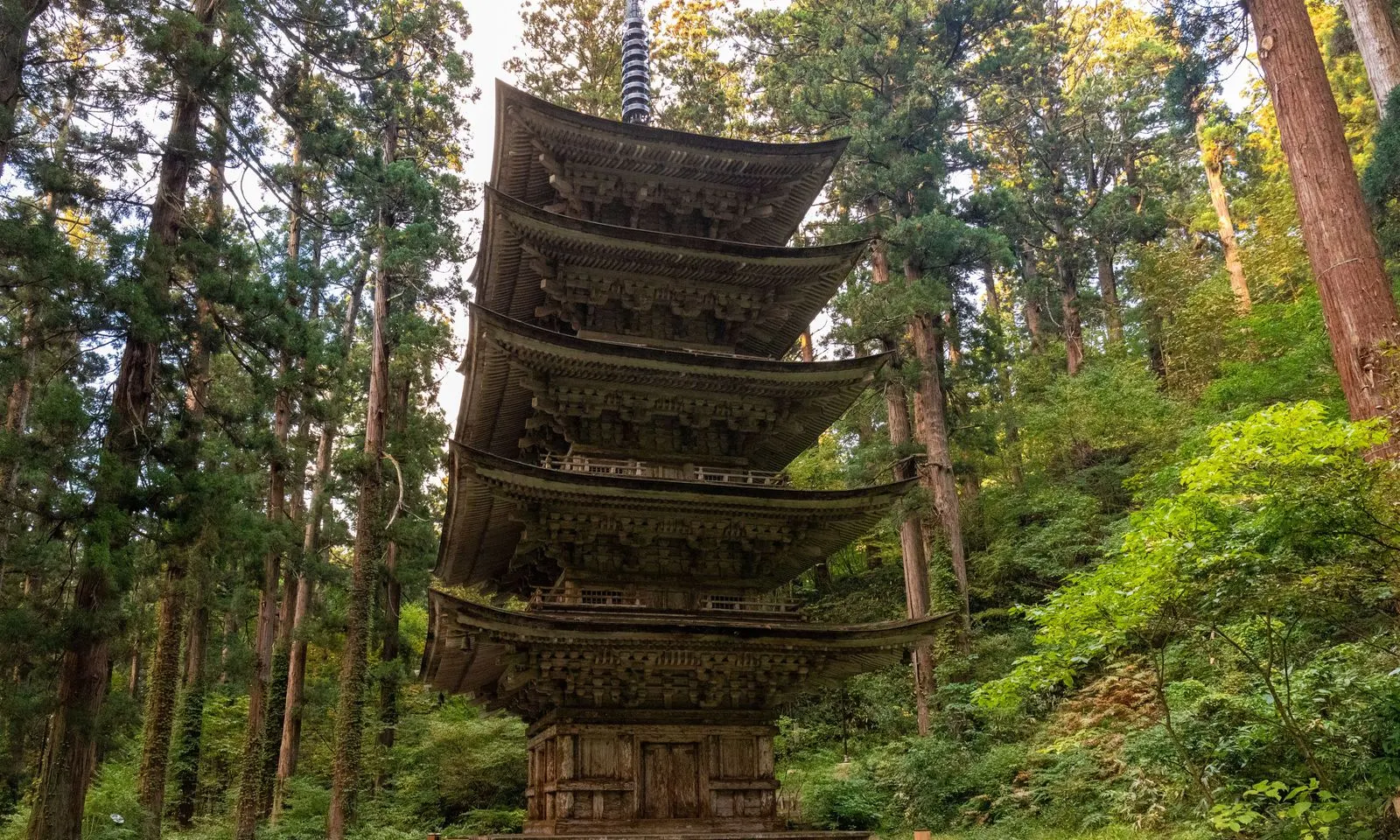
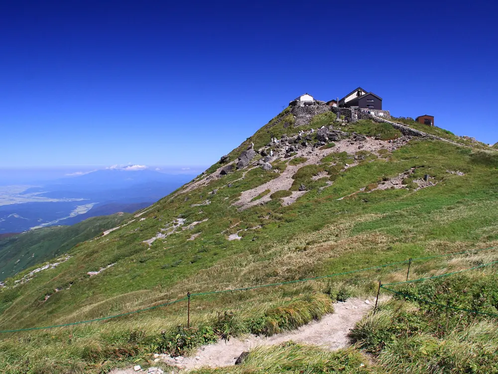
The five-storied pagoda of Mount Haguro among tall cedars

Photos: くろふね (CC BY 4.0), No machine-readable author provided. Crown of Lenten rose assumed (based on copyright claims). (CC BY 3.0), ChiefHira (CC BY-SA 3.0), Raita Futo from Tokyo, Japan (CC BY 2.0)

Distance
About 5 km, Gassan 8th Station to summit
Steps
2,446 on Mount Haguro
Summit
Gassan, 1,984 m
Season
July to mid-September

Why go

The three mountains of Dewa, Haguro, Gassan and Yudono, are a pilgrimage, and pilgrims traditionally visit them in that order. The walk combines a stone staircase through a cedar forest to Haguro's summit shrine with a climb onto the high, bare ridge of Gassan, where snow lies even in midsummer.

The route

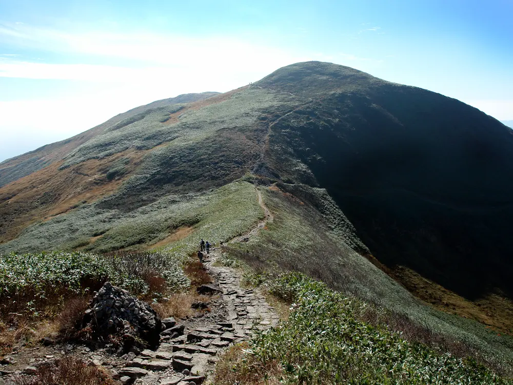
Haguro is climbed on foot by 2,446 stone steps from the base of the mountain through a forest of cedars. About ten minutes in stands the five-storied pagoda, a National Treasure said to have been first built in 937. A teahouse halfway up gives walkers a rest and a free certificate. At the top is the Sanjin Gosaiden, whose thatched roof is more than two meters thick. Gassan, at 1,984 m the highest of the three, is climbed from the 8th Station at the end of the paved road: five kilometers on foot, 2.5 to 3 hours up a rocky, treeless trail to the summit shrine. Pilgrims then descend to Yudono, which is steeper and takes about 2.5 hours.

When to go

Gassan's summit shrine is closed from mid-September to June because of heavy snow, so the full pilgrimage fits into July to early September. Haguro can be visited all year.

Getting there

Tsuruoka is about 4 to 4.5 hours from Tokyo by train via Niigata, or 60 minutes by air from Haneda to Shonai Airport and a 30-minute bus. Buses run all year from Tsuruoka Station to the foot of Haguro in about 40 minutes and to its summit in about an hour. From July to September, on selected days, four buses a day run from Haguro's summit to the Gassan 8th Station in 55 minutes. Since 2017 Yudono has not been served by public transport.

Permits and booking

There is no hiking permit. Entry to the summit shrine on Gassan costs 500 yen and begins with a short purification rite; priests help visitors who do not speak Japanese.

How hard it is

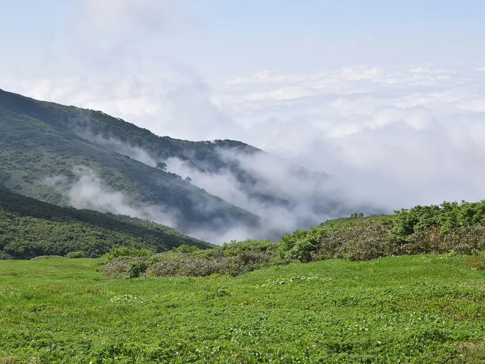
The Haguro steps are steady rather than hard. Gassan is a proper mountain walk: exposed, rocky, with patches of snow even in midsummer, and the descent to Yudono is steeper and more demanding than the climb. There is also a short 30-minute circuit through marsh and flower meadows at the 8th Station.

Where to sleep

Temple lodgings (shukubo) cluster around Haguro. Saikan, just below the summit, offers tatami rooms, vegetarian meals and the morning ceremony, and should be booked ahead. Hotels are in central Tsuruoka.

Tips

  • Spend a night in a shukubo on Haguro so you can climb Gassan the next morning.
  • If you plan to walk on to Yudono, arrange a car or taxi, because no bus serves it.
08 / 10

The Shikoku 88 Temple Pilgrimage

Shikoku: Tokushima, Kochi, Ehime and Kagawa

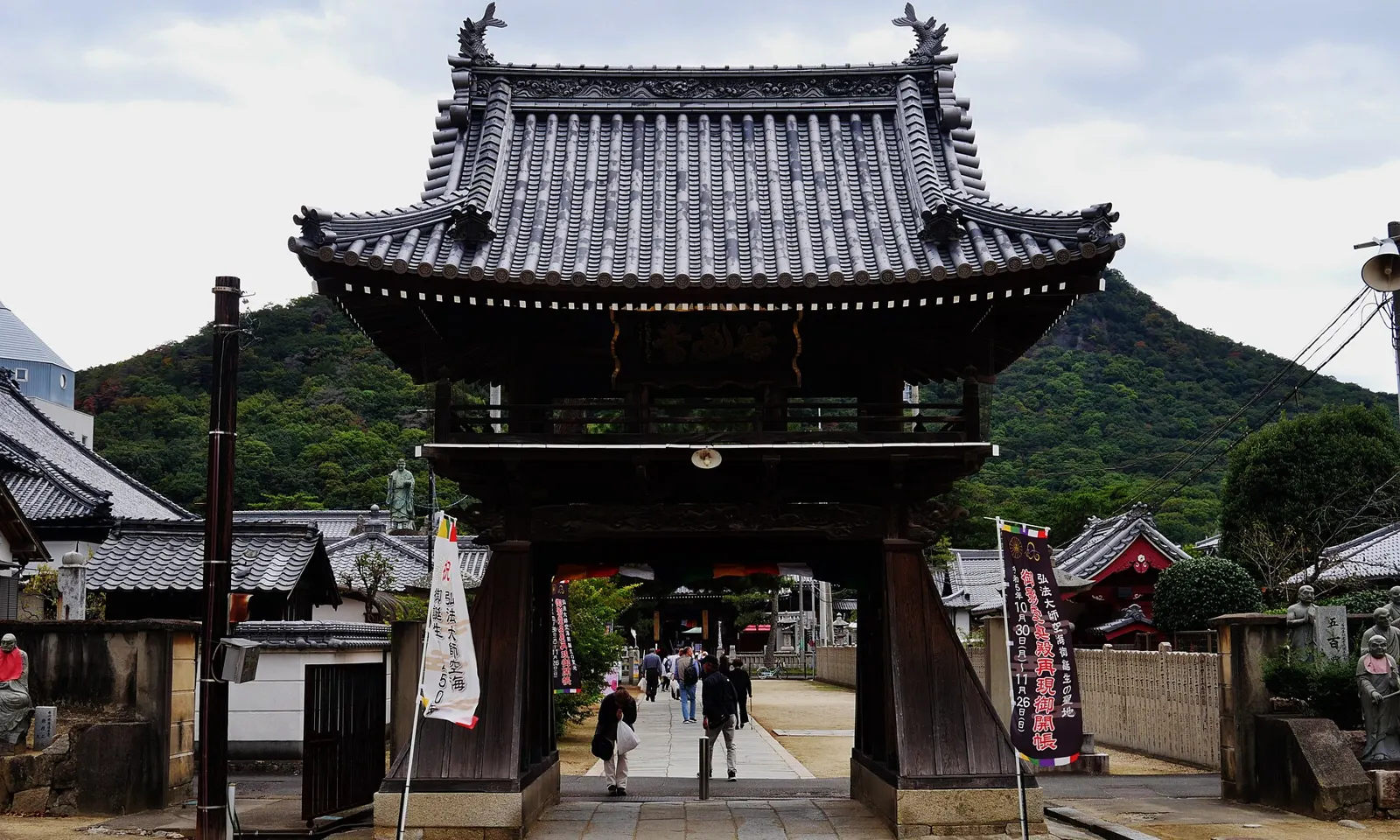
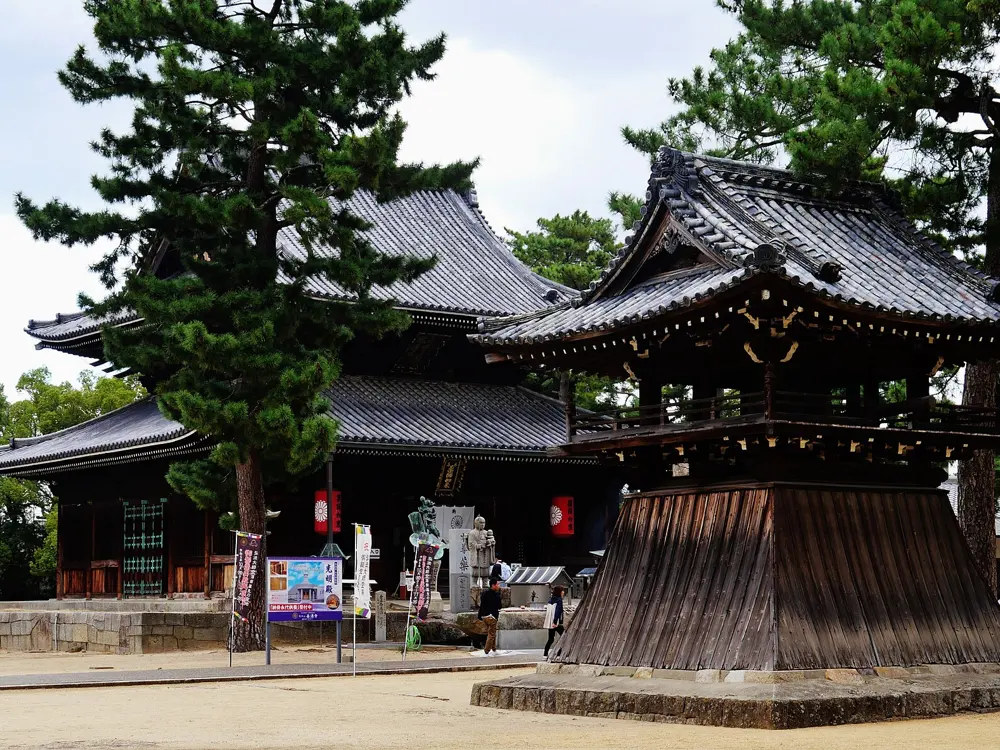
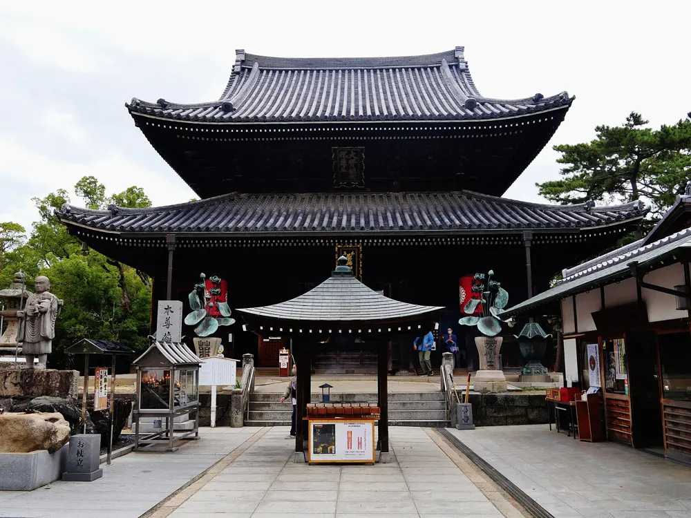
The middle gate of Zentsuji, Temple 75 of the Shikoku pilgrimage, with a hill behind

Photos: Zairon (CC BY 4.0), Reina.otsuki (CC BY-SA 4.0), Zairon (CC BY 4.0), Zairon (CC BY 4.0)

Distance
About 1,200 km loop
Temples
88
Time
About 6 weeks on foot
Season
March to May, October to November

Why go

The henro is Japan's great long walk: a loop around the island of Shikoku linking 88 temples associated with Kukai, known as Kobo Daishi, the monk believed to have trained there in the 9th century. Pilgrims in white walk with a staff that stands for Kobo Daishi himself, under the idea of dogyo ninin, two travelling together. Along the way locals still offer osettai, small acts of kindness such as food and encouragement, to the people passing through.

The route

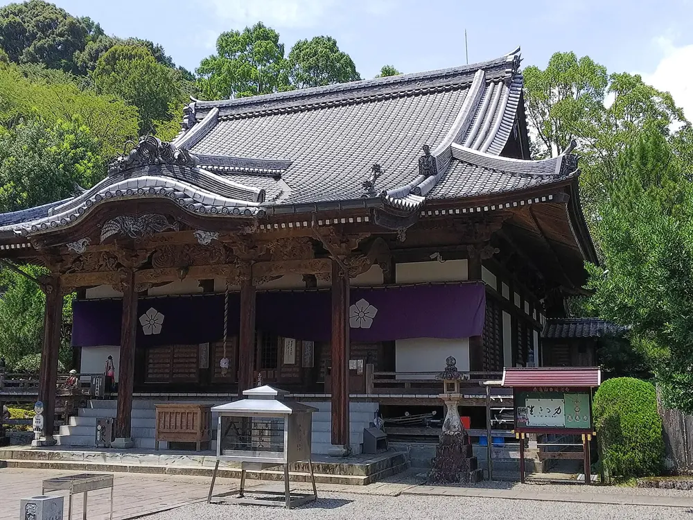
Most pilgrims start at Temple 1, Ryozenji, in Naruto in Tokushima Prefecture, and walk clockwise through Tokushima, Kochi, Ehime and Kagawa to Temple 88, Okuboji. Walking in reverse is also allowed. Tourism Shikoku and Japan's tourism board give the length as about 1,200 km; some official pages put it closer to 1,400 or 1,460 km, depending on the route taken between temples. About three quarters is on roads, from highways to village lanes, with forest paths and mountain temples such as Unpenji, Temple 66, at close to 1,000 m. Many people walk it in sections over several trips.

When to go

March to May and October to November have the best weather and comfortable temperatures. Summer is extremely hot and humid.

Getting there

From Tokushima Airport, take the No. 25 bus to Naruto Station, about 20 minutes, then the No. 131 bus to the Ryozenji stop, about 30 minutes.

Permits and booking

No permit is needed. Most pilgrims carry a nokyocho, a book that is stamped and signed at each temple's office for 300 yen. Wild camping is illegal and frowned upon, so camp only where it is clearly allowed.

How hard it is

Moderate to hard because of the distance, the heat and the amount of road walking. At about 30 km a day, the full circuit takes about six weeks; many walkers take between 40 and 60 days. Temples are well signed.

Where to sleep

Options include free or cheap pilgrim lodgings (tsuyado and zenkonyado) and pilgrim huts, usually first come, first served, as well as guesthouses, hostels and business hotels. Budget guesthouses and hostels cost about 3,500 to 5,000 yen a night per person.

Tips

  • Temples are well signed, but a route app such as Henro Helper also shows walking routes and permitted campsites.
  • If six weeks is too long, walk one prefecture at a time; returning to continue is an accepted way to complete it.
09 / 10

Ozegahara and Ozenuma

Oze National Park, Gunma and Fukushima Prefectures

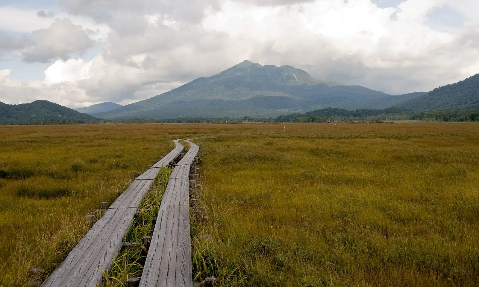
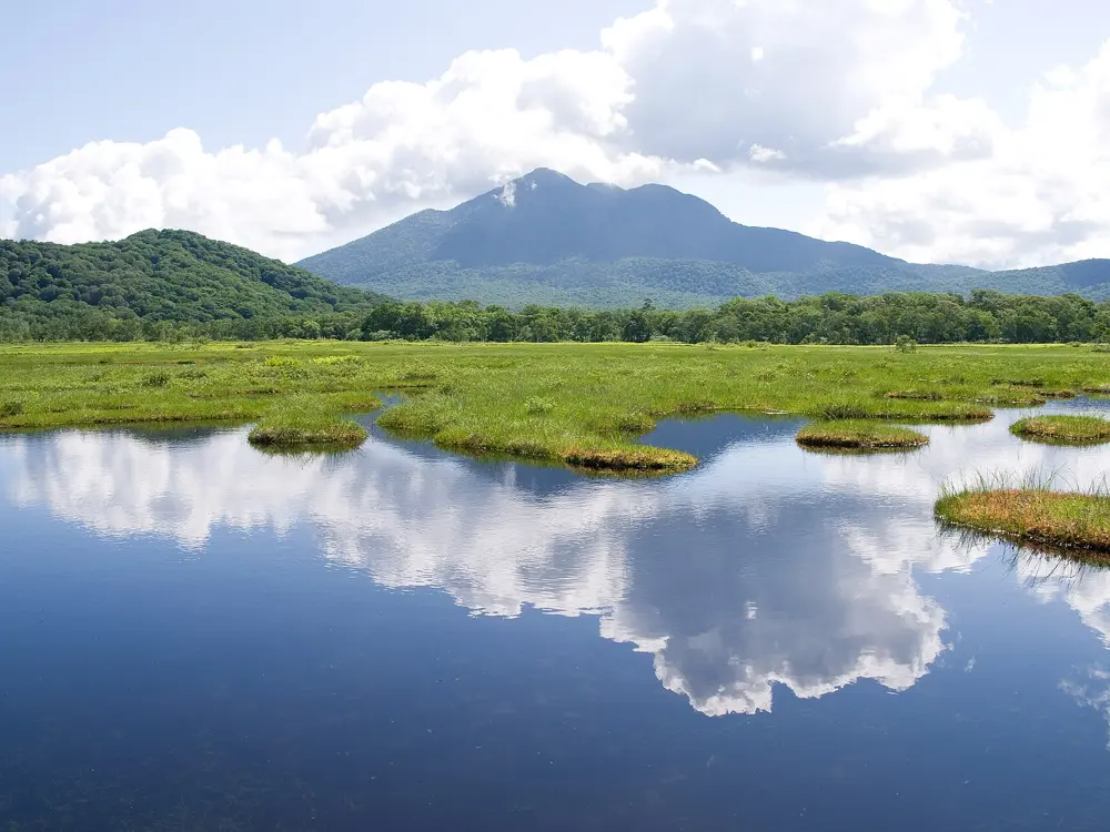
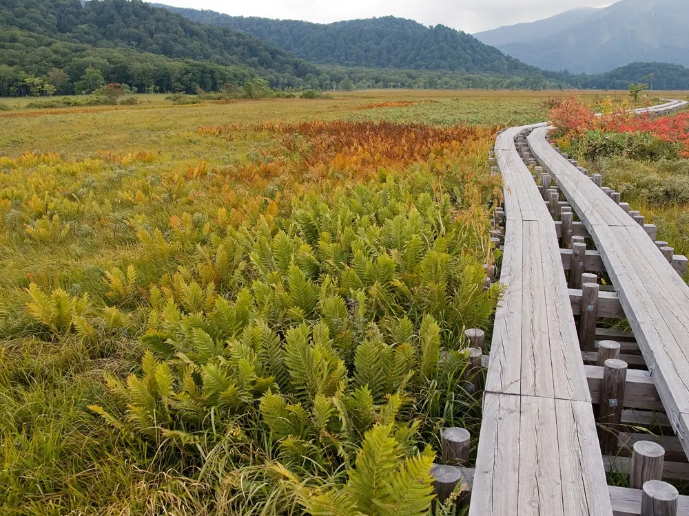
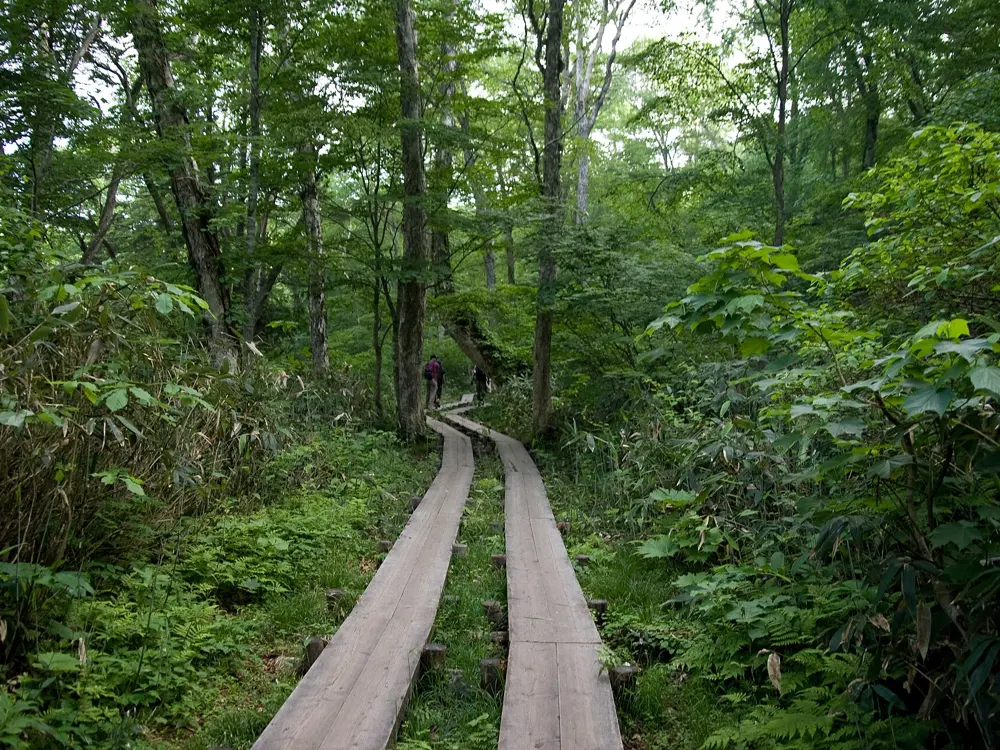
A double boardwalk crossing the golden grasses of Ozegahara towards Mount Shibutsu

Photos: Σ64 (CC BY 3.0), Σ64 (CC BY 3.0), Σ64 (CC BY 3.0), Σ64 (CC BY 3.0)

Distance
15.8 km round trip from Hatomachi Pass
Time
About 6 hours
Altitude
1,400 to 1,600 m
Season
June to October

Why go

Ozegahara is a highland marsh about six kilometers long and one wide, at roughly 1,400 m, crossed by long wooden boardwalks and dotted with hundreds of small pools. Mountains rise at both ends, Shibutsu and Hiuchigatake, and the colours change through the season. Oze is also where Japan's nature conservation movement began, when public campaigns stopped power plants that would have flooded the marsh.

The route

Most walkers come in from Hatomachi Pass, the highest point of the walk at 1,591 m, and reach the western end of the marsh in about an hour. The boardwalks cross Ozegahara to its eastern end; from the eastern end, Ozenuma pond is about an hour and a half on, and a six-kilometer path circles it. The classic day walk goes from Hatomachi past the marsh and the pond to the Oshimizu trailhead, six to eight hours. A shorter round trip from Hatomachi with a loop from Ushikubi is 15.8 km, about six hours, with only 193 m of climbing.

When to go

The hiking season runs from June to October; from November to April the park is under deep snow. White skunk cabbage blooms from late May to early June, yellow alpine lilies in late July and early August, and autumn colour comes in late September and early October.

Getting there

The road to Hatomachi Pass is closed to private cars, and shuttle buses run from Tokura from mid-April to early November, about 25 minutes. From Tokyo, take the Joetsu Shinkansen to Jomo Kogen, about 75 minutes, then a bus to Tokura, about 110 minutes, though there are only a few. Buses run at least hourly from Numata to Tokura in about 80 minutes, and from late May to mid-October a direct bus runs from Busta Shinjuku in about four hours.

Permits and booking

There is no permit. The mountain huts in the park are open in the climbing season, from late April to mid-October, and require a reservation.

How hard it is

Easy and almost level on the boardwalks, with no steep climbs; the main effort is the distance. Snow lingers into May, so early-season walkers should check conditions.

Where to sleep

A few mountain huts stand inside the park around the marsh and the pond, and there is more lodging in the Tokura area just outside it.

Tips

  • Allow as many hours as you can: Hatomachi to Oshimizu alone takes six to eight hours.
  • The Oshimizu trailhead stays open to private cars all season, which is useful if you are driving.
10 / 10

Mount Takao and the ridge to Mount Jinba

Hachioji, Tokyo

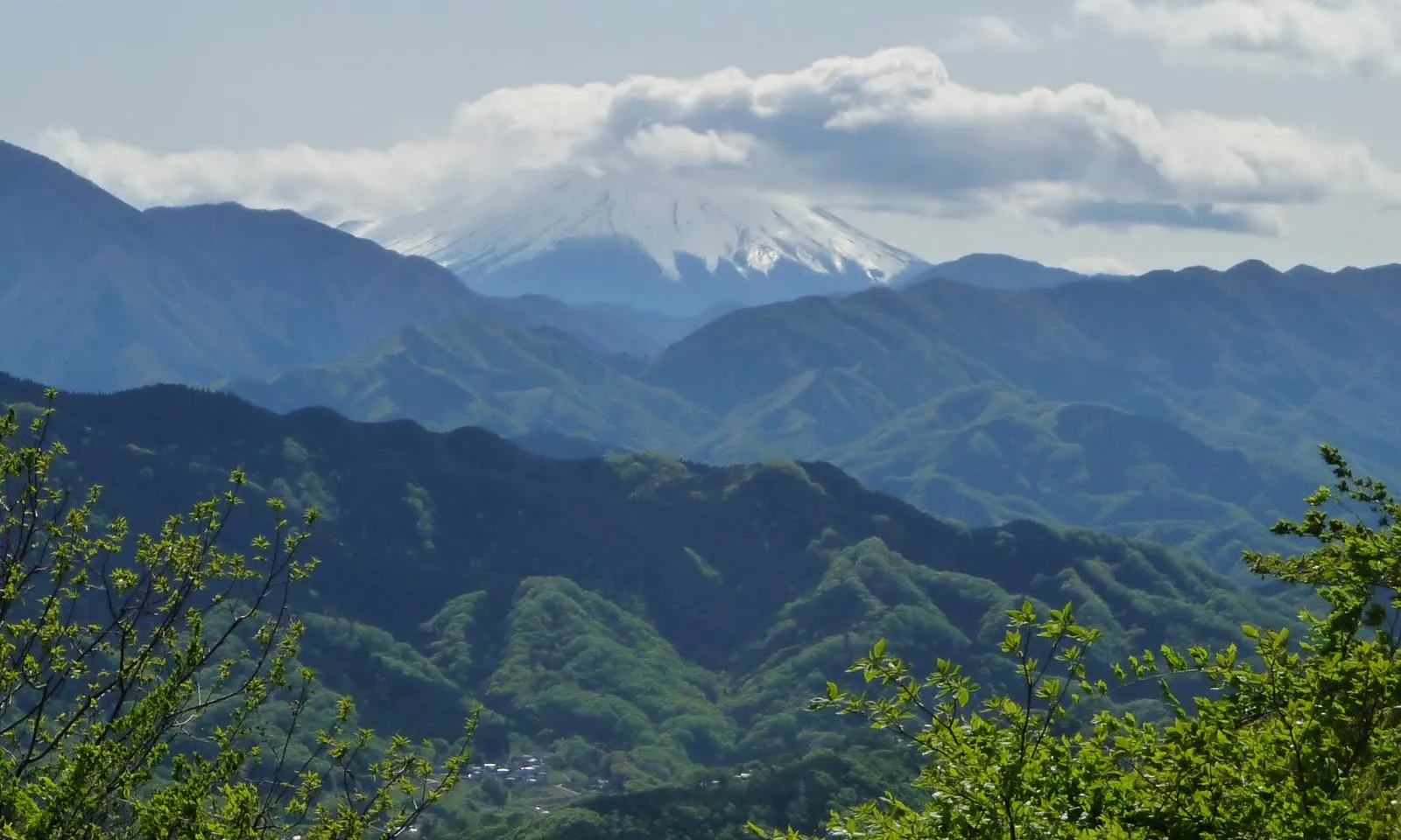
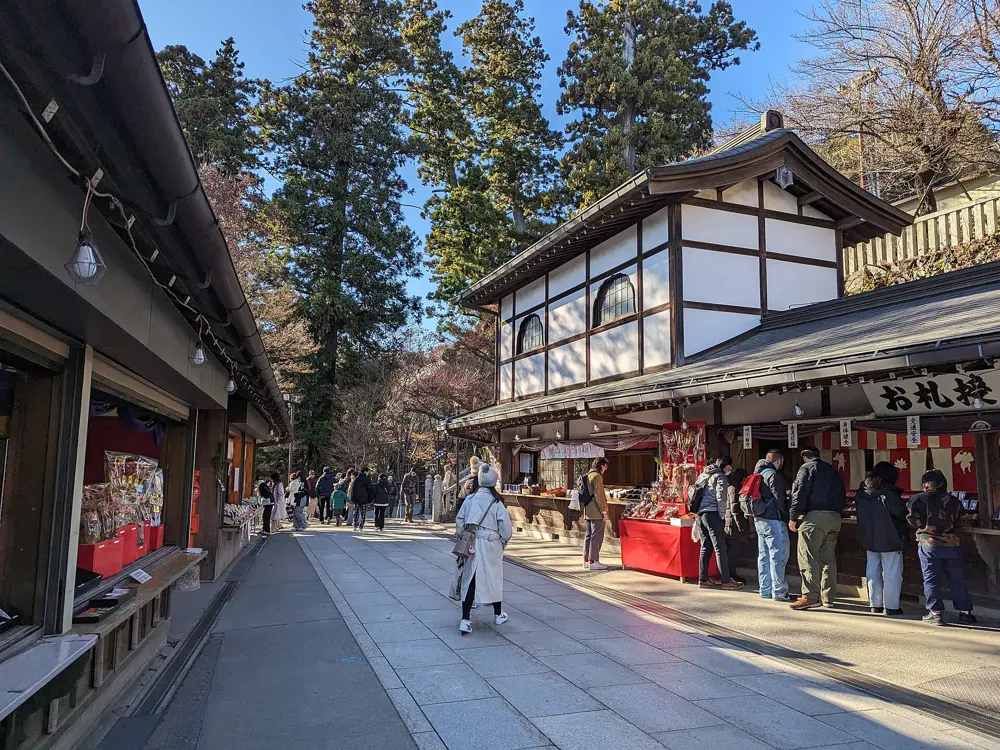
Mount Fuji above layered green mountains, seen from Mount Takao

Photos: Asteiner (CC BY-SA 3.0), Syced (CC0), Syced (CC0), Tobihino1977 (CC0)

Distance
6 km on Trail 1; 17.2 km to Jinba
Summit
599 m
Time
About 90 minutes up Trail 1
From Shinjuku
About 50 minutes by train

Why go

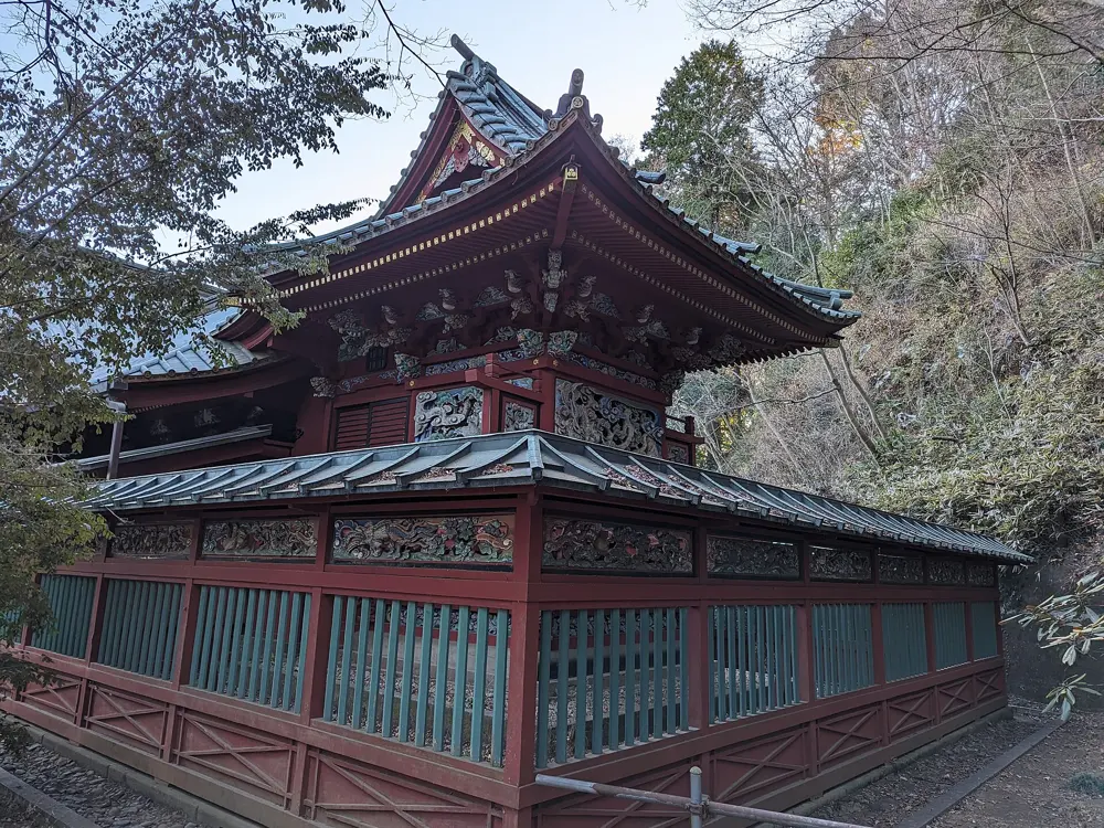
Mount Takao is Tokyo's mountain, under an hour from Shinjuku, and on a clear day the view from its summit stretches to Fuji. It is forested, busy and full of character: a temple where people pray to the tengu, the mountain spirits, a 500-year-old cedar with roots shaped like an octopus, and a choice of trails. For a real day out, the ridge beyond the summit continues west to Mount Jinba.

The route

Trail 1, the main route, is broad and mostly paved and passes the main sights: the Takosugi cedar, the top stations of the cable car and chairlift, and Yakuoin temple, about 20 minutes below the summit. The other numbered trails are narrower, unpaved and much quieter. From the summit at 599 m, the ridge runs on over Shiroyama, 670 m, Kagenobu, 727 m, and Dosho, 731 m, to Mount Jinba at 855 m. From Takaosanguchi Station to the bus stop below Jinba is 17.2 km with 665 m of climbing.

When to go

Takao can be walked all year. Autumn is the most popular season, with the colours peaking in the second half of November. Weekends are very crowded, so go on a weekday if you can.

Getting there

Keio limited express trains run from Shinjuku to Takaosanguchi in about 50 minutes, every 20 minutes or so. From Jinba, the Nishi Tokyo bus from the Jinba Kogen Shita stop runs to JR Takao Station in about 36 minutes, but only hourly.

Permits and booking

No permit is needed. The cable car and the chairlift each cost 490 yen one way and take you about halfway up.

How hard it is

Trail 1 is an easy walk of about 90 minutes from the base, or half that if you ride up. The Jinba ridge is a full day of up and down on forest paths; allow up to six hours.

Where to sleep

Most people walk Takao as a day trip from Tokyo. At the foot of the mountain, Keio Takaosan Onsen Gokurakuyu has indoor and outdoor hot spring baths for after the walk.

Tips

  • Start as early as you can, especially at weekends, when the mountain is very crowded.
  • Check the bus times from Jinba Kogen Shita before you set off along the ridge.

Sources

Distances, heights, seasons and permit rules were checked against these pages. Rules change, so check the park or trail authority before you go.