Rungs Labs

Rungs Pilgrimage · Climbing · Europe

The 10 Best Places for Rock Climbing in Europe

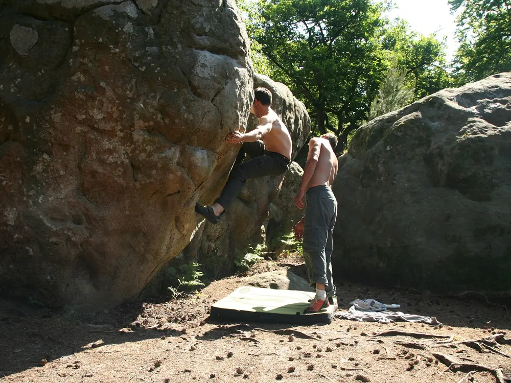
Fontainebleau, Seine-et-Marne, France. Photo: Amada44 (Public domain)

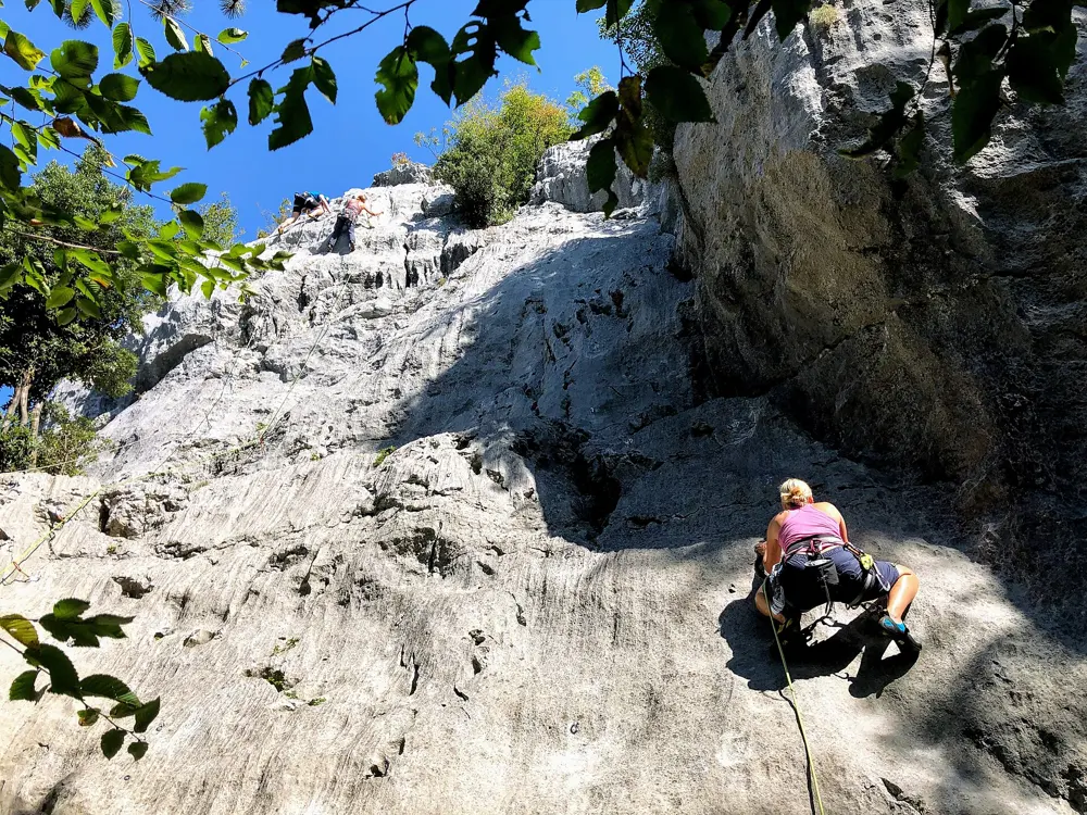
Europe is where sport climbing and modern bouldering began, and it still has more good rock within a day's travel than anywhere else. These ten take in the sandstone boulders of Fontainebleau, the limestone of the Verdon, the Frankenjura, Siurana, El Chorro, Arco, Paklenica and Kalymnos, the dolomite towers of the Italian Alps and the sea granite of Lofoten above the Arctic Circle. The UK and Russia have lists of their own.

For each one you get the rock, the classic climbs and grades, the best season, how to get there, the permits, fees, closures and access rules, how hard it is and where climbers stay. Every fact comes from park authorities, tourism boards, climbing bodies, guidebooks or the other pages linked at the bottom.

Updated 2026-10-19

  1. 01FontainebleauSeine-et-Marne, France
  2. 02KalymnosDodecanese, Greece
  3. 03The DolomitesSouth Tyrol, Trentino and Veneto, Italy
  4. 04The Gorges du VerdonAlpes-de-Haute-Provence and Var, France
  5. 05The FrankenjuraFranconian Switzerland, Bavaria, Germany
  6. 06SiuranaPriorat, Tarragona, Catalonia, Spain
  7. 07El ChorroMálaga, Andalusia, Spain
  8. 08LofotenNordland, Norway
  9. 09PaklenicaVelebit, Zadar County, Croatia
  10. 10Arco and the Sarca ValleyGarda Trentino, Trentino, Italy
01 / 10

Fontainebleau

Seine-et-Marne, France
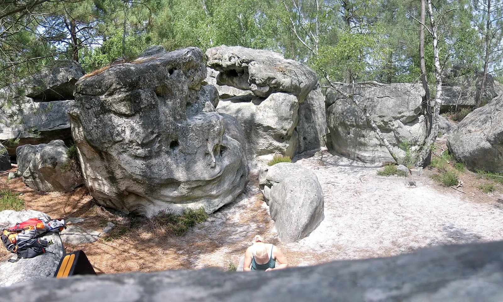
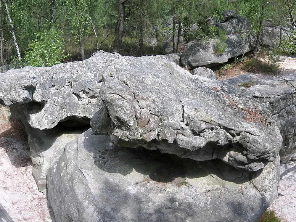
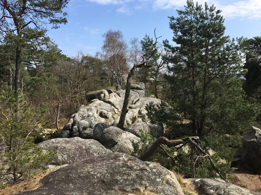
Rounded sandstone boulders on white sand among pines in the Fontainebleau forest

Photos: Amada44 (Public domain), Jerome Bon from Paris, France (CC BY 2.0), Amada44 (Public domain), Protolanguage17 (CC BY-SA 4.0)

Rock
Oligocene sandstone, boulders rarely over 7 m
Style
Bouldering on colour-coded circuits
Circuits
180 authorised circuits on 56 sites
Best season
Cold, dry days from late October to mid-March

Why go

This is where bouldering grew up and where the Font grade began. The ONF counts about 30,000 sandstone boulders in the forest south of Paris and some 4 million climbing visits a year. The first painted circuit appeared at Cuvier Rempart in 1947.

The route

Bas Cuvier, between Fontainebleau and Barbizon, is the old heart of Bleau, with circuits from orange (AD+) to white (ED+). La Marie-Rose, a 6a wall on slopers first climbed by René Ferlet, is the problem everyone queues for, and Le Carnage (7b+) is the classic roof. The Gorges d'Apremont, painted from 1952, have classics such as Le Croque-Mitaine (5+) and Le Mur des Lamentations (7a). Franchard Isatis is the third great sector. Circuits follow painted numbers and arrows, and the colour gives the adjectival grade: yellow PD, orange AD, blue D, red TD, black or white ED.

When to go

Friction is best on cold, dry days, so most climbers come between late October and mid-March, with spring and autumn as the milder choice. Warm, humid weather makes the rock greasy.

Getting there

Trains on Ligne R from Paris Gare de Lyon reach Fontainebleau-Avon in about 47 minutes and Bois-le-Roi in about 42. From Fontainebleau-Avon, bus 21 runs to Barbizon Cimetière in about 20 minutes, a 20 to 25 minute walk from Bas Cuvier and 15 minutes from Apremont. Drivers park at the Carrefour de l'Épine for Bas Cuvier.

Permits and booking

No permit or fee is needed. Stay on the marked circuits, and respect ONF bans such as the 2023 climbing closure on the north side of the Restant du Long Rocher, which protects rare mosses. Fire and sleeping in the forest are not allowed. A fire that began on 12 July 2026 burned about 2,000 ha, and 80 percent of the massif reopened on 22 August. As of 1 September most of the Trois Pignons, Cul de Chien and Roche aux Sabots stayed closed, along with parts of Apremont (Envers, Est, Solitude, Sully), while Cuvier, Franchard and the Éléphant were open. Check the ONF map.

How hard it is

Font grades feel stiff, and circuits mix slab, mantel and slopers on rounded, sandy rock. Landings are sand and roots, so bring a pad and a spotter. Never climb wet sandstone: it stays weak inside after the surface dries.

Where to sleep

Fontainebleau town and Bois-le-Roi have hotels and gîtes. Fontainebl'hostel at La Chapelle-la-Reine, 12 km from Fontainebleau, opens all year and is a 35 minute walk from the Éléphant.

Tips

  • Wipe your shoes on a rag before every attempt, use little chalk, and brush it off afterwards with a soft brush, never a wire one.
  • Lift your pad rather than dragging it, since the ground around popular boulders is eroding.
02 / 10

Kalymnos

Dodecanese, Greece

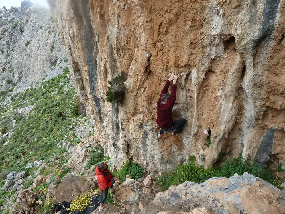
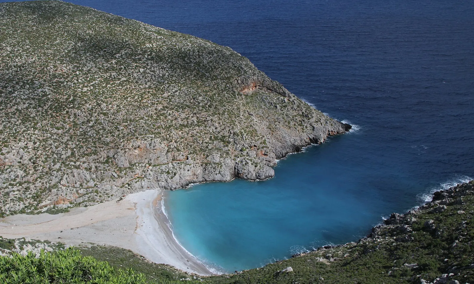
A bay with a pale beach below the hills of Kalymnos

Photos: alpguide (CC BY-SA 2.0), alpguide (CC BY-SA 2.0), alpguide (CC BY-SA 2.0), alpguide (CC BY-SA 2.0)

Rock
Limestone, grey slabs and steep tufas
Style
Sport climbing, mostly single pitch
Routes
4,216 sport routes in the 2025 guidebook
Best season
October, then April and May

Why go

Kalymnos is a small island off Kos where the limestone above the west coast hangs in caves full of tufas. Andrea Di Bari saw its potential in 1996, and the 2025 guidebook lists 4,216 sport routes on 61 crags, most of them within walking distance of Masouri.

The route

Grande Grotta, the cave above Masouri, is about 20 minutes on foot from the Philoxenia Hotel. Aegialis (7c, French grades) climbs its tufas, with DNA (7a) and Ivi (7a+) nearby. At Odyssey, Adam Ondra made the first ascent of Los Revolucionarios (9a) in 2009, the first route of that grade in Greece. Spartacus has The Siege of Thermopylae (6c+) and Daniboy (8a), and on Telendos, across the strait, Typhoon (7c) climbs the Crystal Cave.

When to go

October is the peak month, then April and May. Tufas can seep in February and March, and much of Masouri closes from mid-November to late March. In summer, start around 6 am. The municipality's International Kalymnos Climbing Festival last ran on 16 to 19 October 2025.

Getting there

Most climbers fly to Kos, take a taxi about 7 km to Mastichari and cross to Pothia by ferry in about half an hour, then take a taxi to Masouri. High winds can cancel the crossing. Sky Express flies from Athens to the island's airport, 7.2 km from Masouri. Scooters reach the further crags, and since 2015 you need a motorbike licence to rent one.
Permits and booking

None of the guides we used mention a climbing permit or fee, but 2026 brought new rules. On 10 April the municipality temporarily closed 10 crags for rebolting, and new routes are banned for now. Close the goat fence gates on the approaches, and never top rope directly through the anchors.

How hard it is

On 27 March 2026 a climber died on St. Savvas (7b+) at Jurassic Park when the anchor bolts and the bolt below failed. Rebolt Kalymnos, a volunteer group, asks climbers to avoid unrebolted routes bolted before 2005, and had re-equipped almost 400 routes with titanium by September 2026. Grande Grotta is steep, pumpy tufa climbing, tufas can break, so wear a helmet, and humid days make everything feel harder.

Where to sleep

Masouri, Myrties and Armeos are the usual bases, with crags within walking distance.

Tips

  • Bring an 80 m rope, which reaches about 99 percent of routes, and at least 16 quickdraws. Some routes on Telendos need 100 m.
  • Check Bolt Beta before you climb to see which routes have modern bolts, and report bad ones there.
03 / 10

The Dolomites

South Tyrol, Trentino and Veneto, Italy

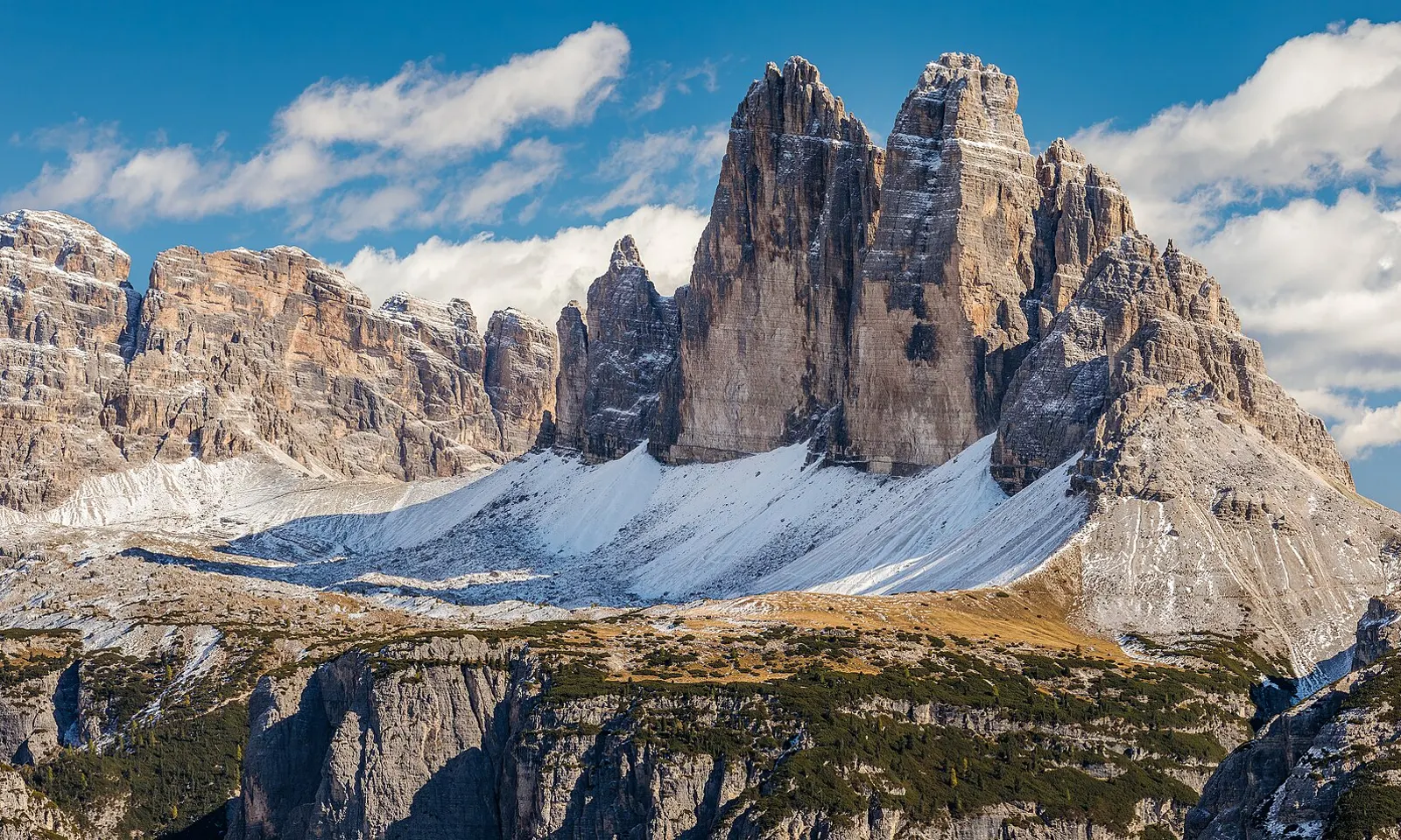
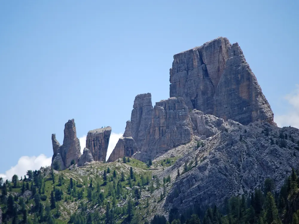
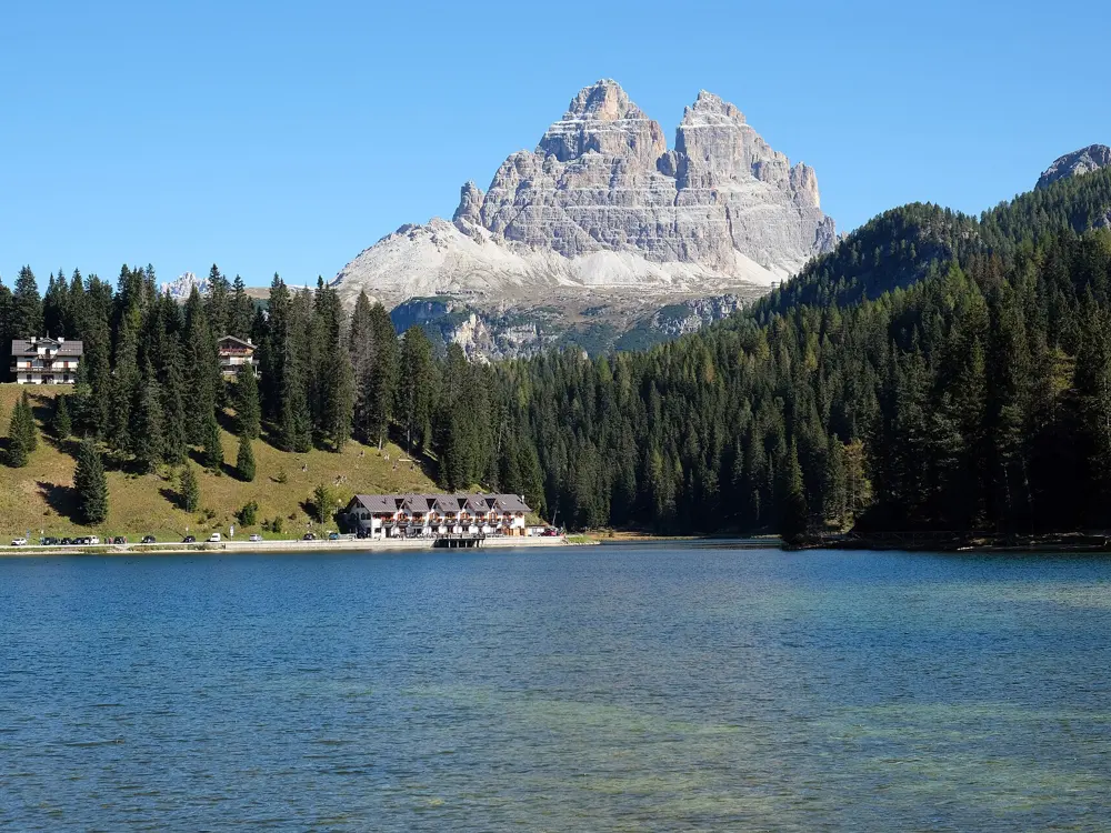
The Tre Cime di Lavaredo and the Croda dei Toni above early snow, seen from Monte Specie

Photos: Ximonic (Simo Räsänen) (CC BY-SA 4.0), Clemens Stockner (CC BY-SA 4.0), Svíčková (CC BY-SA 3.0), kallerna (CC BY-SA 4.0)

Rock
Dolomite, a pale Triassic carbonate rock
Style
Long multi-pitch on fixed pegs, plus bolted cragging
Grades
UIAA, from IV+ classics to VII and harder
Best season
Mid-June to late September, while the huts are open

Why go

Pale dolomite towers rise straight out of high meadows here, a UNESCO World Heritage Site since 26 June 2009. Free climbing goes back to 1887, when 17-year-old Georg Winkler soloed a Vajolet tower. Roads cross the passes and huts sit under the walls, so long routes start from short approaches.

The route

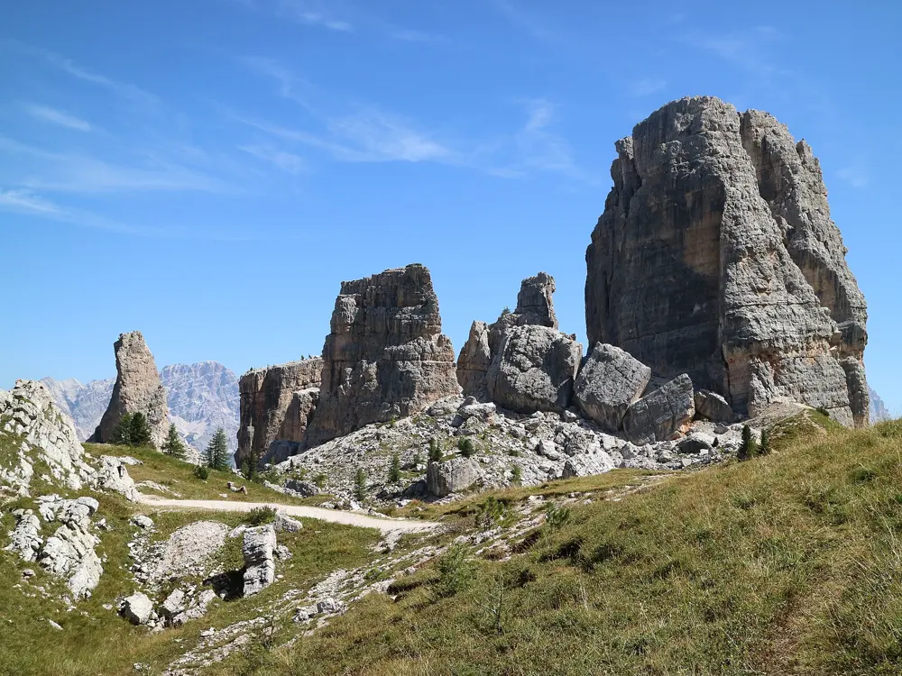
On Cima Grande di Lavaredo, the Spigolo Dibona climbs about 500 m in 17 pitches at UIAA IV+. The Comici on the north face is VI with aid, VII free. Above Sella Pass, the First Sella Tower has the Steger (IV+), the Tissi (VI+, 7 pitches) and Delenda Carthago (VII, 6 pitches). The Marmolada's south face holds Don Quixote, about 750 m in 20 pitches with obligatory VI, and the Vinatzer on Punta Rocca, about 800 m in 28 pitches. On the Vajolet towers, the Piaz arete on Torre Delago is five exposed pitches at IV+. Cinque Torri, whose Torre Grande reaches 2,361 m, has routes from grade 3 to 8b.

When to go

Huts mostly open from mid-June to late September; Rifugio Re Alberto lists 20 June to 20 September. July and August are surest, though weather changes fast even then.

Getting there

The Cortina Express bus takes about 2 hours 10 minutes from Venice airport to Cortina. A chairlift rises to Cinque Torri from Bai de Dones, on the road to Passo Falzarego. Sella Pass, between Val Gardena and Val di Fassa, is under an hour from the First Tower routes. A 6 km toll road climbs to Rifugio Auronzo under the Tre Cime. For the Marmolada, path 610 leads from Malga Ciapela to Rifugio Falier in about 1 hour 15 minutes.

Permits and booking

No climbing permit is needed and guides are optional. The Tre Cime road, open since 23 May 2026, needs an online booking: 40 euros a car for 12 hours, with the plate entered by 23:59 the day before. After the July 2022 glacier collapse, Canazei closed the Marmolada's north side; in August 2022 Punta Penia reopened only by the west ridge via ferrata. No 2026 ordinance was found; check Canazei notices before going high.

How hard it is

Classic routes use the UIAA scale. Popular lines are polished, which can add a full grade. Belays are often fixed pegs, descents usually abseils, and walls reach 3,343 m on the Marmolada.

Where to sleep

Rifugio Auronzo has 99 places under the Tre Cime. Re Alberto sits at the foot of the Vajolet towers, Scoiattoli beside Cinque Torri and Falier below the Marmolada. Dorm half board runs about 50 to 60 euros.

Tips

  • Book the Tre Cime road early: July and August weekend slots sell out quickly.
  • Tap water above 2,000 m is often not drinkable, so carry your own.
04 / 10

The Gorges du Verdon

Alpes-de-Haute-Provence and Var, France

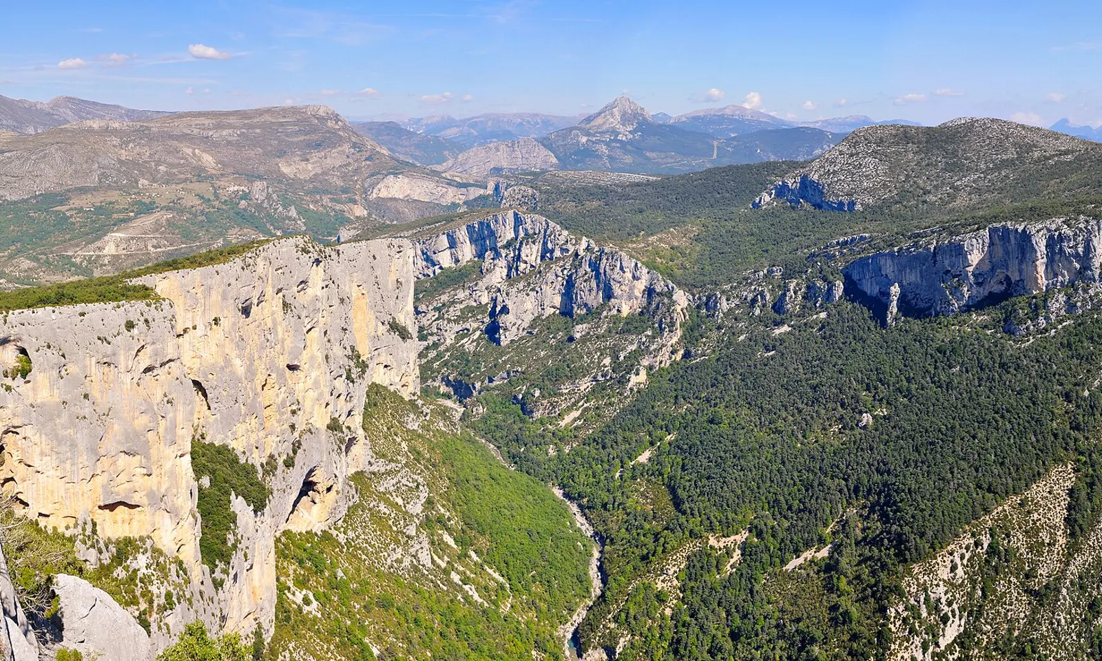
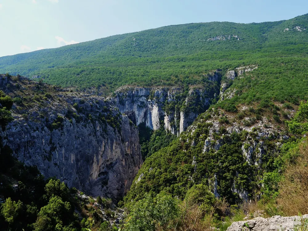
The Escalès cliff above the Gorges du Verdon, seen from the Route des Crêtes

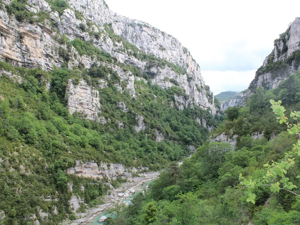
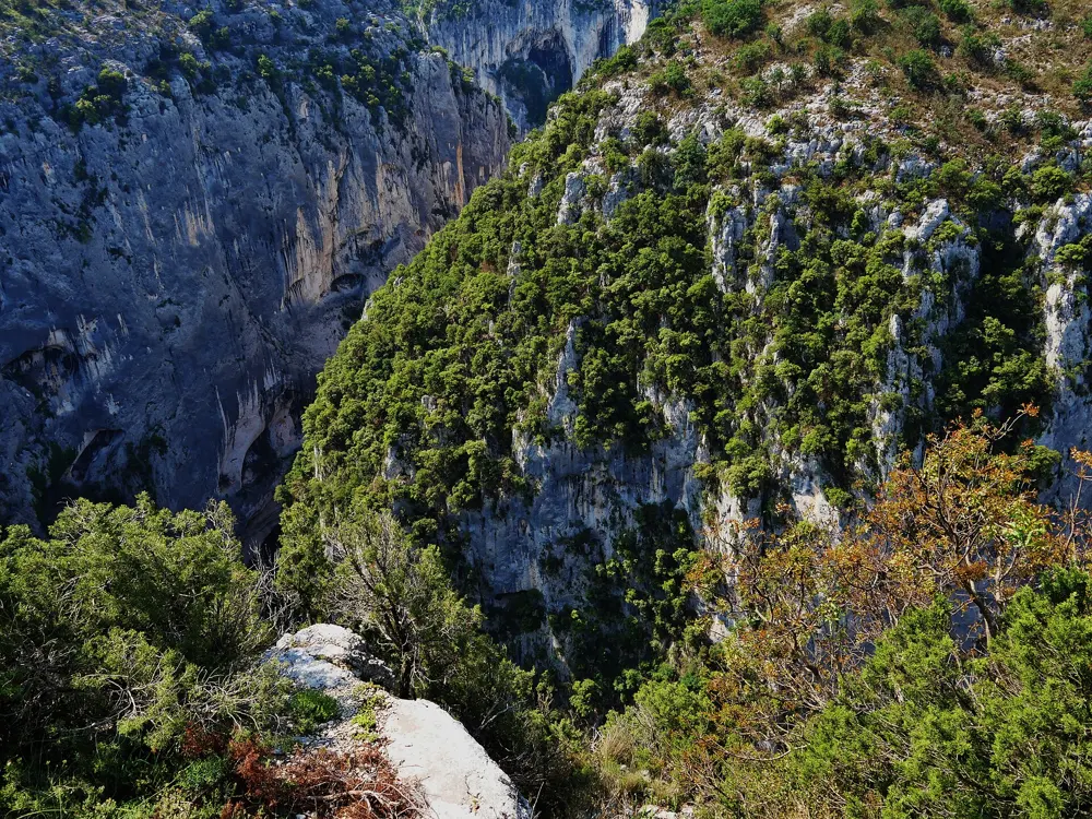
Photos: Tobi 87 (CC BY-SA 3.0), Chabe01 (CC BY-SA 4.0), Zairon (CC BY 4.0), Zairon (CC BY 4.0)

Rock
Limestone, in a gorge up to 700 m deep
Style
Multi-pitch sport and trad, mostly reached by abseil
Routes
More than 1,500
Best season
Late spring to autumn

Why go

The Verdon cuts a limestone canyon up to 700 m deep between Castellane and Moustiers-Sainte-Marie, and its walls hold more than 1,500 routes. Climbing began here at the end of the 1960s with François Guillot, Patrick Cordier and Bernard Gorgeon, and Patrick Edlinger's film La vie au bout des doigts made the gorge famous well beyond France. The Escalès, the great wall below the Route des Crêtes, is the one everyone comes for. In April 2022 Seb Bouin climbed DNA here, only the second route of 9c in the world.

The route

La Demande, opened in the late 1960s, was the first route on the Escalès and is still its longest, at about 350 m. Mountain Project grades it 6a+ over 12 pitches of trad climbing, much of it in a long chimney and crack system. La Ula (6b+, 11 pitches, trad) follows an unbroken crack and corner line high on the wall. For bolted climbing, Dalles Grises (6a, 6 pitches), Afin Que Nul Ne Meure (6a, 5 pitches), the Arête du Belvédère (6b, 9 pitches) and Série Limitée (7a, 8 pitches) are classics. Multi-pitch routes run from 100 to 350 m. Away from the big walls, single-pitch sectors such as the Col d'Ayen, Félines and Chasteuil start at 3b.

When to go

Mountain Project calls late spring to autumn the best time, and the gorge is not a winter venue. Afternoon thunderstorms are common in August and September. Many walls go into shade by mid-afternoon, so a late start makes summer climbing workable. The vultures' breeding season overlaps the climbing season, which matters for route choice.

Getting there

By car the gorge is just over two hours from Cannes or from Marseille. Most climbers base themselves in La Palud-sur-Verdon and drive the D23, the Route des Crêtes, to the top of the Escalès; part of the road is one-way, so take the right exit from the village or some areas cannot be reached. Without a car, regional buses run from Marseille to Castellane in about three and a half hours, according to Frommers.

Permits and booking

No climbing permit or fee is needed. Some routes pass close to griffon vulture nests, and each year the Parc naturel régional du Verdon publishes which routes to avoid, alongside the LPO's list of sensitive routes. The park's 2026 walk sheets give the vultures' sensitive period as 1 January to 31 August, though some say 1 February to 30 June, and ask climbers not to set up highlines. Check the current list before you abseil in.

How hard it is

Most routes start with an abseil from the rim, so once you are down, the easiest way out is up. The climbing is technical and exposed. On La Demande the protection has improved over the years, but UKClimbing still suggests nuts and cams up to 2 inches, and on La Ula gear to 3 inches unless you are happy with long runouts between bolts.

Where to sleep

La Palud-sur-Verdon and Rougon are the climbers' villages, and most sectors are within ten minutes' drive of them on the right bank. There is a campsite on the east side of La Palud, and the village has gîtes to rent.

Tips

  • Buy the local topo at the tourist office in La Palud-sur-Verdon or Castellane.
  • In August and September start early: afternoon thunderstorms are common, and retreat from the middle of a wall is hard.
05 / 10

The Frankenjura

Franconian Switzerland, Bavaria, Germany

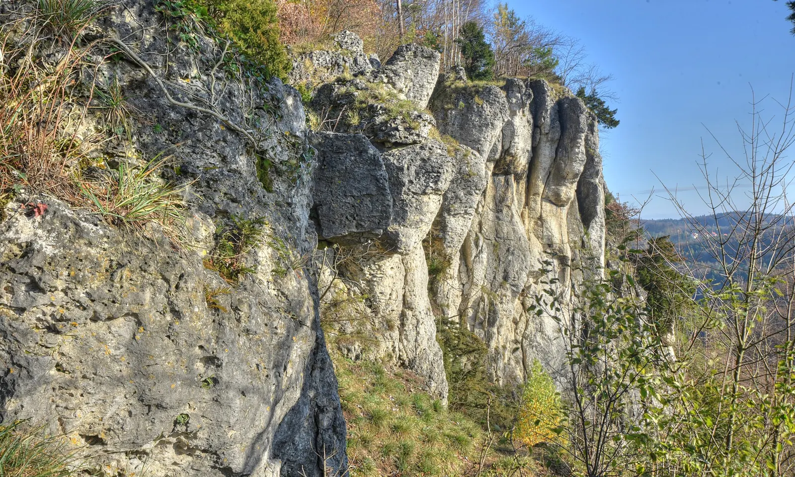
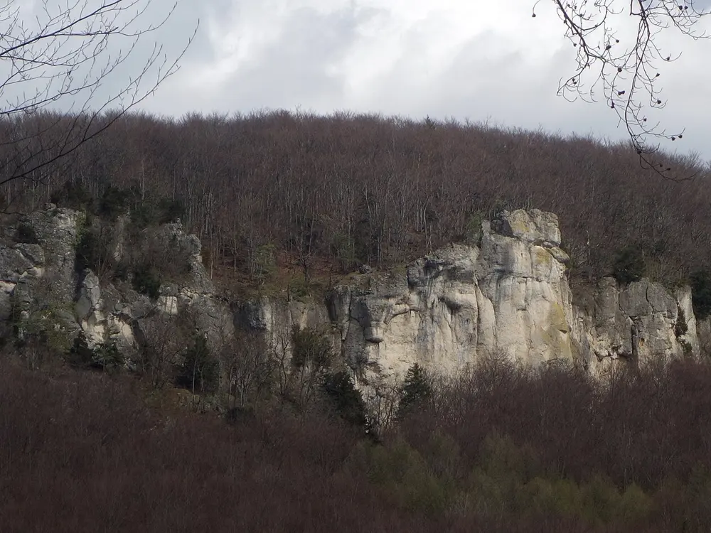
Pale limestone pinnacles of the Röthelfels above a wooded valley in the Frankenjura

Photos: Pegasus2 (CC BY-SA 4.0), Spike (CC BY-SA 4.0), Ermell (CC BY-SA 4.0), Reinhold Möller Ermell (CC BY-SA 4.0)

Rock
Limestone and dolomite of the White Jurassic
Style
Single-pitch sport climbing on pockets
Routes
About 9,000 on more than 900 crags
Best season
Autumn, though you can climb all year

Why go

The northern Frankenjura, between Bamberg, Bayreuth, Erlangen and Amberg, is Germany's biggest karst landscape and its great sport climbing area. The German Alpine Club counts about 9,000 routes on more than 900 crags and towers. It is often called the birthplace of redpoint climbing: Kurt Albert introduced the Rotpunkt idea here, and it started a climbing boom. Wolfgang Güllich then climbed Wallstreet in 1987, one of the first routes of 8c, and on 14 September 1991 Action Directe, the first route in the world with a consensus grade of 9a.

The route

Most crags are short limestone walls and towers in the woods, spread over valleys such as the Trubachtal, Wiesenttal and Püttlachtal and the Hersbrucker Alb. The Weißenstein near Neuhaus an der Pegnitz is a good first stop: 50 routes of 10 to 20 m, 24 of them up to UIAA 6, two minutes from the road, including Eieruhr (6+) and Kurt Albert's Dampfhammer (8, 1979). The Röthelfels near Urspring is the largest crag, with routes from UIAA 2 to 9+; Mountain Project's top classic there is Devil's Crack (5.10c). Wallstreet climbs the Krottenseer Turm, and Action Directe, about 20 hard moves up a steep wall at the Waldkopf in the Krottenseer Forst, has had only a few dozen ascents.

When to go

You can climb all year. Autumn brings the best conditions, shady forest crags suit summer, and south-facing walls stay climbable in winter. Some crags close each year, mostly from January to July, while peregrine falcons and eagle owls nest.

Getting there

Fly or take the train to Nuremberg, then a train to Pegnitz or Ebermannstadt, where buses run to the villages. The crags are spread over a large area, so most climbers bring a car. For the Weißenstein, leave the A9 at Plech.

Permits and booking

No permit or fee is needed, but every crag sits in a climbing concept. Zone 1 rocks are closed to climbing, zone 2 allows climbing only on existing routes to the lower-off, and zone 3 allows new routes outside vegetation zones. Zones are signed at the crags, and current closures are listed crag by crag in the DAV Felsinfo. Do not top out, except on the few towers where it is allowed, park only in signed places, never block farm tracks, and light no fires.

How hard it is

Grades use the UIAA scale. The rock is soft and easily damaged, and quality varies from crag to crag: Mountain Project describes the Röthelfels as ranging from bullet hard to chossy and suggests a helmet and some nuts. The south of the area is known for technical vertical walls, the north for steeper climbing that needs power and finger strength.

Where to sleep

There are apartments in most villages and hundreds of campsites, and BedAndBoulder Frankenjura is run by climbers. The youth hostel in Pottenstein has 168 beds, its own climbing wall for wet days, and is 17 km from Pegnitz station.

Tips

  • Brush holds after climbing with a soft brush, never a steel one, and clean your shoes before you start.
  • Check the DAV Felsinfo for the crag you plan to visit, since bird closures are adjusted during the season.
06 / 10

Siurana

Priorat, Tarragona, Catalonia, Spain

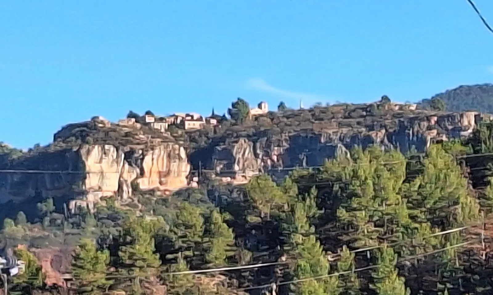
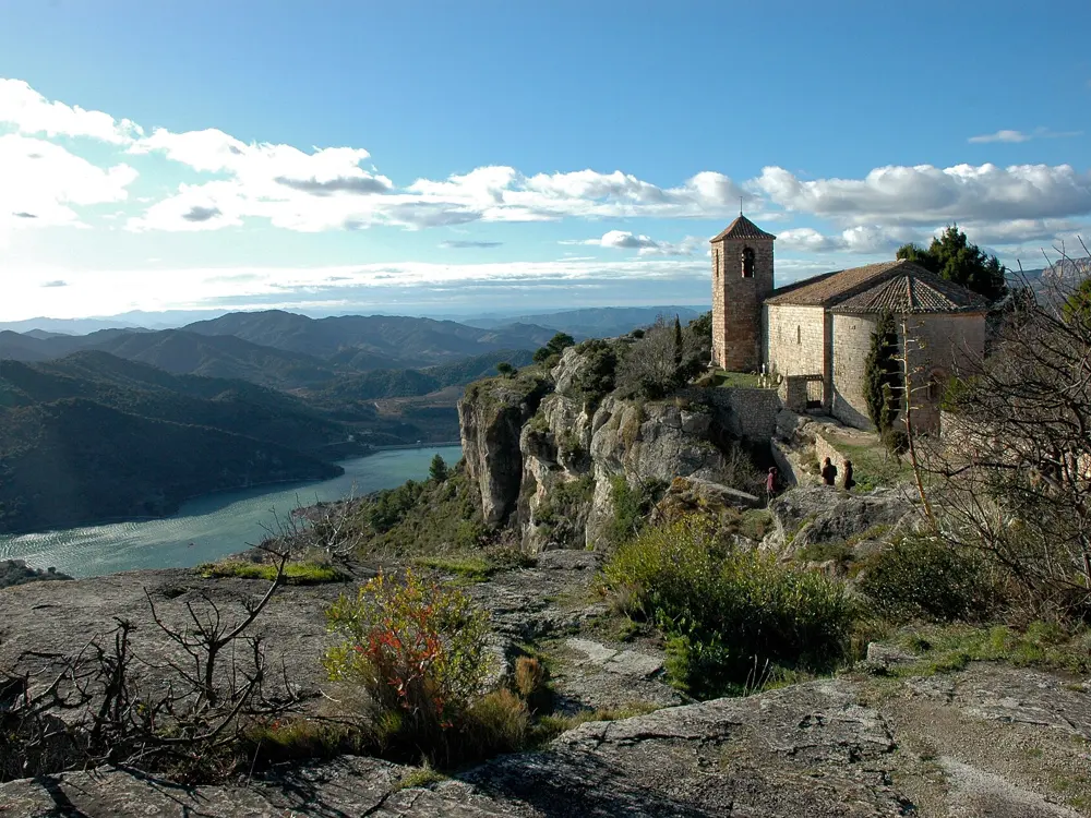
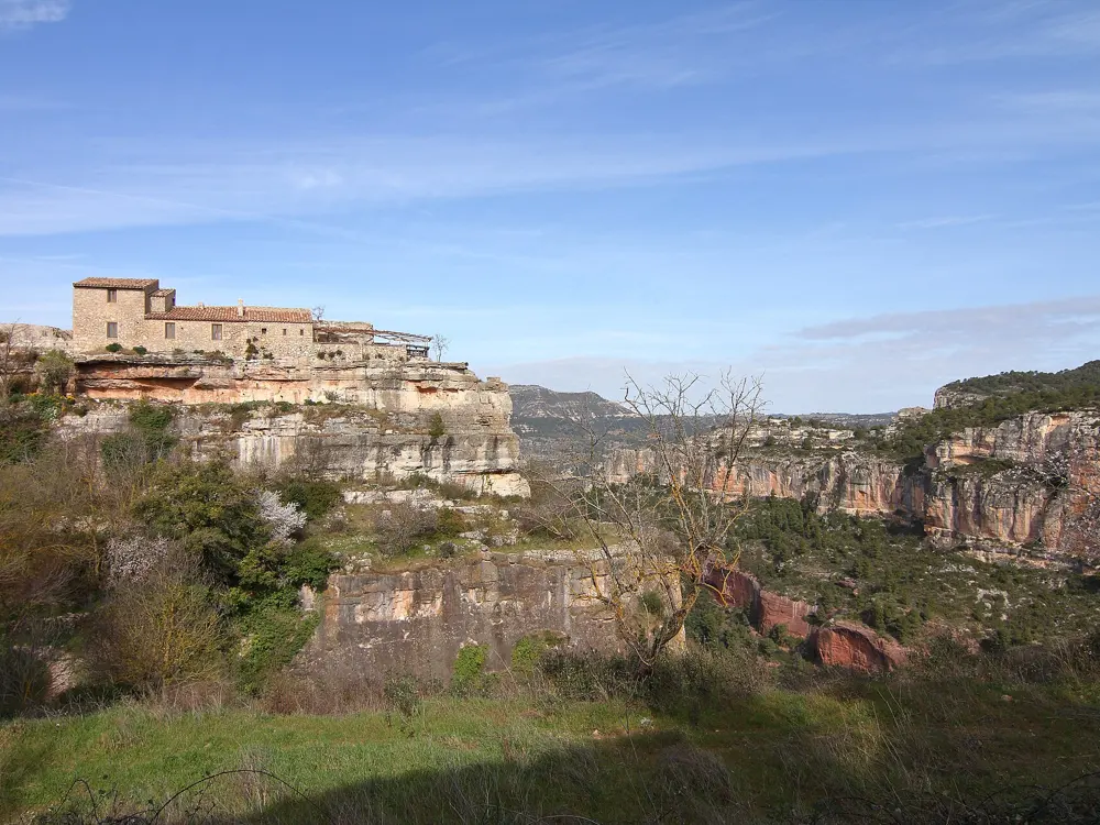
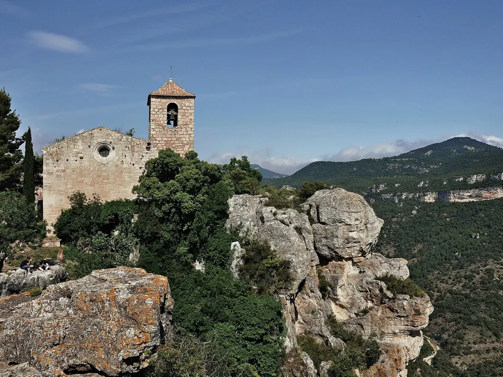
The village of Siurana on top of its orange limestone cliff above pine forest

Photos: Pere López Brosa (CC BY-SA 4.0), Lohen11 - Josep Renalias (CC BY-SA 3.0), Malopez 21 (CC BY-SA 4.0), Alberto-g-rovi (CC BY-SA 3.0)

Rock
Limestone with pockets and sharp edges
Style
Single-pitch sport climbing
Crags
About 30, from short steep walls to 35 m slabs
Best season
November to March

Why go

Siurana is a stone village on the edge of a limestone cliff in the Prades mountains, above vineyards and olive groves, and its walls hold some of the most famous sport routes in the world. La Rambla, at the El Pati crag, began in 1994 as Alexander Huber's 35 m route of 8c+. Dani Andrada extended the bolts to 41 m, and on 8 March 2003 Ramón Julián Puigblanque climbed it at 9a+. Adam Ondra made the sixth ascent in 2008, and on 26 February 2017 Margo Hayes climbed it, the first confirmed 9a+ by a woman.

The route

There are about 30 crags, some around the village and others down in the valley. Most of the rock is vertical, with pockets and sharp edges, and the routes run from short, steep power climbs to 35 m slabs. L'Olla is the exception, with tufas. Mountain Project's classics include Mayling (5.11b), Viagraman (5.11c), Remena Nena and Delicatessan (both 5.12a), Rauxa (5.12b, two pitches climbed as one), Mandragora (5.12c) and L'Escamarla (5.13a). La Rambla is at El Pati.

When to go

Most of the cliffs face south, so Siurana is a winter destination and most climbers come between November and March. In summer the sun on the walls is unbearable, though climbers who know the area find shade.

Getting there

Fly to Barcelona or to Reus, which is about an hour closer, and hire a car. From Barcelona take the AP7 or C32 to Tarragona, then the T-11 and N-420 to the C242 towards Cornudella de Montsant. A small road signed for Siurana climbs about 8 km to the village.

Permits and booking

We found no climbing permit or fee. A natural park for the Prades mountains was due to start in mid 2026; Cornudella de Montsant, the municipality Siurana belongs to, had refused to join, and the Catalan government's secretary for ecological transition said in October 2025 that climbing near raptor nests should be regulated in the breeding season rather than banned. We found no such rule in force for Siurana. Respect any signs at the crags.

How hard it is

Mountain Project warns that the grades are stern next to holiday crags. Most climbing is vertical and technical, and the overhanging routes tend to be hard.

Where to sleep

Camping i Bungalow Siurana, on the road from Cornudella at the edge of the village, has pitches, wooden bungalows, hot showers, a restaurant and a pool, and is run by the climber Toni Arbones. The old Refugi in the village has reopened under the Centre Excursionista de Catalunya as a bar-restaurant and information point for the Montsant natural park, without beds for now. Cornudella de Montsant, below, has rooms.

Tips

  • Older Mountain Project reports say car camping was accepted at the castle car park; check before relying on it.
  • Parking in the village is limited: in 2017 the Plaça del Castell held about 40 cars, with a larger car park for about 200 about 500 m before the village.
07 / 10

El Chorro

Málaga, Andalusia, Spain

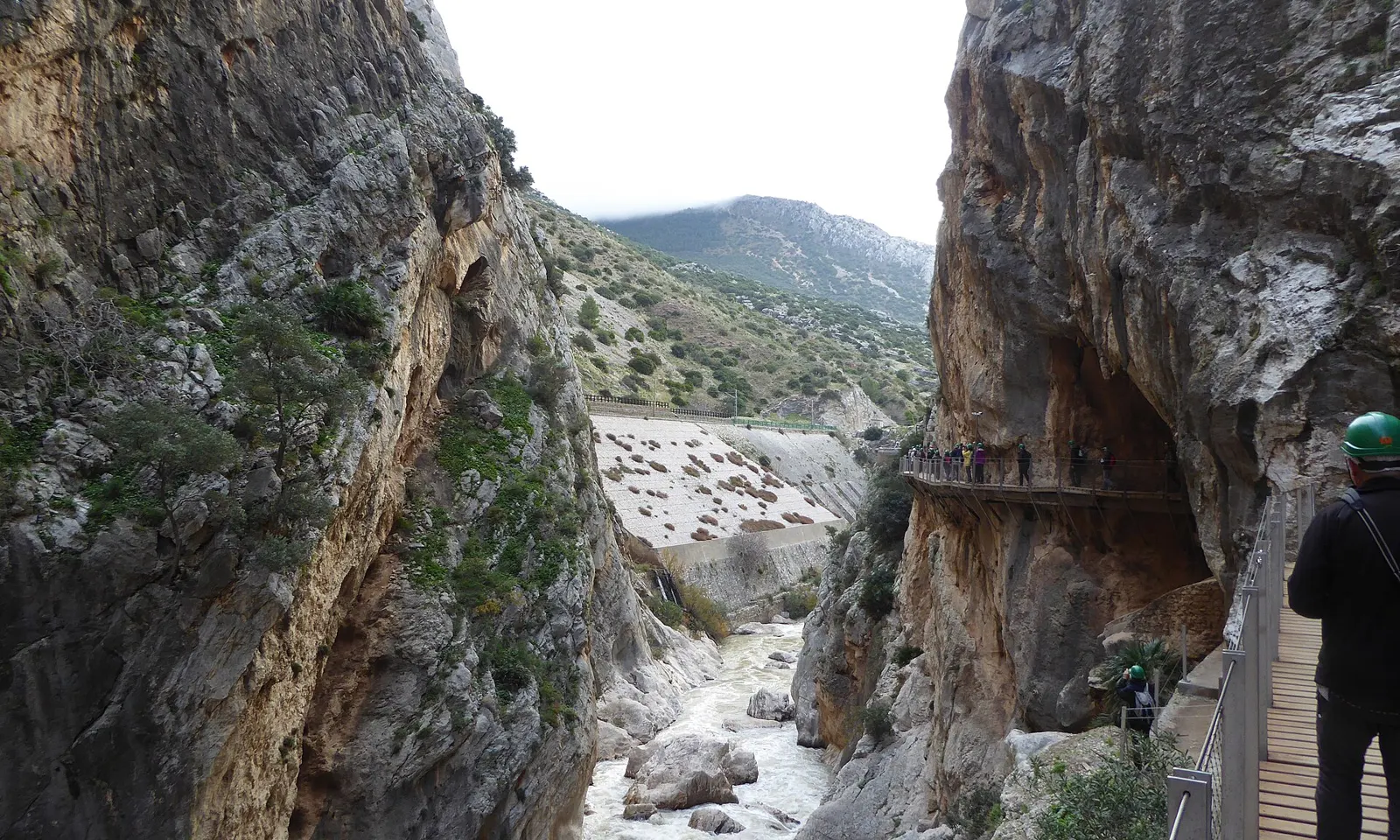
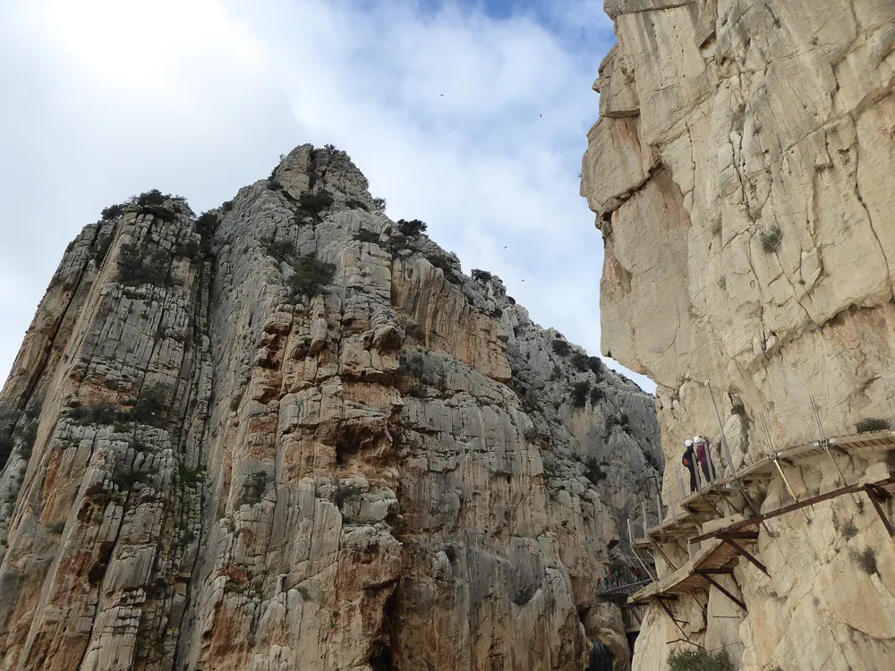
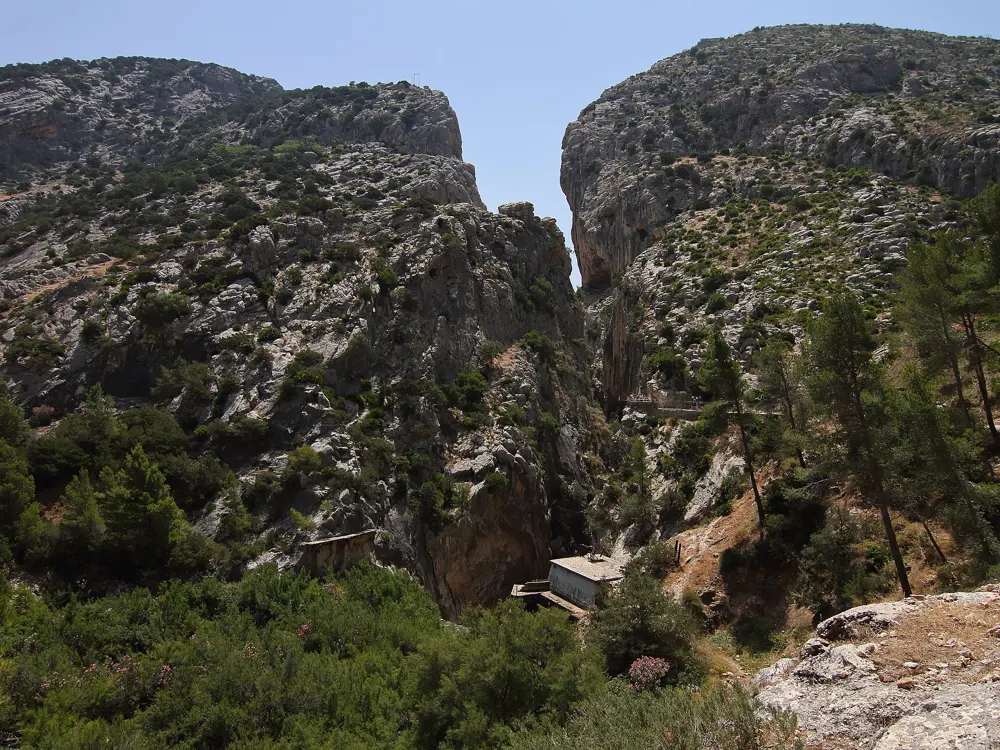
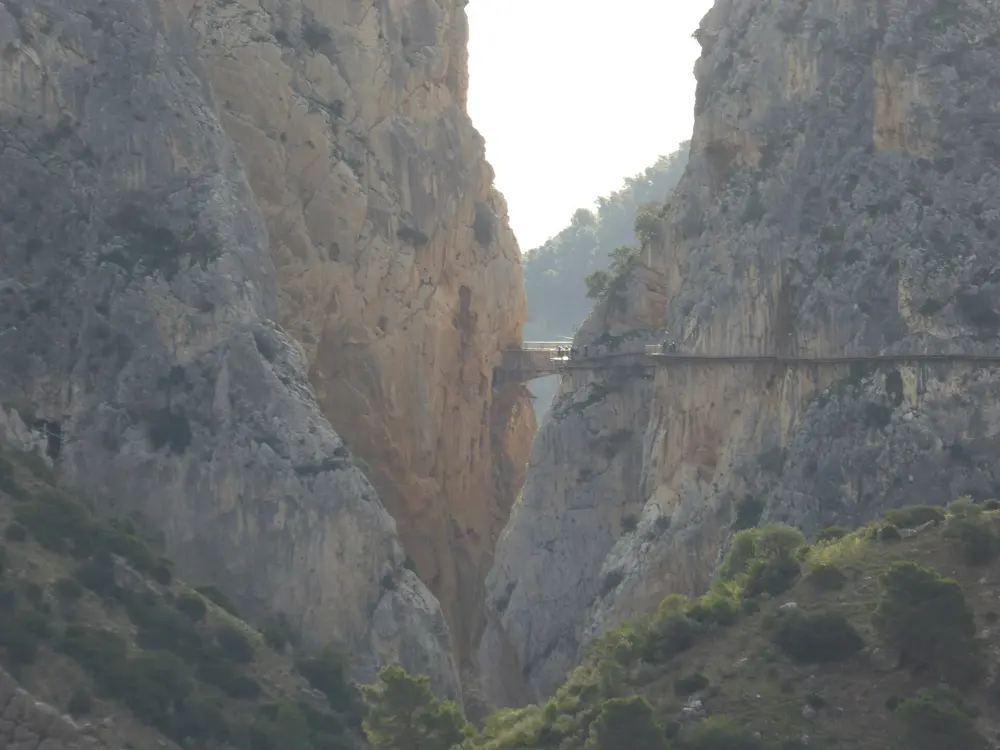
The Caminito del Rey walkway on the wall of the Desfiladero de los Gaitanes at El Chorro

Photos: Millars (CC BY-SA 4.0), Millars (CC BY-SA 4.0), Malopez 21 (CC BY-SA 4.0), Millars (CC BY-SA 4.0)

Rock
Pocketed limestone
Style
Sport climbing, single pitch and bolted multi-pitch
Biggest sectors
Frontales 231 routes, Desplomilandia 183, Makinodromo 155
Best season
Mid-October to early May

Why go

El Chorro sits about 50 km from Málaga at the mouth of the Desfiladero de los Gaitanes, a limestone gorge famous for the Caminito del Rey walkway. It was one of the first places in Europe to be developed for sport climbing, in the 1980s, and it is now one of the largest climbing areas in Andalusia, with bolted multi-pitch routes of up to ten pitches above the village and many sport crags around it.

The route

The Frontales, the big walls above the village, hold the long routes: Lluvia de Asteroides (5.10a, 8 pitches), Amptrax (5.10-, 8 pitches) and Estrella Polar on the Solarium (5.10c/d, 10 pitches). Poema de Roca (5.11d) is the famous single pitch there. In the gorge, Zeppelin (5.11c) climbs ten pitches. The Makinodromo, with Life is Sweet (5.11a), is steep and popular, and Desplomilandia, with 183 routes, is the place for shade. Escalera Árabe has 143 routes and Las Encantadas 56.

When to go

The best weather usually runs from mid-October to early May, with autumn and spring the best of it. Avoid June to mid-September, when inland temperatures can reach 40°C. In a heat wave, go to Desplomilandia for shade or El Torcal for height.

Getting there

Málaga airport has flights from much of Europe all year. Trains from Málaga María Zambrano run often to Álora and about once a day to El Chorro, for about 4 euros; from Álora, take a taxi or bus. By car it is about 45 minutes from Málaga. Many crags are within walking distance of the village, though not all.

Permits and booking

We found no climbing permit or fee. The Caminito del Rey, closed in 2000 and reopened in March 2015, now has a single entrance at the north end of the gorge and a strict daily limit, so booking on its official website is almost always needed. Climbers can no longer use it to reach the routes in the lower and upper gorge.

How hard it is

The limestone is very pocketed and not always sound, so knock on flakes before you pull on them. Most faces are vertical to slightly overhanging, with very steep routes at a few crags. Bolts are plentiful and routes rarely feel runout.

Where to sleep

The Climbing Lodge, The Olive Branch and Finca La Campana are climbers' places near the crags, and there are rentals such as Casa El Chorro, Cortijo Don Rodrigo and La Almona Chica. Álora, Ardales and the Abdalajís valley are nearby. Camping is possible, but Mountain Project notes that hostels and B&Bs cost nearly the same.

Tips

  • Mountain Project suggests carrying both the Rockfax guide and the local Málaga Rock Climbs guide, since each has errors.
  • Plan train days carefully, since only about one train a day stops at El Chorro.
08 / 10

Lofoten

Nordland, Norway

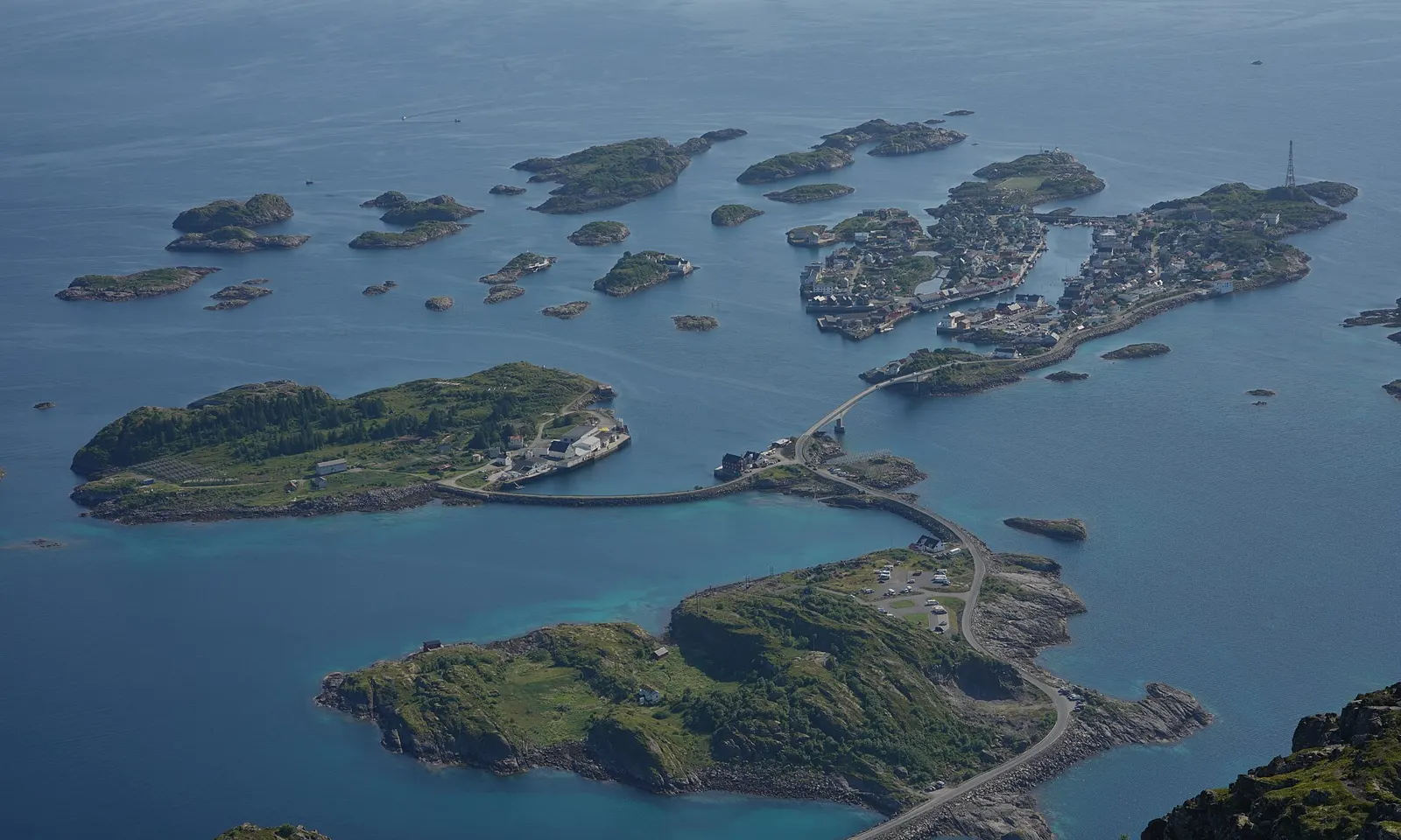
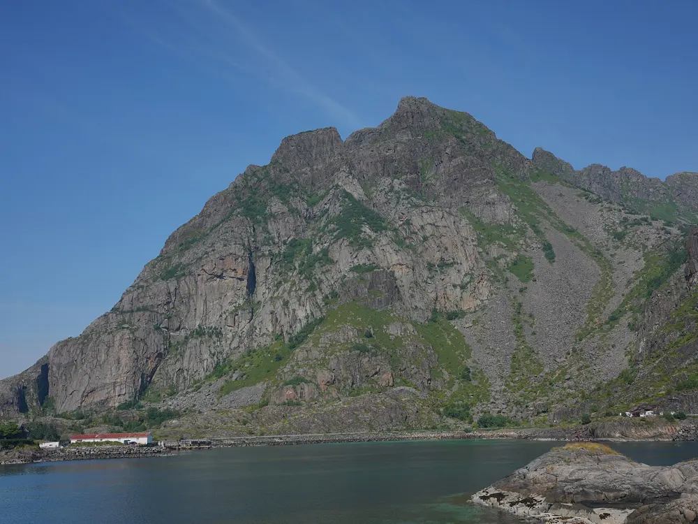
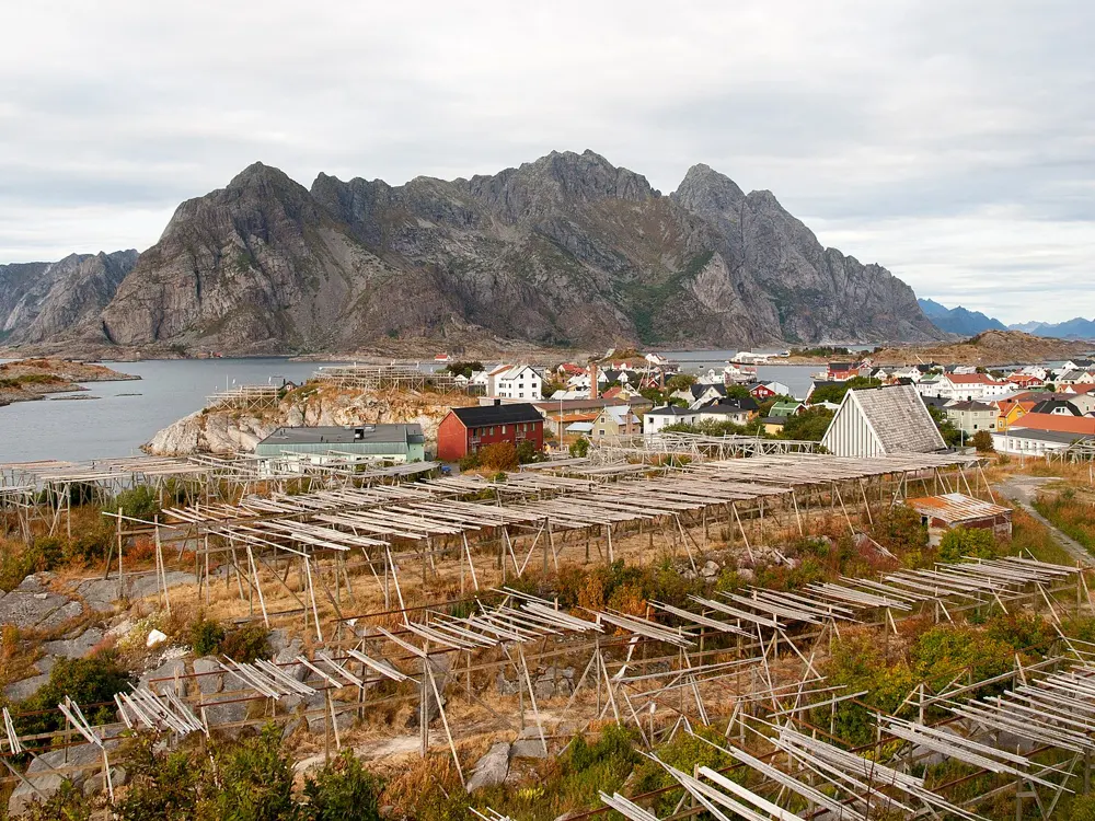
Henningsvær's islands and causeways in a blue sea, seen from Festvågtinden

Photos: Lukas Beck (CC BY 4.0), Sonia Marotta (CC BY-SA 2.0), Lukas Beck (CC BY 4.0), Christoph Strässler from Oberdorf BL, Schweiz (CC BY-SA 2.0)

Rock
Granite
Style
Trad, from single pitches to long multi-pitch
Midnight sun
About 28 May to 14 July
Best season
June to September

Why go

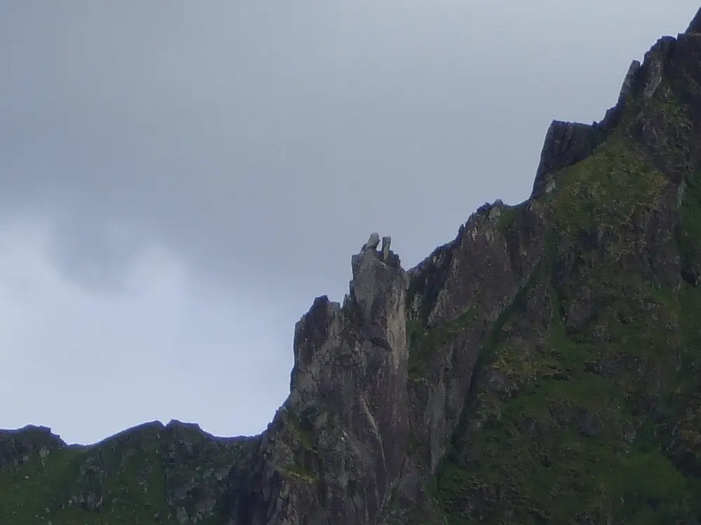
Lofoten is a chain of mountain islands off Norway's northern coast, north of the Arctic Circle, where granite walls rise straight out of the sea. The climbing is almost all trad, from short crags by the road to long free routes on Presten and serious alpine walls. In midsummer the sun never sets, and climbers around Henningsvær, the fishing village that is their base, climb at any hour.

The route

Vestpillaren on Presten, a granite face of 400 to 500 m above the sea near Henningsvær, is probably the best known route in Norway: a long line of corners and cracks graded 5.10 or Norwegian 6, of 12 to 14 pitches depending on the variation. Bare Blåbær above Djupfjord (5.8, 7 pitches) follows clean splitter cracks. Gandalf and Gollum (both about 5.8, 3 pitches) on the Gandalf wall are the usual first routes. Forsida (5.9, 5 pitches) climbs Svolværgeita, the granite tower above Svolvær, a trip of three to four hours. At Store Festvåg, Lundeklubben and Fire Forsøk are both 5.10b.

When to go

Summer is the season. From June to September average daily temperatures are 9 to 13°C and about 85 mm of rain falls each month. The midnight sun lasts from about 28 May to 14 July, so there is no need for a headlamp. Rain is common, but near constant wind dries the rock quickly.

Getting there

Svolvær airport, served by Widerøe, has flights via Bodø and in summer some direct from Oslo. Evenes (Harstad/Narvik) has bigger planes and more hire cars and is about 170 km from Svolvær, 2.5 to 3 hours by road. The car ferry from Bodø to Moskenes takes about 3.5 hours, and the Nordlandsekspressen passenger boat runs from Bodø to Svolvær. A car makes life much easier.

Permits and booking

No permit is needed to climb. Norway's right to roam lets you camp on uncultivated land at least 150 m from buildings or fences, but it does not let you park anywhere. Parking at the old camping spots at Kalle and Henningsvær costs 20 euros a day with no facilities, the free tent area near Henningsvær closed in August 2025, and Svolværgeita now has paid parking. Download the EasyPark app before you arrive.

How hard it is

Mountain Project compares the granite to Rocky Mountain National Park rather than Yosemite: solid in general, with the odd loose block, and clean on popular routes. The top classics can have queues, but you can avoid them by leaving the best known 50 routes.

Where to sleep

Most climbers camp around Henningsvær, which has food shops, free toilets and water taps in the big car park past the second bridge into the village. Svolvær has the larger supermarkets and the state wine shop.

Tips

  • Bring a stove that runs on butane or propane canisters, which are sold in grocery and gear shops; white gas is not available.
  • The Rockfax guide Lofoten Rock (2024 edition) is sold at the Henningsvær climbing shop and at Retur in Svolvær.
09 / 10

Paklenica

Velebit, Zadar County, Croatia

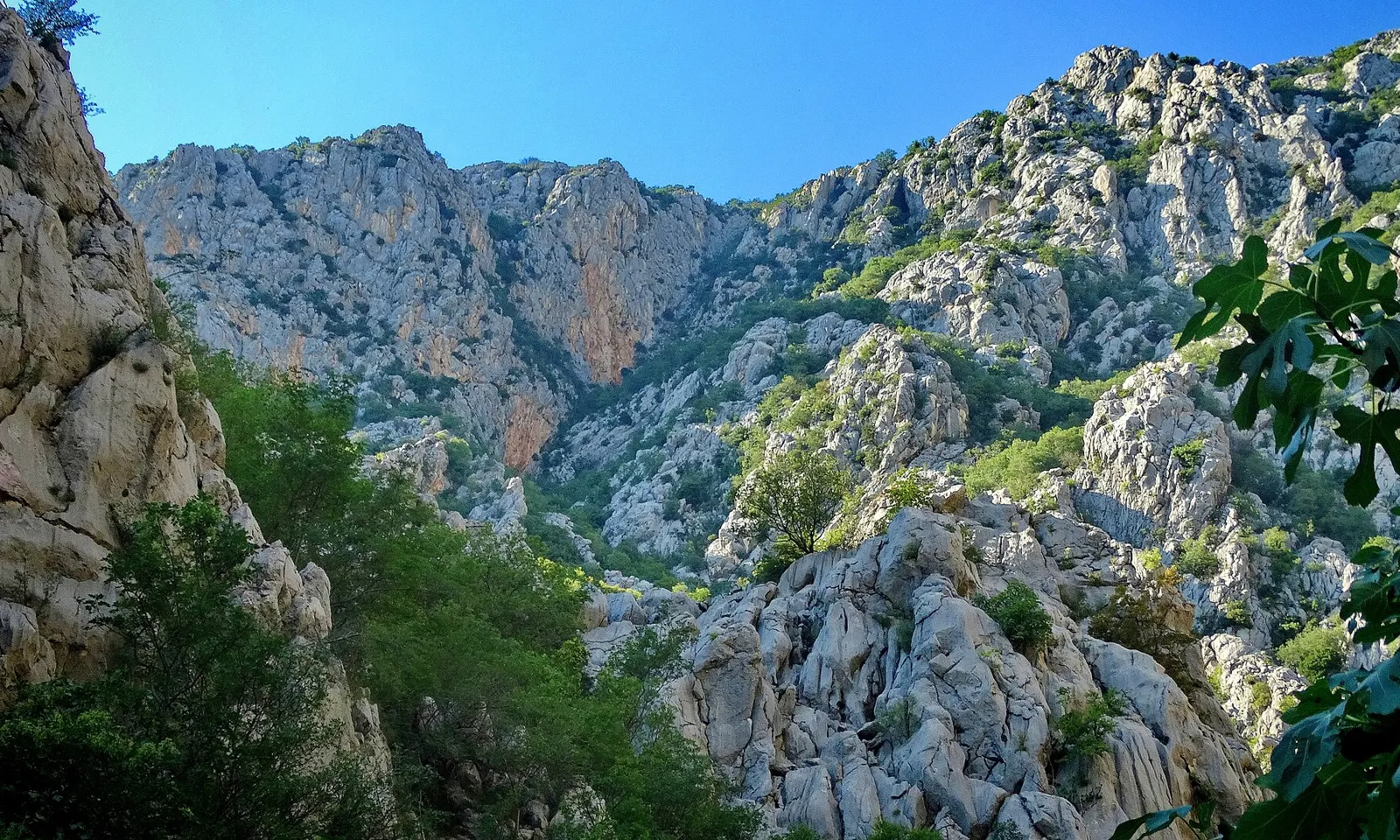
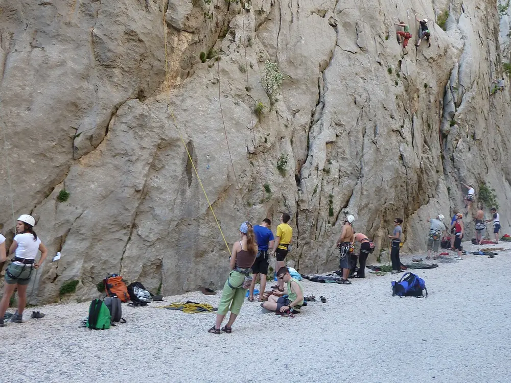
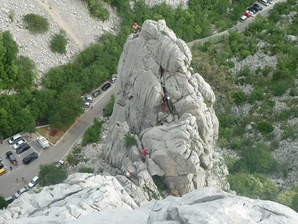
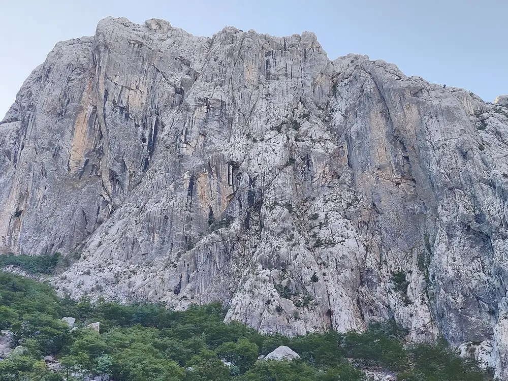
Pale limestone walls and peaks above the wooded Velika Paklenica canyon

Photos: Miroslav.vajdic (CC BY-SA 4.0), Danilo Tic (CC BY-SA 2.0), Danilo Tic from Slovenska Bistrica, Slovenia (CC BY-SA 2.0), Harald Hetzner (CC0)

Rock
Limestone (carbonate rock)
Style
Sport and long multi-pitch, some trad and aid
Routes
About 600 marked, equipped routes
Best season
Spring to late autumn

Why go

Paklenica National Park, created in 1949, lies in the Velebit mountains close to the Adriatic at Starigrad, and its Velika Paklenica canyon is Croatia's most visited climbing area. Climbers first came in the late 1930s and opened the first route, Brahm, in 1940. Croatian climbers added the classic big wall routes between 1957 and 1969, and after the park reopened in 1995 Boris Čujić and Ivica Matković rebolted many of the old routes, so long climbs and short sport routes sit a few minutes apart.

The route

Anića kuk is the famous wall, with routes up to 350 m long, from old aid lines to modern sport routes. Its three classics are Mosoraški (1957), Velebitaški (1961) and Klin (1966). Velebitaški, the most popular, has 403 m of climbing, mostly in the fifth and lower sixth UIAA grades with one move of 7-. Klanci, the narrowest part of the canyon, has most of the short sport routes, starting with Mauro Corona's Stimula (7a). Il Marattoneta (8b+), freed by Maurizio Zanolla, is the hardest route in the park; Adam Ondra onsighted it in 2020 and added a 9a variant.

When to go

The park gives spring to late autumn as the season, and many climbers time a visit for the International Climbers' Meeting around 1 May. Spring brings showers, but the karst dries quickly. Summer is hot, though Anića kuk is in shade in the morning, and the sunny Crljenica sector suits winter.

Getting there

Zadar airport is about half an hour's drive from Starigrad-Paklenica, and buses from Zadar take about 45 minutes. By road the park is 235 km from Zagreb and 137 km from Split. The Ancona to Zadar ferry takes about 8 hours. Entrance 1 is at Velika Paklenica, at the edge of Starigrad.

Permits and booking

There is no separate climbing ticket: the park entry ticket covers climbing. In 2026 a one day adult ticket costs 5 euros from November to February, 8 euros in March, April and October and 10 euros from May to September. Three day passes cost 10, 16 or 20 euros and five day passes 15, 24 or 30 euros. Climbing is allowed only in Velika Paklenica, helmets are required, solo climbing is banned, and new routes or changes to routes need the park's permission. Some routes may close for rare species, and camping in the park is not allowed.

How hard it is

Grades run from 3 to 9a. Older routes are protected by pitons and newer ones by bolts, and on Velebitaški all belays are bolted but spacing is wide in places, so take nuts, cams, 12 quickdraws and two 60 m ropes. The approach to Anića kuk takes about 45 minutes and the descent by the red-marked path about an hour. Croatian Mountain Rescue staff are on site every day in July and August and on long weekends.

Where to sleep

Starigrad-Paklenica has shops and fuel. The park runs Camp Nacionalni Park in Starigrad, and Marko, Vesna, Peko and Popo are other campsites, with rooms at places such as Pansion Anđelko and Hotel Rajna.

Tips

  • Buy a three or five day pass if you plan to climb more than a day: they stay valid for five and seven days from purchase.
  • In an accident call 112; the mountain rescue station in Zadar is on 091 721 0010.
10 / 10

Arco and the Sarca Valley

Garda Trentino, Trentino, Italy

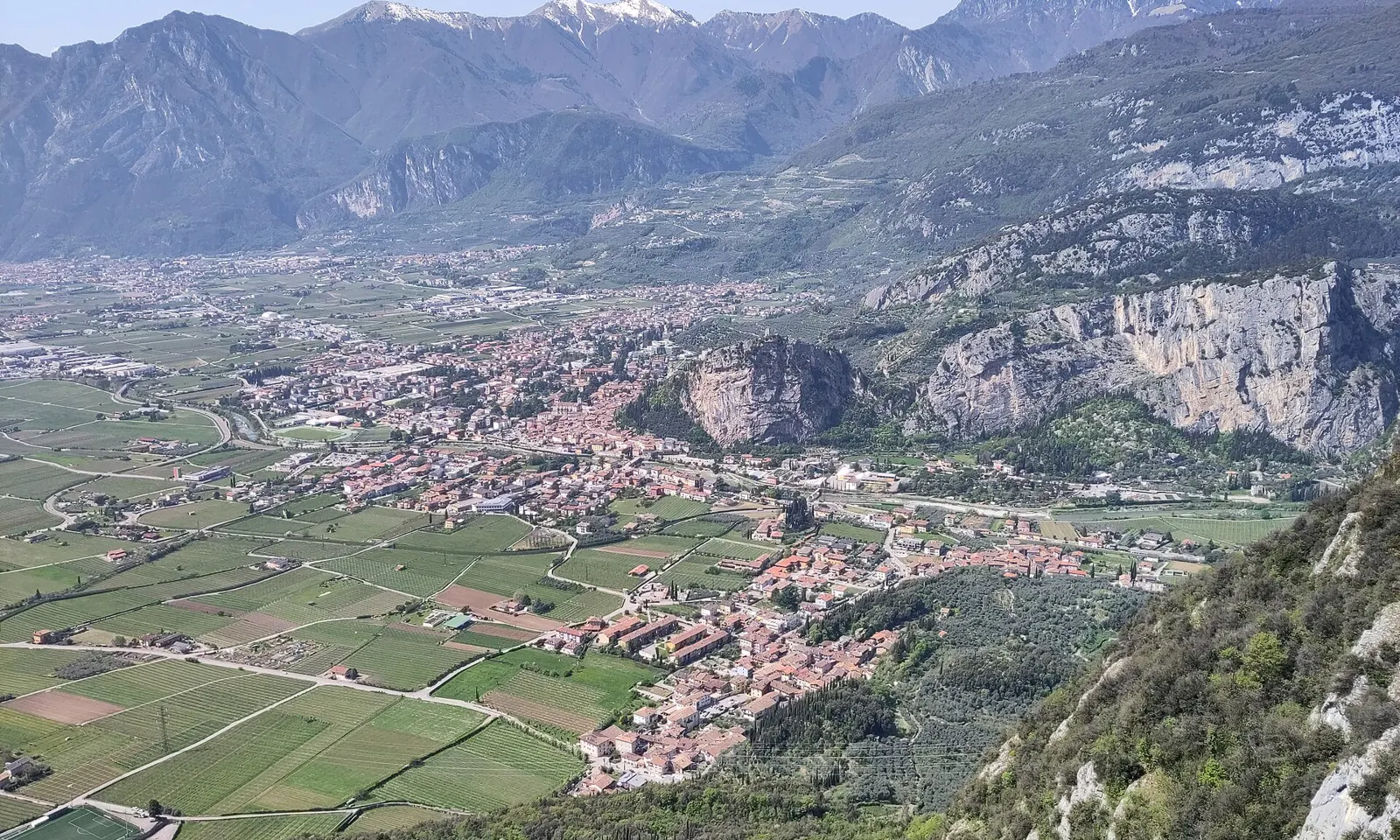
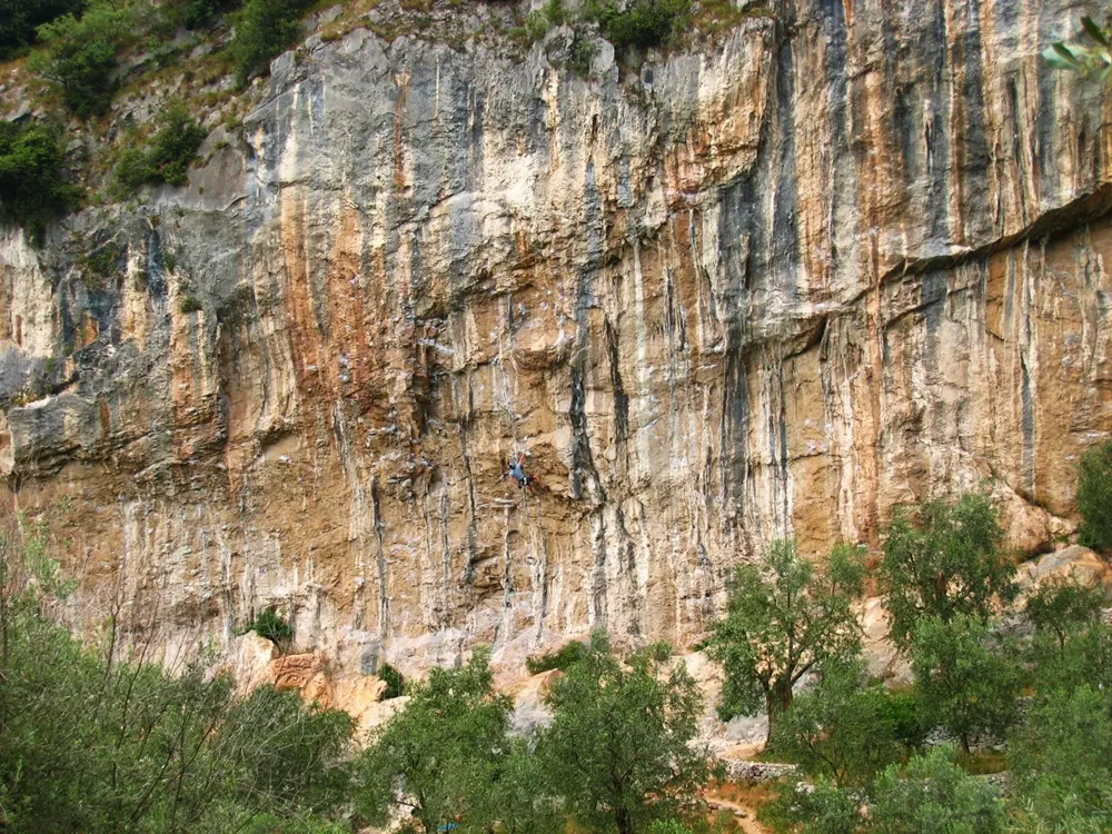
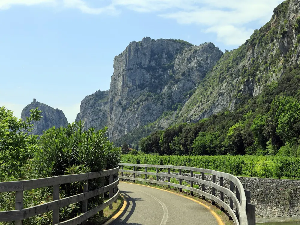
Arco, its castle rock and the Sarca valley seen from the cliffs above, with olive groves and mountains

Photos: Alpenhexe (CC0), Thomas Ribière (CC BY-SA 2.0 fr), Wasquewhat (CC BY-SA 4.0), Falk2 (CC BY-SA 4.0)

Rock
Limestone
Style
Sport cragging and multi-pitch
Routes
More than 1,000 in 47 or more sectors
Best season
Spring and autumn

Why go

Arco lies in the Sarca valley just north of Lake Garda, under limestone walls from 15 to 500 m high. Sport climbing competitions began here: in 1986 Sport Roccia was held on the rock at the foot of Monte Colodri, and it grew into the Rock Master, which marked 40 years on 2 to 4 October 2026 in the Climbing Stadium below Colodri. Many crags are a short walk from town, some of them among olive groves.

The route

The Massone has the famous Policromuro, with nearly a hundred routes of every grade and angle among olive trees. Monte Colodri, the big wall behind Arco castle, has longer climbs: the first ascents in the 1970s followed the corners of the Barbara and Bertamini routes. Mescalito on the Rupe Secca, once VI+/A2, is now a bolted climb of 260 m in 9 pitches up to 6c/6c+, and Zanzara e Labbradoro, with a 7a+ third pitch, is perhaps the most sought-after multi-pitch sport route in the valley. The Massi di Prabi boulders lie at Colodri's foot, and the Belvedere at Nago has about 50 routes.

When to go

You can climb all year in Arco's mild climate. Spring and autumn are best, since the south-facing crags are too hot in summer, though cooler ones exist. In 2026 the Rock Master was held in early October.

Getting there

The nearest railway station is Rovereto, served by Trenitalia, ÖBB and DB, and Trentino Trasporti buses run from there to Arco, Riva del Garda and Torbole. Buy bus tickets before boarding, since they cannot be bought on board. By car, leave the A22 Brenner motorway near Rovereto.

Permits and booking

We found no climbing permit or fee. Since 2015, thirteen crags around Arco, Nago-Torbole and Dro have belonged to the Outdoor Park Garda Trentino: the municipalities have them equipped by professionals and checked every year, with a board and map at the foot of each. Many other crags are on private land, so respect any closures or access limits.

How hard it is

Routes run from easy single pitches to multi-pitch climbs of 300 m. A 60 m rope is essential, a 70 m rope helps at the Massone, and 15 quickdraws cover most routes.

Where to sleep

Arco has many hotels and campsites, and the Prabi campsites sit below Colodri, 5 to 15 minutes' walk from the crags. Summer and weekends are crowded, so book ahead.

Tips

  • Buy the local guidebook in Arco itself for an up to date list of sectors and routes.
  • Prefer north-facing or shaded crags in summer and the south-facing walls in winter.

Sources

Distances, heights, seasons and permit rules were checked against these pages. Rules change, so check the park or trail authority before you go.